Yesterday, was a nice day, but we did end up with some mixed temperatures for highs. The northeast breeze kept Norfolk’s temperature in the upper 60s, but we hit 80 in a few inland areas.
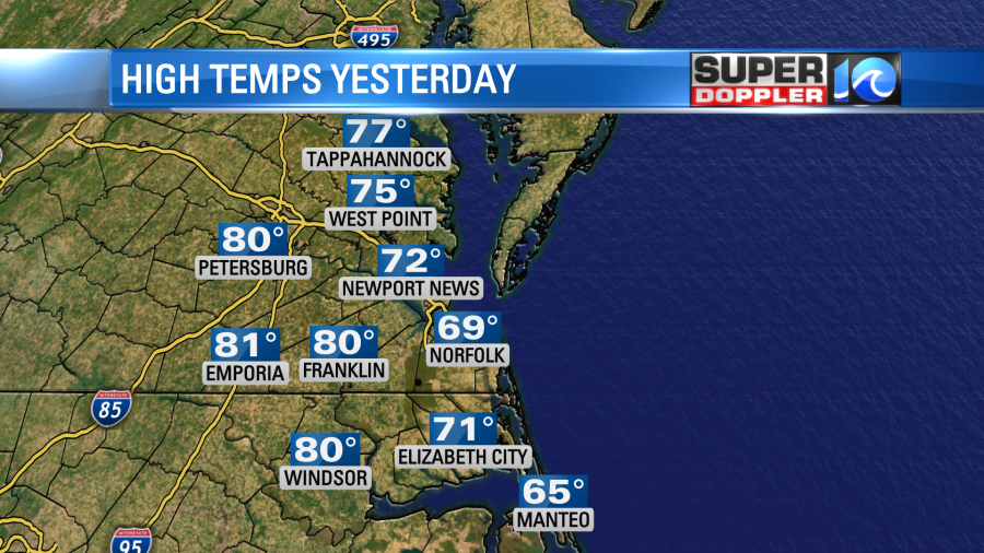
This difference was due to the northeast winds coming in off of the water. Water temps are still in the 50s and 60s, which is normal for this time of year. Regardless, it was pretty nice out. Today will also be nice, but temps are going to warm up big time! High pressure has shifted offshore. So the surface winds are going to be out of the southwest.
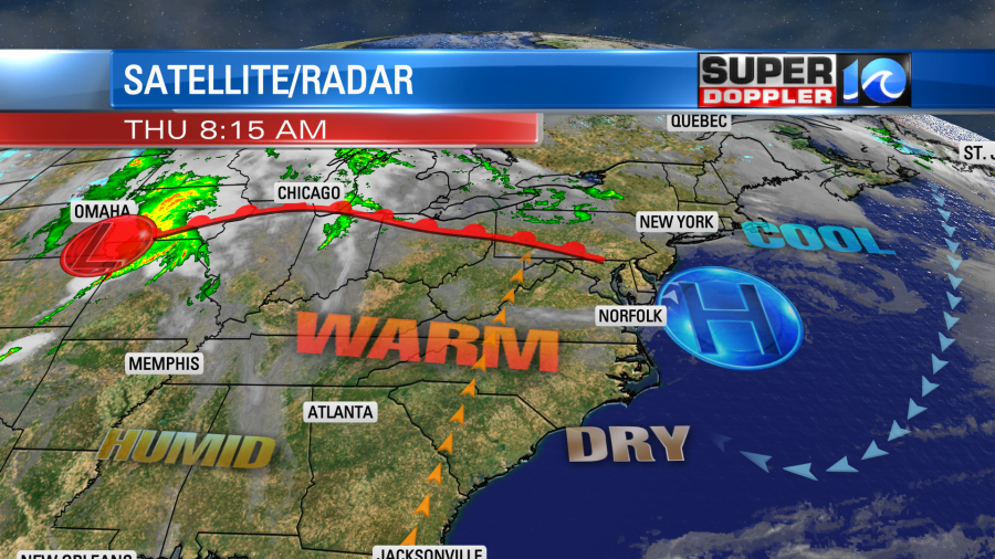
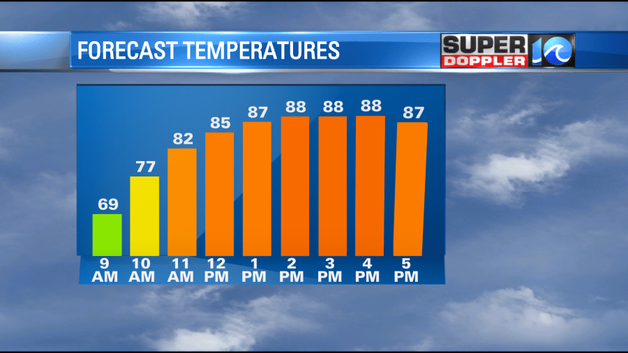
They will only run at about 5-10mph. This could let a sea breeze happen, which would cool down some coastal areas. However, no matter what, we will all be warmer than yesterday. With mostly sunny skies all day temps will push up to the upper 80s with a few 90s inland.
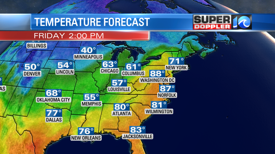
Tomorrow we’ll have similar weather here, except there will be a few more clouds. We’ll have a light southwest wind again. High temps will rise back up to the upper 80s with a couple of 90s inland.
We’ll still have quiet weather Friday night into Saturday morning. High pressure will slide a bit more offshore during that time. We’ll still have a southerly wind, but the humidity will definitely rise. This will increase the cloud cover through the day. By late in the day there will be some scattered showers and storms forming inland/west.
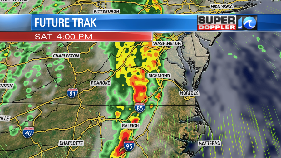
Then by the evening a broken line of showers and storms will enter the area from the west. There may be some brief heavy rain and gusty winds.
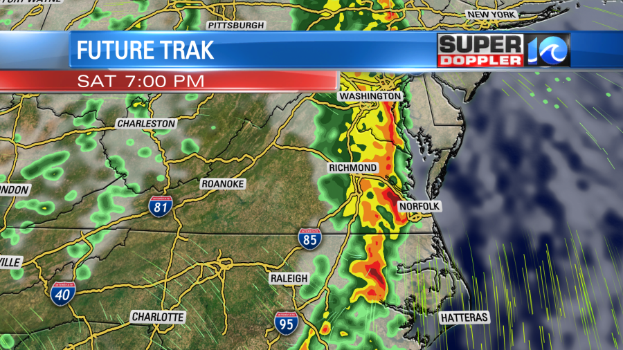
The rain should wrap up by Sunday morning. Then we’ll dry out as we go through the day. High temps will be in the upper 70s to near 80 Saturday, but temps will drop to the upper 60s on Sunday.
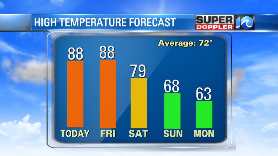
We’ll be cooler and dry early next week. High temps will be in the 60s.
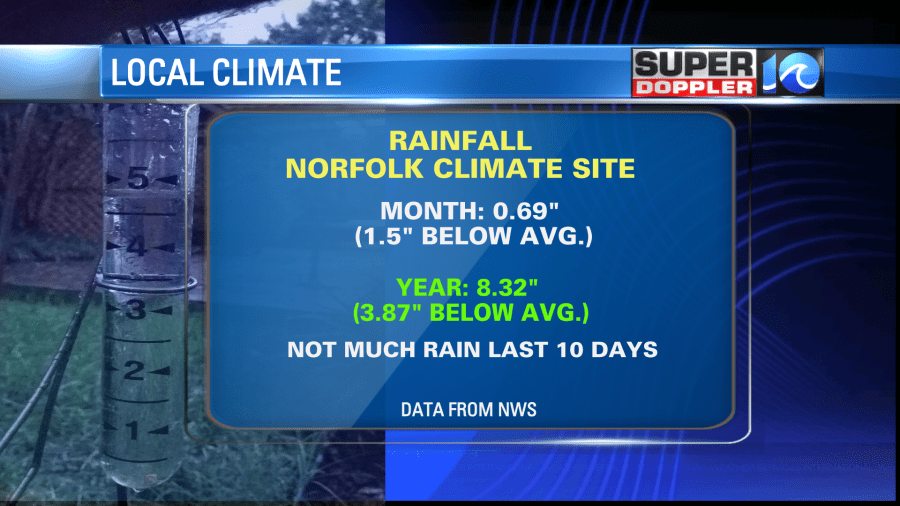
It’s a bit early to have a detailed rainfall forecast for the weekend. For now I’d say that we are looking at about a half an inch to an inch, but It’s still too early for any confidence in that. We’ve been so dry lately that it could reduce the actual rainfall totals when it arrives. We’ll see. We are down about an inch and a half for the month. We are 3.87 inches below average for the year.
In national news… The active Spring weather season continues across the U.S. There were several reports of tornadoes across the Plains States yesterday. They resulted in at least a couple of deaths and many buildings destroyed. Here is the article with more information: central U.S. tornadoes. The threat for severe weather will shift east today. More tornadoes will be possible across the Deep South.

There may be some isolated severe weather in our region late Saturday into Saturday night. Stay tuned for updates on that.
Meteorologist: Jeremy Wheeler


