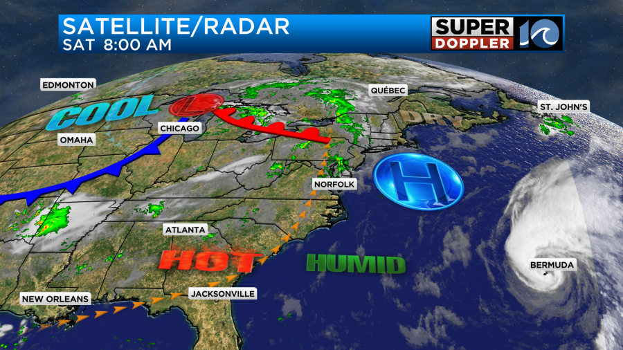
Hurricane Ernesto technically made landfall this morning over Bermuda. The center of the storm was producing damaging winds and heavy rain over the island.
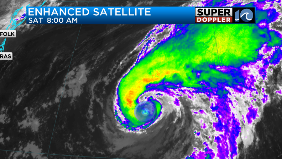
Hurricane-forced winds of 85 mph sustained were around the island for a couple more hours.
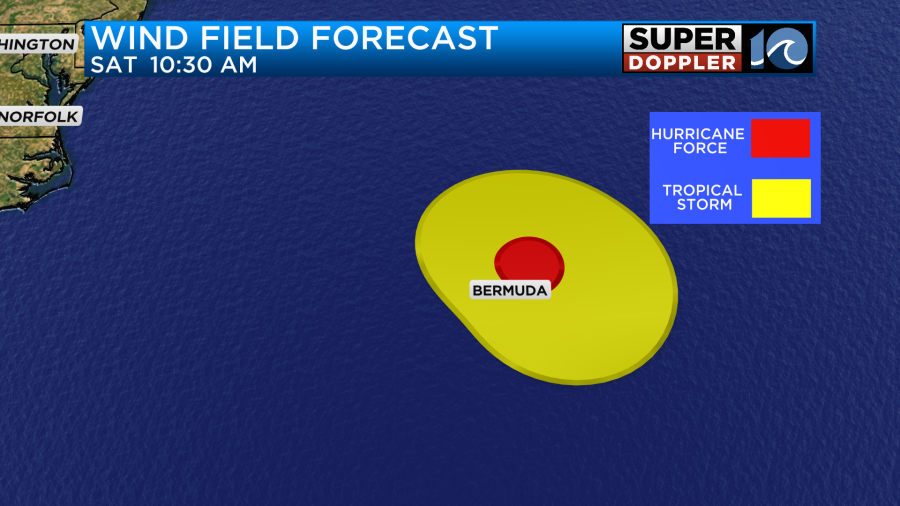
Tropical storm-forced winds will continue through early tonight. The storm will then move over the open Atlantic.
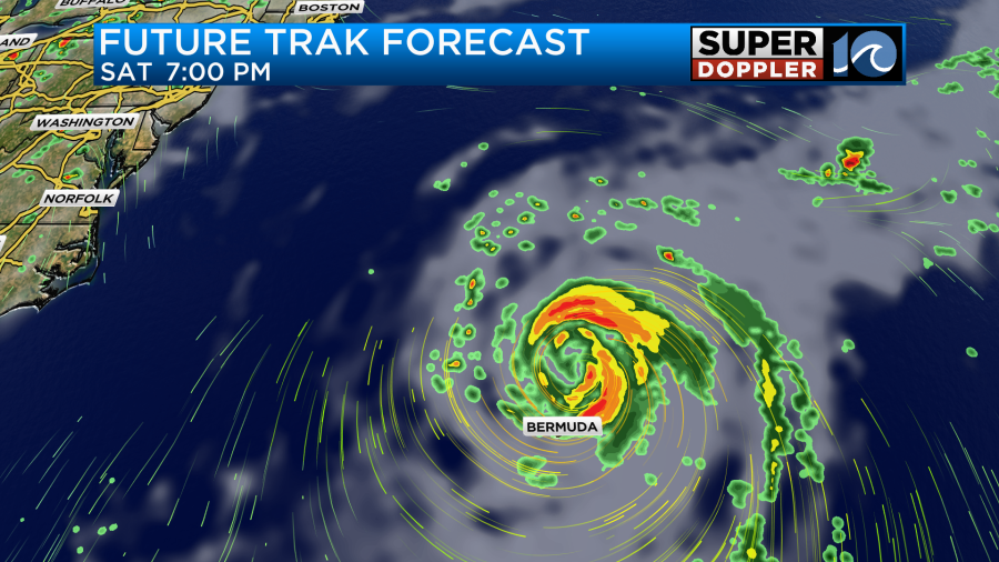
The system will move over the cooler waters of the north Atlantic. It may brush up against Newfoundland for a brief time.

The waves will be about 10-15ft out near the center. However, our waves have increased as well.
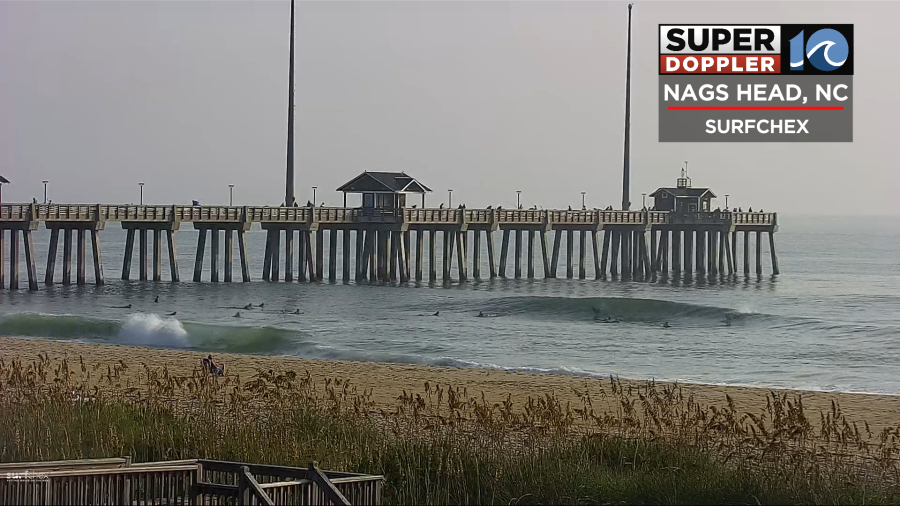
The waves will run about 2-4 ft in Virginia Beach today. They will be about 5-7 ft along the Outer Banks.
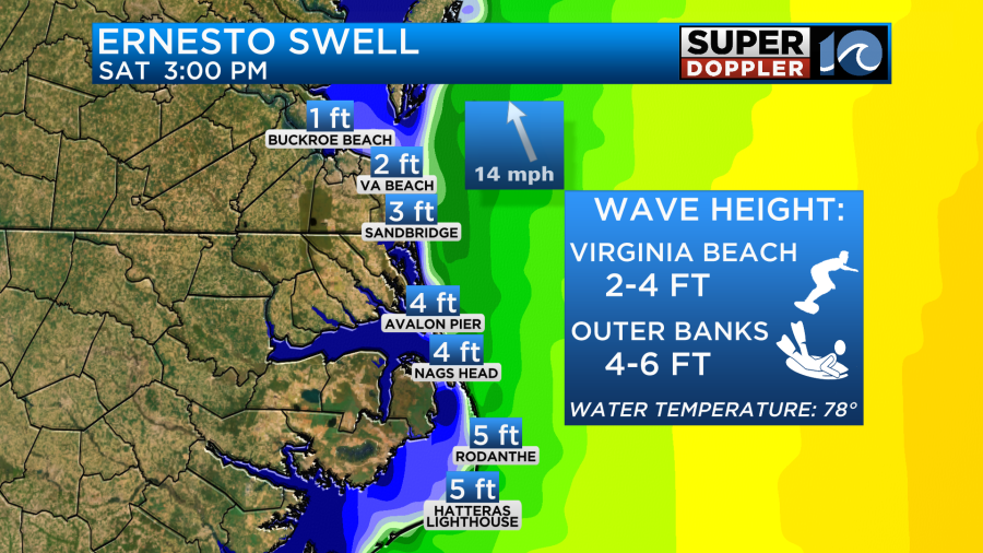
They will run about the same tomorrow, but may be just a little higher. This is great for experienced surfers, but swimmers should stay out of the water. There is a high risk for rip currents at all our beaches today.
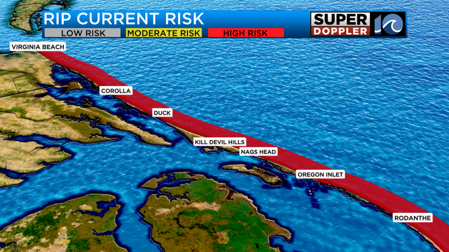
This high risk for rip currents will continue tomorrow and likely into Monday.

Outside of that we should have some decent weather in the region today. There will be a few showers as the moisture increases, but they should be light and spotty. High pressure is just offshore. There is a cold front building over the Midwest.
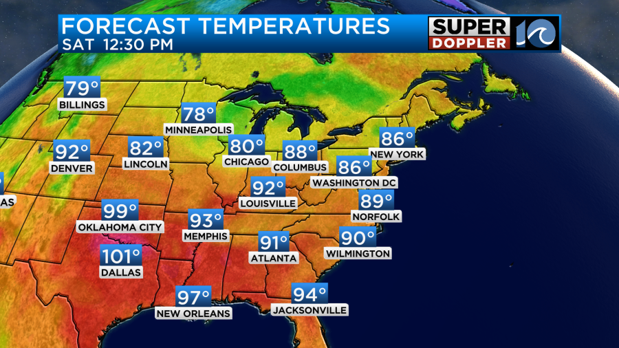
We’ll heat up today into the upper 80s to near 90.
The dew points are climbing. So it will feel fairly humid this afternoon. We’ll be partly cloudy. Most of the day should be nice, but a few rain showers will try to fall this afternoon into the evening. The chance for rain is about 30%. Tomorrow we’ll have a stronger south breeze. Dew points will rise even more to near 70. High temps will be near 90 degrees.
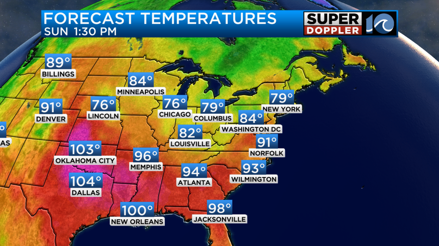
The extra heat and humidity will be some fuel for scattered thunderstorms in the afternoon and evening.

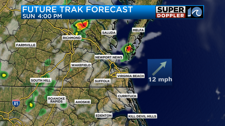
Some of these storms could be strong to severe. This will be ahead of the cold front. The front will arrive tomorrow night. Then it will stall out over the region on Monday. This will lead to more scattered showers and a few storms. However, we will cool down a bit. High temps will be more in the mid 80s.
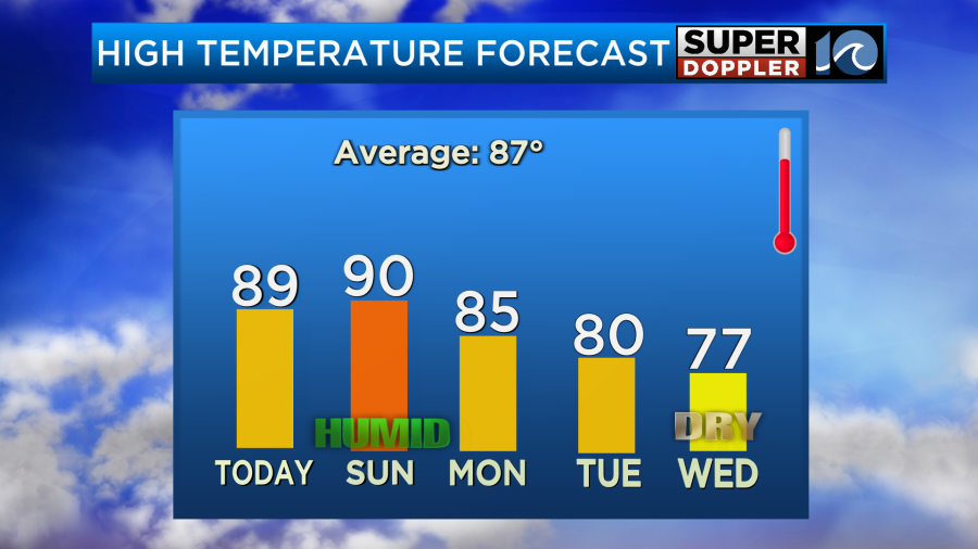
The front will sink to our south by Tuesday. High temps will drop to near 80 degrees. Then we’ll be in the upper 70s Wednesday and Thursday. Now the cooler temps are one thing. However, there will also be a HUGE drop in the humidity. Take a look at the dew point forecast:
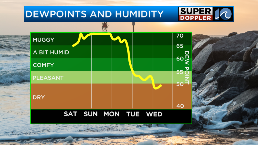
Wow! This will be a taste of early Fall weather. The low temps will be down in the 50s and low 60s Wednesday and Thursday morning. Some folks will need the medium jackets heading out.
Meteorologist: Jeremy Wheeler


