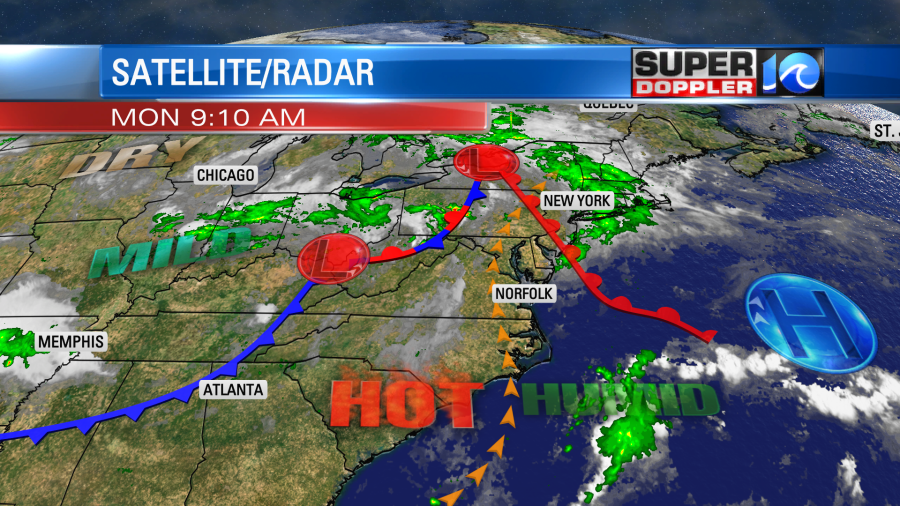
We are coming off of a pretty quiet weekend. It was pretty nice out both days, but the heat and humidity did creep up yesterday. Today we are going to be downright hot and humid. A warm front has moved to our north, and it will keep moving north. There is a cool front far to the west/northwest.
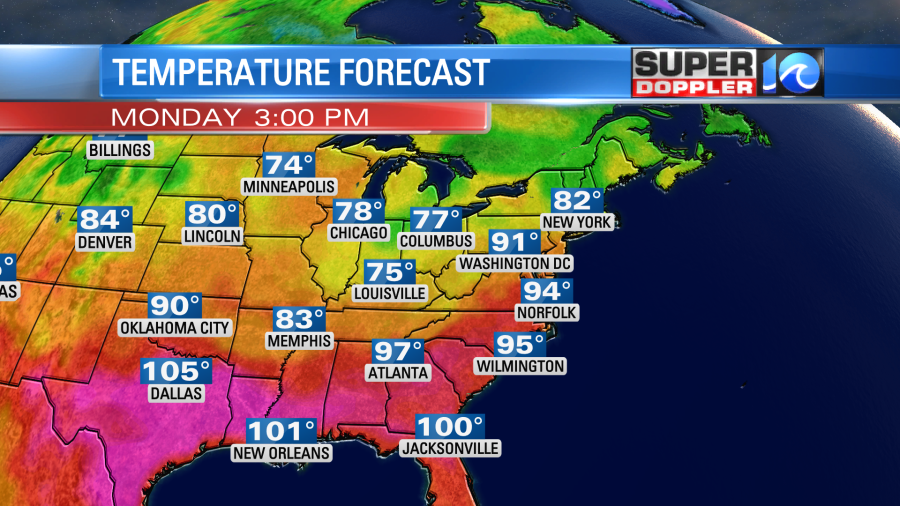
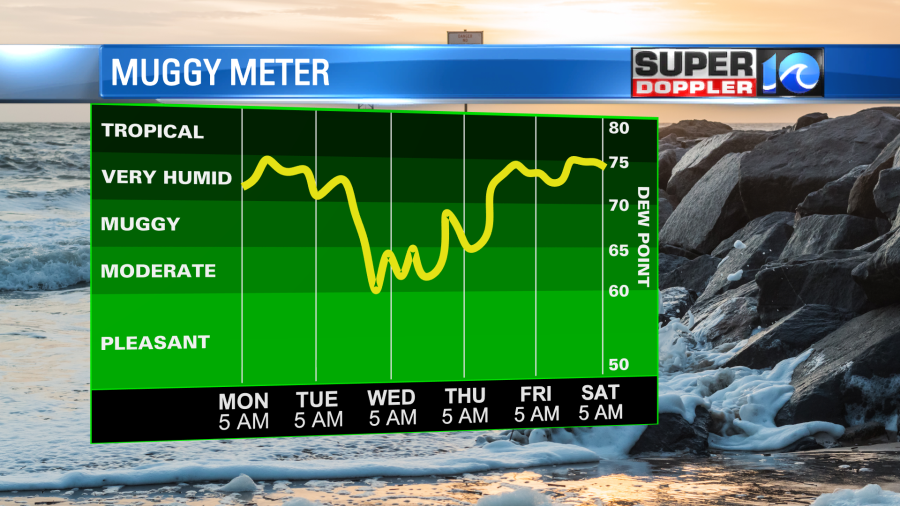
We’ll be in the zone of hot, humid, and fairly quiet weather today. Skies will be mostly to partly sunny. We’ll have a south breeze running at 10-15mph. It will be nice to have a bit of a breeze. However, that same wind will push the temps and humidity up higher. Dew points will rise to the mid 70s this afternoon. High temps will run up into the low-mid 90s.
The heat index will will run up into the lower 100s. It could be up to 106 in some inland areas.
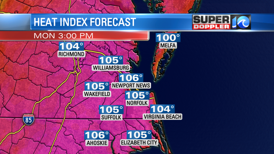
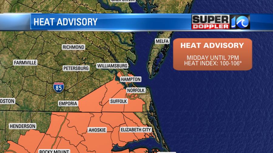
Because of this there is a Heat Advisory in effect for a big chunk of the region.
There may be some isolated showers or storms this afternoon, but the chance is pretty low. However, the chance goes up during the evening. A broken line of storms will form to our west by 6pm. These will slide east into the mid-late evening.
Our HRRR version of Future Trak is just a little quicker with the storms. It brings them into the area between 7-10pm.
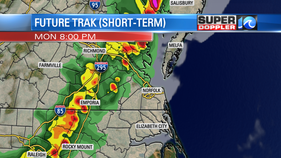
The Graf version of Future trak is more 7-9pm inland and 8-10pm in the metro and near the shore.

Either way the models agree that the broken line of storms will come through in the evening, and that they will pack a punch. As of this writing the Storm Prediction Center had put out a “Moderate” risk for severe weather up around the D.C. area. There is a 10% chance for a tornado from Roanoke to D.C. It has an “Enhanced” risk down to the Peninsula and part of the Southside with a slight risk for the the rest of the Southside.
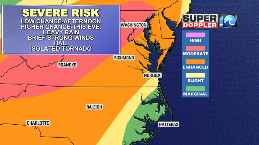
The main threats will be heavy downpours, strong gusty winds, and lightning. Severe winds (58mph or greater) may happen over a large area to our north, and some of them could last down to our region. The lesser threats will be hail and isolated tornadoes.
There will definitely be some fuel for the storms with warm temps and dew points in the 70s tonight. So make sure you have a way to get alerts overnight.
Tomorrow the cool front will keep sliding east. We’ll dry out behind it a little bit. Dew points will steadily drop to the 60s. High temps will still make it to the low 90s. However, the breeze will be fairly strong tomorrow. It will run at 10-15mph, but some of the gusts could be up to 25mph. Along with the drop in dew points, the breeze should make it feel quite a bit drier and more comfortable. Other than a stray shower or two we should be partly sunny through the day.
We’ll stay quiet on Wednesday. High temps will be near 90, and the humidity will stay moderate.
By Thursday the heat and humidity will bounce back. High temps will return to the low-mid 90s. The heat index will be in the 100s. Maybe up to 107. We’ll stay pretty hot and humid into next weekend. I’ll talk more about that in tomorrow’s weather blog.
Things are quiet in the tropics for now.
Meteorologist: Jeremy Wheeler


