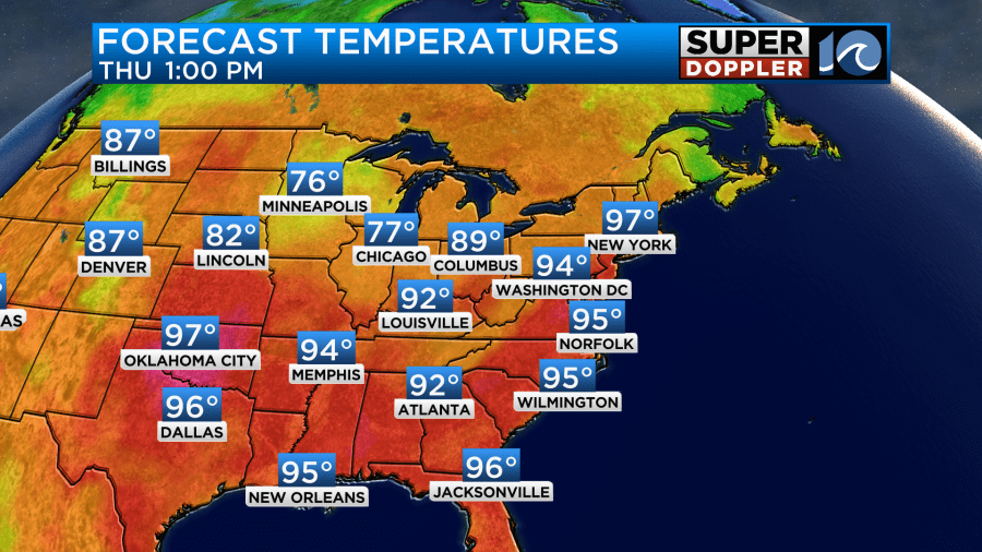
Yesterday was another rough day. High temps made it into the low-mid 90s over most of the area as expected.
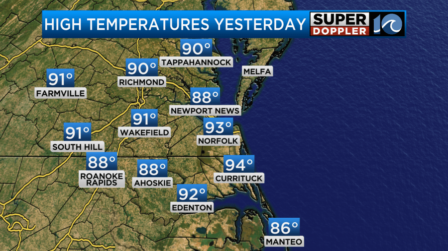
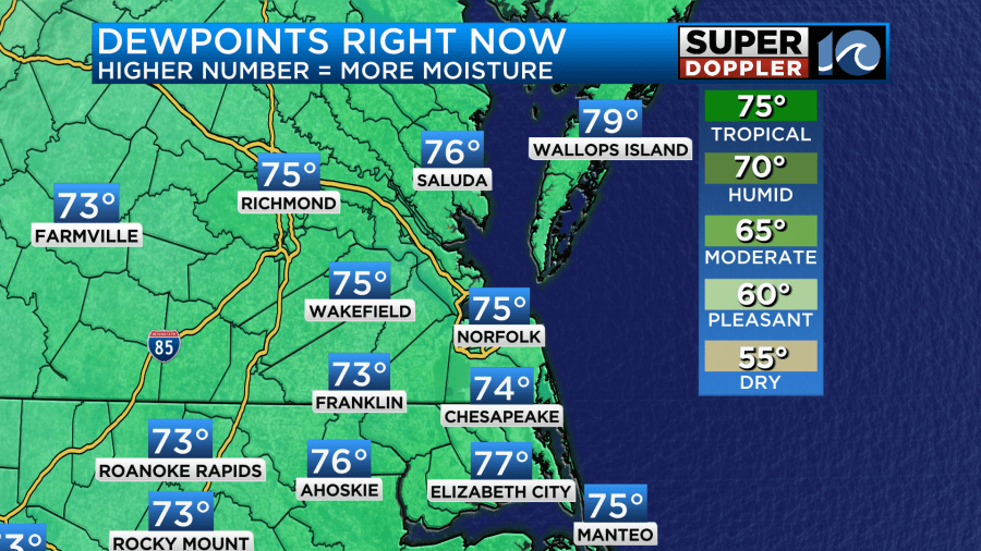
The humidity became very thick. So the heat index was near or over 100 in many locations. Today we are going to be (you guessed it) even hotter and more humid. Dew points are now solidly in the 70s.
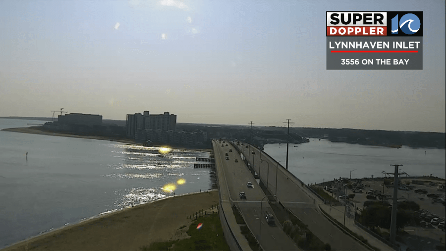
We started off with lots of sun but also had a thin haze.
We have high pressure offshore with a weak are of low pressure over the Midwest.
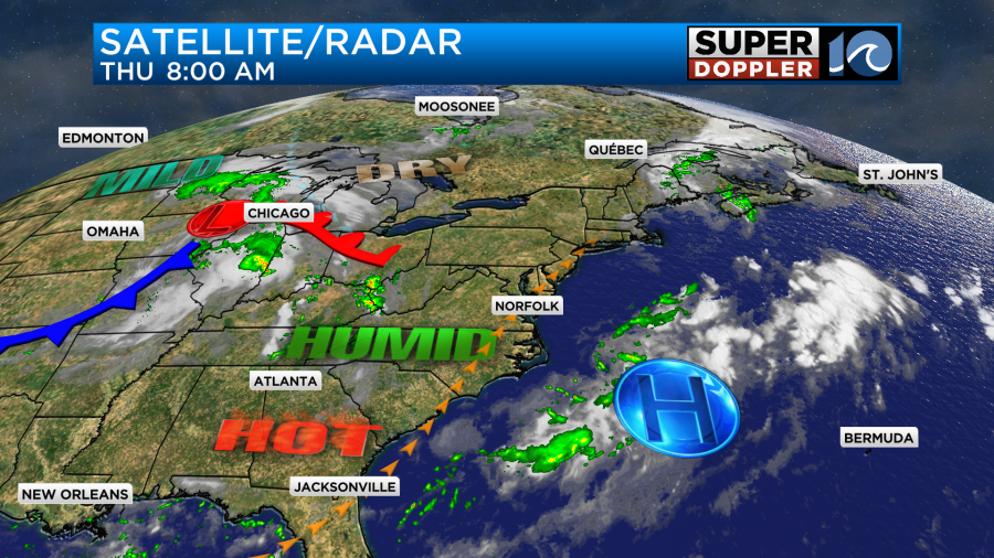
We will be locked into what I call a heat pump pattern for a few days with high pressure sitting offshore and stretching east past Bermuda. This will allow southwest winds to keep pumping in the heat and humidity from the south. We’ll have a light southwest wind, but it will only run at 5-10mph. So don’t expect the breeze to cool you down today. We are going to push the high temperatures up to the mid 90s.
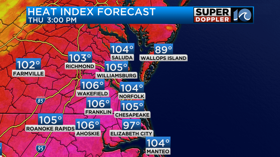
The heat index will make it all the way up to between 102 and 107 degrees.
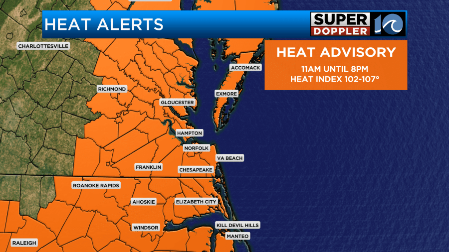
This has prompted Heat Advisories to be issued by the National Weather Service.
We’ll have a lot of sunshine with some scattered clouds this afternoon. This is also going to make it tougher to be outside for a significant period of time. Be sure to stay hydrated and take plenty of breaks in the shade or A.C. I’m not expecting much rain today, but some isolated showers or storms will be possible.
Tomorrow the heat and humidity will probably be even higher. We’ll likely start the day near 80 degrees. We’ll be partly cloudy for most of the day with a light southwest wind. This will help to push the high temperatures up into the mid-upper 90s. The heat index will be between 105 and 110 degrees.
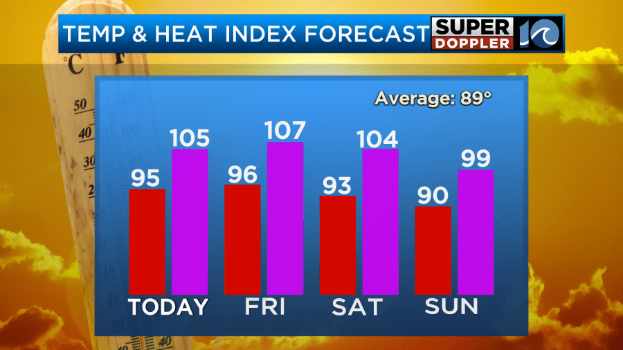
There is already an Excessive Heat Watch up for tomorrow. However, tomorrow there is a little better chance for some scattered thunderstorms in the afternoon.
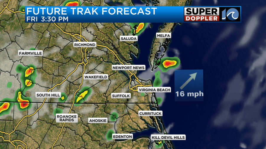
There may be even more by the evening.
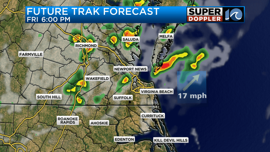
It’s possible that some areas will cool down a little due to the storms, but most areas will likely stay hot. The humidity will be up tomorrow through the weekend. The dew point will be above 75 for a while.
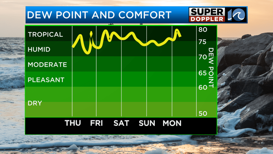
We are expecting more clouds over the weekend and some higher rain chances, but neither day should be a washout. The extra clouds and showers should be able to keep the temps down a bit, but it will still probably be in the 90s. Again, the humidity is not expected to drop. Rain chances may go up to 60% on Sunday as a cool front moves into the area. It could cool us down to the upper 80s on Monday, but we’ll see.
The hazy skies today are partly from the high humidity. However, there may be some haziness from the far-traveled wildfire smoke. This is from parts of Canada and the western U.S.
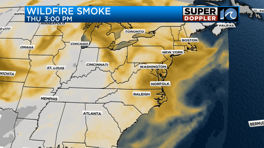
A lot of this will be elevated, but some of it could sink closer to the ground. If that happens then there is a potential for it to be unhealthy for sensitive groups.
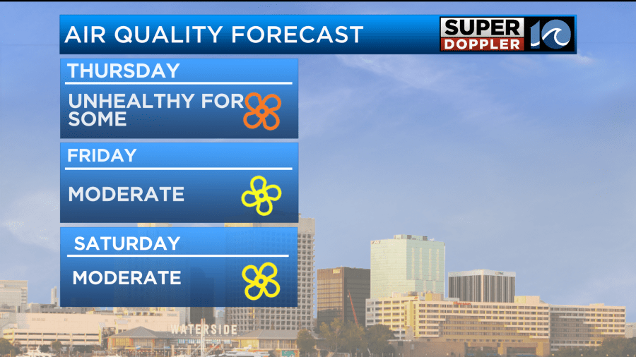
Regardless, it should be better tomorrow.
We are still tracking the tropical disturbance hear the Dominican Republic. It now has several large clusters of thunderstorms around it.
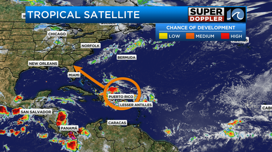
It is forecast to move northwest, and it could eventually form into a system.
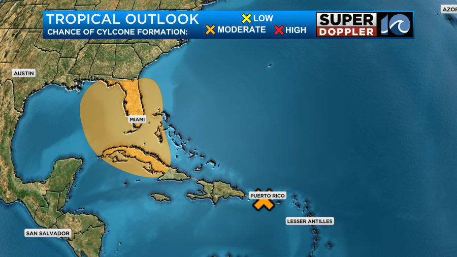
The models are (I’ll say it) all over the place. The Euro had it near the east coast for a couple of days. Then this morning’s update came out, and has it doing basically nothing. The GFS had this feature make it into the Gulf of Mexico, hug the southwest coast of Florida, and then move west. Now it has it moving over the big bend of Florida and hanging out for a while possibly even riding to the east.
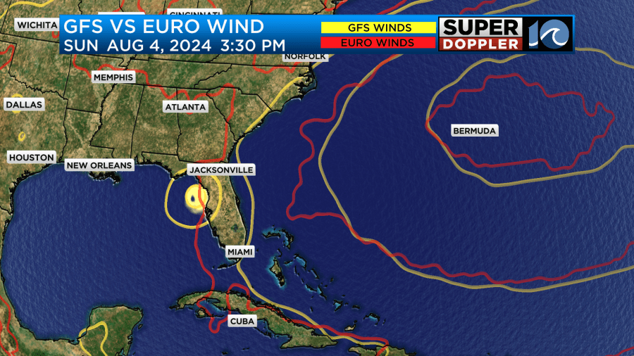
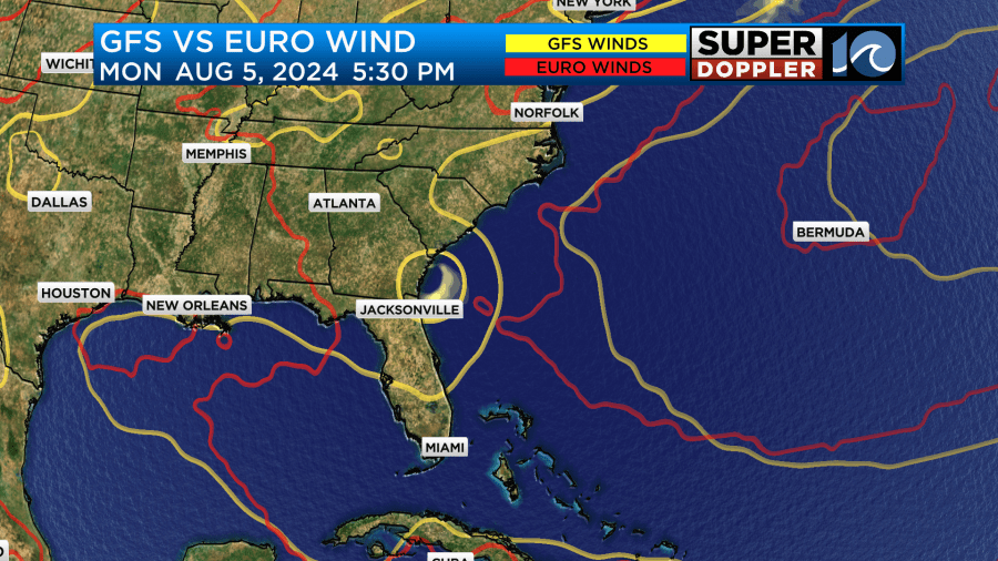
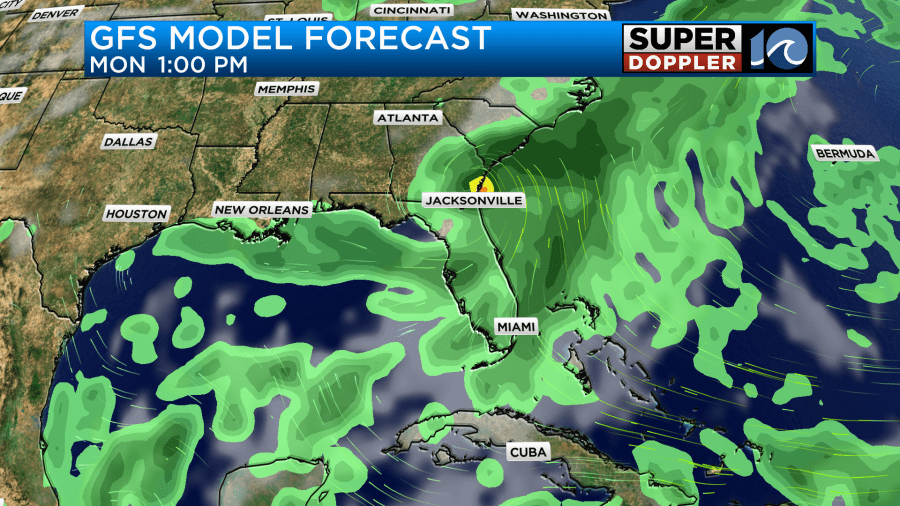
There is a good chance that it will at least bring heavy rain to parts of Florida. Outside of that there is too much uncertainty to now what it will do. Stay tuned for updates.
Meteorologist: Jeremy Wheeler


