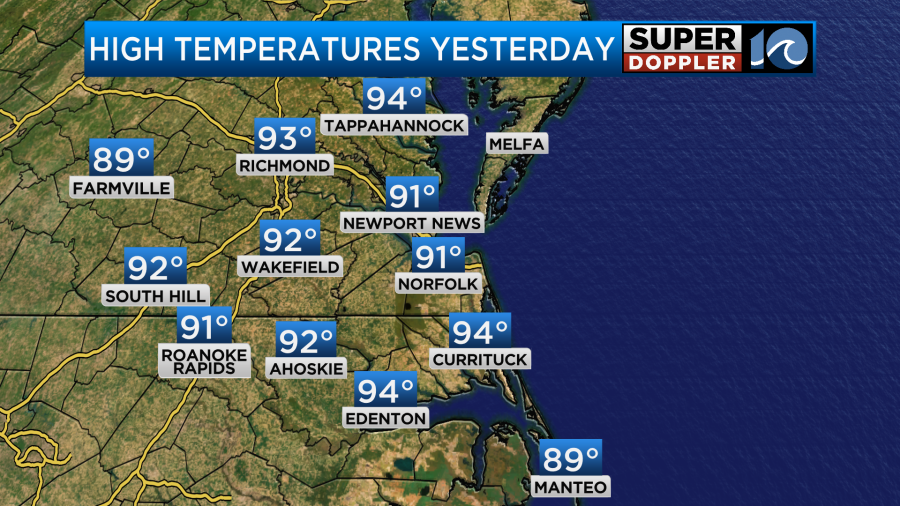
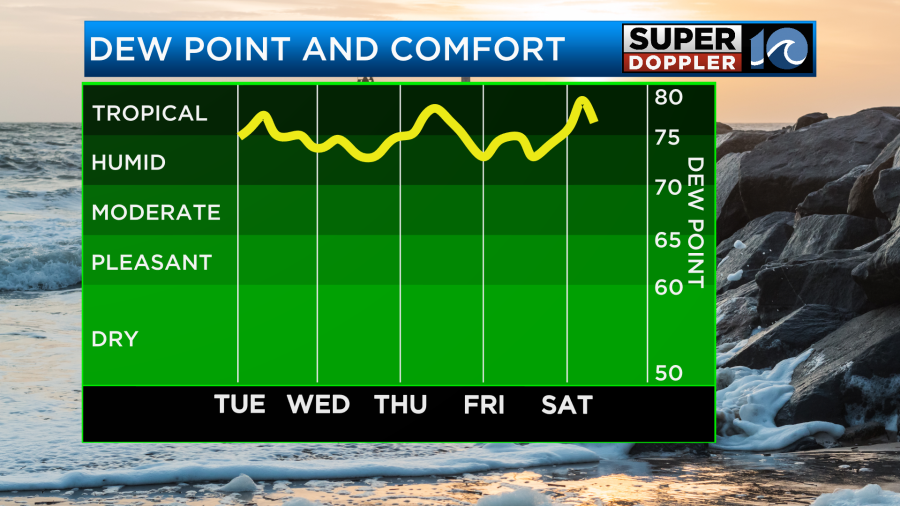
Yesterday I went for a very short walk with the dog. It didn’t take long for the sauna-like weather to get to me. So I even got a tad light-headed. Right after the walk I cooled down in the A.C. Course then I powered through a light workout in the garage. (insert eyeroll emoji here). We actually had a lot of clouds through the day, but the dew points were very high. High temps were really only in the low 90s which is close to average.
The heat index was around 100.
Today a stationary front has drifted a little farther west of our area with high pressure edging in from the east a bit more.
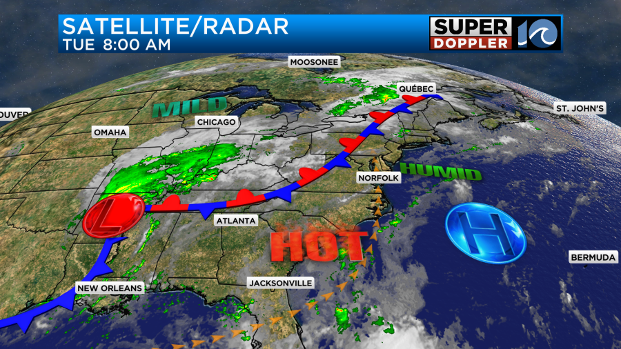
This is going to put us farther in the hot zone this afternoon. Plus, we’ll have more sunshine overall (partly cloudy). There will also only be some isolated showers or storms in the afternoon with a light south wind. These conditions will push our high temperatures up into the mid 90s later today.
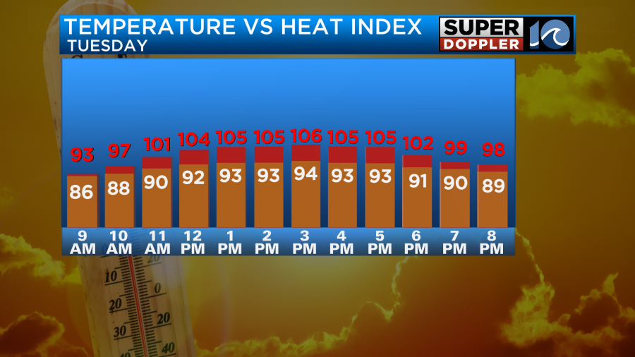
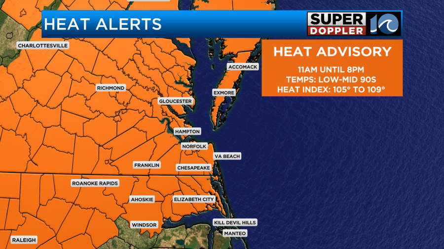
The heat index will be over 105 degrees for many.
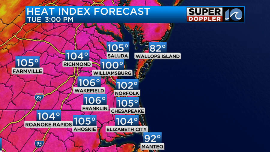
This has prompted Heat Advisories for the region.
Tomorrow we’ll have very similar weather to today. There will be one difference…The breeze will be a little stronger out of the south. It will run at 10-15mph. A breeze can really help on these hot and humid days. Especially if you are working outdoors.
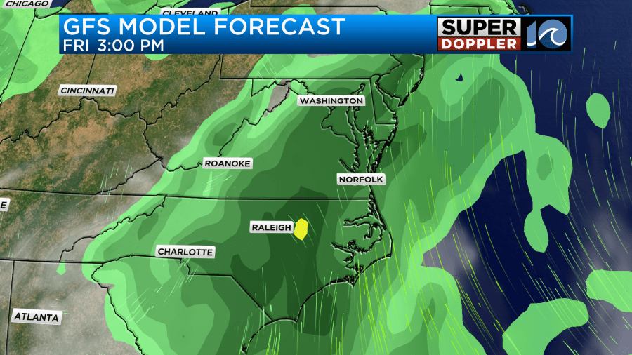
By Thursday a cool front will move into the region. There will be a lot of deep/rich moisture ahead of the boundary. So as it comes in it will create a lot of scattered showers and thunderstorms. They may kick off as early as 8am Thursday.
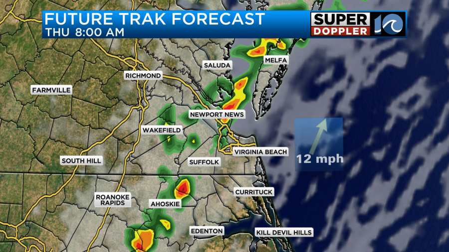
The front will probably stall out on Thursday. This means that the rain showers and thunderstorms could keep forming over the same area again and again.
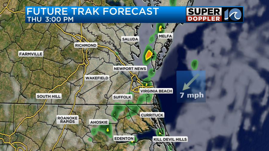
This could lead to some isolated flooding in the area. High temps will at least get knocked down to near 90, but the heat index will still be above 100.
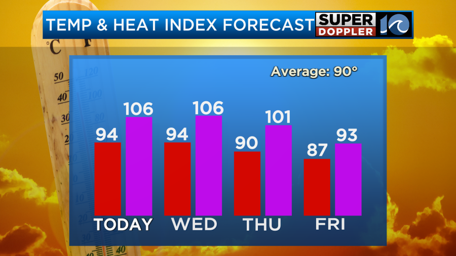
The front will sink a little more to the southeast on Friday. High temps will drop to the upper 80s, but the humidity will not drop.
Rain and storms will continue through the day Friday.
Then there will be more scattered showers and storms through the day Saturday. Heavy rain will again be possible. There may be some more flooding through that time. The front should fall apart by Sunday. We’ll have more sunshine again, but the high temps will bounce back up to the mid 90s.
Meanwhile, Beryl is grinding down over Arkansas today. After slamming parts of Texas and causing lots of damage, it is now mainly a rainmaker.
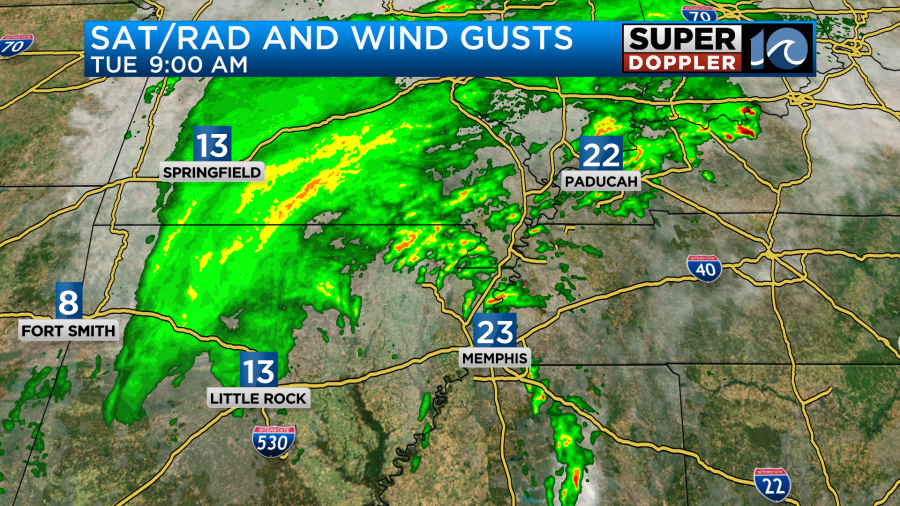
The storm will now move northeast as a broad area of low pressure.

It does still have the potential for thunderstorms, heavy rain, and isolated tornadoes as it moves towards the Ohio River Valley. It will stay to our west, but it also will drag that cool front into our region that will affect our weather. Stay tuned for updates.
Meteorologist: Jeremy Wheeler