
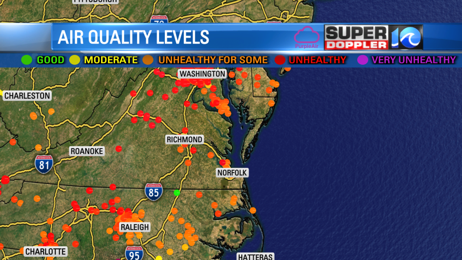
This morning the haze was back on our tower cams.

Though it wasn’t as thick as yesterday. We will still have some of that haze through the day. It won’t be too bad, but it will be unhealthy for sensitive groups. Especially those with Asthma and Emphysema.
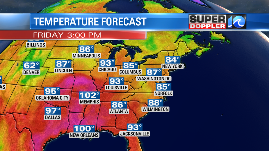
Other than this we are looking at a pretty good Friday. We have high pressure to our north with a stationary front offshore.
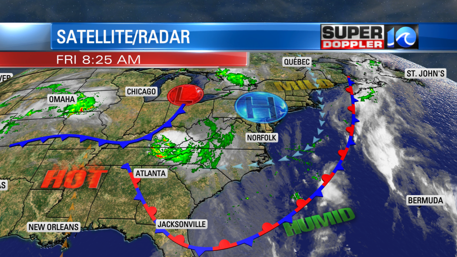
With the way the features are lined up, we’ll have a light easterly wind developing. Maybe that will help a little with the smoke/haze.
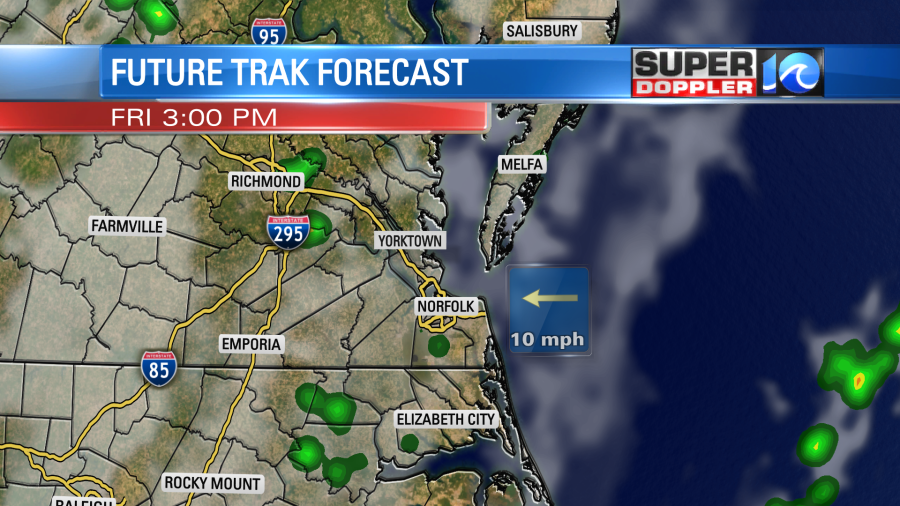
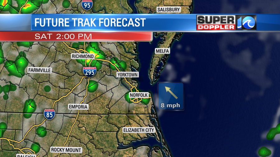
We’ll be partly cloudy through the day. There will be some isolated showers in the afternoon. I’d say there will be a little higher chance out closer to I-95.
Any rain we get today won’t add hardly anything to the monthly rain totals. But hey, we are already over two and a half inches above average anyway.
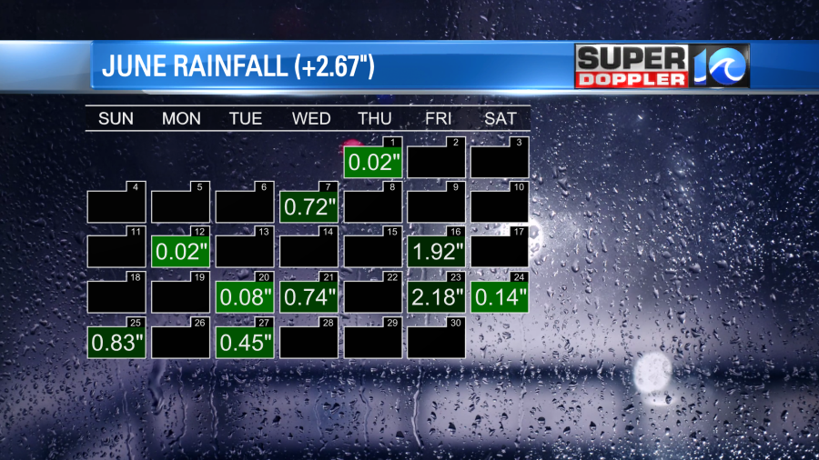
This is how we will round out the month. Meanwhile, we are also ending about 4 degrees below average. Wow!
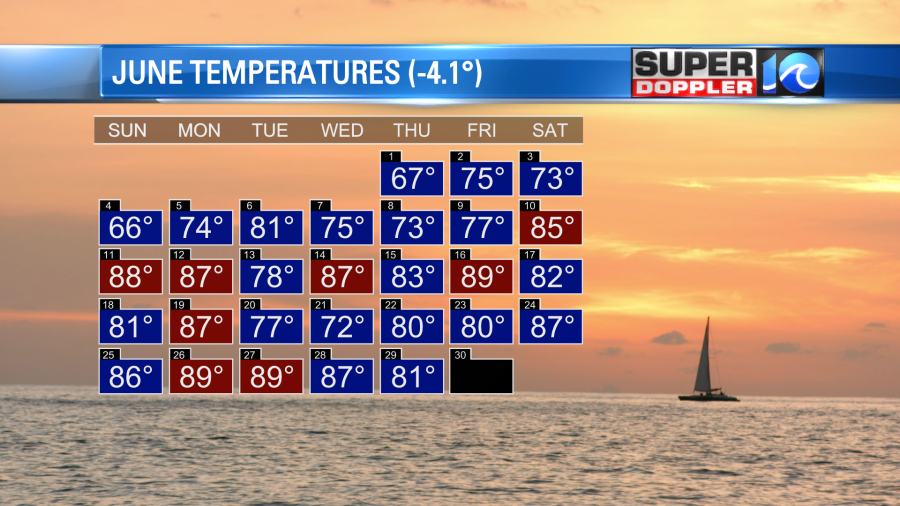
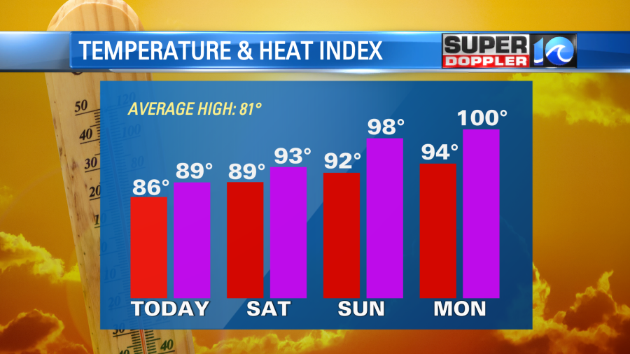
We still haven’t hit 90 degrees yet this year. We likely won’t hit that today. We are aiming for the mid-upper 80s this afternoon. This is a little below average.
Humidity won’t be too bad. Dew points are still in the 60s. Tomorrow we’ll have increasing humidity as the winds turn out of the south. We’ll have a mix of sun and clouds with a few rain showers at times.
High temps will rise to the upper 80s. We may hit 90 in a few spots. Dew points will rise to near 70. However, Sunday will have even higher temps and humidity. We’ll aim for the low 90s for high temps. There may be some mid 90s inland even. The heat index will be in the upper 90s, and it might even hit 100 for some.
The rain forecast for Sunday is very tricky. There have been large clusters of thunderstorms developing over the Midwest lately. These have been dropping to the southeast. On Sunday it’s possible that we’ll have some rain from one or two of these clusters, but the models have been going back-and-forth about it. So I have a few showers and storms on Sunday for now, but I have a low confidence in the placement and timing. Here are a couple of our models for Sunday.
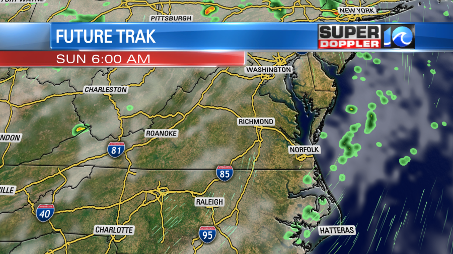

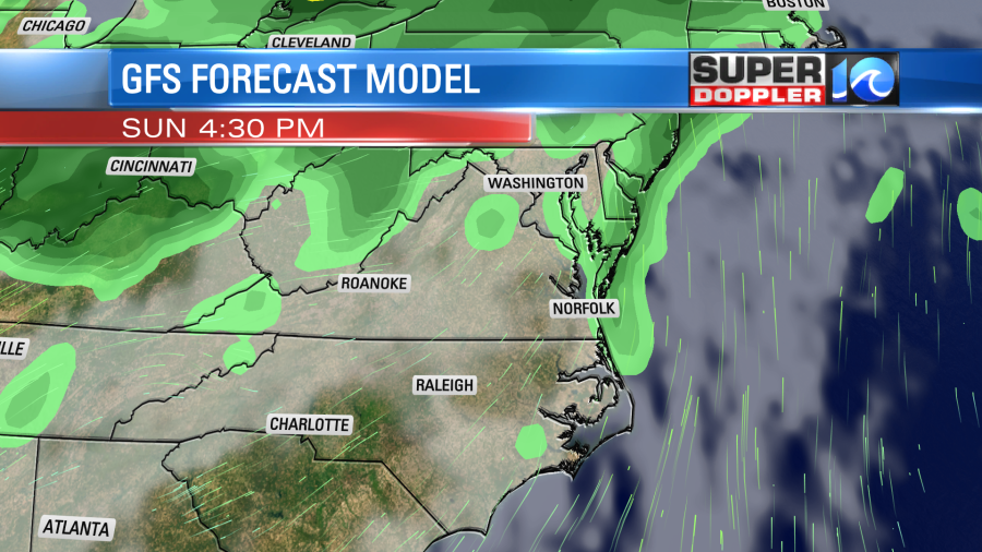

It’s easily possible that the track of some of those clusters could change direction (as has been happening lately). So check back for updates on that. Either way I don’t think we’ll have any big areas of rain in the region. The models are trending wetter on Monday with some storms in the area Then the GFS Model has some rain Tuesday morning, but it dries things out later in the day. Hopefully, this will hold true and keep the rain away from the evening. We’ll see. It’s still pretty far out.
No change in the tropics. There is still a low chance of a tropical disturbance forming near Bermuda within the next few days.
Meteorologist: Jeremy Wheeler