Severe Weather Alerts: A flash flood warning for Norfolk, Chesapeake, Portsmouth and Suffolk is in effect until 7:30 p.m.
There is also a severe thunderstorm warning for Virginia Beach until 5:15 p.m.
A tornado watch that had been issued until 7 p.m. has been canceled as of 6 p.m. The watch had been for much of Hampton Roads and Northeast North Carolina.
Today we are going to have 3 H’s. Haze, heavy rain, and heat. We even have a potential for some localized flooding. Let’s talk about it.
Today a cool front is moving into the northern fringes of the viewing area, but it is stalling out.
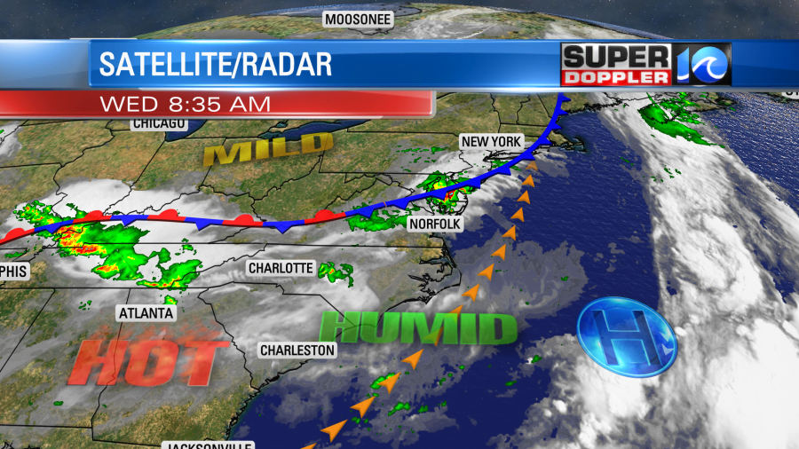
We have a southwest breeze which is pushing the deep/rich moisture through our region and up towards the front. We also have a weak upper level disturbance creeping east along the front.
This last feature helped to create one round of showers this morning north of Hampton Roads. However, we’ll likely have 2 or 3 more rounds through the day. There may be one between midday and the early afternoon.
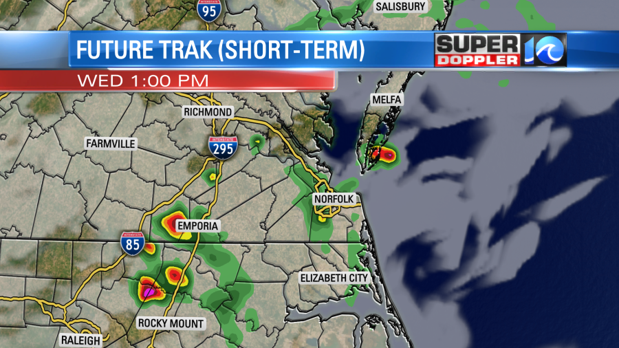
Then there will be another round or two between the late afternoon and early evening.
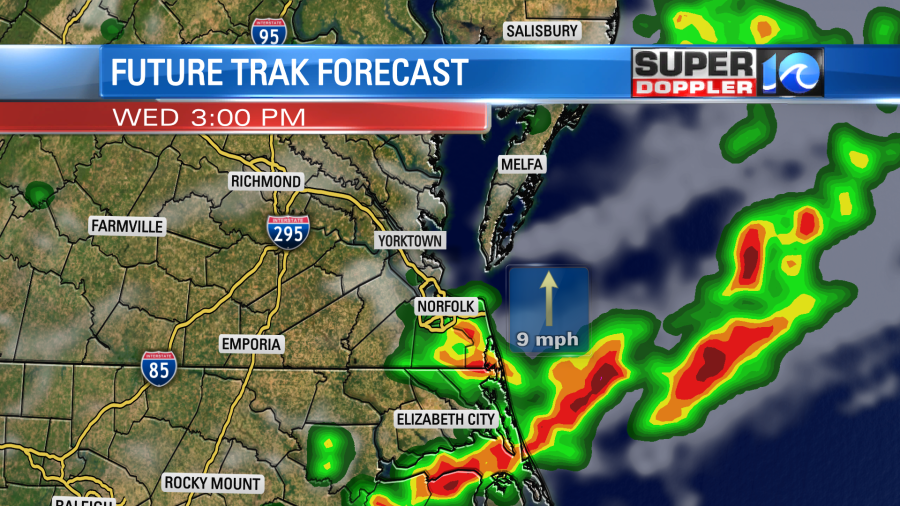
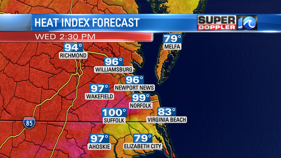
Any of these clusters of showers and storms could put down some heavy rain. Otherwise we’ll have a mix of sun, clouds, and haze. High temps will rise to the upper 80s to low 90s. The heat index will be in the mid-upper 90s.
Tomorrow the front will lift north every so slightly. We’ll be partly cloudy with a few PM showers and storms, but the chance for rain will be lower. The chance may pick up a bit by the evening.
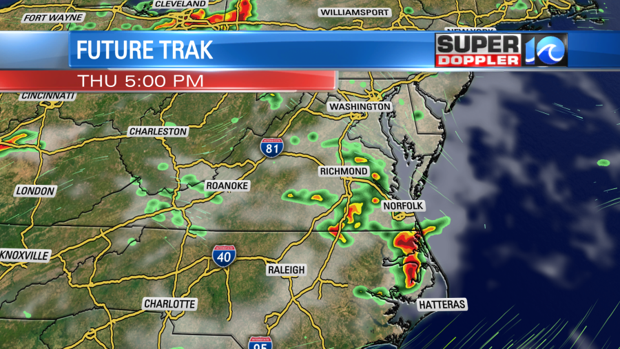
High temps will be near 90 or in the low 90s. By Friday temps will pick up some more. Highs will be in the mid 90s. The heat index will be back to around 100 degrees. There will be some isolated showers or storms. We’ll have cooler weather over the weekend with fairly quiet weather. High temps will be in the mid-upper 80s. It should be a little drier too.
I mentioned haze. The haze and smoke from the eastern Canadian Wildfires has returned to our region. We definitely had the haze overhead yesterday and this morning.
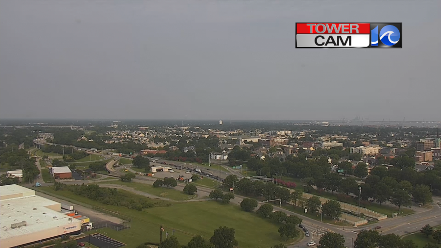
Some of the smoke and haze has dropped and made it closer to the ground today.

There are Air Quality Alerts (code orange) for a large chunk of the viewing area.
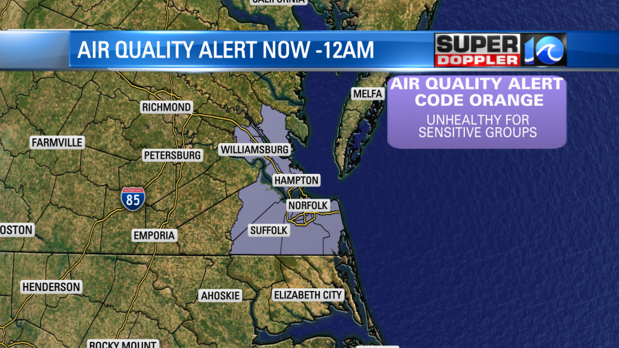
Luckily if the rain gets as heavy as forecast, then it should wash out some of that smoke and haze.
Finally, tropical storm Don is still churning in the middle of the Atlantic. It is still tracking on that big loop. It will stay out to sea.
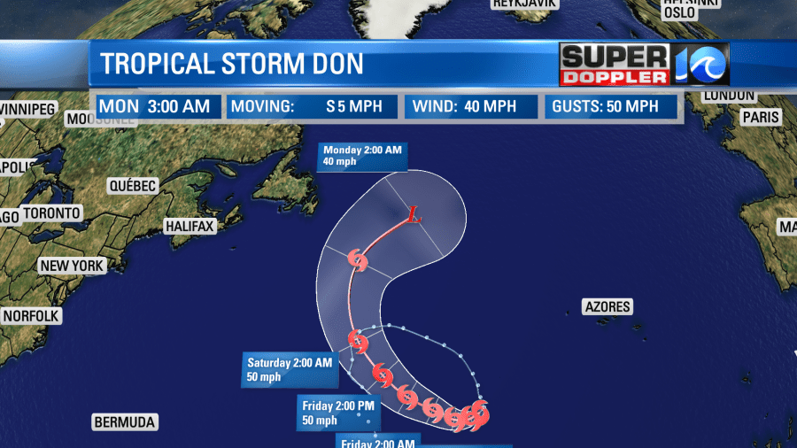
It should move over cooler waters in a few days. At that point it will either become extra-tropical, or it will fall apart.
Meteorologist: Jeremy Wheeler


