There is some awesome weather that is moving into our region today! I want to talk about it, but I should probably mention yesterday’s weather first. We had large clusters of showers and thunderstorms rolling though the region late in the day into the evening.
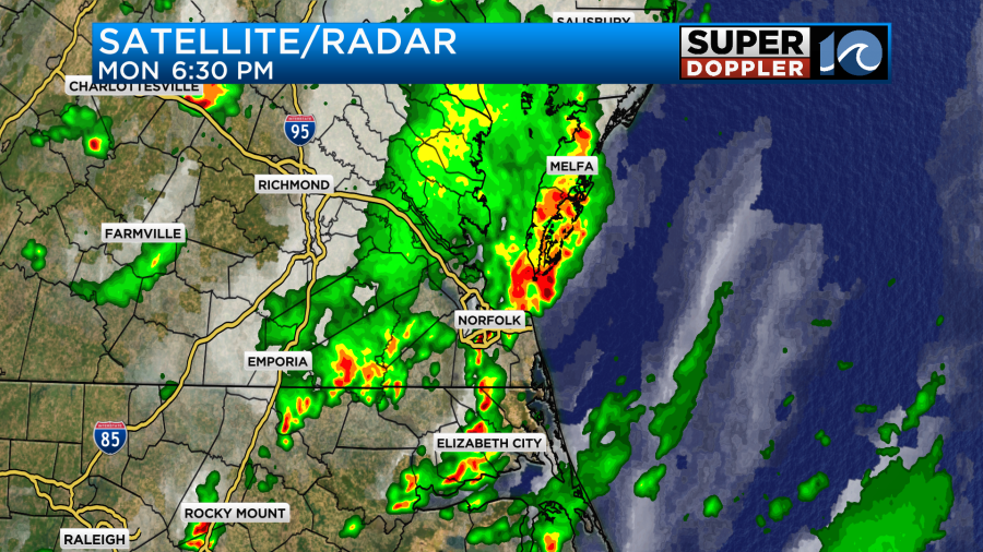
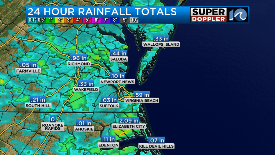
There was some brief flooding, and there were a couple of wind damage reports from near the Yorktown area, but the rain totals varied greatly. Some spots like Elizabeth City had over 2 inches of rainfall. Meanwhile Suffolk only had a couple hundredths of an inch.
This was expected, and it was ahead of a cold front. That front is dropping to our south today. High pressure is slowly building in from the northwest.
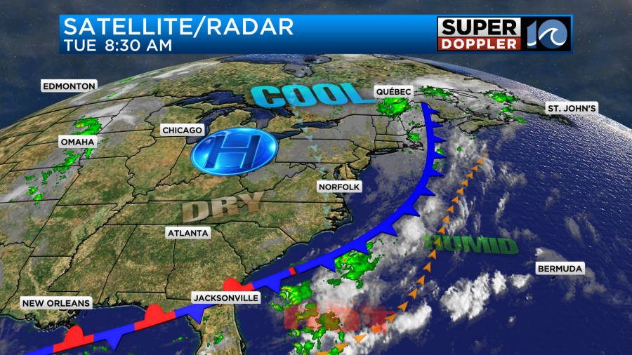
We will have a north breeze developing at 5-15mph. This will pull down some much drier air into the area. Dew points will drop into the 50s by the end of the day. We’ll have partly cloudy skies through the day. There is an upper level trough (dip in the jetstream) that may cause a stray shower or two, but that’s it.
High temps will be cooler. We’ll be near 80 degrees this afternoon with upper 70s mixing in and north of the metro.
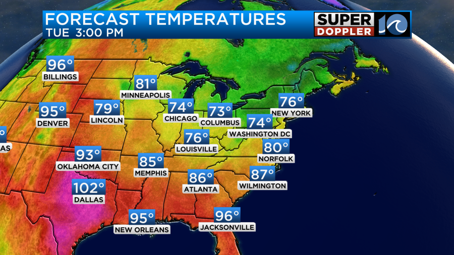
Tomorrow will be even nicer! We’ll have mostly sunny skies through the day with a northeast breeze. High temps will only rise to the upper 70s.
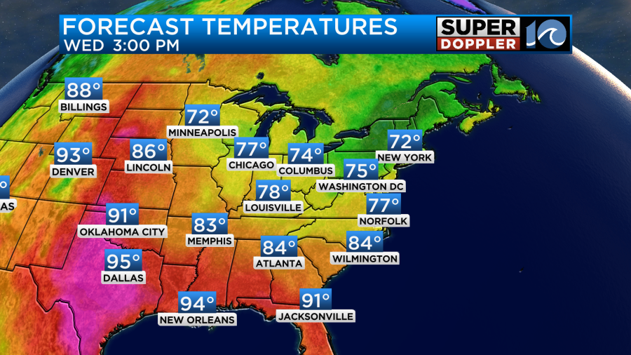
The humidity will drop even more. In fact, the dew points may drop as far down as the 40s if the model is right.
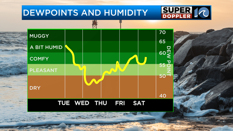
We’ve been getting periodic shots of cooler/drier weather in August for the past few years, but this will be a true taste of Fall! This will also allow the low temps to drop down to the 50s and 60s over the next couple of mornings. The coolest morning will probably be Thursday morning. Not only will there be 50s and 60s, but I wouldn’t be surprised if there were a couple of upper 40s far inland. Get the medium jackets ready to go. We’ll rise to the upper 70s in the afternoon with lots of sunshine.
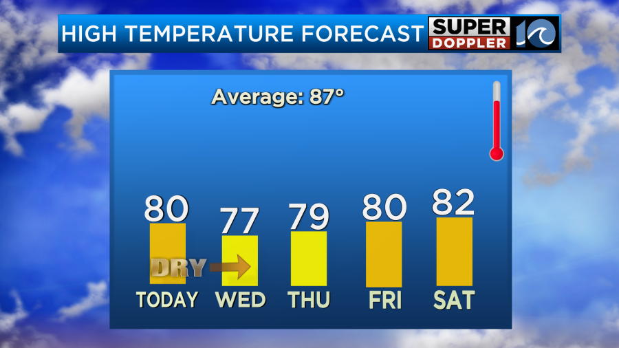
The nice weather will continue through the weekend. We’ll stay dry with highs remaining in the 80s. This will be great for folks that want to get outside, but if you missed the rain yesterday, then you might be watering your grass by then.
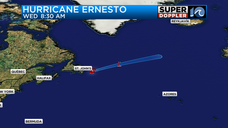
The only thing we have in the tropics is Ernesto. It was a hurricane early this morning, but it will likely become post-tropical soon.
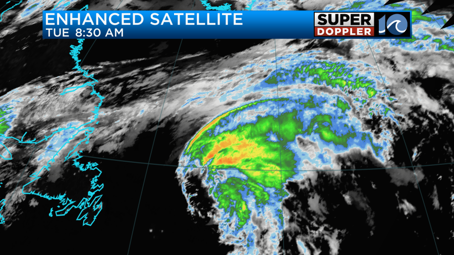
It was jetting to the northeast at 36mph over the cooler waters of the North Atlantic. So it will become post-tropical if it hasn’t already.
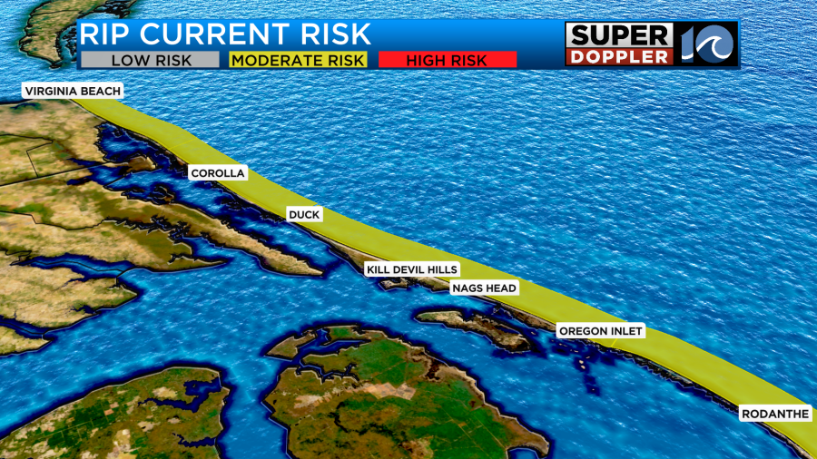
This is good for our rip current threat. It has gone to moderate today, and it should decrease even more by tomorrow.
Meteorologist: Jeremy Wheeler


