The local weather is going to be very nice over the 3 few days. High pressure is building stronger into the area from the west, and a cold front is far offshore.
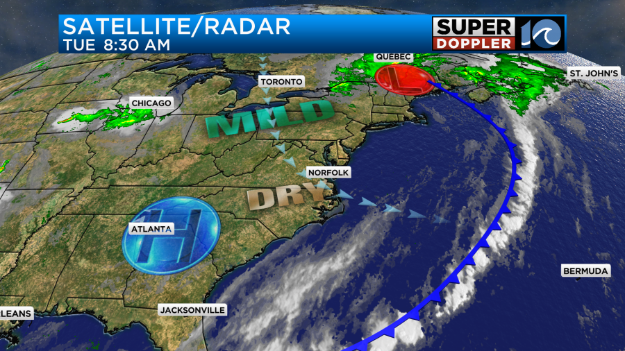
We are going to have a lot of sunshine today through Thursday. High temps will be in the upper 70s to low 80s today through that time.
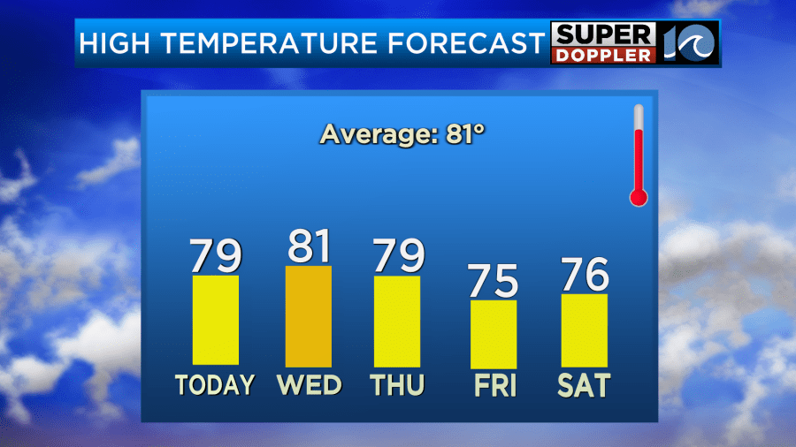
Low temps will be in the 50s and 60s tonight, but it will be more in the 60s Thursday and Friday mornings. Humidity is down, and that is making it very comfortable and Fall-like.
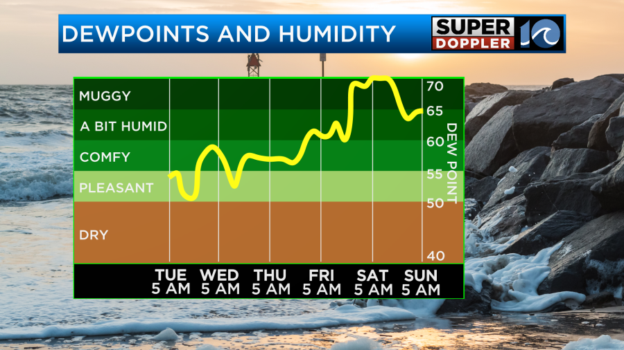
The humidity will go up by the weekend. A coastal low is forecast to develop to our south. This will push a lot of moisture up into our region by Friday.

The models show an area of low pressure forming around Florida in a couple of days. They then have it slowly rising northward along the coast. The GFS Model’s latest solution has a bit of a split. It actually has one weak low Friday night near the shore with a bigger low moving just offshore on Saturday.
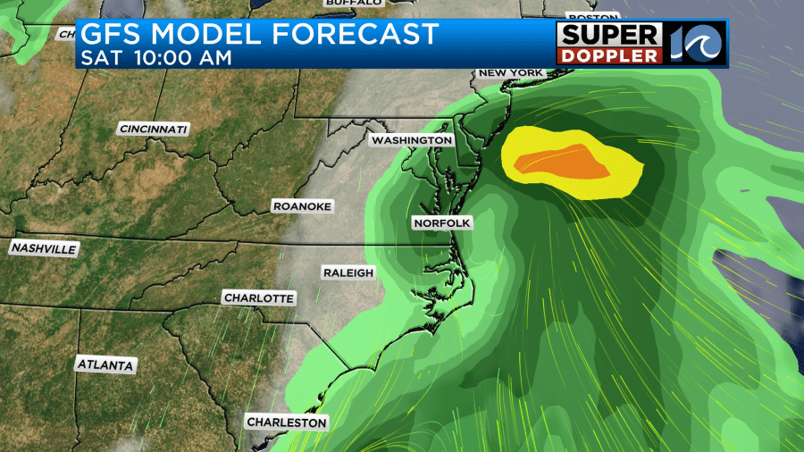
The latest European model keeps the main low to our south over the weekend, but it still pushes the moisture up our way. So it also has some rain late Friday with a lot of rain on Saturday. However, it keeps the low to our south even on Saturday now.
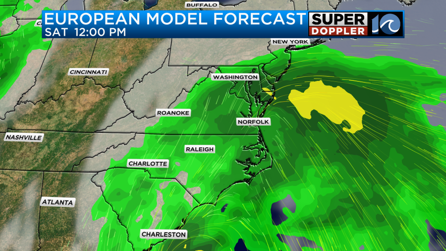
Both models have at least some rain continuing on Sunday.
The bottom line is that it looks like a wet weekend, but as we get closer in time the forecast will probably still morph a bit. We still have some time for the forecast to change.
Meanwhile we are tracking hurricane Nigel in the middle of the Atlantic. It was on a northwest path this morning, but it is forecast to take a bend to the northeast in a couple of days.
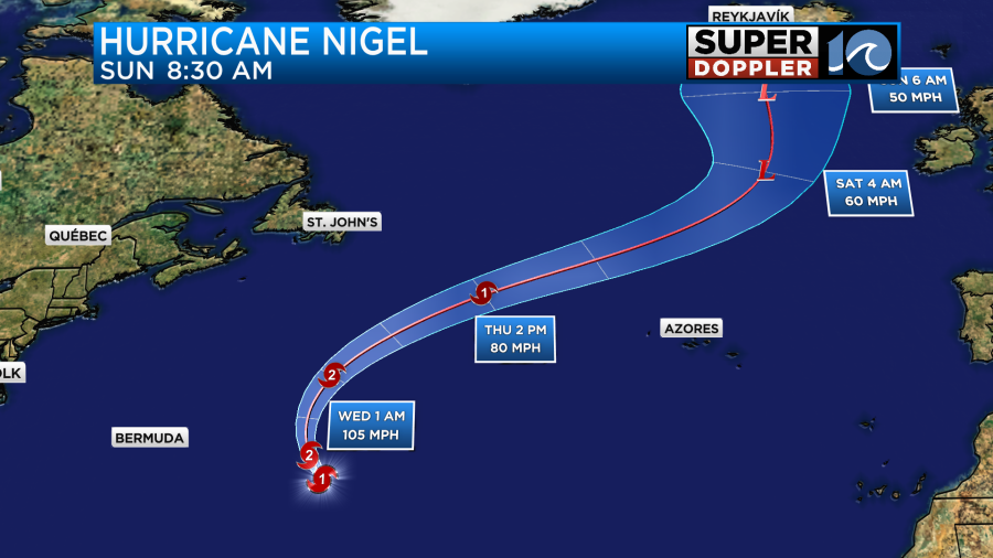
It will stay out to sea, but it will send us some more waves over the next few days. There is another tropical disturbance in the eastern Atlantic that has a high chance of formation in the next 3-5 days.
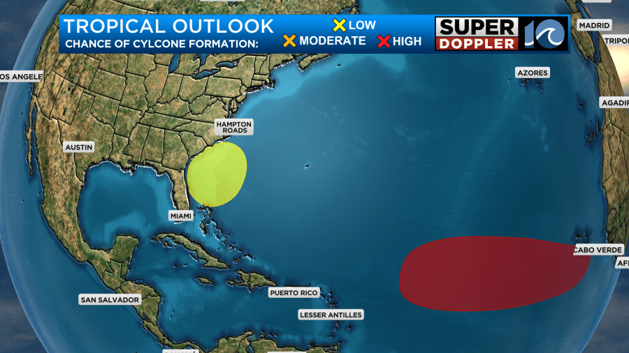
The yellow area south of the Carolina’s is that coastal low that I was talking about. It is possible that it could become tropical or subtropical, but we’ll see.
Be sure to check back for updates.
20 years ago hurricane Isabel hit our region, and it changed everything. It was a scary category 5 hurricane while it was out at sea. However, it had weakened to a category 2 as it made landfall over the Outer Banks.

The system weakened even more as it moved through Virginia, but the strong winds had spread out from the core of the storm. We had lots of wind damage, tidal flooding, and power outages in the area. It was the second highest tidal flooding on record with 7.9ft recorded at Sewell’s Point (MLLW). Here is a report about it from the National Weather Service: Isabel, NWS.
WAVY TV did an hour long report on Isabel and its specific impacts on the local area. Here is that report: WAVY TV report on Isabel
Meteorologist: Jeremy Wheeler