(Updated: The system in the Gulf is now tropical storm Francine. See update below):
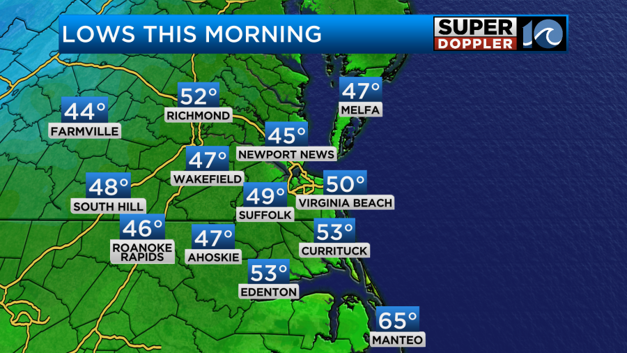
Locally, we are going to have some great weather for a few days. Over the weekend a big cold front slid into the area. It created some wonderful conditions yesterday as it sunk to our south (as predicted). We had lots of sun and very dry conditions Sunday. Today we are continuing with the nice weather. We started off the morning with fair skies and cool temps. Lows made it down into the 40s and 50s.
We have high pressure to our north with a stalled out front to our south.

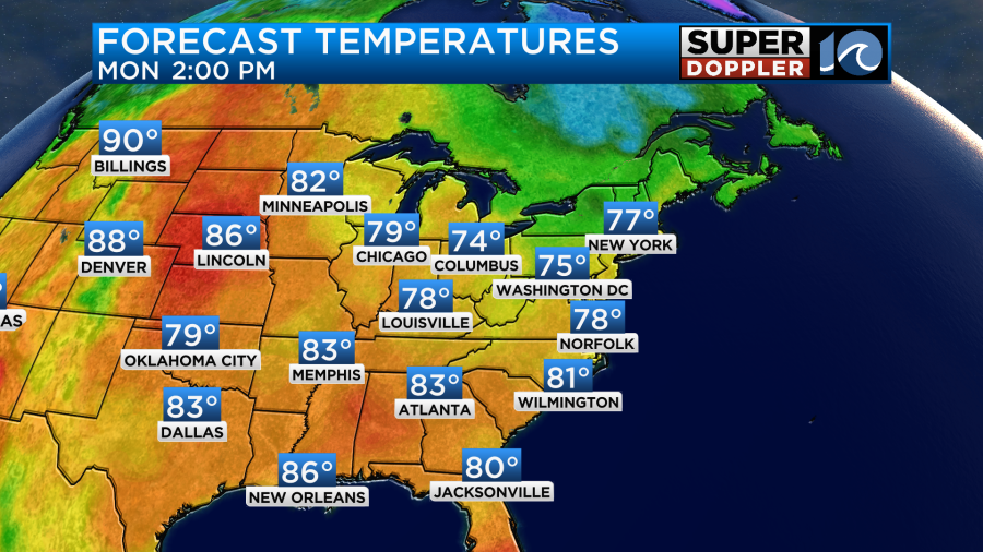
We’ll have lots of sunshine through the day with a light north breeze. High temps will be in the upper 70s.
It will be dry with dew points still down in the 40s. This is bone-dry air for this time of year.
Tomorrow we’ll still be dry with lots of sunshine. Low temps will be more in the 50s than the 40s. We’ll warm up to the low 80s in the afternoon.
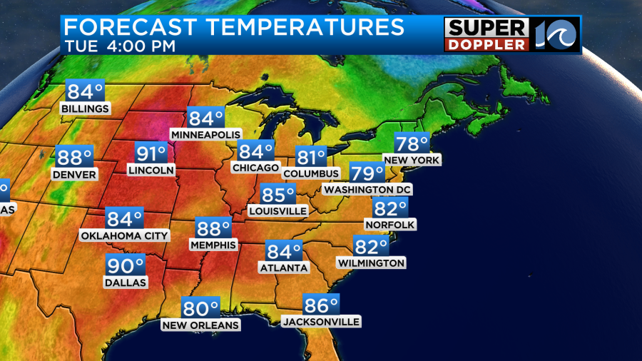
We’ll stay pretty dry and sunny through Wednesday.

Temps will be near 80 or in the low 80s most of the week.
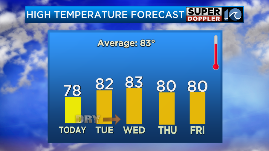
We’ll have some more moisture by the end of the week. There may be some spotty showers between Friday and Saturday, but it’s a low chance. We do need some more rain. We had a little this last weekend, but it didn’t add up to much. We are about a quarter of an inch below average.
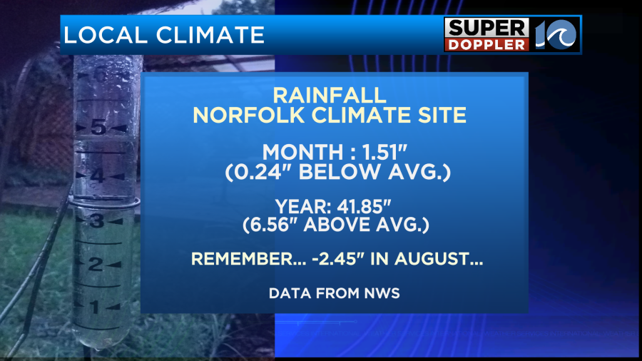
That’s not much of a deficit, but remember we finished 2.45″ below average for the month of August. So the 2 month average is not good.
Some of the moisture later this week may come (indirectly) from a tropical system to our west. As I write this a tropical storm is brewing in the Gulf of Mexico.
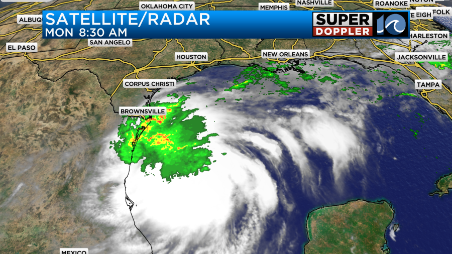
There was a large cluster of thunderstorms there with gusty winds. However, it wasn’t very organized up to this point. The National Hurricane Center has this features as a Potential Tropical Cyclone, but it may be tropical storm Francine by the time you read this. Regardless, here is the track: (update: As of 11am, the National Hurricane Center has deemed this system tropical storm Francine).
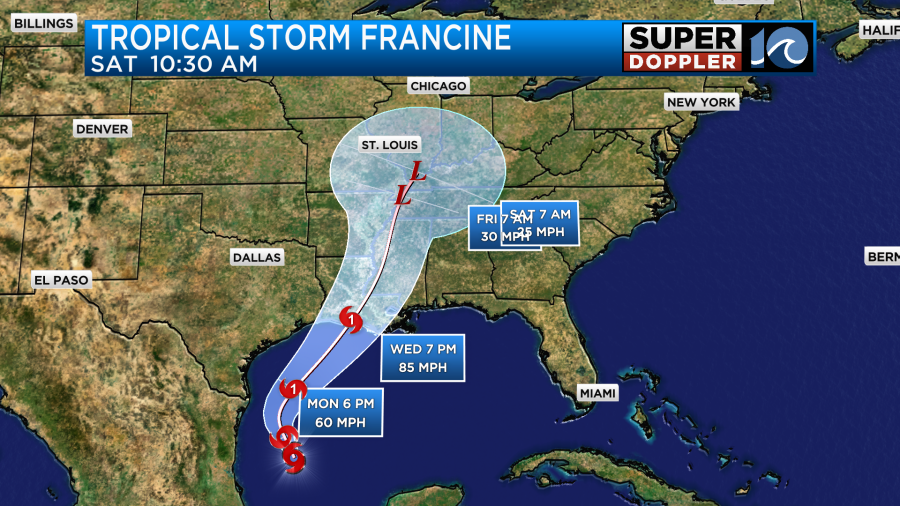
It is forecast to move north and then northeast and strengthen over the next couple of days. It is forecast to be a category 1 hurricane by mid week as it moves towards the Louisiana Gulf Coast. Many people don’t think much of a category 1 hurricane. However, in 2012 hurricane Isaac made landfall as a category 1 hurricane, and it really shook things up across Louisiana and other parts of the Gulf coast. It created a storm surge over 10 ft which was due to its large size. So that’s another good example of why storm surge height is no longer directly associated with category.
The models are in pretty good agreement as to the track of Francine.
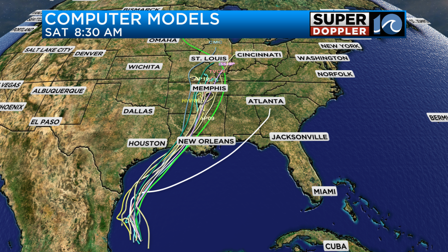
After landfall (and weakening) it may bring some beneficial rain to the Tennessee River Valley. We’ll have updates on it over the next couple of days.
There are 2 other features in the central Atlantic that have a medium chance of formation.
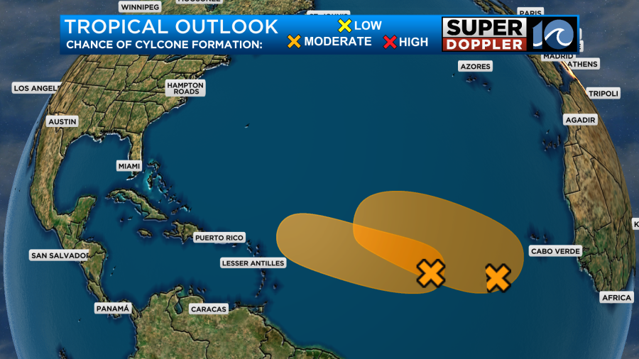
They are both moving to the west/northwest. We’ll continue to monitor those as well.
Meteorologist: Jeremy Wheeler


