
This morning we had some frosty conditions in some of our inland areas. Frost Advisories were issued yesterday afternoon by the National Weather Service and they have verified.
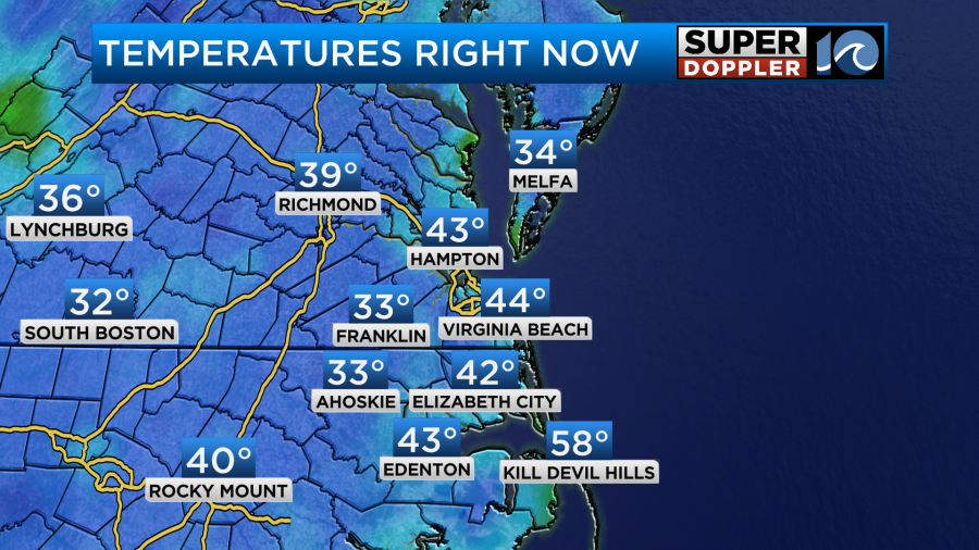
We’ve had very dry air in place for a few days, and we had clear skies and light winds overnight. This allowed for our maximum cooling.
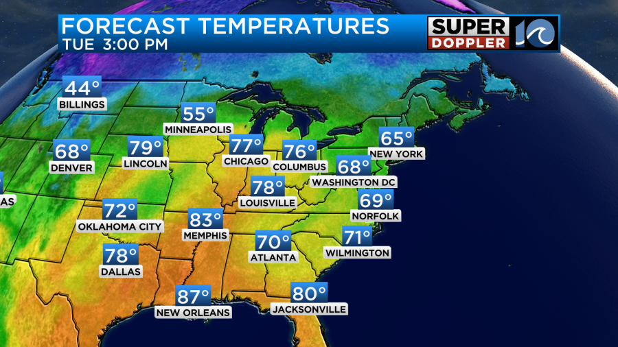
Today temps will warm fast. With the dry air and strong October sun we’ll rise from the 30s and 40s this morning to the low 60s by midday. We’ll top off in the upper 60s this afternoon.

For some areas this will be more than a 30 degree rise in temps. It will be cool and dry this afternoon here, but there is some warmth building to our west.
We still have a large area of high pressure over the east coast.
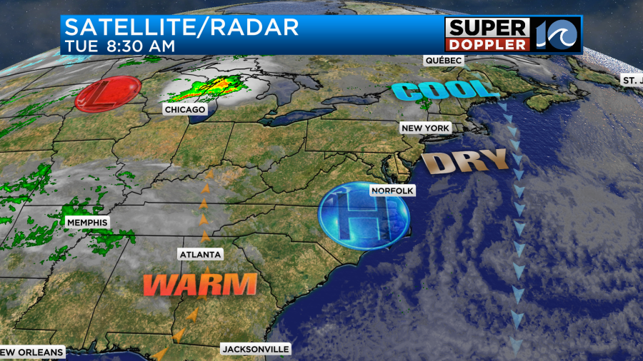
This will produce a light northeast wind, but it should only run at about 5-10mph.
Tomorrow the high will slide offshore. This will allow the wind to turn more out of the south. Even though it is a light wind, it should still help to warm us up. We’ll start off in the 40s and 50s. We’ll end up in the mid 70s.
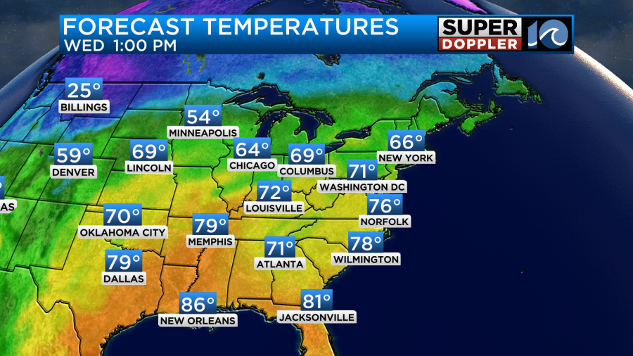
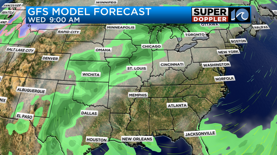
We’ll be mostly to partly sunny Wednesday. It should be very nice out!
We’ll still have lots of sunshine for the rest of the week. Southerly winds will continue Thursday into Friday. This will push our high temps up to the upper 70s to near 80 degrees.
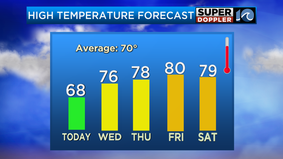
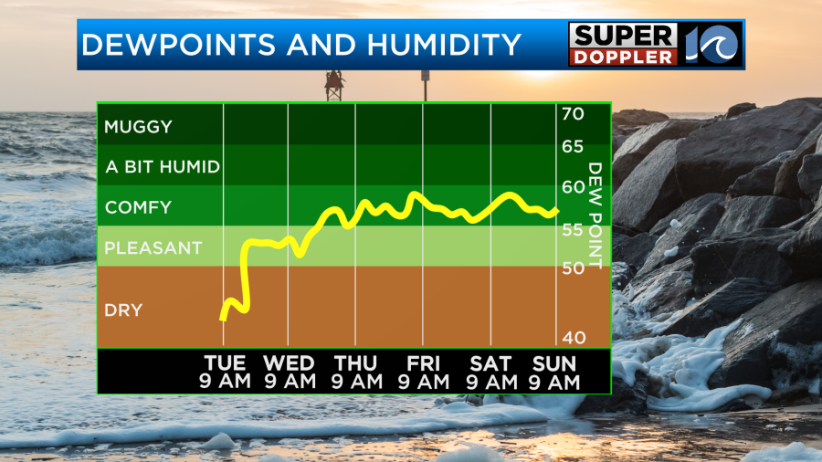
This will continue into the weekend. Humidity will increase a bit. Dew points are in the 30s today. They will be in the 50s Friday into the weekend.
Meanwhile, we have 2 systems in the tropics again. However, tropical depression 21 will be very short-lived. It formed late yesterday. It will likely fall apart soon. It is becoming a heavy rainmaker over Nicaragua.
Meanwhile hurricane Tammy is maintaining some strength. It a minimal hurricane now. It is south of Bermuda, but it is slowly meandering in that direction.

The system will snake its way northward over the next few days. As it does it will have some increased wind shear, and it will move over cooler water. So it should weaken during that time. It will also interact with some cooler/drier air. The forecast calls for it to become post-tropical in about 2-3 days.

The models are interesting. The GFS and Euro models have it getting close to Bermuda in a few days, but as a very weak (and post-tropical system).
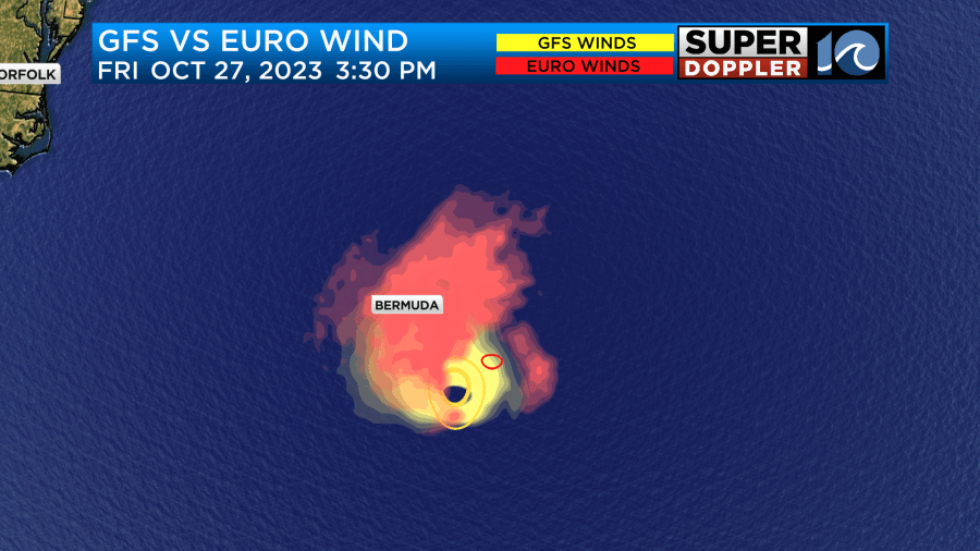
However, some of the models now have it taking a sharp turn to the right and missing the island.

We’ll see. We’ll probably maintain some 2-4 waves along our shores, but Tammy could up the waves some more by next weekend. Even if it does become post-tropical.
In U.S. News… There is still a very bad drought happening over the central U.S.
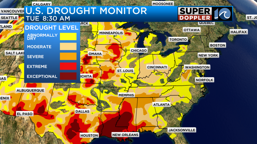
Luckily, they are going to have a wet pattern for a couple of days starting tomorrow.
It won’t be a drought-buster, but it will help.
Meteorologist: Jeremy Wheeler


