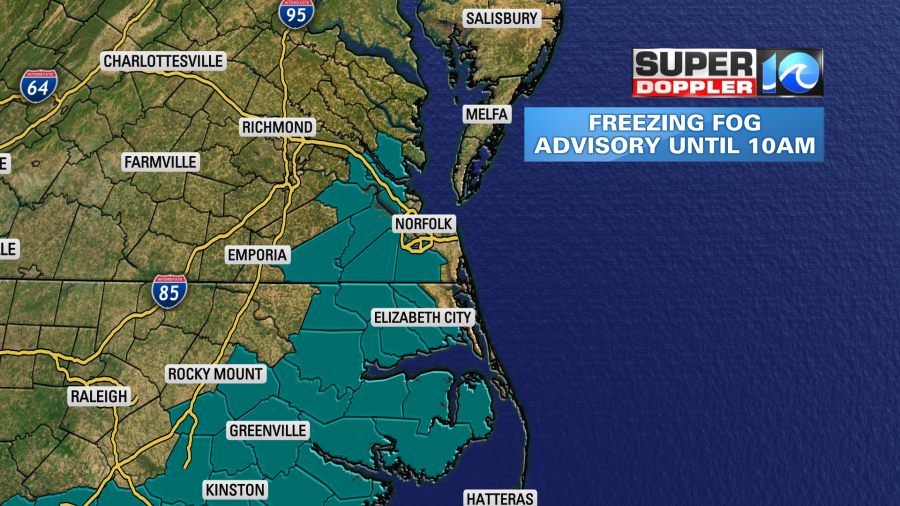
In our efforts to get to some warmer, enjoyable sunshine later this week, there’s a small hurdle in our path. Just like everything else in life, right? Freezing fog is said hurdle, and is not only lowering visibility this morning but potentially causing some slick spots.
The Freezing Fog Advisory from the National Weather Service goes until 10 this morning. It’s in place for the majority of northeastern North Carolina communities and a good chunk of Hampton Roads. Chesapeake, Suffolk, Isle of White, Southampton, Surry, York, James City, Newport News and Gloucester dealing with fog. Visibility will improve by late morning, so after 9 or 10 a.m. we’ll be off and racing into a nice day.
Freezing Fog – this is a pretty interesting weather phenomena. The small, tiny water droplets that develop in the nearly 100% saturated air at the surface become supercooled. Meaning they remain in liquid form despite air temperatures at/or below freezing. This also means that once these water droplets come in contact with a physical surface, they can freeze instantaneously. So, long story short, this fog not only creates lowered visibility, but also some slick/icy spots. Use caution!
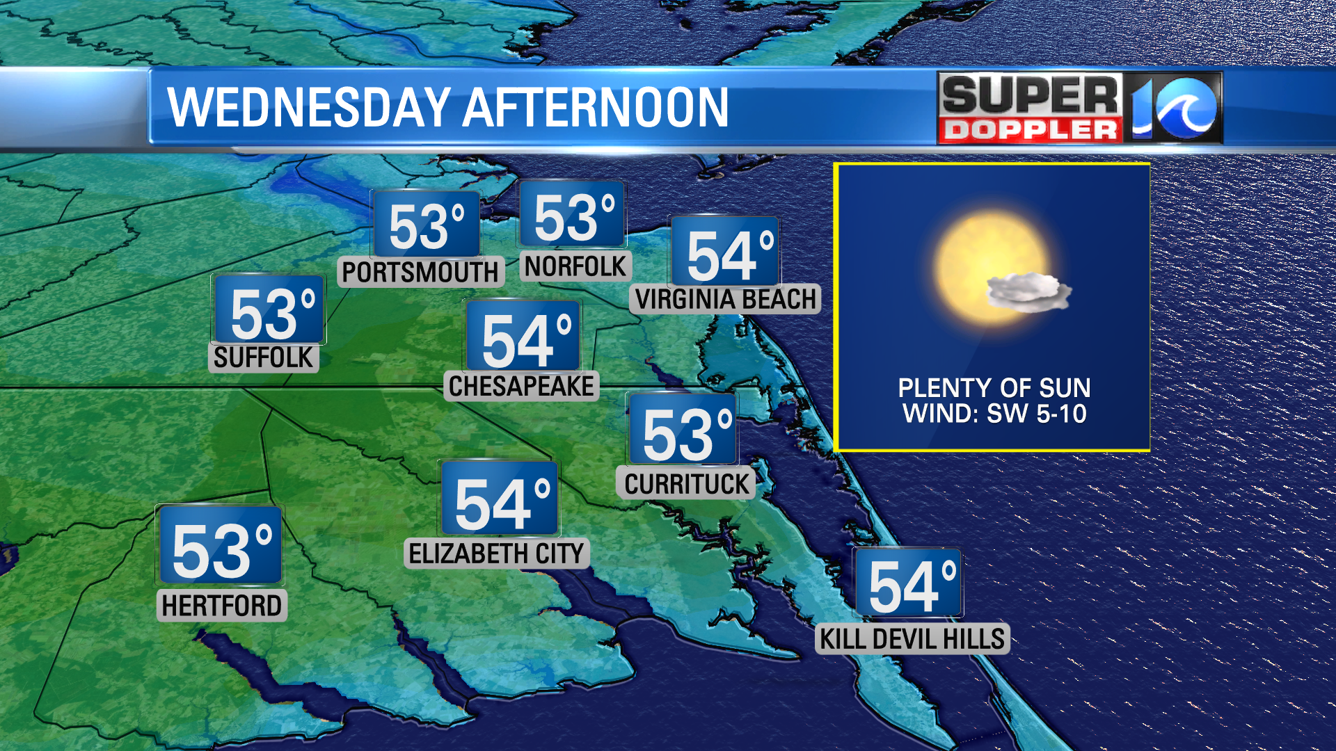
Alright, thanks for allowing me to nerd out there for a bit. The rest of the day really shapes up, as does the rest of the week. After the fog clears and we defrost, a sunshine filled day will bring us to the low 50s. A few clouds stream in later this evening, but should just add some color to the sunset.

High pressure settles in place by the end of the day today and as a result, tonight will not be as chilly. Lows only drop to near 40° by dawn tomorrow. So not as much frost and no freezing fog (maybe some regular fog though). Since we start the day Thursday milder, we’ll finish warmer. Plenty of sunshine will boost our highs to 60°! A similar day on Friday too, with a milder morning and highs in the mid to upper 50s.
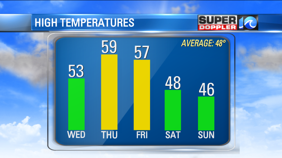
A few clouds start to stream in Friday afternoon as we await our next frontal system. This brings our next chance of rain to the area. As of now, look for a few showers late Friday night (well after dark) and persisting into Saturday morning. Behind this front is some colder air so our temperatures this weekend will get back to January standards. Mid to upper 40s for highs; stubborn clouds after the rain on Saturday with sunshine returning Sunday.
Stay stoked! – Meteorologist Steve Fundaro


