This morning we had thick fog covering a large part of the viewing area.
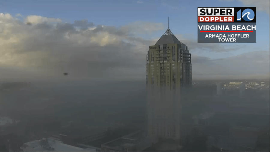
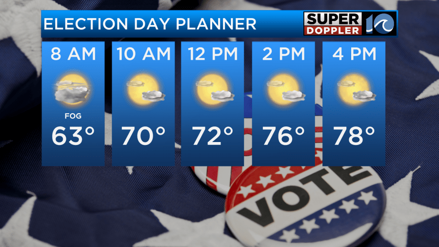
The fog is thinning out as I write this, and it should burn off soon. This impacted both morning commuters and folks heading to the polling stations. The good news is that after the fog dissipates then we should have some nice weather for this Election Day. We’ll be partly cloudy with temps warming up to the upper 70s.
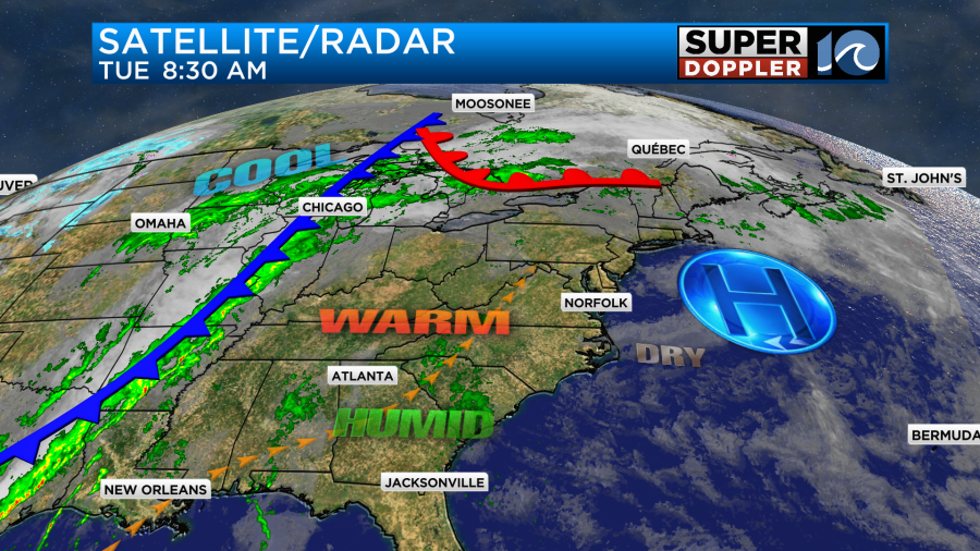
We’ll have a light south wind, and that will aid in warming us up this afternoon. High pressure is offshore. There is a cold front over the Mississippi River Valley.
The weather should be good through the evening for late-day voters as well.
Tomorrow we’ll be solidly in the warm zone. High pressure will be offshore with the cold front still off to our west. We’ll also have more of a southwest breeze. Between that and a good amount of sunshine temps will push up to near 80 degrees.
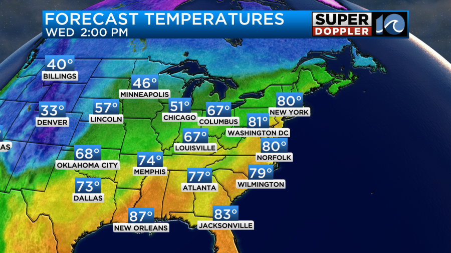
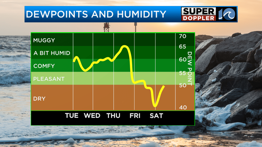
On top of that, the humidity will be climbing. Dew points will rise to near 60, and they’ll stay there for a couple of days.
We’ll be partly cloudy for the majority of Wednesday. It will be nice but unseasonably warm.
On Thursday the cold front will move into the region but slowly. As it comes in there’s a chance for some isolated showers during the day. However, I don’t think we’ll have much more than that.
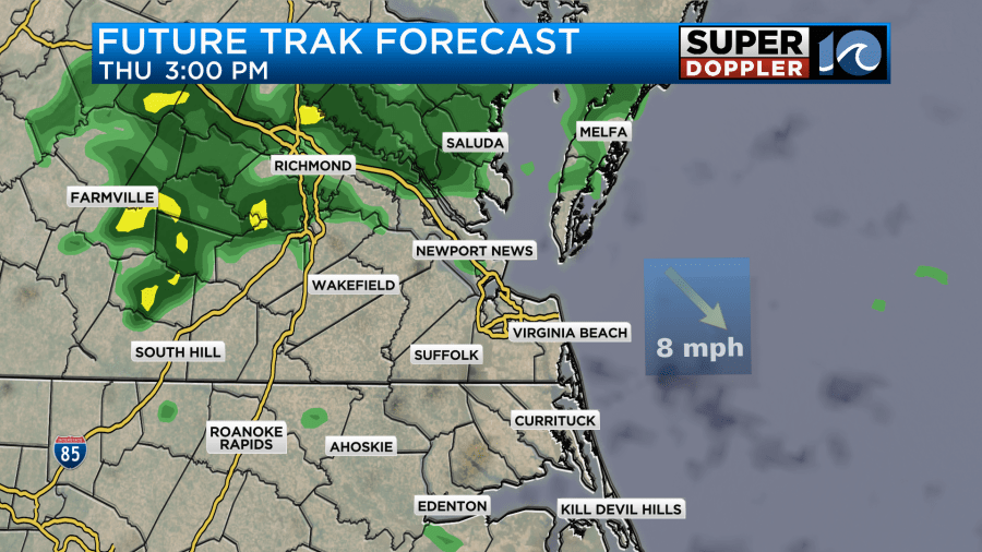
It is promising that a cluster of showers shows up to our north/northwest on Future Trak Thursday afternoon. However, a lot of those will probably break up as they move east.
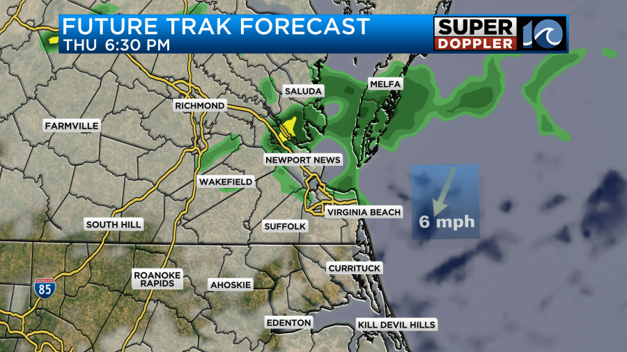
By the end of today we will have broken the record for consecutive days without rainfall. It will be 34 days. The rain on Thursday will be too late for that record. Also, it may not add up to much in the rain gauge. So the drought will continue.
Regardless, we’ll cool down a little on Thursday. Highs will be in the mid 70s. Then we’ll cool down some more by Friday with high temps returning to the 60s.
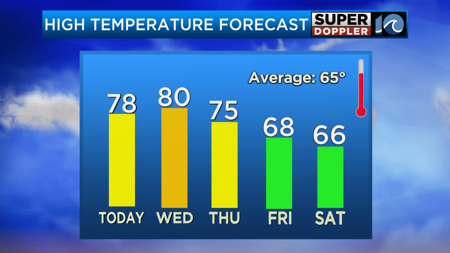
We’ll be dry and cooler on Friday. Then we’ll be cool on Saturday with some moisture returning. There may be some more isolated showers as a second front drops to the south. As of right now it looks like there will be a little higher chance for rain on Sunday and Monday. We’ll see. I’ll talk more about that tomorrow.
Meanwhile, tropical storm Rafael is gaining strength over the Caribbean Sea. It was just to the southwest of Jamaica this morning.
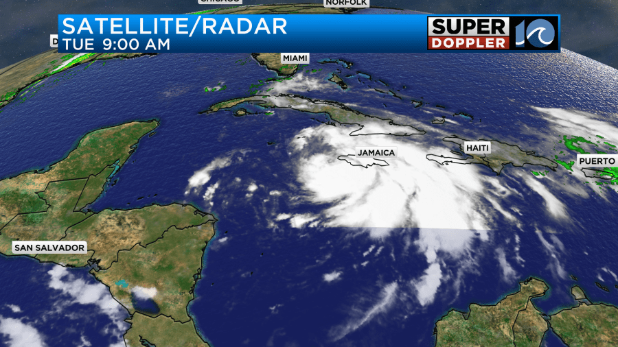
It is looking more impressive on the satellite. It is forecast to move northwest today. Then it is expected to hit western Cuba by tomorrow as a hurricane.
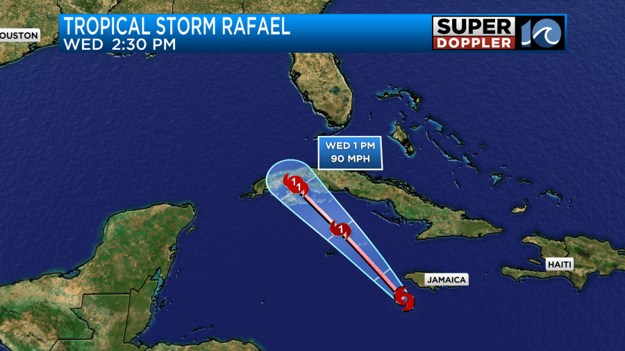
The island just had another hurricane (Oscar) affect eastern Cuba recently. They also had a large part of the country without power. So hopefully, residents down there will be ok.
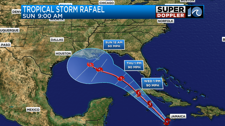
After Cuba the storm is forecast to move northwest and….weaken. Yes. Despite, very warm ocean water the system should encounter more wind shear. It will also encounter some drier air. So it may only be a weakening tropical storm as it tries to head towards the Gulf Coast this weekend.
I will say that there is a lot of uncertainty in the model tracks.
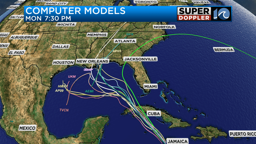
There may be a bit of a trend towards eastern Louisiana, coastal Mississippi, and Alabama. The GFS model does have the system weakening as it gets closer to the coast.
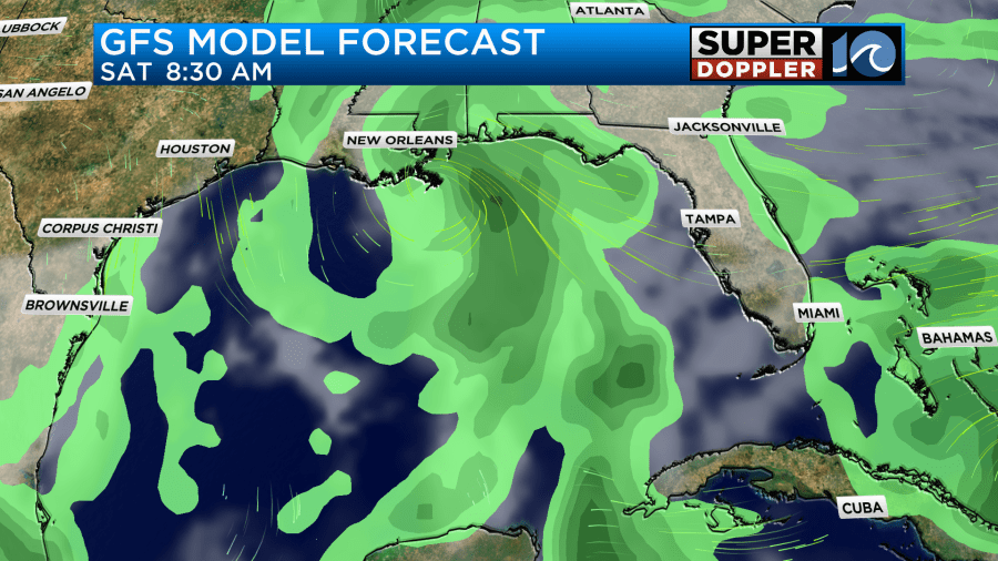
We’ll keep an eye on it over the next few days.
Meteorologist: Jeremy Wheeler


