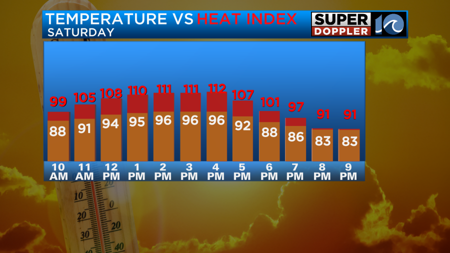
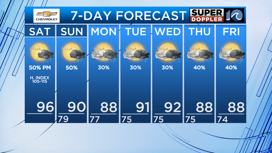
It is going to be very hot and humid as we go into the weekend. High temps will be in the mid 90s Saturday with a heat index between 105 and 112 degrees. We have high pressure offshore with a light southwest wind and a good amount of sunshine.

We’ll be partly cloudy today with a few afternoon showers and storms popping up. The window opens for some showers and storms after around 1-2pm. We’ll see the potential for more widespread rain later in the evening. Heavy downpours are possible. Some models suggest rainfall totals of 2″-3″ which could lead to some flash flooding in the area. However, because of the scattered nature of things – some spots will likely see nothing or only a half an inch. Some big winners, other’s miss out…

A cool front will move in and stall out over the area on Sunday. High temps will be near 90 degrees, but it will still be humid. That will allow once again for a chance of heavy rain with storms.
We’ll finally cool down to the upper 80s on Monday. There will be some scattered thunderstorms, mainly in the afternoon. Then, we’ll have some typical summer weather for most of next week. Highs will mainly be in the 90s.
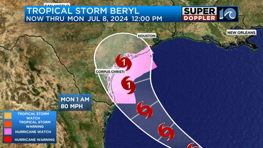
Meanwhile, Beryl is now in the Gulf of Mexico. It will aim for south central Texas late Sunday into Monday. This morning, it is fighting off some organization issues and dry air. It is expected to restrengthen on Sunday, with the NHC forecasting a hurricane at landfall. No impacts expected here – and no additional development expected across the Atlantic basin over the next 7 days.