Update Thursday Afternoon:
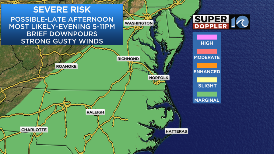
SEVERE T-STORM WATCH UNTIL 9 PM THIS EVENING
As the approaching cool front crashes into the region this evening, a broken line of thunderstorms will accompany it. Some of them could produce damaging wind, be sure to stay weather aware this evening!
Thunderstorm activity should move in after 5 or 6 this evening and take us through at least sunset. Any activity will fade by midnight or the late night hours. The warm breeze keeps things hot and humid through the evening before some pleasant weather moves in tomorrow.
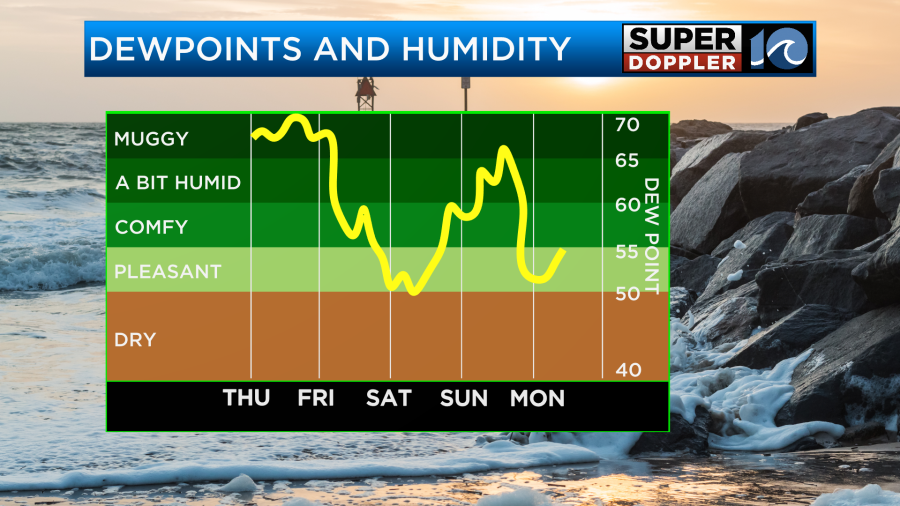
Behind this front, low humidity, dry weather and sunshine takes over for tomorrow and the weekend. A late night shower is possible Sunday into Monday, with some unsettled weather expected next week. Enjoy this weekend!
_____________________________________________________________________________________________________
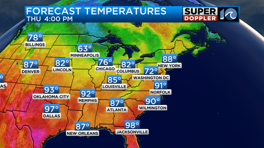
We are in for another steamy day. In fact, today will be worse than yesterday in terms of heat and humidity. At least on Wednesday we had quite a bit of cloud cover. Today we’ll have much more sunshine. We also have something that we haven’t had in a while… A strong breeze. Winds will be out of the southwest at 10-15mph with gusts up to 20mph.

This will help a bit as we are forecast to hit the low 90s this afternoon under partly cloudy skies.
The heat index, however, is going to make it feel like the mid 90s.
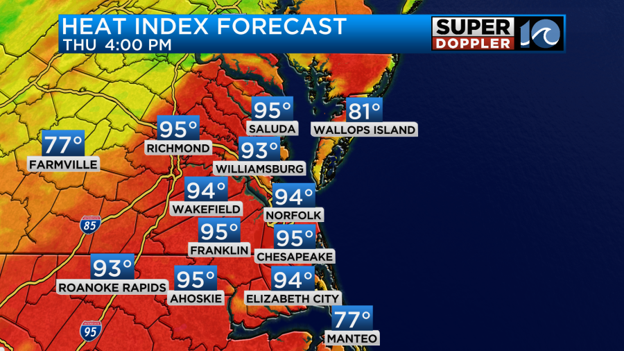
This will be from the mid afternoon until the early evening. We are going to be in the “hot zone” today. A warm front is passing to our north with a cold front off to the west.
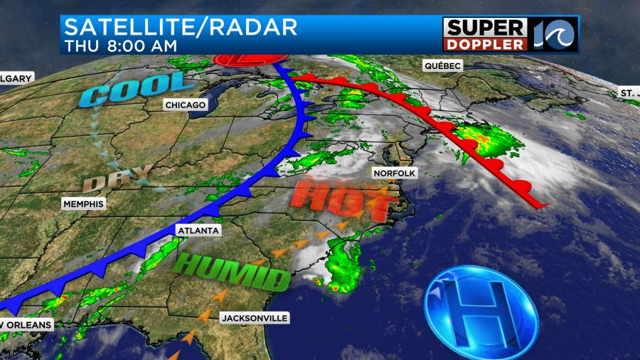
We will likely have a long stretch of quiet weather. There may be some isolated (pop-up) showers and storms in the late afternoon.
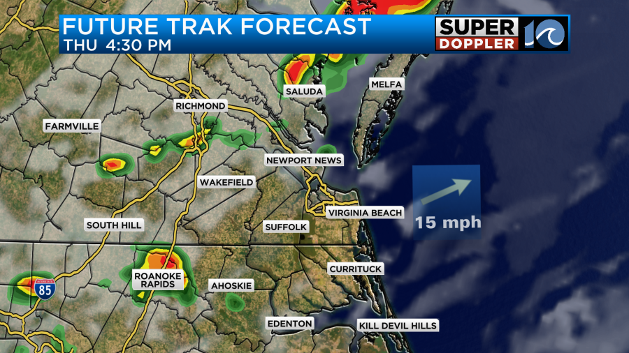
However, it looks like there will be a big/broken line of showers and storms during the evening.
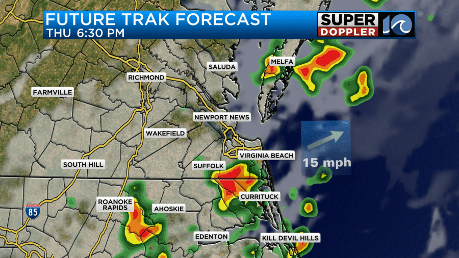
This is when there will be a low chance for some severe weather. Our whole area is under a marginal risk. I believe this is mainly for the evening.
The storms should die down after about 11pm.
Behind the front tomorrow we’ll dry out steadily through the day.
We’ll be partly cloudy through the majority of the day. The breeze will be steady out of the northwest. While we will dry out, it will still be fairly warm. High temps will be in the mid 80s.
However, it should feel a lot better in the afternoon as the dryness kicks in. It should be good weather for the parade of sail.

We’ll have some excellent weather on Saturday. Humidity will be low. Skies will be mostly sunny. High temps will be in the low-mid 80s. It will warm up a little though on Sunday. High temps will rise to the upper 80s.
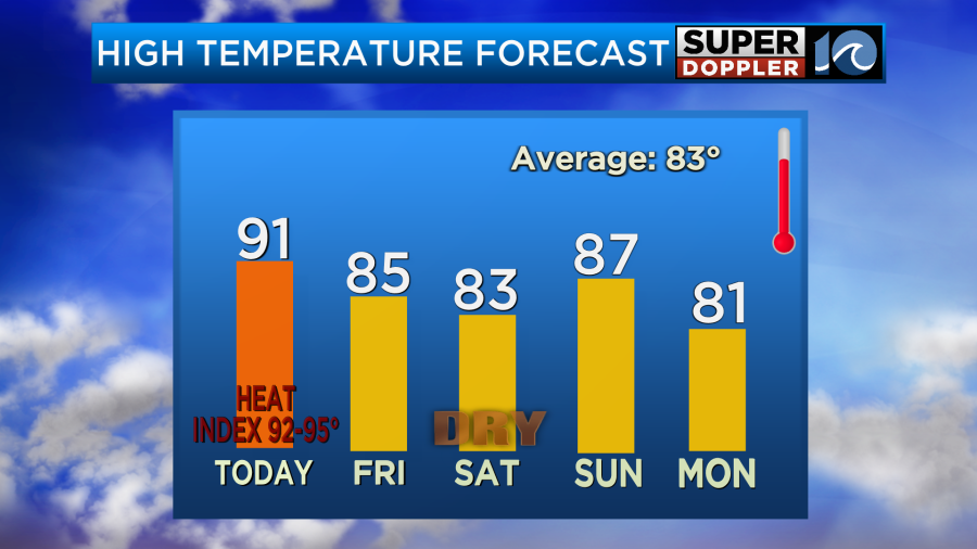
The humidity will also increase a bit on Sunday, but I still think it will be a decent day. We’ll be in the low 80s on Monday. There may be a cluster of showers and storms late Sunday evening until early Monday morning. I’ll talk more about that in tomorrow’s weather blog.
Meteorologist: Jerem Wheeler


