Yesterday the sunshine finally came back to the region. It was on hiatus for about 8-9 days. It was a veeeeerrry nice day. Today will be very similar. We started off with lots of sunshine this morning.

A large/strong area of high pressure has built in to our west.
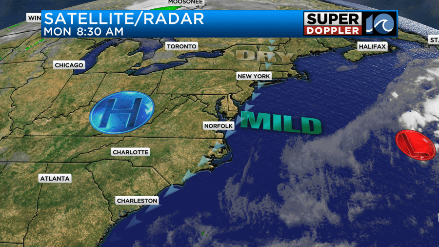
We’ll have lots of sunshine again today. It will be beautiful. You may notice that the sky has a bit of a haze high aloft. Yesterday this actually happened as some smoke from more wildfires in eastern Canada dropped south over the parts of the East Coast.
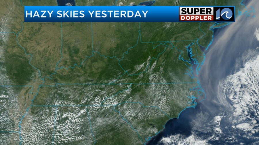
Today there will be some more of that. However, it is a thin layer of haze, and it won’t impact things at the surface.
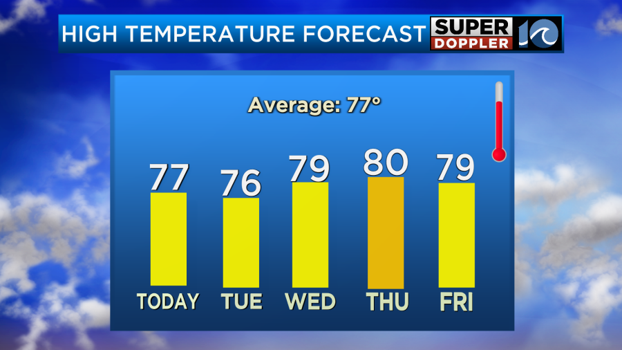
We’ll have a light northeast wind through the day. This will keep our high temps down a bit, but they will be close to average. So most temps will top off in the mid-upper 70s, but there will be a couple of 80s inland.
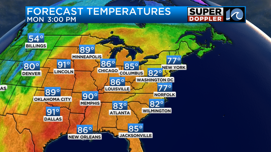
It’s interesting that the heat is holding over the central U.S. In fact they cancelled a marathon up in Minnesota just the other day due to record heat. Temps over the entire central U.S. are running well above average.
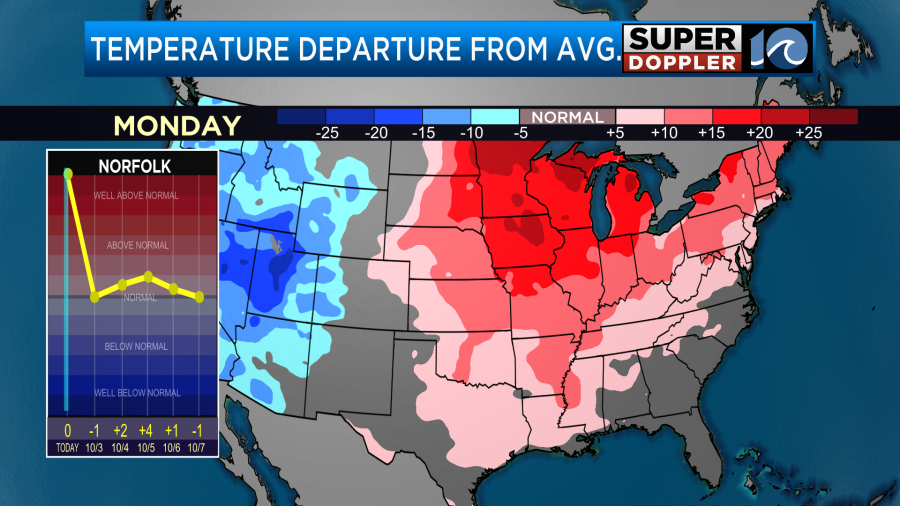
We will be close to average for the next 2-3 days. We’ll heat up to near 80 for Wednesday, Thursday and Friday.
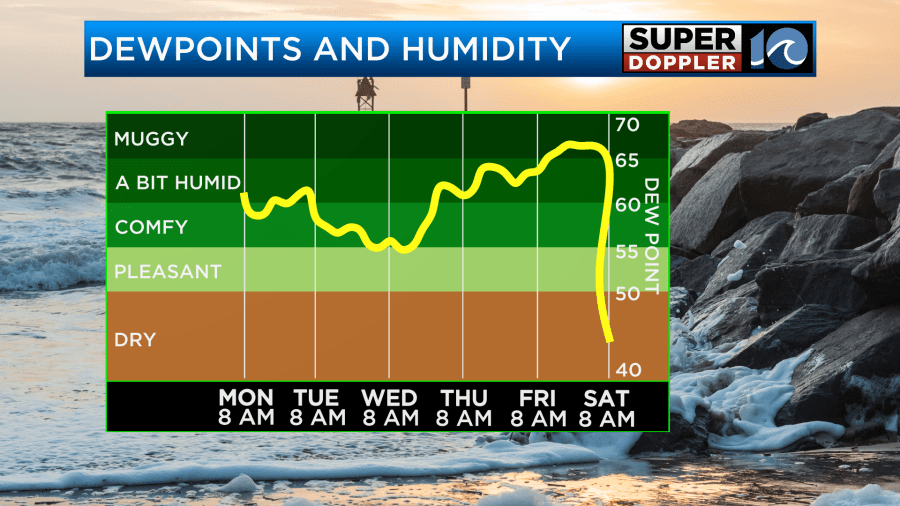
Humidity will climb a bit late week as well.
It’s a bit early, but it looks like the entire eastern half of the country will have a sizeable cool down next weekend. I’ll talk more about that in tomorrow’s weather blog.
Today’s high tide will be the last one with minor tidal flooding.
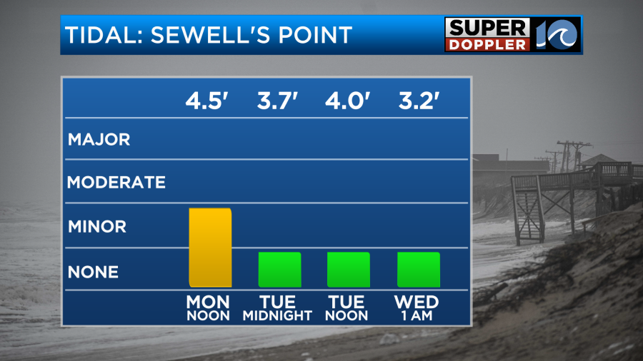
After that we’ll either have some nuisance or no tidal flooding.
Tropical storm Rina is no longer. It is now a remnant low over the middle of the Atlantic. However, tropical storm Philippe has managed to hold together. It is east of the Lesser Antilles, and it is moving generally to the north. Not only will it not die off in the next couple of days. Now … it is forecast to become a hurricane in 3-5 days.
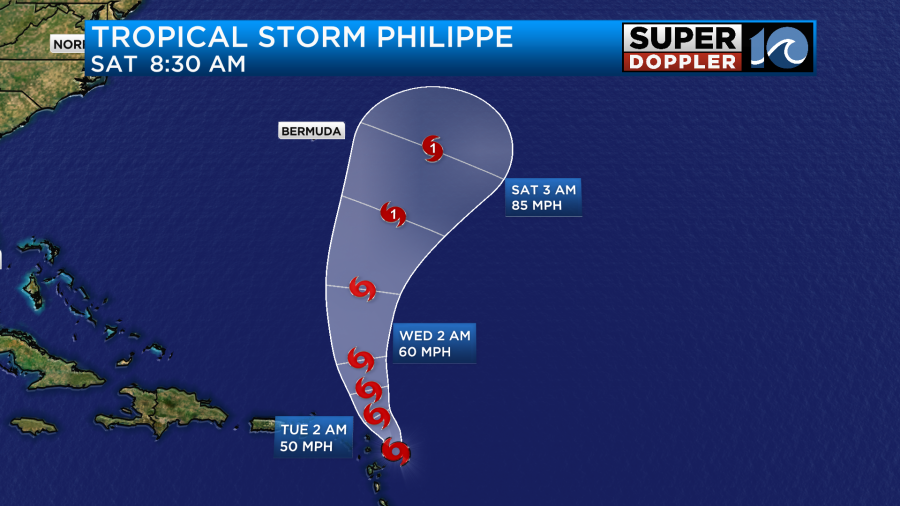
The wind shear should let up, and the water temps are running well above average. It should stay east of Bermuda, but it will likely produce some higher waves at the oceanfront as we heat into next weekend. Course the ocean isn’t exactly calm right now. Stay tuned for updates.
Meteorologist: Jeremy Wheeler