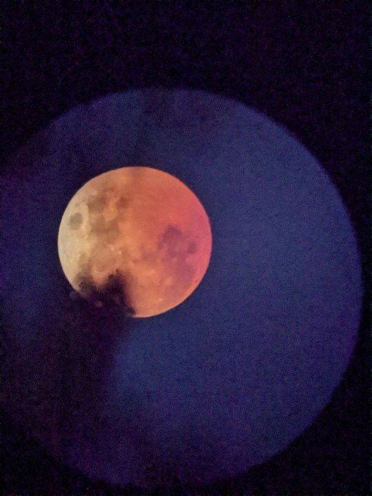
Before I get to the weather, this morning there was a sight to sea. We had a lunar eclipse that was viewable in our region. This happened early before sunrise.
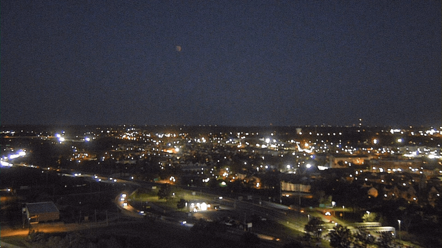
It was tough to zoom in with our cameras as the focus couldn’t be adjusted that well. Luckily, chief meteorologist Jeff Edmondson snapped a quick pic for us.
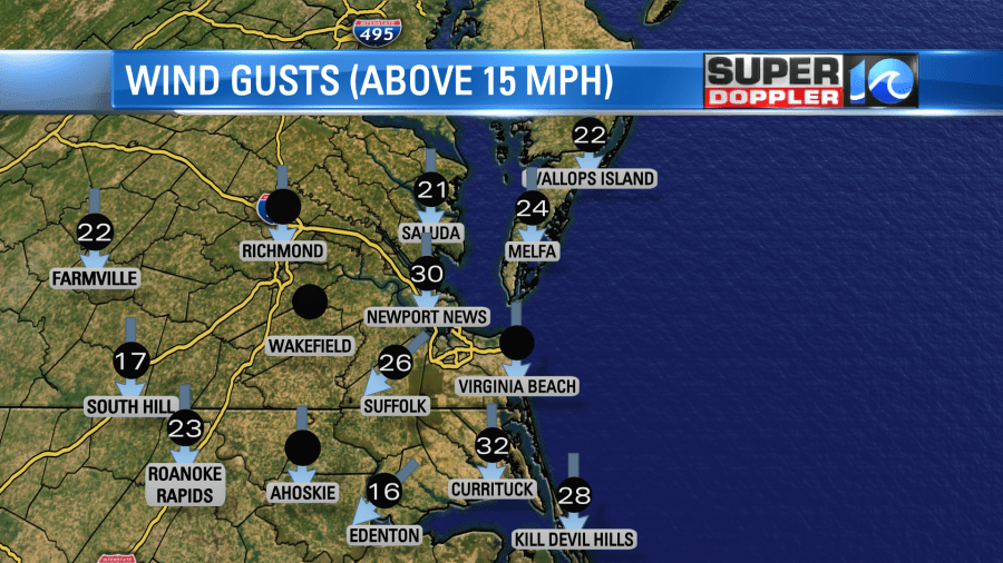
Anyone that went outside was greeted with some strong northeast winds. Gusts were up to 30mph near the shore with gusts to 25mph in many other locations.
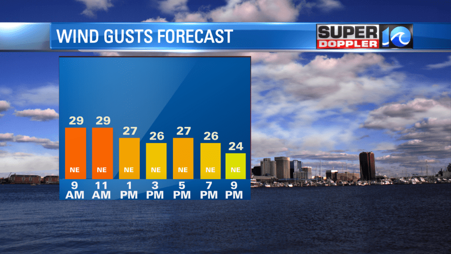
The wind will stay up out of the northeast today. They will run at 10-20mph with gusts to 30mph.
This is from the combination of very strong high pressure to the north and the cold front and Nicole to our southeast.
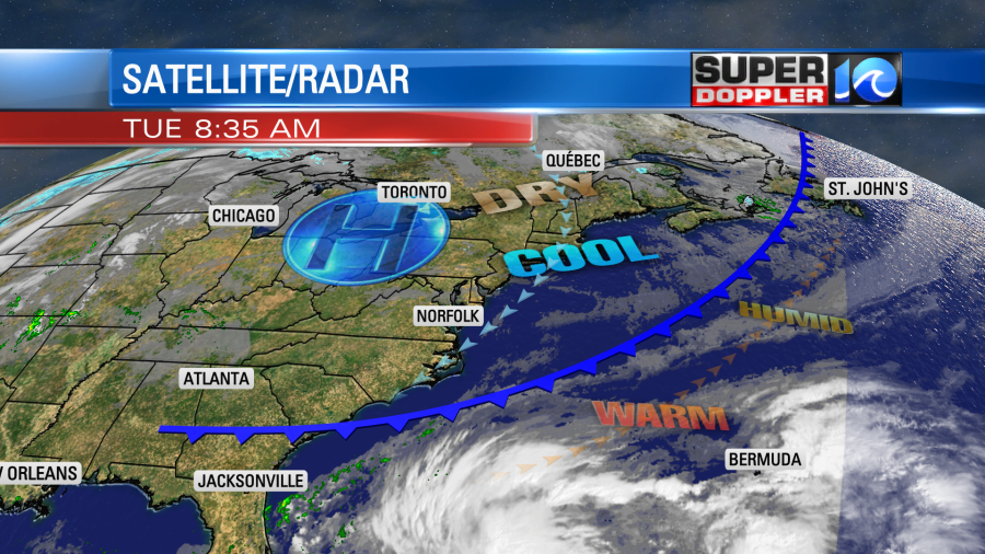
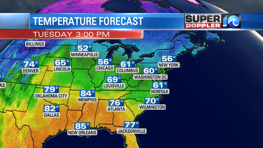
High pressure is the stronger influence on our weather today. So we will have lots of sunshine. However, the strong wind will keep temps down during the day. They will only top off in the low 60s this afternoon.
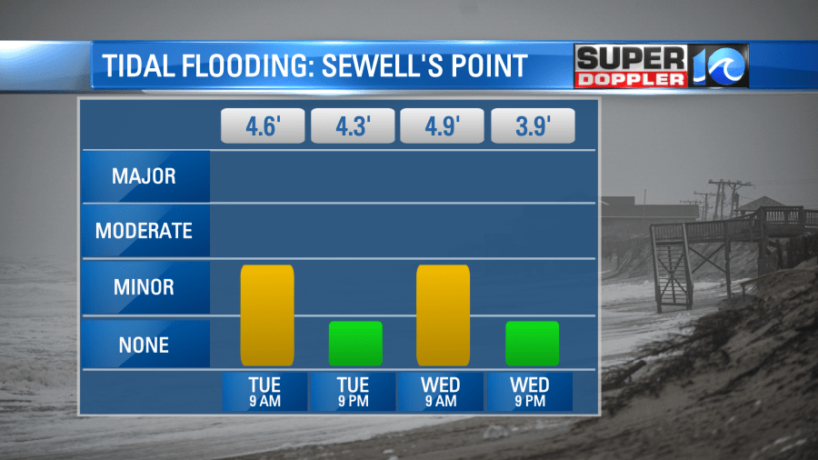
Also, that strong wind will create some minor tidal flooding this morning and tomorrow morning.
Please keep this all in mind when you go out to vote today. It will be chilly and windy for most of the day.
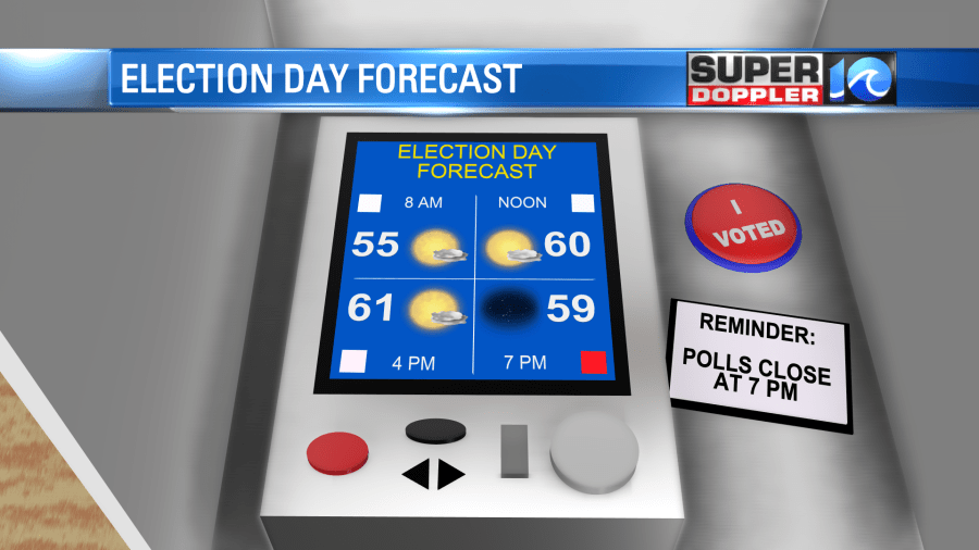
Winds will stay fairly steady this evening as well. They will be a little weaker tonight into tomorrow, but not too much weaker. Gusts will still be between 20-25mph.
We’ll be dry again tomorrow, but there will be some more clouds. Highs temps will be in the low-mid 60s.
We’ll have some nice weather on Thursday. We’ll be partly cloudy with more of a south wind. So high temps will be in the 70s. Then rain will move in on Friday. This will come from some of the moisture from Nicole.
This morning subtropical storm Nicole was to the northeast of the Bahamas. It was briefly moving to the northwest.
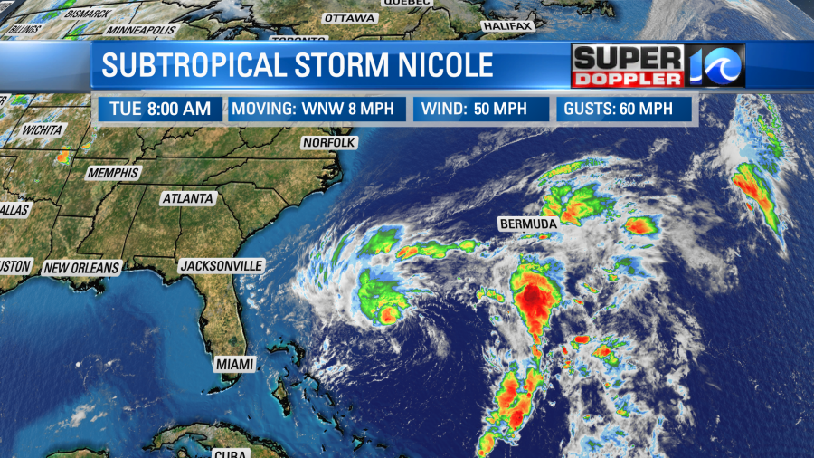
This system is transforming into a tropical system as thunderstorms are increasing around the center. The system is forecast to to snake its way westward towards the east coast of Florida. During that time it will move over some warm ocean water. Therefore it is forecast to strengthen into a category 1 hurricane before then. This will be late Wednesday night into early Thursday morning.
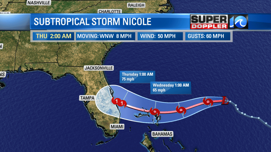
After that point it will turn to the northwest and weaken over land. There’s a lower chance for it to move over the eastern Gulf of Mexico now, but some models still take it briefly over the water. On Friday the storm is expected to be over land and turning more to the northeast. It will then move northeast and most likely over land.
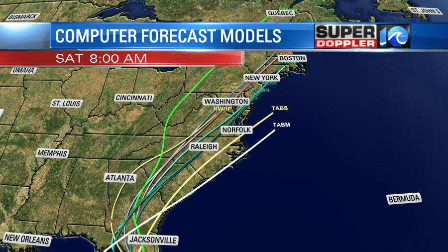
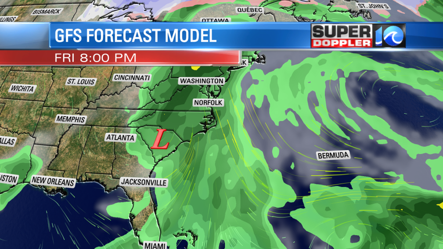
The moisture and the rain will extend well north/northeast of the system. So we will have rain from that effect on Friday even though the center will be to our southwest. Between Friday and Saturday the system should become a weak area of low pressure. The track then takes it towards our region.
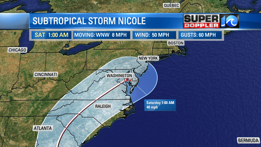
However, as the system moves northeast it will likely get absorbed into a strong cold front. So the latest models are trending towards the low falling apart, and the front swiping through quickly.
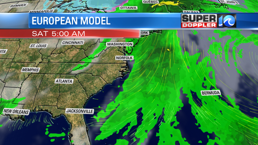
In fact… The some models now have a pretty dry Saturday after some rain showers early in the morning. So we’ll see how that part of the forecast trends. There has been a fairly dramatic shift since yesterday as Sunday now looks completely dry. Either way it will be much colder Sunday into Monday. More on that in tomorrow’s weather blog.
Meteorologist: Jeremy Wheeler


