Yesterday was hot! We ended up hitting 94 degrees in Norfolk.

This was 4 degrees below the standing record, but it was also about 10 degrees above average. To add salt to the wound…the heat indices were in the upper 90s for many. It even felt hot in the evening.
Last night there was a line of showers out ahead of a cool front. It basically fell apart as it moved in.
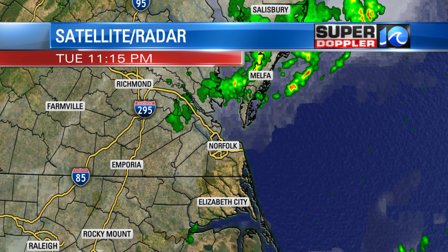
So there were a few showers between Gloucester, Reedville, and Parksley, but everybody else missed out.
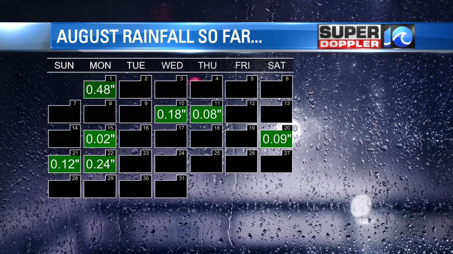
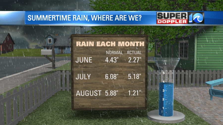
Unfortunately, we really need some rain. August came in a few inches below average, and we’ve been below average for a while.
I say that if it’s not raining, then it might as well be comfortable. We will start the the drying process today. A cool front is slowly sinking to the south.
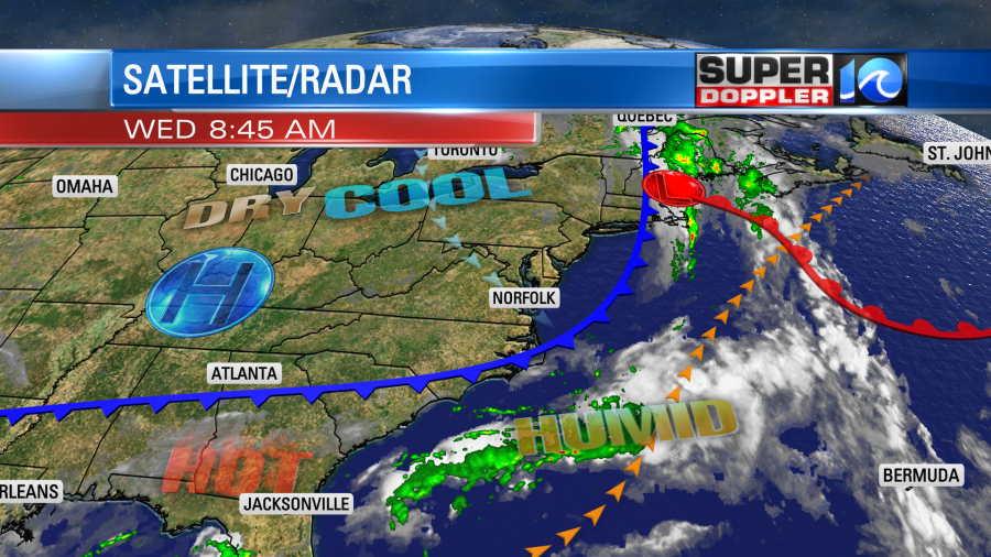
We’ll gradually dry out through the day. Dew points will drop from near 70 this morning to the low-mid 60s later this afternoon. With a steady northwest breeze, it should feel pretty good outside. High temps will be in the upper 80s with a few 90s inland.
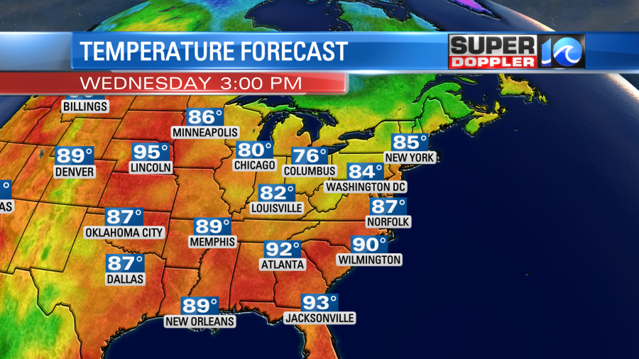
Tomorrow the front will sink a little more to the south. It will be an awesome day as high pressure builds in. We’ll have lots of sunshine with high temps in the mid 80s. Humidity will be moderate. We’ll have a light northerly breeze. We’ll continue with the warm/drier air tomorrow through the weekend.

There may be some isolated showers early next week, but the models have backed off the precip a little bit. Again, looking at the rain climatology above that’s not a good thing. Although it is good news for the holiday.
In the tropics… There are 3 tropical disturbances that we are watching. There is one in the north central Atlantic that has formed along a dying front.
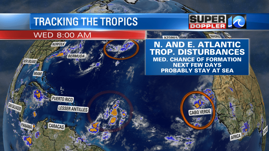
That one is moving east, and will likely stay out to sea whether it forms or not. The one in the eastern Atlantic is moving west/northwest. It has a moderate-to-high chance of formation in the next 2-5 days. However, it will also likely stay to so sea.
The disturbance in the middle of the Atlantic still has a high chance of formation. It had a flare-up of thunderstorms overnight, but they have weakened since then. It is moving to the west/northwest.
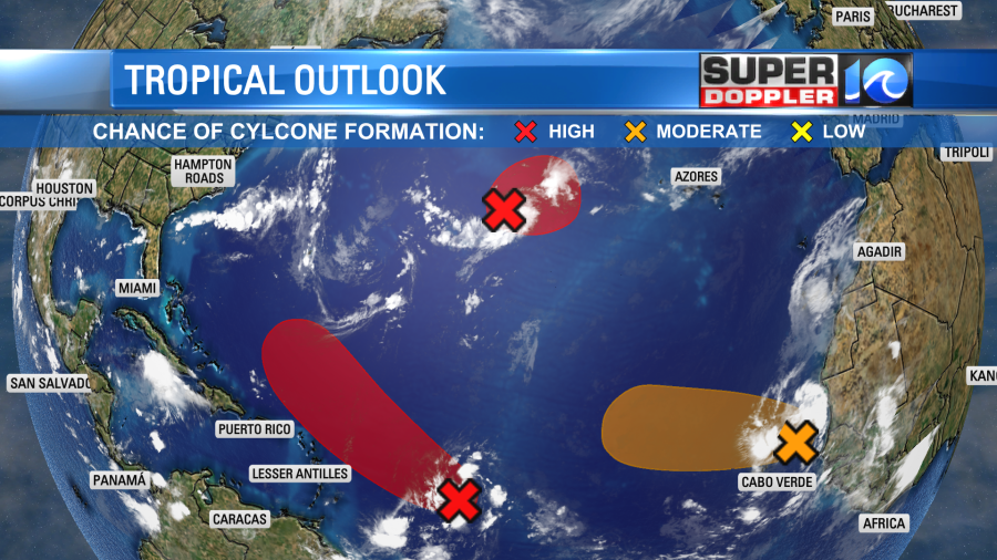
The forecast models have been trending a bit slower and more offshore. Our Future trak model is even keeping it on a track that takes it east of Bermuda in a few days.

It still hasn’t formed yet. So we still need to keep an eye on it. We’ll have updates on the full tropics later today.
Meteorologist: Jeremy Wheeler


