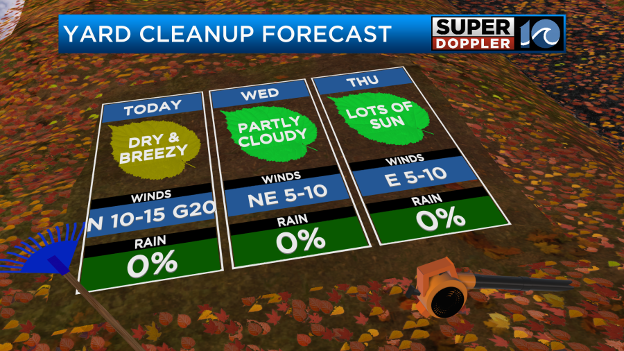
Locally today won’t be a bad day for raking leaves. However, it won’t be the best day either. We are going to continue with the mostly sunny skies and cool temps that we’ve had. However, today the wind is going to pick up.
A cold front is dropping south through the region, but it is falling apart. So it is basically turning into a wind shift.
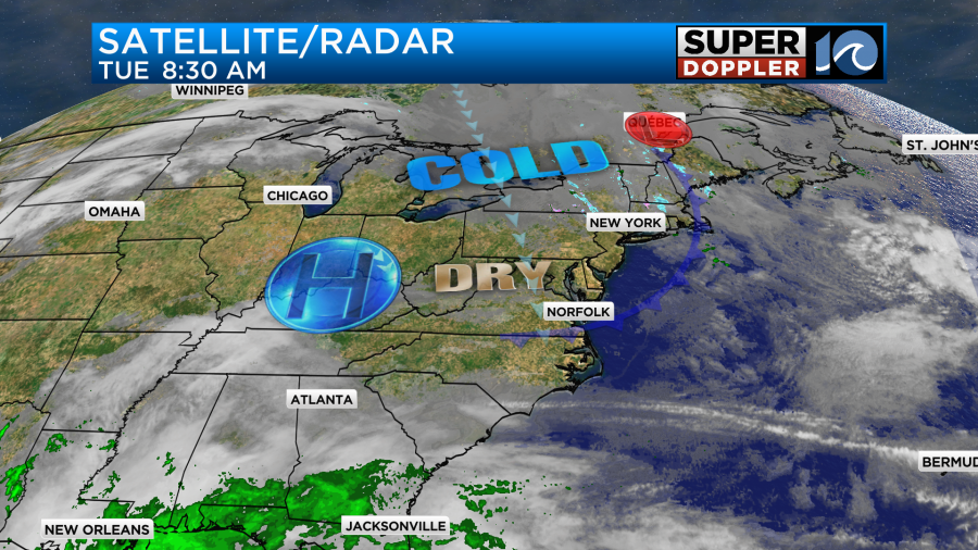
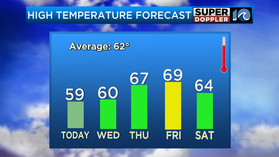
High pressure is still to our west. We’ll be dry and cool today with high temps aiming for the upper 50s to near 60 degrees.

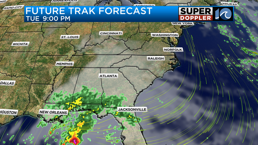
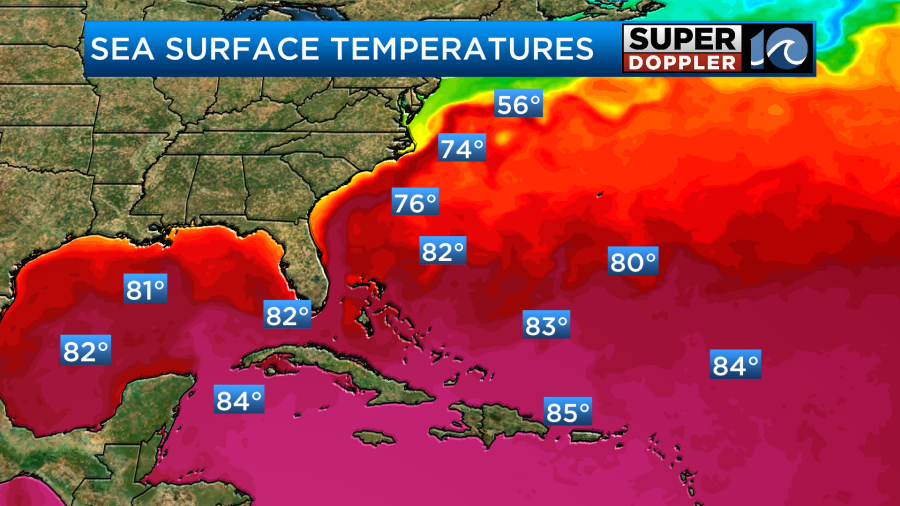
It will feel cooler than the actual temps at times due to the breeze. We’ll be dry and cool tomorrow with more clouds in the region. This will pull up some moisture that will travel a long distance from a system near the Gulf coast. This non-tropical low will bring some desperately needed rainfall to the Gulf Coast states tonight into tomorrow.
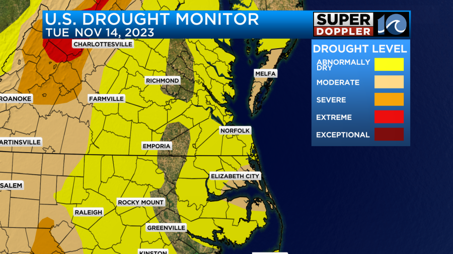
There is currently an exceptional drought down across Louisiana and Texas.
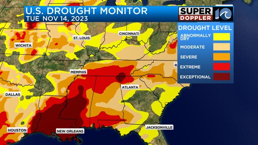
That is level 5 out of 5. They have even had problems with drinking water down there recently.
We are in a drought here, but it is not as bad.
We won’t have any rain tomorrow, but we’ll have a mix of sun and clouds with high temps near 60 degrees. Then we’ll warm to the upper 60s on Thursday with partly cloudy skies. That will be the best day of the week.
By Friday an area of low pressure will form off the east coast. It will be to our southeast on Friday during the day. However, it will push some moisture up into our region. We’ll have mostly cloudy skies with a few PM showers possible. The rain MIGHT pick up Friday night. It depends on which model you believe. The GFS has our region on the edge of the rain.
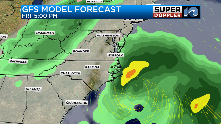
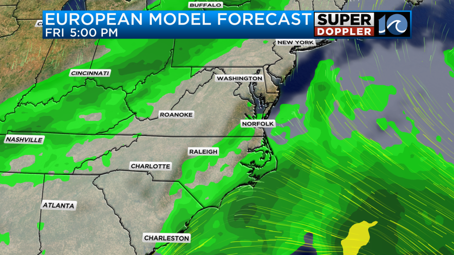
However, the European model has the rain a little more into the region. I’m not too hopeful yet that we’ll get the rain.
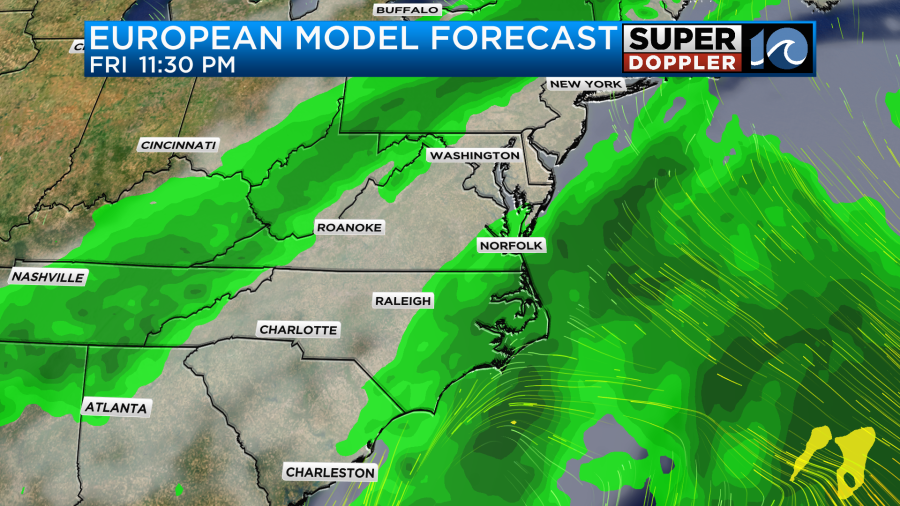
We have been….ripped off… a couple of times recently. So we’ll see. This will be as a cold front also moves through the area. We’ll cool down to the low-mid 60s on Saturday with some 50s back on Sunday.
While a non-tropical system affects the Gulf coast today and tomorrow, there is a potential tropical system in the western Caribbean.
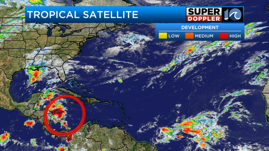
This feature is drifting for now, but it will move to the northeast over the next few days. The water temps are still warm enough that systems could develop.
It would likely stay well to our south, but check back for updates just to be sure.
Meteorologist: Jeremy Wheeler