Today is going to be a quiet day, but things are going to get a little messy going into Saturday. Let’s talk about it….
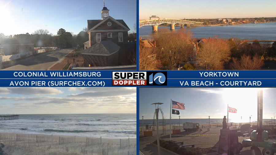
This morning we had lots of sunshine over the area. It looked good out the window, but it was chilly.
High pressure is over the area. This will give us a lot of sunshine until the early afternoon.
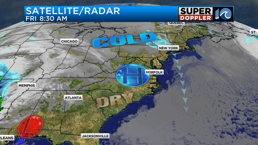
By the late afternoon a few clouds will come in from the west, but we’ll stay dry. We’ll have a steady north breeze at 8-12mph through the afternoon. This will keep temps down in the low-mid 40s.
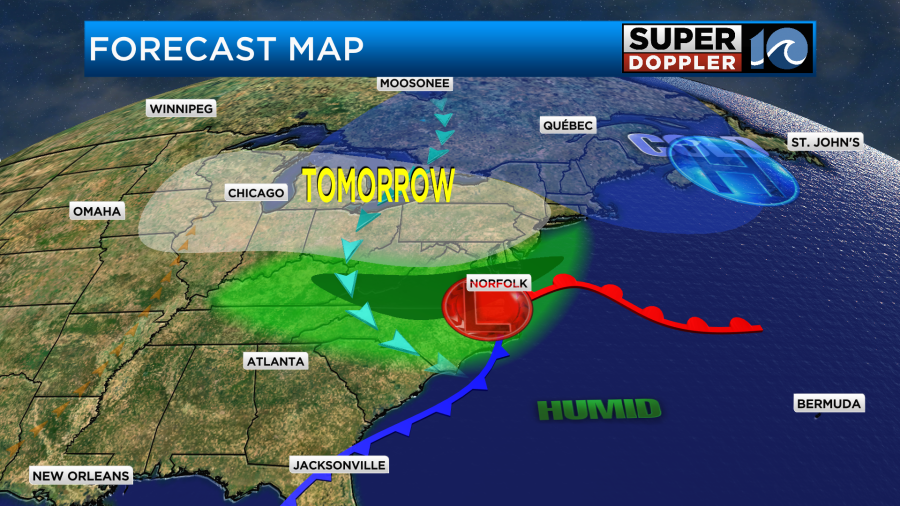
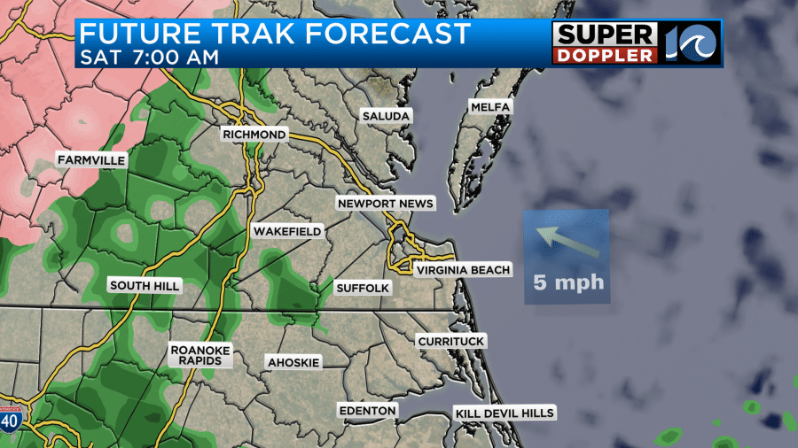
Meanwhile an area of low pressure is forming near the Florida panhandle. It will have a big impact on our weather tomorrow. Through the day Saturday that low will quickly stream to the northeast. It will also strengthen through that time.
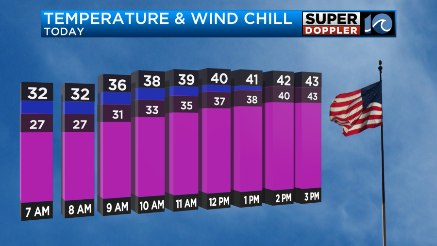
The wind will pick up out of the southeast as we go into Saturday morning. Moisture will also increase through the day. Tomorrow morning we’ll be pretty dry at the surface. However, there may be enough moisture for a few spotty showers. Temps will be above freezing, but a few temps out towards I-95 may be just above freezing. This could lead to a (little) mixed precip over towards Emporia and Wakefield.
There will be a lot more of a wintry mix over towards Charlottesville and Staunton.
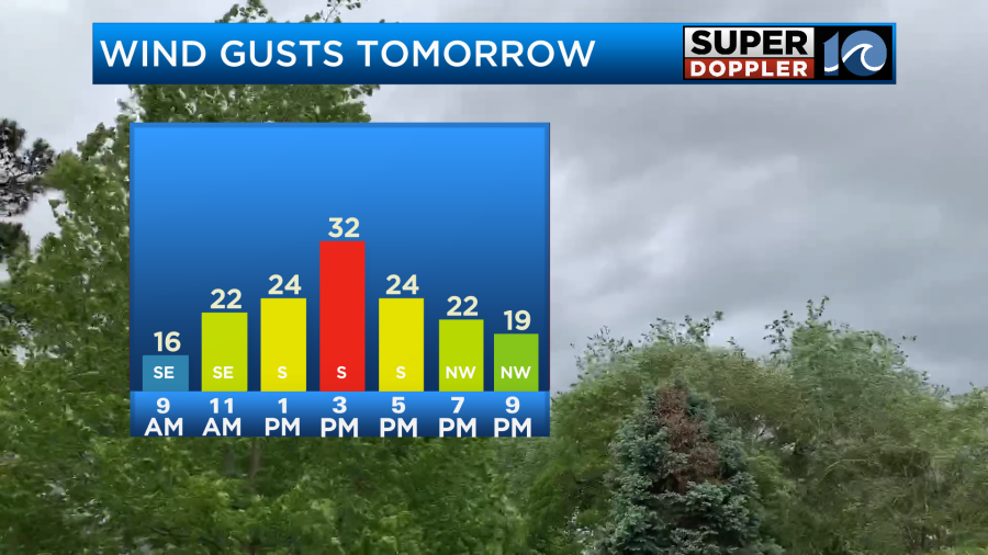
Winds will increase out of the southeast into later morning. Gusts will be between 25 and 30mph during the midday and the afternoon.
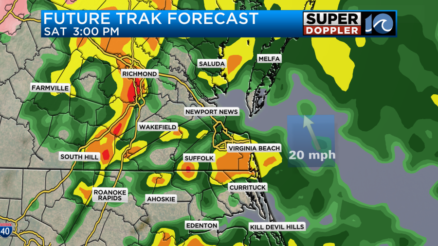
This will help to increase the temperatures despite lots of clouds and increasing rain showers. High temps will be able to make it into the mid 50s.

Rain will become widespread in the afternoon, and it could be heavy for a time as well.
This will be all rain for us, and really for a lot of Virginia. There will be some snow over in the western part of the state. This is good news for some of the ski resorts.

As the system moves to our northeast Saturday night, there will be a lot of snow moving into the northeast states. This is good news for many as some locations up there haven’t had any real snow for a couple of years. They are in a snow-drought. The latest models move the system even faster. So our model dries us out already by tomorrow evening.

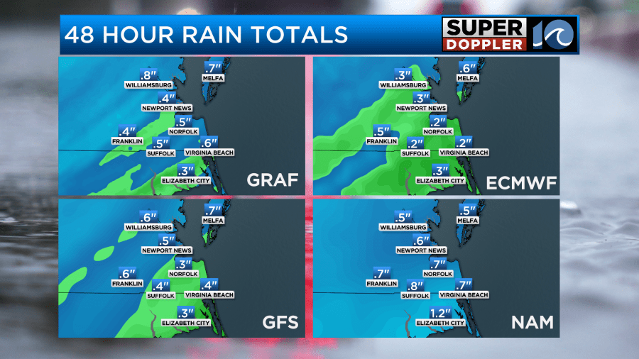
Before the rain ends we could get about 0.3″ to 0.75″ or rain. Some isolated areas could see an inch.
Sunday looks pretty dry now as the low quickly streams to the northeast. Locally, there will be a breeze out of the northwest, but it will be a dry breeze. High temps will be near 50 degrees. We’ll be partly sunny.
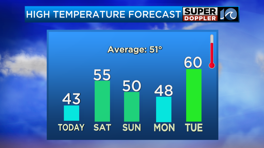
We’ll be dry and chilly on Monday with highs in the 40s. Then another system will move through the area on Tuesday. That will be another big area of low pressure. It will bring us even more rain and wind than tomorrow’s system.
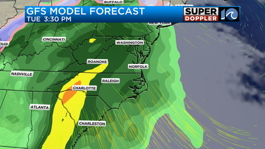
We’ll warm up even more with high temps aiming for 60 degrees. I wouldn’t be surprised if we even have some isolated thunderstorms. We’ll see. We’ll have more updates on that over the weekend.
Meteorologist: Jeremy Wheeler


