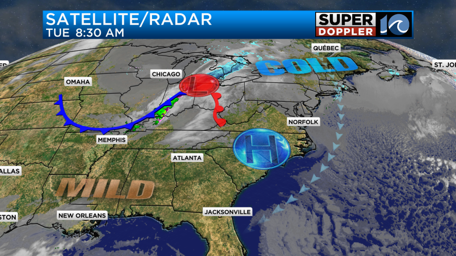
Today doesn’t look like it will be too bad outside. We started the day with a mix of sun and clouds. Temps were as mixed as the sky conditions. We had 30s and 40s in the metro with 20s inland. Today we have a weak area of high pressure just to our west. There is an area of low pressure that we are tracking over the Midwest.
We’ll have a mix of sun and clouds up through the early afternoon. Then as high pressure moves to the south we’ll have increasing cloud cover. We’ll have a northeast wind at about 8-12mph. That will keep the temps down in the 40s later today.
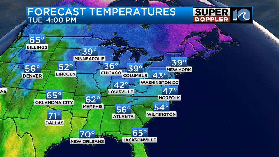
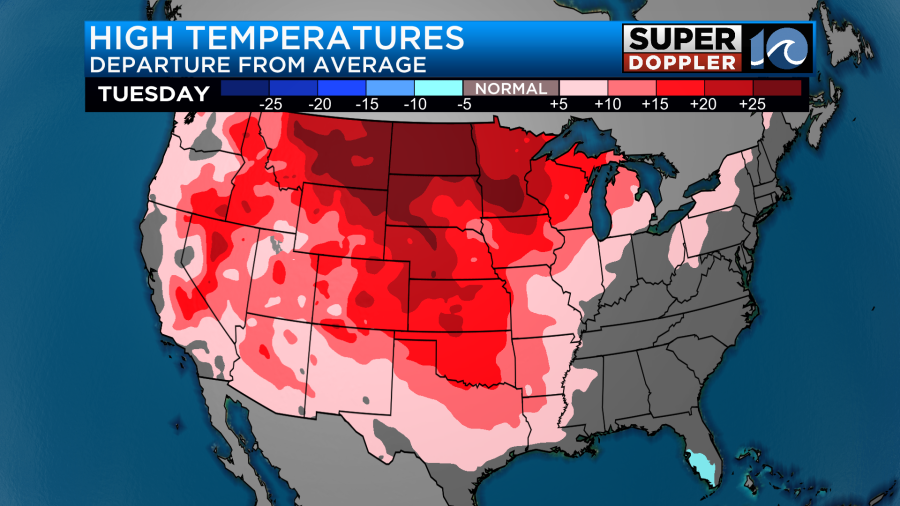
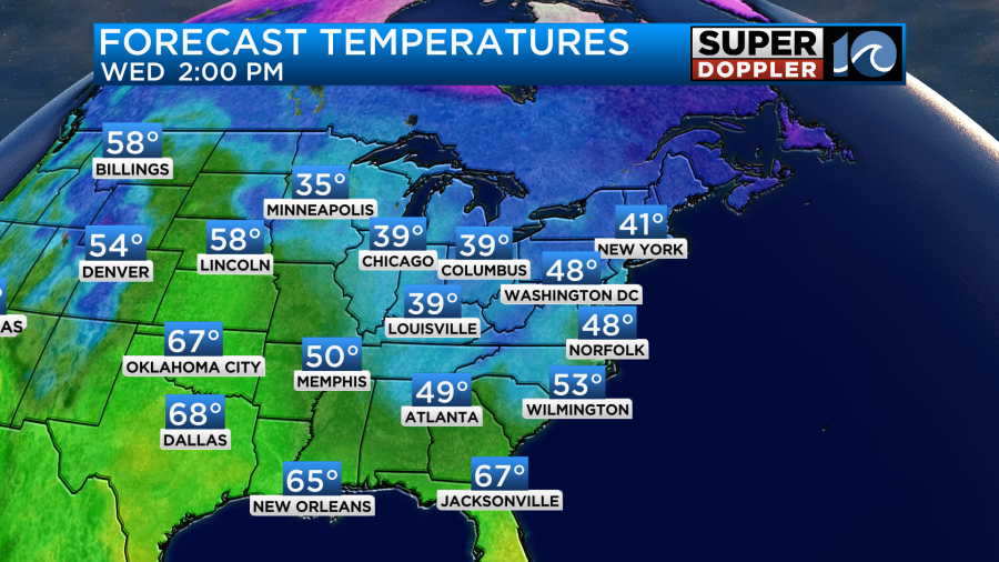
You may notice the very mild temps up in the north/central U.S. Temps up that way will be running about 20-25 degrees above average. 60s in Billings Montana? Wow!
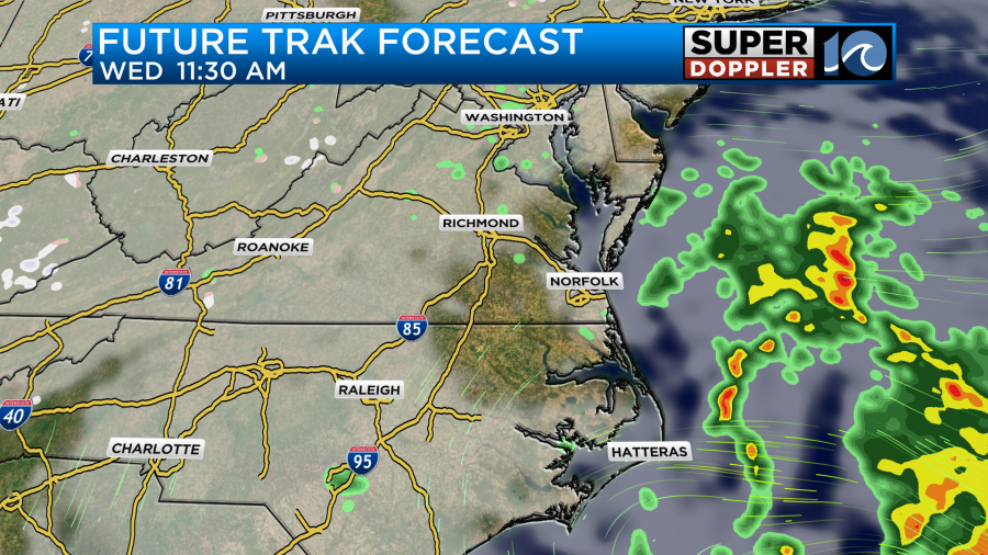
There will definitely be a lot of melting snow up there today. Tomorrow, a large upper level trough will swing down our way from the Midwest. That surface low in the Midwest will also head our way, but it will weaken quite a bit.
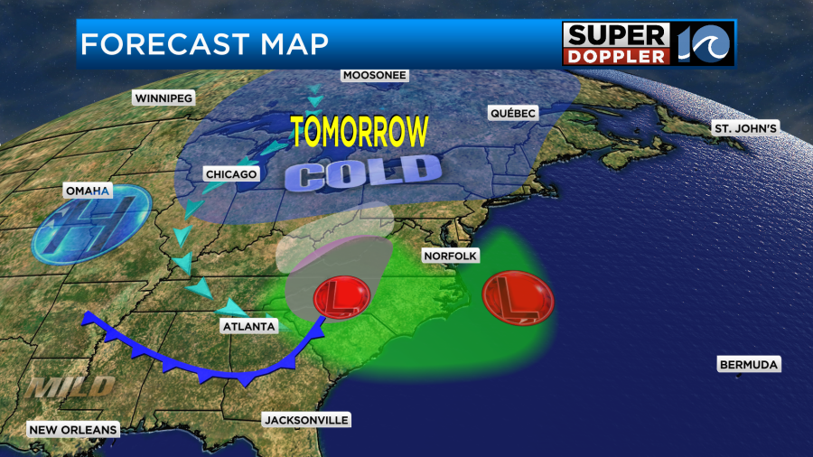
At the same time an area of low pressure will be forming offshore. This will strengthen through the day. Our region will be in-between these weakening/strengthening systems. So we’ll catch a few rain showers, but there will definitely be more rain to our east and our west.
We’ll be mostly cloudy through the day with a few peeks of sun. There will be a stronger northeast breeze. Gusts will be up to 20mph. This will cap the high temps at 48-51 degrees.
After that we’ll have some nice weather. We’ll have lots of sunshine Thursday and Friday. High temps will be in the 50s.
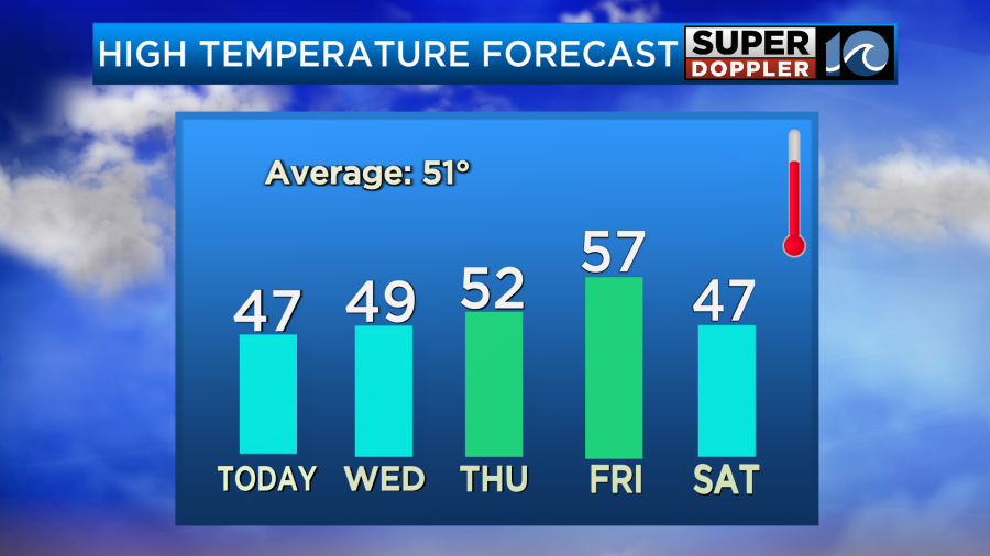
The odds are good that our local groundhog “Chesapeake Chuck” will see his shadow on Friday. We’ll see. We will be chilly but dry next weekend…
Meteorologist: Jeremy Wheeler