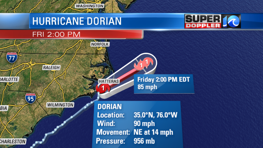
There’s a little bit of good news with Dorian and a little bit of bad news. The bad news is that there was a gust to around 63 mph over Ocracoke Island early this morning. There was also a gust to over 90 mph near Cedar Island, North Carolina. That was on the north edge of the eyewall, and that eyewall was still moving towards Hatteras.
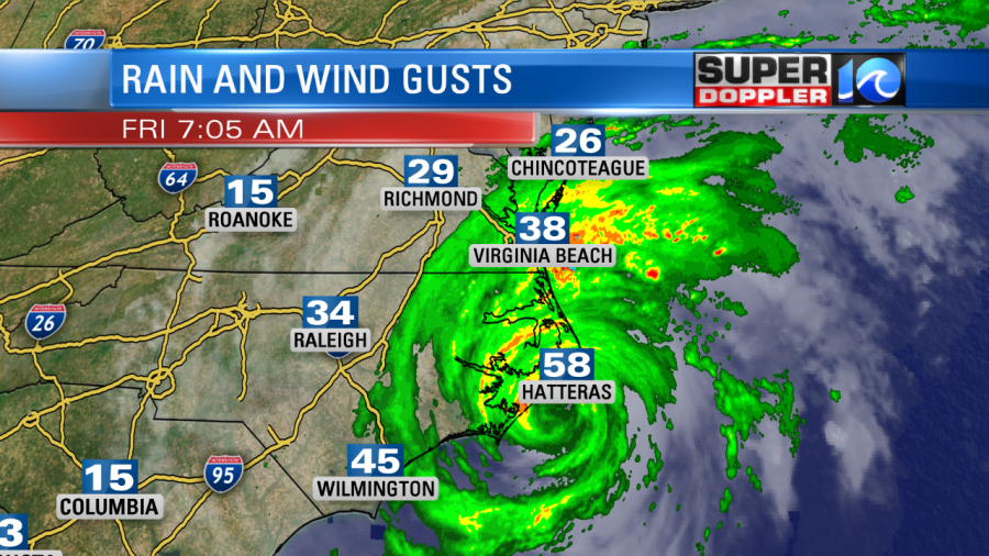
The gusts are increasing over the entire region. The general gusts have been about 35-45 mph between Hampton Roads and Elizabeth City. There are lesser gusts north of Hampton Roads. The winds are still forecast to increase. Gusts could be to around 80 mph over the Outer Banks this morning as Dorian moves over that region. The eye should move away from the Outer Banks by the late morning.
However, the storm is interacting with a cold front. This should allow the winds to expand. This means that the winds may be stronger as they pull out of the north/northwest this afternoon behind the storm. This is what our forecast models suggests:
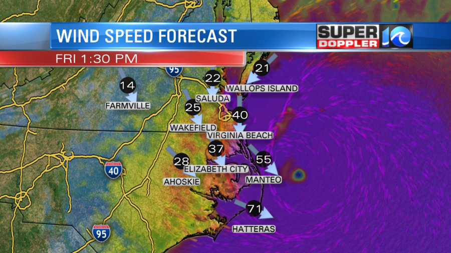
Having said that…the model actually has higher sustained winds this afternoon for the southern Outer Banks compared to this morning. So we’ll see if that pans out. It’s predicated off of the interaction with the front.
So you ask…What’s the good news? Well, the wind and rainfall look a little lower for Hampton Roads now. I’ve lowered the rainfall for the Southside to 3-7″ (the lesser amounts toward Suffolk), 1-3″ for the Peninsulas and 1-3″ for the Eastern Shore. However, I am keeping the rain for northeast North Carolina and the Outer Banks between 5 and 9″ (down 1″ from before).
I’ve still got the highest gust to 80 mph along the Outer Banks. However, I’ve got it closer to 55 mph inland North Carolina. Closer to 55mph for Hampton Roads. Though it could gust to over 60 mph along the shore. Then gusts closer to 40mph for the Peninsula and 50mph on the Eastern Shore. These still could be adjusted, but that’s the latest that I have.
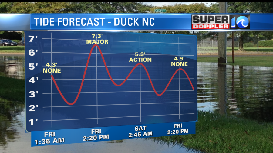
There will be tidal flooding this afternoon. I brought it down slightly, but not much just yet. Here is the latest that I have for Sewell’s Point:
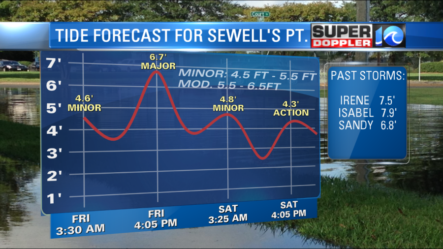
I may bring it down a little more, but I have to wait for another model update. Still major tidal flooding for the Outer Banks, though. The forecast for Duck has actually gone up! Now up to over 7ft.
There may also be a surge of 4-6′ on the Sound side of the Outer Banks. That will depend on those winds behind the system.
These are the latest trends. The weather should still improve by this evening. We’ll have great weather this weekend. We’ll have another blog around midday. Plenty of updates on-air until then.
Meteorologist: Jeremy Wheeler