(WAVY) — Heavy rain has been falling in several rain bands that have stretched out far from the center of Debby over the past 48 hours as tornado watches continue through large stretches of northeastern North Carolina and Hampton Roads until 7 a.m. Friday.
The National Weather Service has also issued a flash flood warning for Bertie and Hertford counties in northeastern North Carolina, as well as southeastern Northampton County in northeastern North Carolina. A tornado warning has been issued for Bertie County until 9 p.m.
At 8:23 p.m. Thursday, Doppler radar indicated thunderstorms producing heavy rain in the warned area, according to the National Weather Service. A NWS employee reported a flooded road near the intersection of Governors Road and AC Smith Road near Roxobel, in northwestern Bertie County.
The National Weather Service said between a half-inch and 1.5 inches of rain have fallen, with another inch possible in the warned area, and it said flash flooding is ongoing or expected to begin shortly.
The National Weather Service issued a tornado watch until 7 a.m. Friday for the following areas in northeastern North Carolina, including Bertie, Camden, Chowan, Currituck, Gates, Hertford, Northampton, Pasquotank and Perquimans counties.
In Virginia, the tornado watch area includes much of central and east central Virginia, along with Mathews and Middlesex counties, as well as most of Hampton Roads and Western Tidewater.
The city of Suffolk, Isle of Wight County and Southampton County in Hampton Roads along with Surry and Sussex Counties, and Sunbury County, Gates County, Camden County, Chowan and Perquimans in North Carolina all issued tornado warnings Thursday afternoon. The National Weather Center issued multiple alerts for the WAVY viewing area throughout the afternoon. Click here for the current weather alerts.
Around 4:10 p.m., an additional tornado warning was issued for Isle of Wight County, Surry county and James City County until 4:45 p.m.
Then, another tornado warning was issued for Surry and Sussex counties until 6 p.m., but it was canceled at 5:49 p.m.
Tropical Storm Debby’s winds are causing some ferry routes to temporarily suspend operations: our Pamlico Sound Routes and the Cherry Branch-Minnesott Beach route are currently suspended, and the Ocracoke Express Passenger ferry will suspend after the 3 p.m. run from Ocracoke.
The Jamestown Scotland Ferry is also currently not operating.
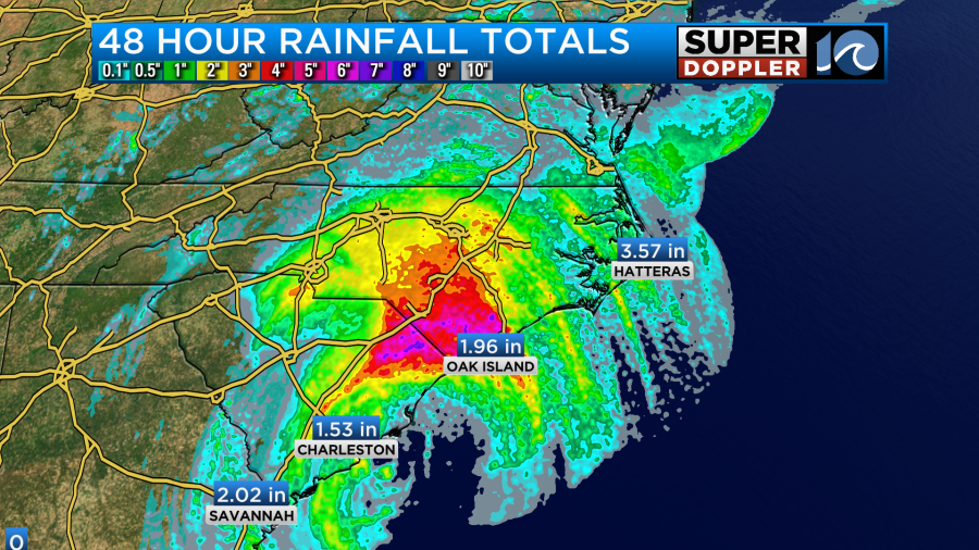
Heavy rainfall has led to flooding over parts of the Southeast. We had some heavy rain here, but it mainly led to some small areas of standing water.
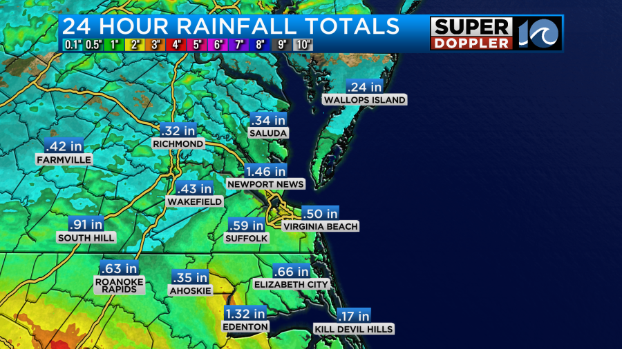
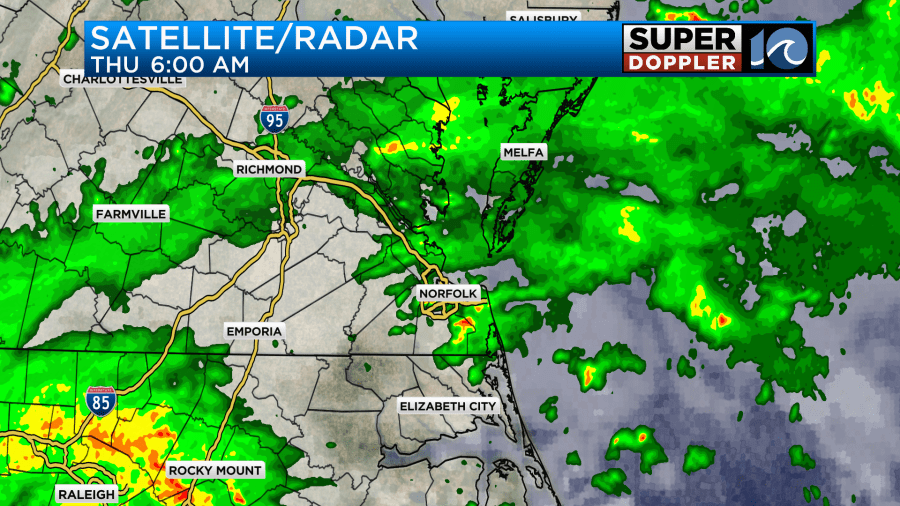
On Thursday morning, the heavy rain did lead to some accidents and slowdowns.
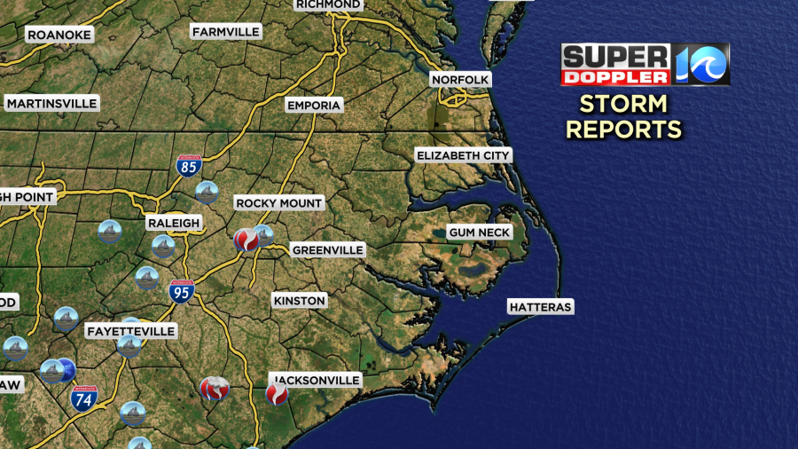
There were some reports of tornadoes to our southwest.
There is a potential for some isolated tornadoes to form in our region today. So there is a Tornado Watch until 8 p.m. for most of the region. This may be extended later today.
Debby did make landfall early this morning around 2 a.m. near Bulls Bay, SC. It is moving northwest now. However, it did look like it took a small jog to the west around 7-8 a.m.
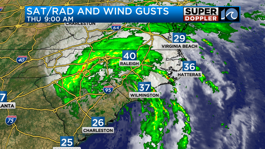
Debby will continue to track north/northwest into the afternoon.
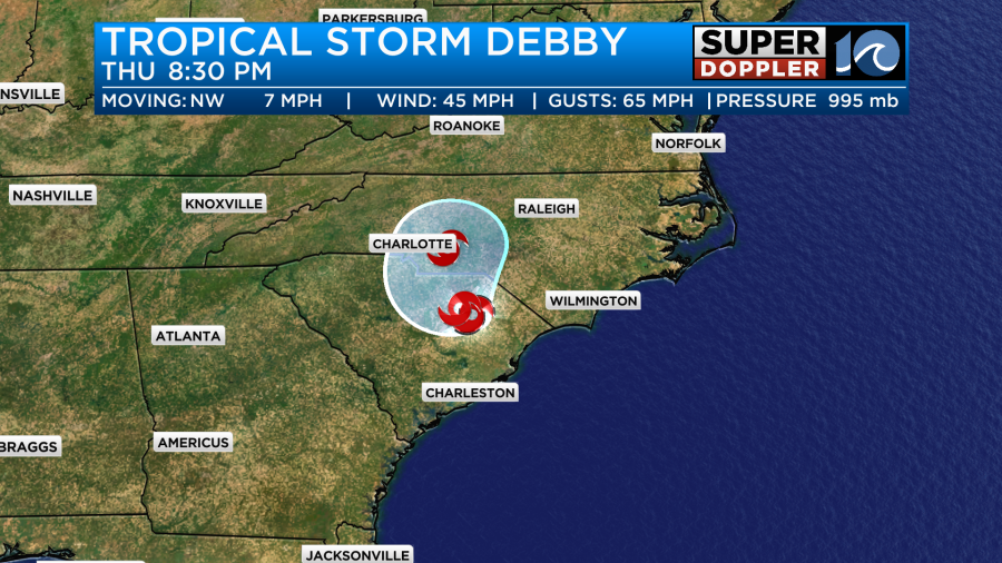
This will run it up into the higher elevations of western North Carolina and Virginia. This should help to weaken the storm. Also, it will start to interact with a stalled out front. So that should also aid in weakening the system. The front is currently just to our west.
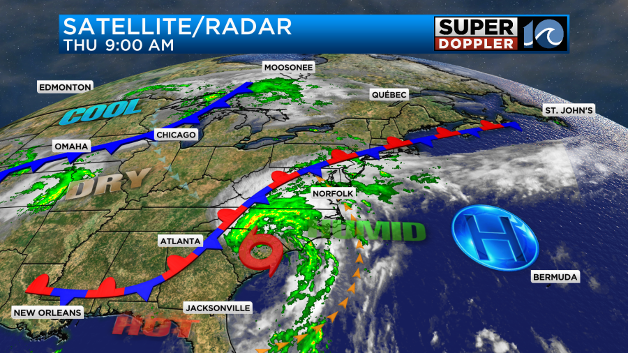
Debby will start to accelerate to the northeast late today into tonight. Then it will quickly jet off to the northeast states.
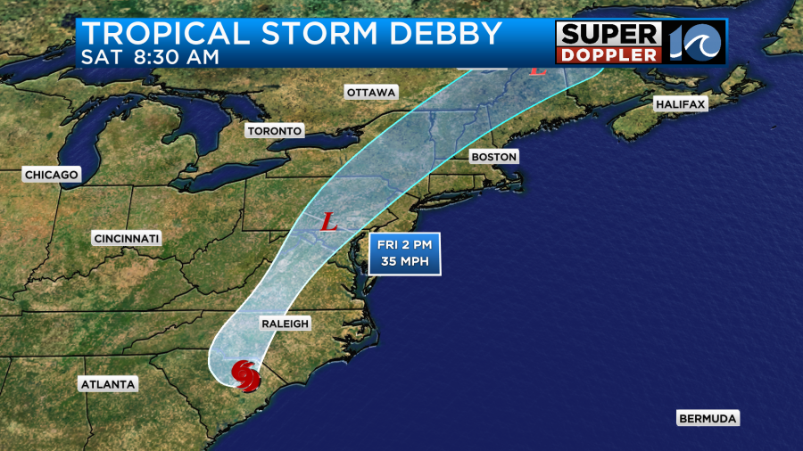
Despite the center of Debby staying a good distance from our area we will still have some effects. I already mentioned that isolated tornadoes will be possible. That will be as some of the strong rain bands come through later today.
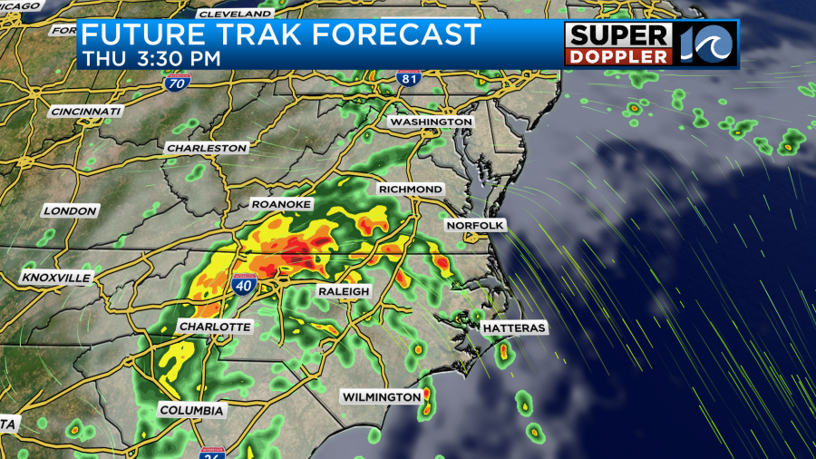
Some of these bands could also produce strong gusty winds and heavy rain. A few more of these will continue into the evening.
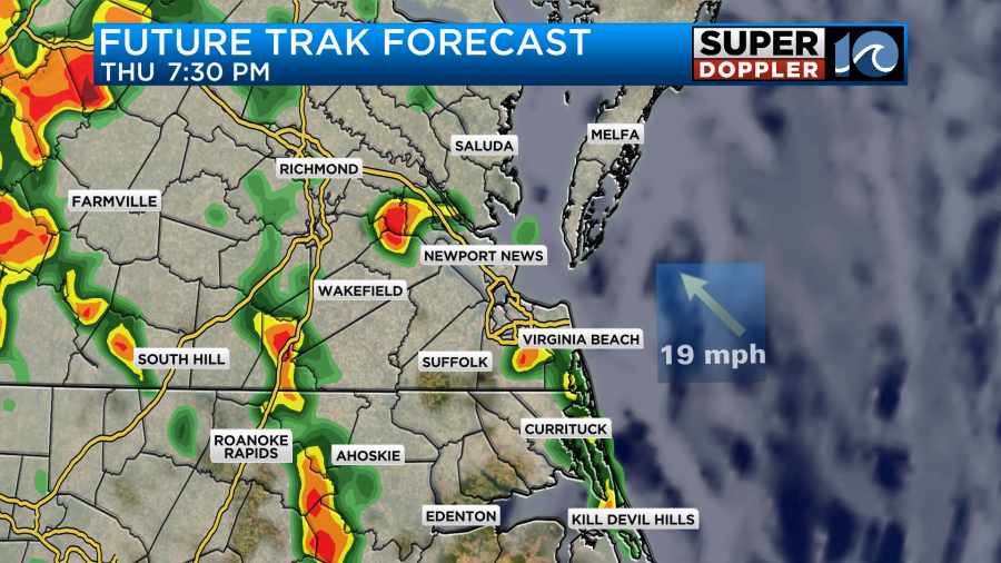
A wind shift will come through tomorrow and create a few more showers and storms in the morning with the last round coming through late in the day.
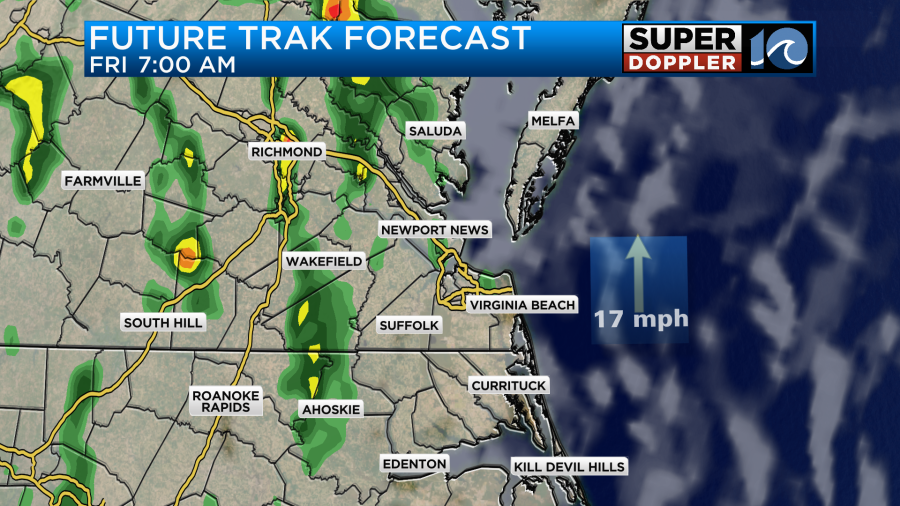
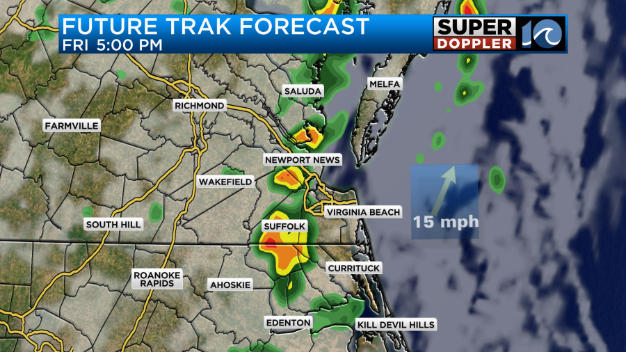
There will probably be a lot of breaks in-between the rain. A cool front will finally move through Saturday morning. After a few showers early we should dry out for the rest of the day.
The general wind will run out of the southeast today. It will get up to 25mph in the metro and most of the area, but there will be some gusts up to 40mph near the shore. Especially over the Outer Banks.
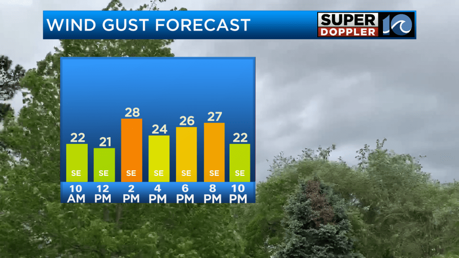
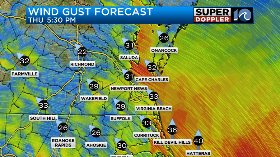
We’ll have those same type of winds tonight into tomorrow morning.
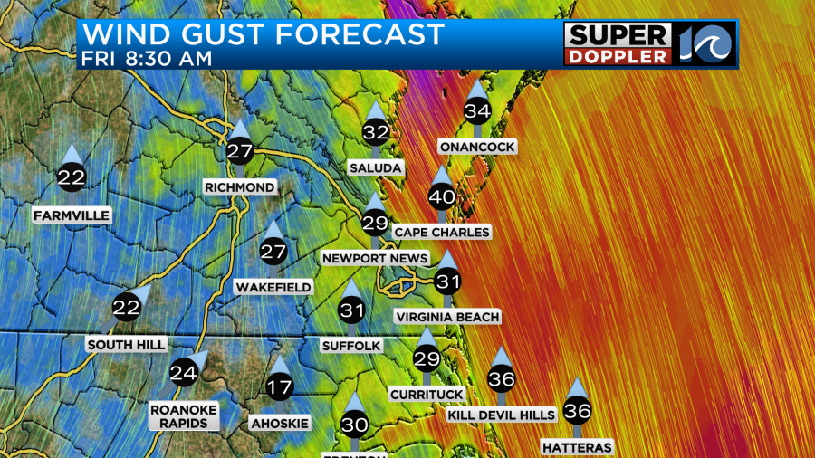
However, the winds will taper off through the day.
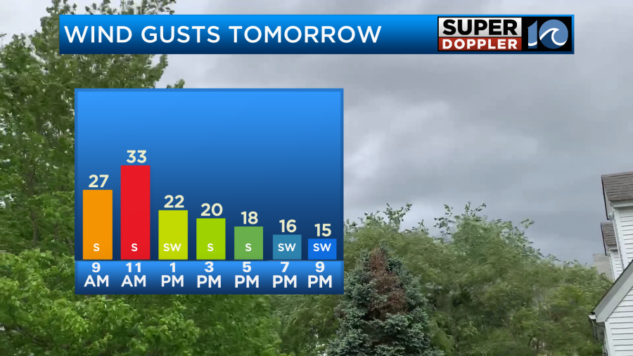
It’s possible that these winds could decrease a little more than forecast. That will be IF Debby weakens faster and moves north faster than forecast. We’ll see about the weakening part, but I have seen many fast moving systems jump well ahead of the given forecast when they go form southwest to northeast. We’ll see. This will be due to the upper level winds mainly picking it up.
Either way these persistent southeast winds at the surface will create some minor tidal flooding along the north end of the Albemarle Sound up into southern Virginia Beach.
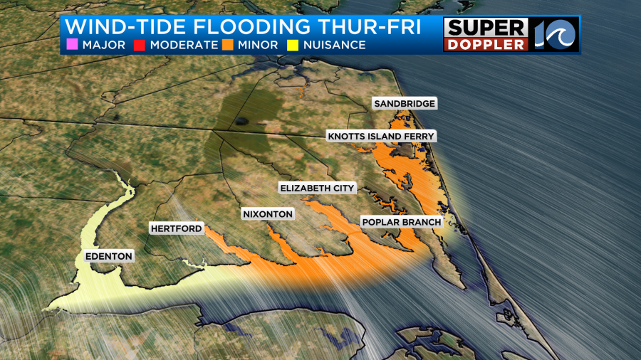
The tides over the Bay and the Atlantic should run normal.
As far as rainfall goes. We have already had about 0.5″ to 1.5″ since yesterday.

Going forward we could see another 1-2″.
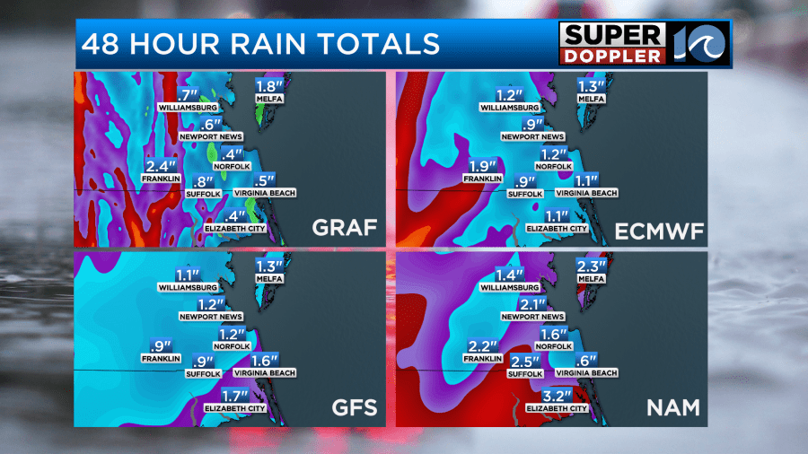
I almost wonder with those forecast amounts if the Flood Watch will be discontinued. However, I have to keep in mind that the ground is very saturated. So it might not take a whole lot of rain to create some more street flooding.
High temps will be in the mid 80s today. Then we’ll be in the upper 80s tomorrow. We’ll be in the low-mid 80s over the weekend. The humidity should drop some between Saturday and Sunday. It will drop a lot more between Sunday and Monday. We’ll then have some nice weather going into early next week.
Meteorologist: Jeremy Wheeler


