It has been nice over the last couple of days that there hasn’t really been a huge variation in the forecast for hurricane Lee. The models have actually been in decent agreement. Even for the anticipated “northerly turn”. This morning the system was a category 3 hurricane, but it may be showing signs of weakening. The satellite this morning showed that the eye was still large but also ragged.
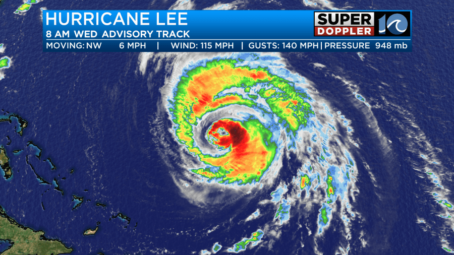
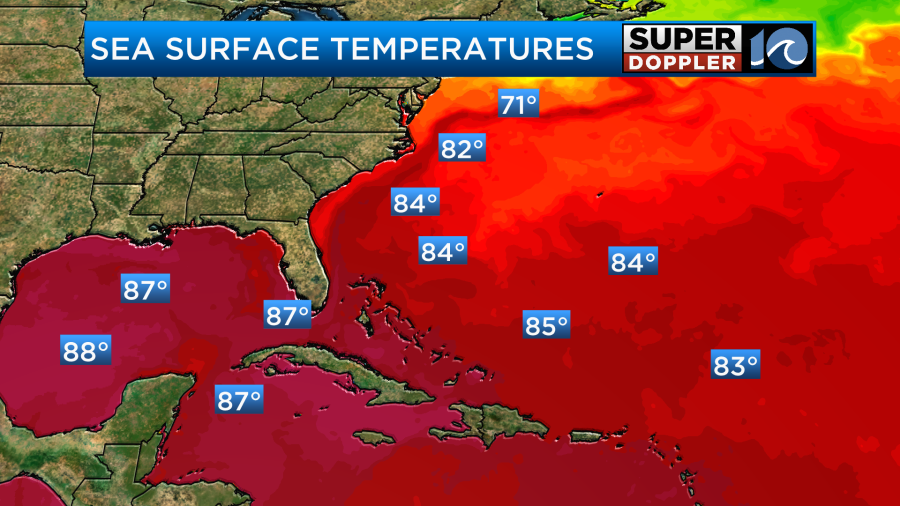
Lee is still over some pretty warm water. Surface temps are in the mid 80s. However, it will move over some slightly cooler water soon.
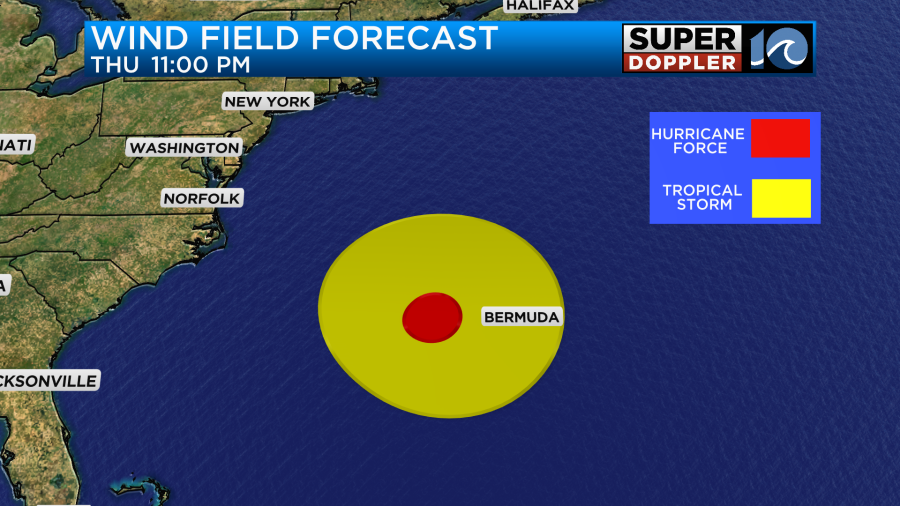
The wind shear is also steadily increasing. So the forecast for Lee is for some gradual weakening. However, it is also expanding some more. It will pass to the west of Bermuda. They will be spared the hurricane force winds. However, they will have some tropical storm forced winds (39-73mph).
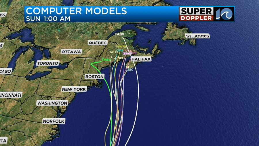
The storm will keep moving northward. It should weaken even more as we get into the weekend. The storm will push north towards the Gulf of Main by the weekend.
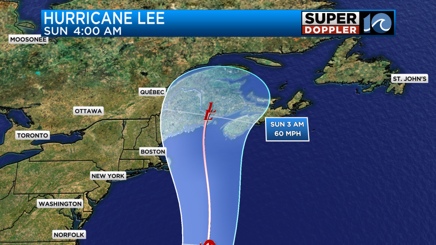
The models are in pretty good agreement on this. They are clustering on that region now, with a little bit of variance from west to east.
The GFS and European models are also in pretty good agreement now. They keep the strongest winds away from our shores, but they do show some gusts close to the shore.
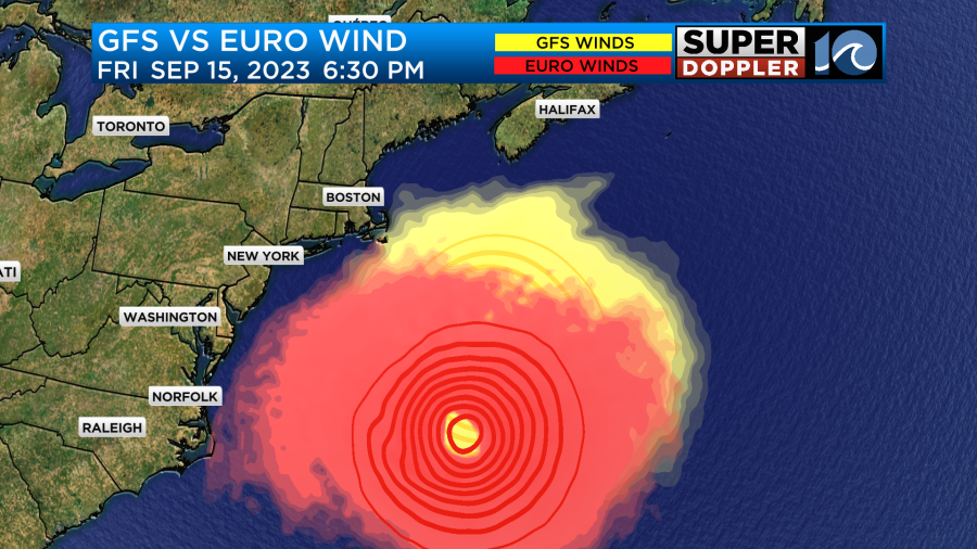
I think we’ll have a few gusts to 30-35mph near the shore with a couple of gusts to 40mph possible over the Outer Banks. This will be briefly on Friday.
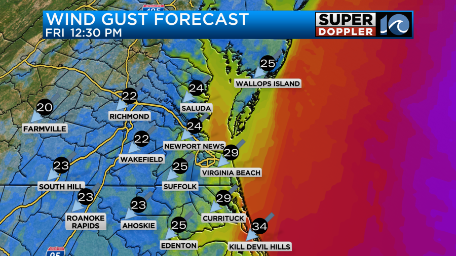
I think the wind will be fine overall, but the gusts could briefly be strong near the shore. There could be some minor tidal flooding from those winds on Friday, but I think the tidal flooding will be minimal.
The wind will be a big problem for areas in the northeastern U.S. As the storm moves towards the Gulf Of Maine it will likely push a large surge into that basin. The storm may weaken, but there will be some momentum from when the storm is stronger. Also, the geography of the Bay could be a problem as the water surges in from the southeast. Winds will be strong up there as well, and it could cover a large area.
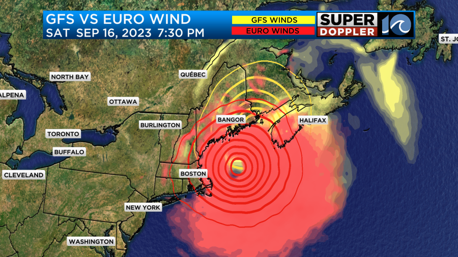
The GFS and Euro are in closer agreement on the track and winds now.
Around here we will continue to deal with the waves from Lee. This morning the surf looked pretty good across the Outer Banks.
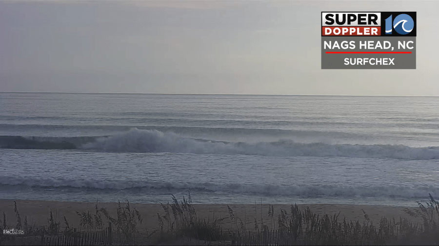
Waves will run about 3-4 feet in Virginia Beach with 4-6ft waves along the Outer Banks. It may get even higher down towards Hatteras.
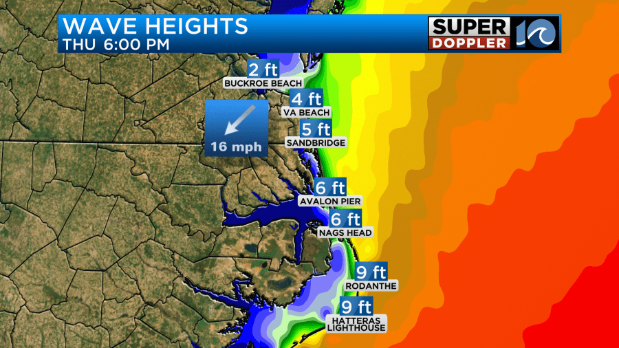
This will go up a little more tomorrow, and could even increase a bit more by Friday. At that point it might be even too dangerous for experienced surfers. Stay tuned. Regardless, it will be too dangerous for swimmers as the rip current risk will stay high through at least Friday if not the weekend.
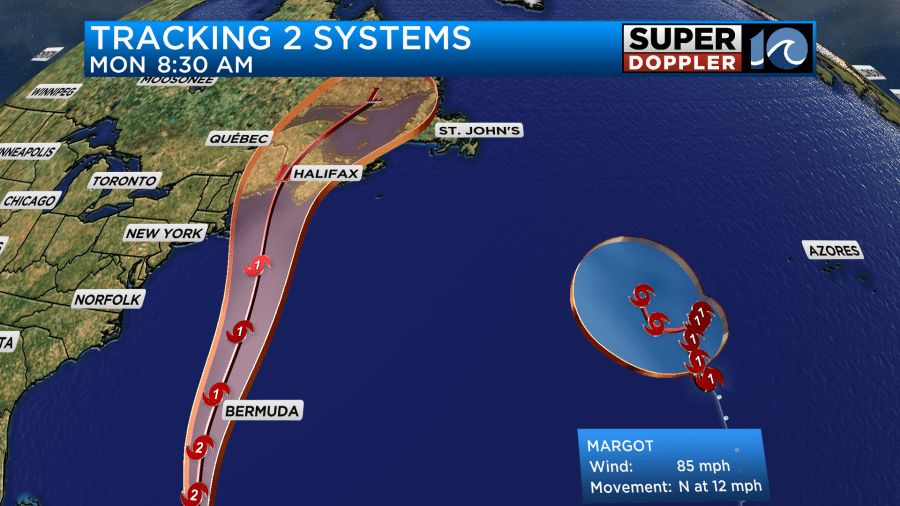
Hurricane Margot is over the eastern Atlantic. It is contributing some wave action but much less than Lee. Margot will stay out to sea.
There is another feature in the eastern Atlantic that has a high chance of formation in a few days.
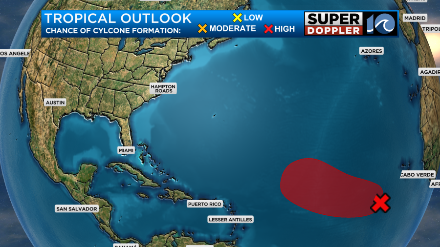
It will move to the northwest. So it “should” stay out to sea.
Meanwhile we have a cold front slowly sliding into the region today. It will steadily move to the east through the day.
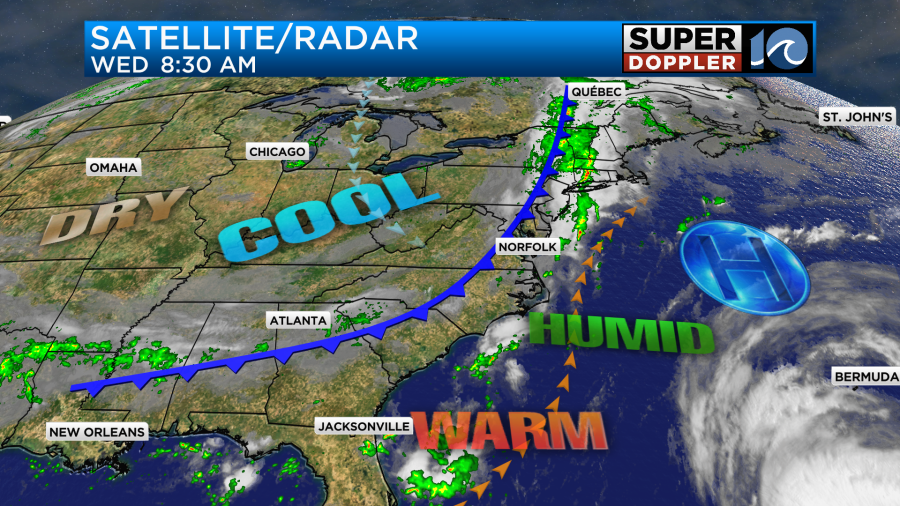
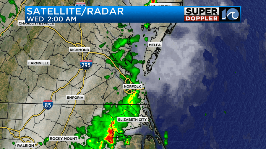
We did have a line of showers ahead of the front last night into early this morning.
We’ll have some more scattered showers and a few storms for later today along with a mix of sun and clouds.
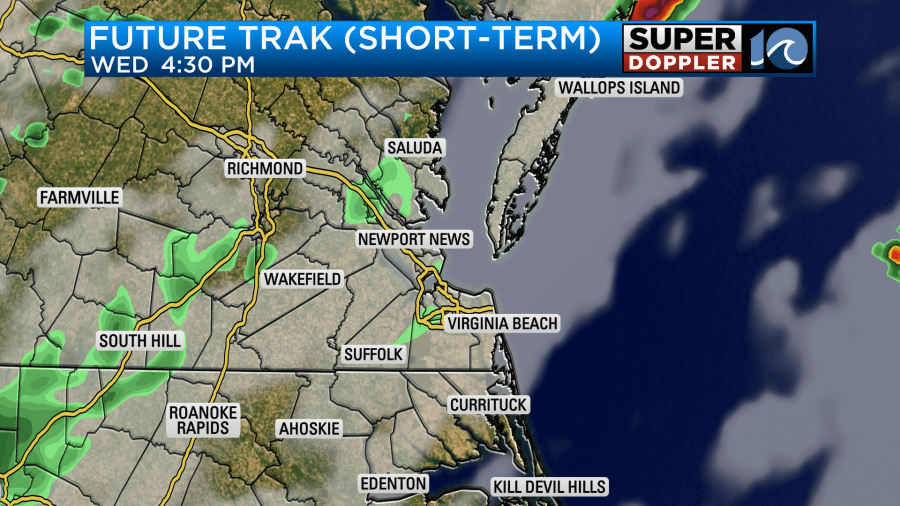
Winds will be light. They’ll turn from southwesterly to northwesterly. Between the clouds and scattered showers the temps should be held down a little this afternoon. They’ll run in the low-mid 80s.

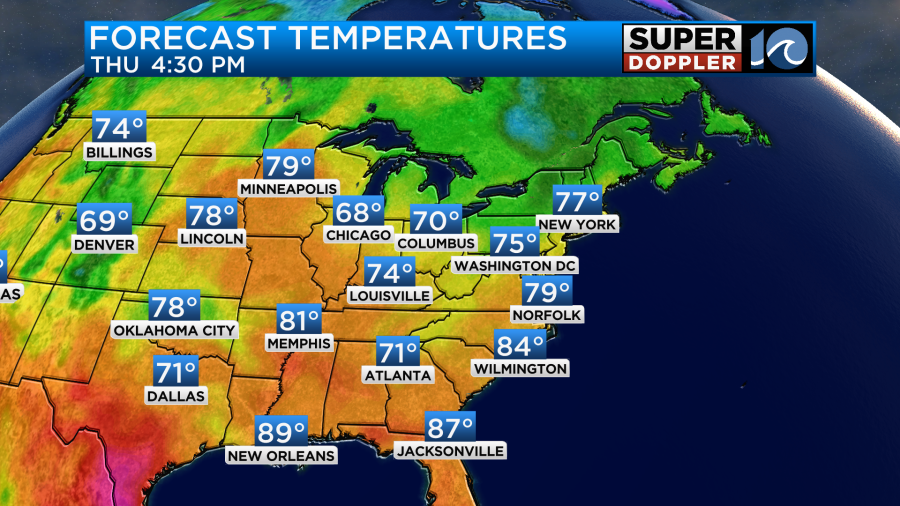
It is still fairly humid, but that is all about to change. By tomorrow the front will slide to our east. We’ll have an increasing northeast breeze. There could be a few gusts to 20mph and maybe some gusts to 25mph near the shore. Other than a stray shower in the early morning we’ll dry out and clear out. It should become very nice out. High temps will be in the upper 70s.
Dew points will drop to the 50s, and they’ll stay there for a few days.
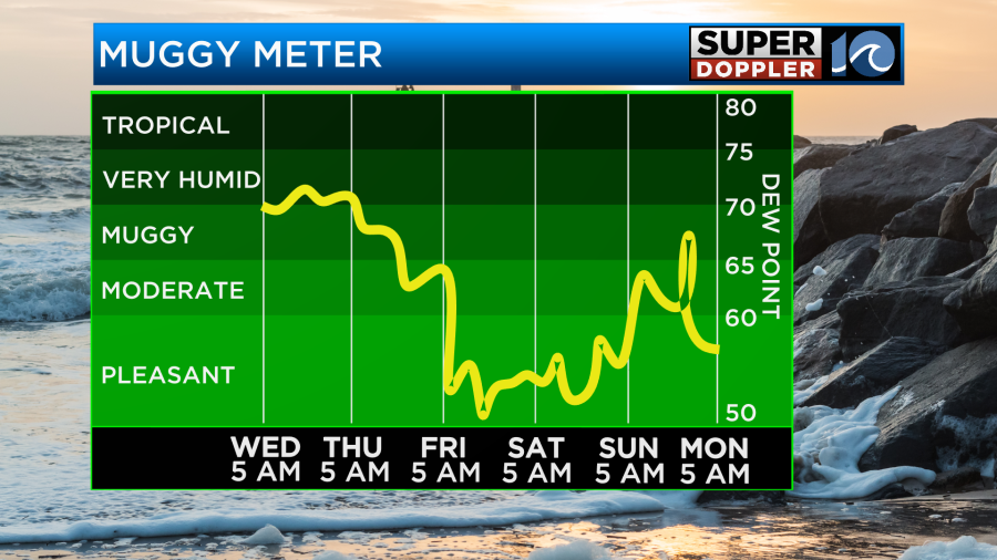
The weather will be great overall from tomorrow through the weekend. We’ll be in the 70s Thursday and Friday with near 80s Saturday and Sunday. There may be an isolated shower by Sunday afternoon.
There was way too much rain up into the northeast states yesterday. Storms created rainfall that put down 10 or more inches in a short period of time. Many homes were flooded. Here is the article with more information: Flooding in Massachusetts and Rhode Island. Again, these were from general thunderstorms. Not from a tropical system. However, they may get some more flooding as Lee moves up into that region this weekend.
In that same time… The U.S. has had a record number of billions dollar disasters this year. This is the most out of any year on record (in number), and we still have 3 and a half months to go before the year ends. Here is the article with more information: Record number of billion dollar disasters.
Meteorologist: Jeremy Wheeler


