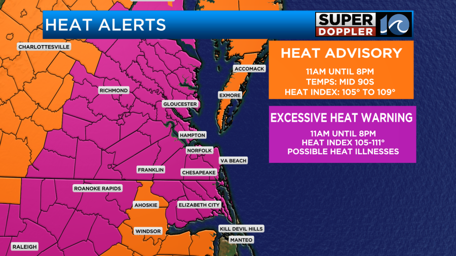
There is an excessive heat warning Friday for much of the WAVY viewing area — until 8 p.m. Dangerously hot conditions with heat index values around 110 are expected.
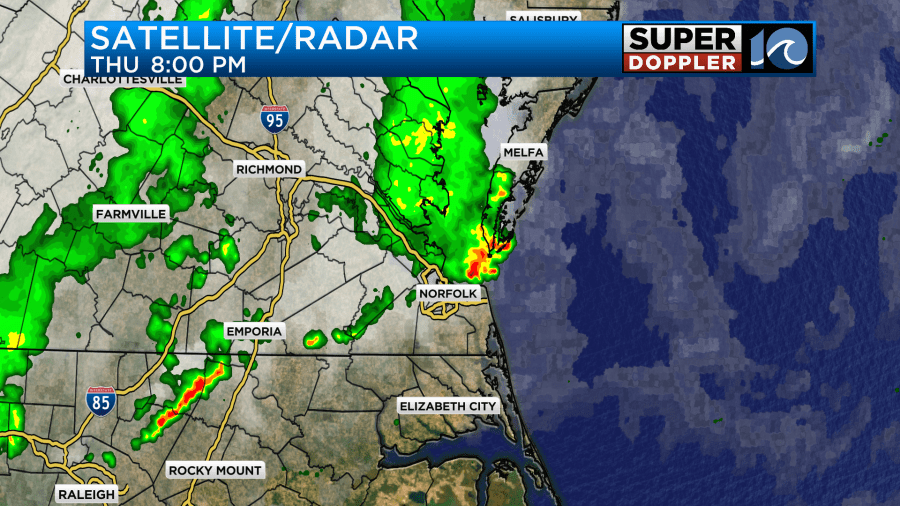
Last night we ended up getting a few clusters of showers and storms over the region. They survived a little longer than the models predicted earlier in the day. This did impact some of the fireworks, but almost all of them still had their show.
It was pretty hot and humid yesterday, but today we could be dealing with some dangerous heat. High pressure is offshore, and that is allowing for a light breeze out of the southwest.

This is going to allow the dew points/moisture to rise even more. They will rise above 75 today which is tropical.

This type of humidity will stick around for a while. At the same time the temperatures are also going to rise quickly. They will be in the mid-upper 90s this afternoon.
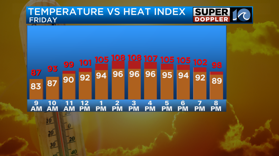
With the heat and humidity combined it will feel like it’s between 105 and 111 degrees this afternoon.
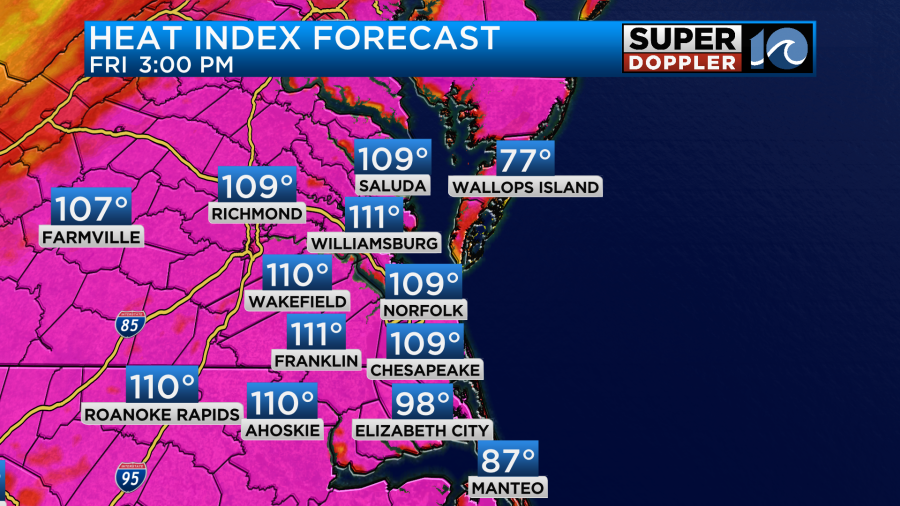
This has prompted an Excessive Heat Warning from the National Weather Service.
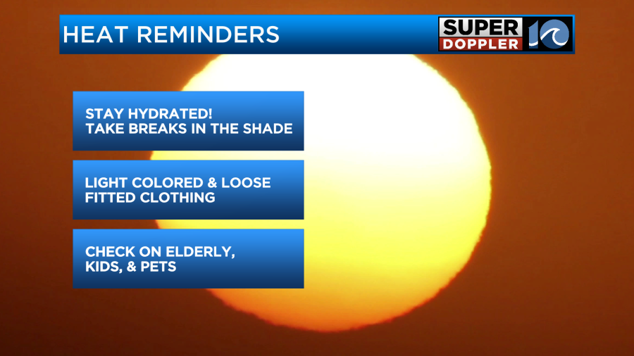
We’ll be partly sunny for a while. There will be a few showers and storms popping up this afternoon. Don’t bank on that to cool you down though. Here are some reminders to combat the heat.
We’ll have similar weather tomorrow. High temps will be in the mid 90s. The heat index will be over 100.
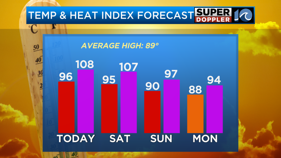
We’ll be partly cloudy again with a few pop up showers and storms in the afternoon. However, tomorrow I believe we’ll have several clusters of thunderstorms in the area developing by the evening.
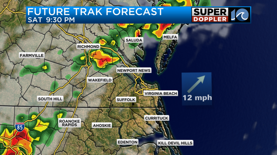
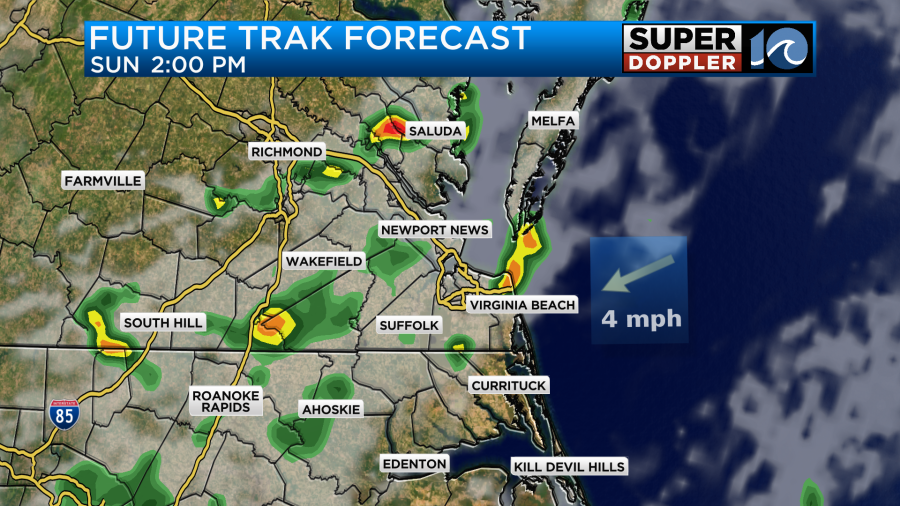
This will be ahead of a cool front that will move in Saturday night into Sunday morning. There may be some heavy rain with those storm clusters. We will cool it down a little on Sunday, but it won’t be that much cooler. The cool front will basically stall out on top of us. High temps will be closer to 90 degrees, but the humidity will barely drop. This stalled out front will create more clouds over the region. We’ll also have scattered showers on and off through the day with a few thunderstorms by the afternoon.
We’ll cool down a little more on Monday. High temps will return to the 80s…for one day. We’ll have typical summer heat and weather next week.
In the tropics we are tracking Hurricane Beryl. It made landfall near Tulum, Mexico around 6 a.m. this morning.
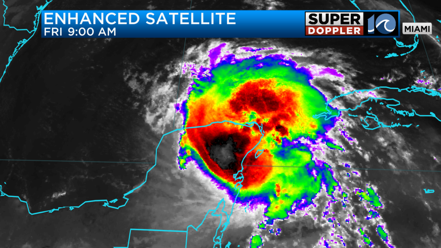
The storm was up to a category 3 last night, but it had dropped to a category 2 before landfall. Now Beryl will move over the Peninsula today and weaken. The system is forecast to weaken to a tropical storm soon. Then it will move back over the waters of the Gulf of Mexico. It will restrengthen over the Gulf during the next 24-36 hours. The latest forecast has it becoming a category 1 hurricane again, but it could easily become stronger than that.

It will aim towards southern Texas between late Sunday into Monday. However, some models are still trending more to the north.

So maybe it will get closer to Corpus Christi or even Houston. We’ll see.
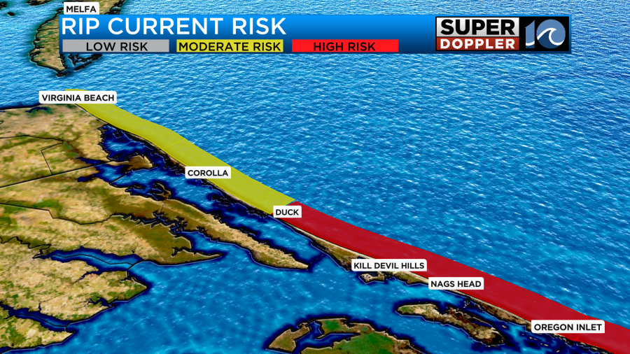
One last thing. There is a moderate threat for rip currents in Virginia Beach today, but there is a high threat again over most of the Outer Banks.
Meteorologist: Jeremy Wheeler