Yesterday, was another wet day across the region. At one point there were Flash Flood Warnings in some inland locations. However, most of the region had only light rainfall. It only added up to a couple more tenths of an inch. Light showers continue into yesterday evening.
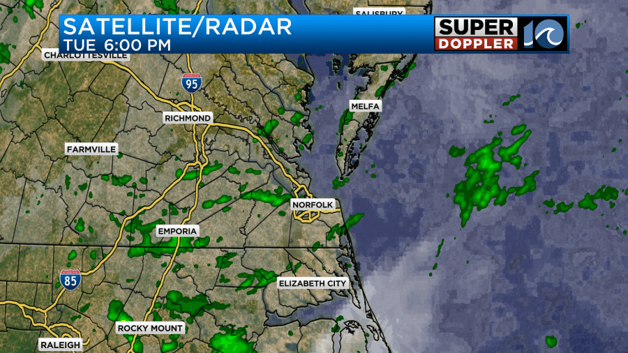
I wish I could just give the all-clear and say that today we will be dry and comfortable. However, there is an upper level low that is slowly rolling east. There is also a weak cool front just to our southeast with a small low offshore. High pressure is to our north.
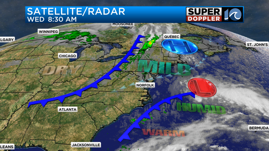
These features could allow for some spotty showers today along with a mix of sun and clouds. Overall, though, it should be a decent day. The sun will be out at times, and the humidity has dropped to moderate levels. Dew points are in the mid 60s now. There will be a northeast breeze at 8-12mph with some higher gusts near the shore. However, with that northeast wind returning, we will have some more minor tidal flooding over the next 24 hours.
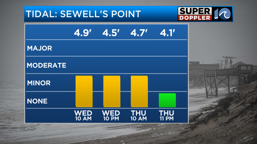
It should go down by late Thursday. Hopefully, it will remain at normal levels for a while.
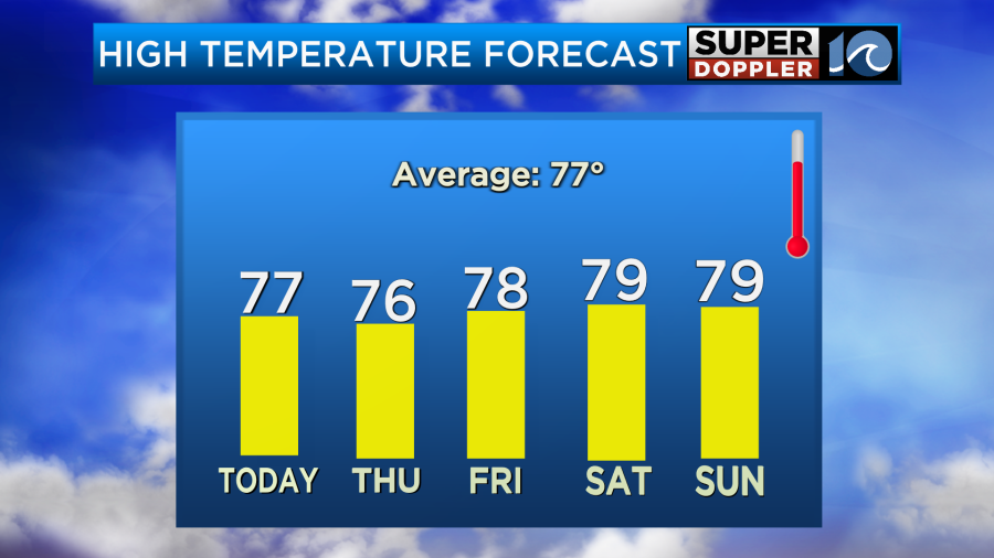
From Thursday onward we are looking good. We’ll have partly cloudy skies through the weekend into early next week. Temps will be in the 70s, and the humidity should be comfortable.

Meanwhile out west they are still baking. They are in the middle of a long-duration heat wave. They have been breaking records left and right out there. In fact… Las Vegas has had over 106 days with a high temperature of 100 degrees or higher That’s crazy. Even for Vegas which typically gets very hot in the Summer.
That heat continues out there today and tomorrow. Actually the whole country is running pretty warm over the next few days.
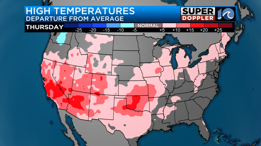
Our temps will be mild, but they will be just above average this weekend.
The tropics are still pretty active. Hurricane Kirk is gaining strength over the middle of the Atlantic. It is forecast to become a major hurricane within a couple of days.
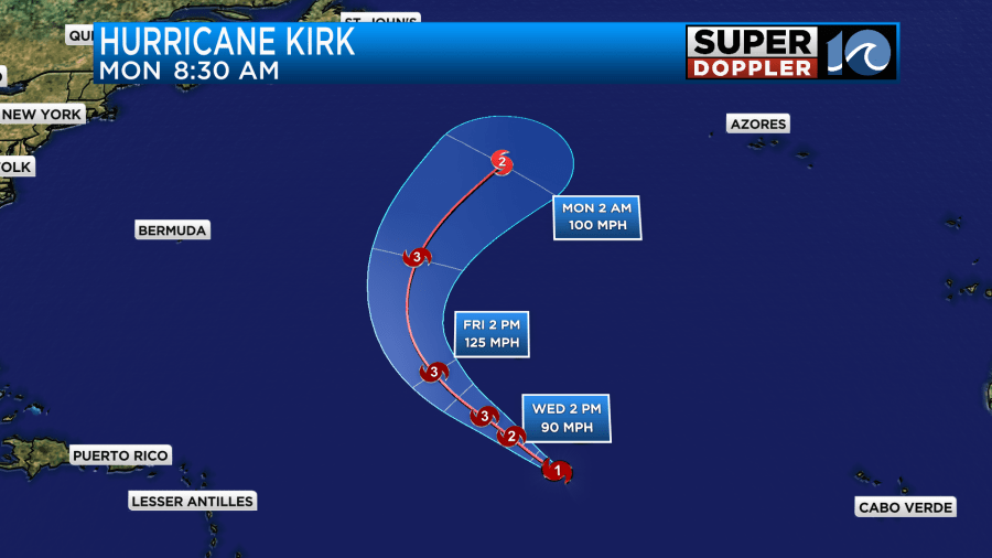
However, the storm will stay far out to sea. Some of the waves from Kirk will travel to the U.S. east coast. over the weekend. Our Wave model is forecasting some 5-6 foot waves.
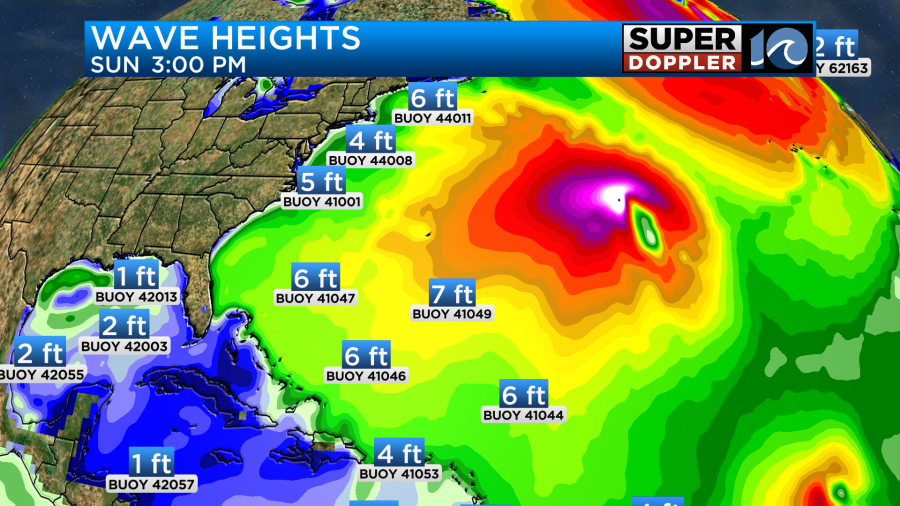
However, I think they will be a little higher Sunday into Monday.
There is a tropical disturbance in the eastern Atlantic. It has a high chance of formation, but it is very far away.

It will probably become a tropical depression or storm later today. It will probably stay out to sea, but I don’t have much confidence in that just yet.
The disturbance that is entering the Gulf of Mexico has a medium chance of formation within the next few days. However, the long range models don’t have it strengthening much.

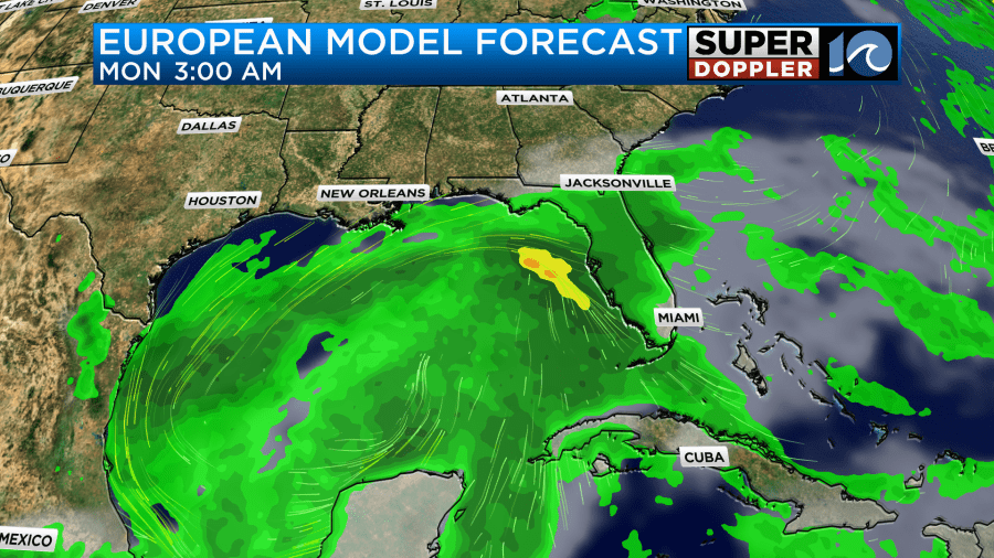
The water temps are very warm across the Gulf. So I wouldn’t be surprised if it gets stronger than forecast. We have some time to watch it. Even heavy rain would be bad for clean up efforts along the Florida coast.
Meteorologist: Jeremy Wheeler


