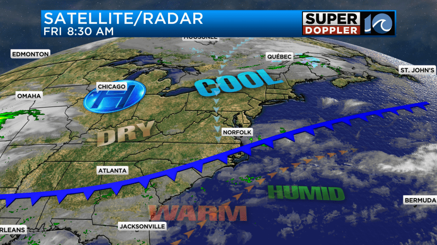
Yesterday, we ended up hitting 80 degrees. This broke the record of 79 set back in 2022. Today we are going to cool down as a cold front slowly sinks through the region.
Early this morning the front created some isolated showers. At one point we even had a heavy shower over the metro area.
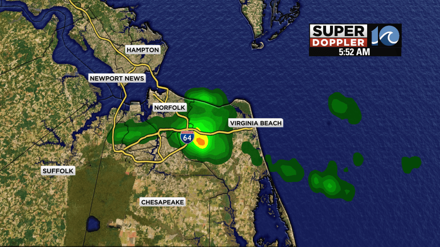
This shower only created a “trace” of rain at Norfolk International Airport. There was another shower last night over Norfolk that put down 0.01″ of rainfall. This technically ends the streak of 36 days without measurable rainfall.
The front is very slow moving, but it will continue to drop to the south through the day.
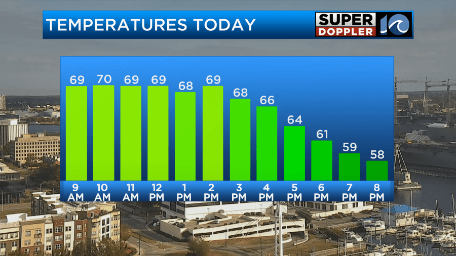
After some clouds and sprinkles through the late morning we will have clearing skies today. The wind will pick up out of the north. It will run at 5-15mph. Temps will rise to around 70 degrees, but then temps will hold steady over even fall a bit later this afternoon.
The humidity is going drop fast as we go into the afternoon.
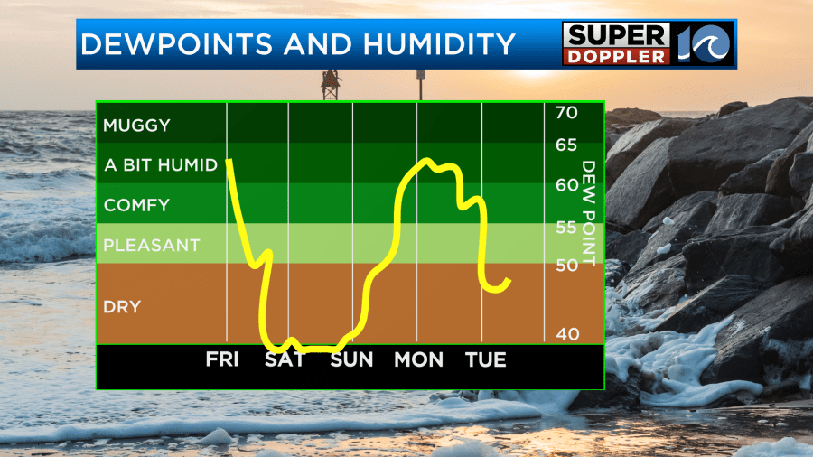
Tomorrow we’ll be dry, cool, and breezy. High temps will only be around 60 degrees.
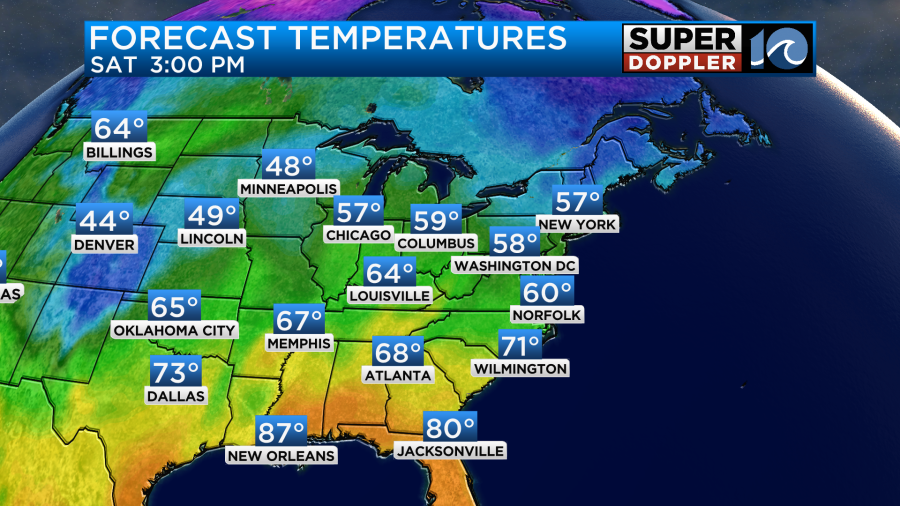
We’ll be mostly sunny through the day, but the northeast breeze will gust up to 20mph. So that will keep us cool.
By Sunday the temps and the humidity will start going up. High temps will rise to the upper 60s to near 70 degrees.
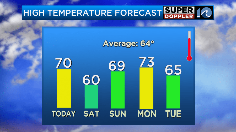
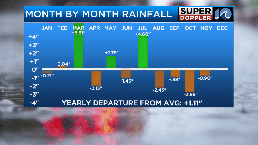
We’ll have increasing clouds, and there may even be some isolated showers towards the end of the day. The extra moisture will pool ahead of the next cold front on Monday. This will create our best chance for rain that we’ll have had in over a month. It’s a bummer that Veterans Day events could be affected, but we REALLY need some rain. We are down about 0.9″ for the month already, and we’ve ran up a big deficit for the past 4 months.
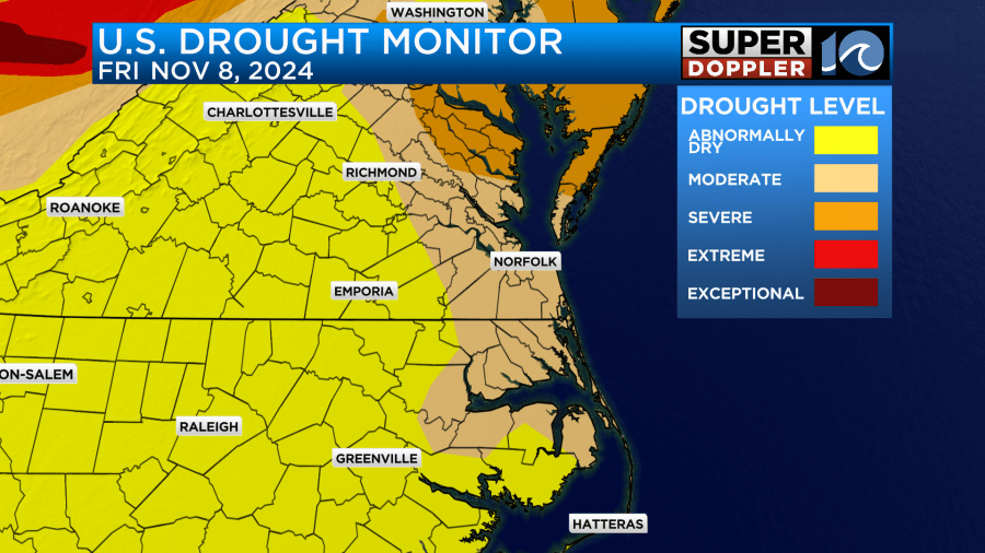
A large portion of the country is under a worsening drought.
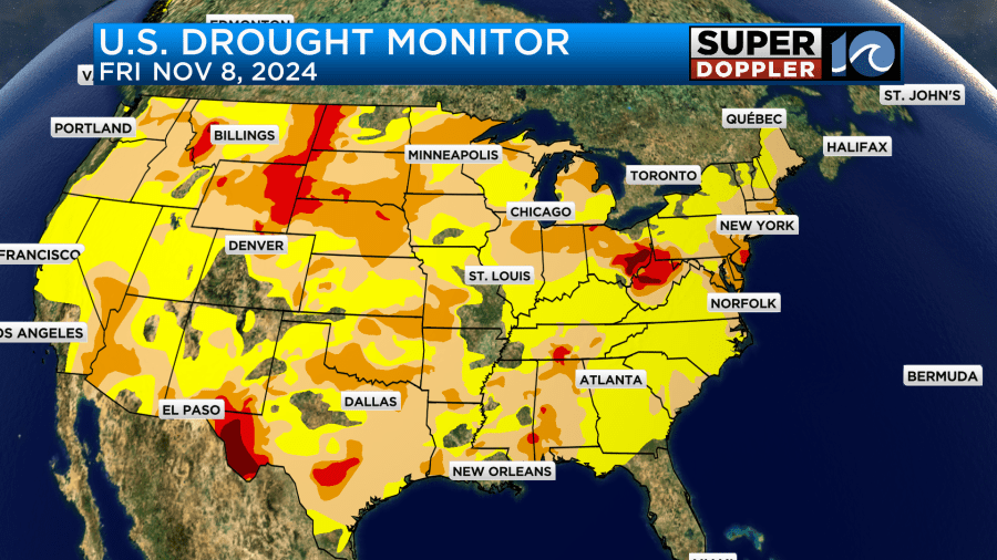
Even locally now we have some of the region in a severe drought.
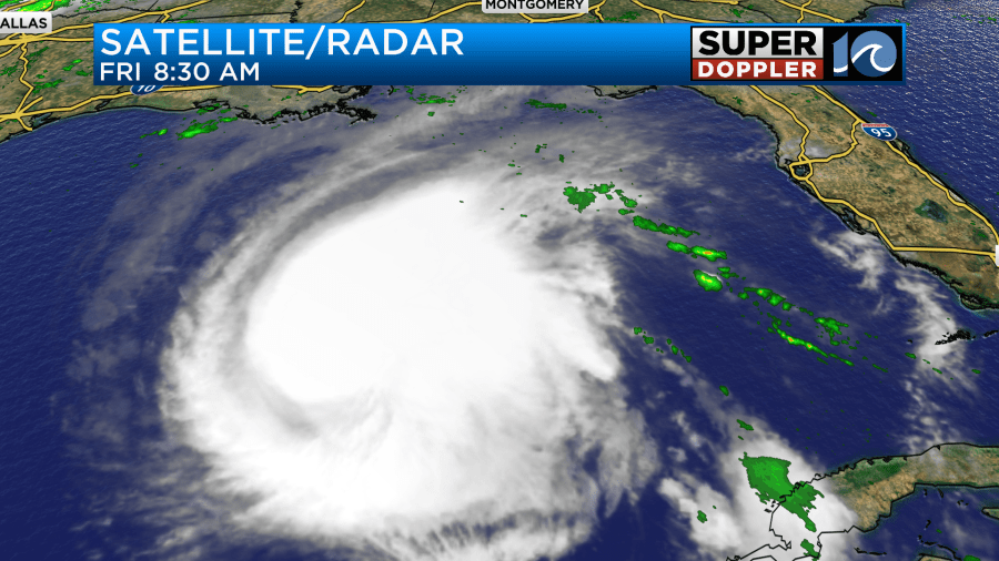
Meanwhile, Rafael is still churning over the central Gulf Of Mexico. It actually flared up again into a category 3 hurricane last night.
The system is on a westerly track. It should continue west over the next 24 hours. After that point it is expected to make a loop to the north then south.
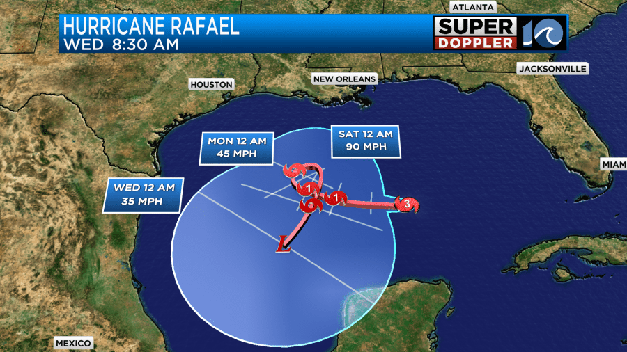
It should gradually weaken through that time as the wind shear increases and it interacts with some drier air. The models are in fair agreement about doing a loop, but I would say that there is still a good amount of uncertainty in the track.
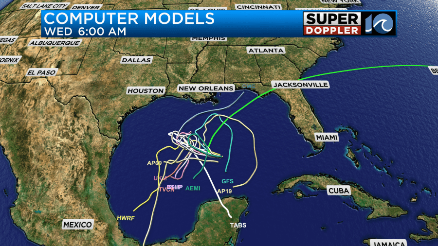
The GFS does have Rafael bringing some rain and wind to the coast over the next few days despite keeping the center offshore.
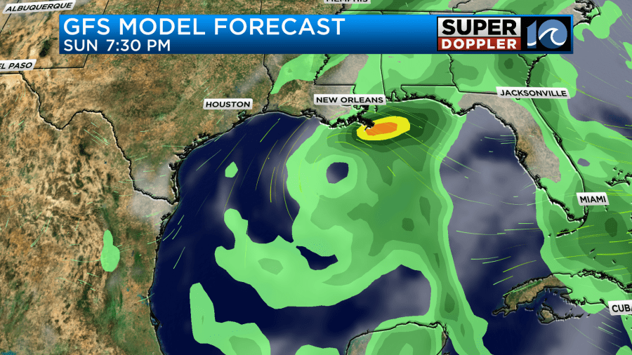
This could be a good scenario as they do still need some rain down there as well.
In national news… This morning I found an interesting article about some colder headlines. There was some heavy snow over parts of New Mexico and Colorado yesterday. About 100 vehicles became stranded in a rural part of the state of New Mexico. Here’s the article: New Mexico snow storm. It may be a long while until we see snow around here. Temps and water temps will have to cool down big time for that to happen. Could we have another year without snow? We’ll see.
Meteorologist: Jeremy Wheeler


