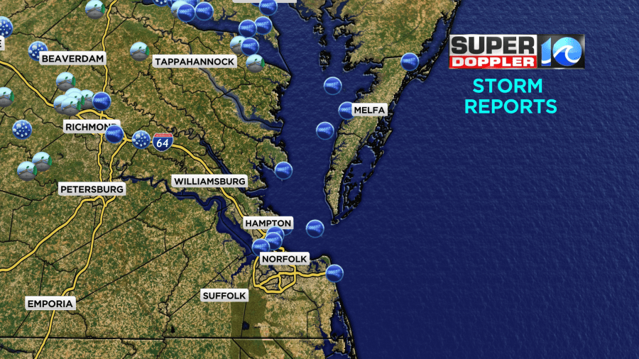
Last night we did have a line of heavy showers and thunderstorms drop down from the north. There were severe storms and warnings just north of Hampton Roads around 7pm.

The storms weakened a bit as they dropped south, but they still put down some heavy rain and brief gusty winds.
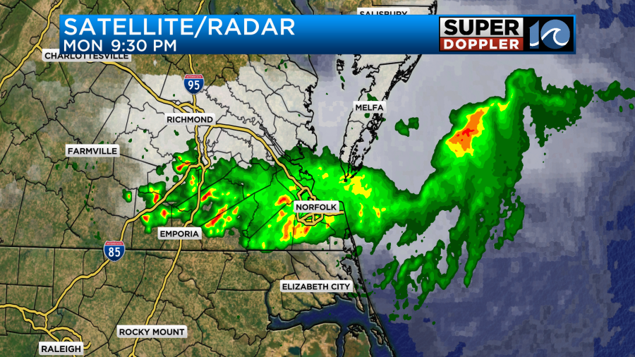
We did have some wind gusts to over 40mph though most of those were over the water.
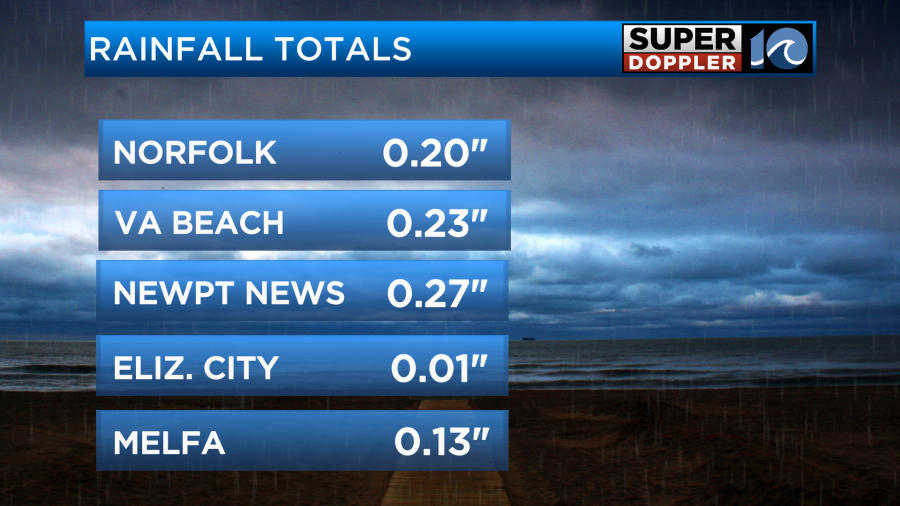
We pick up a couple tenths of an inch of rain with less to the south.
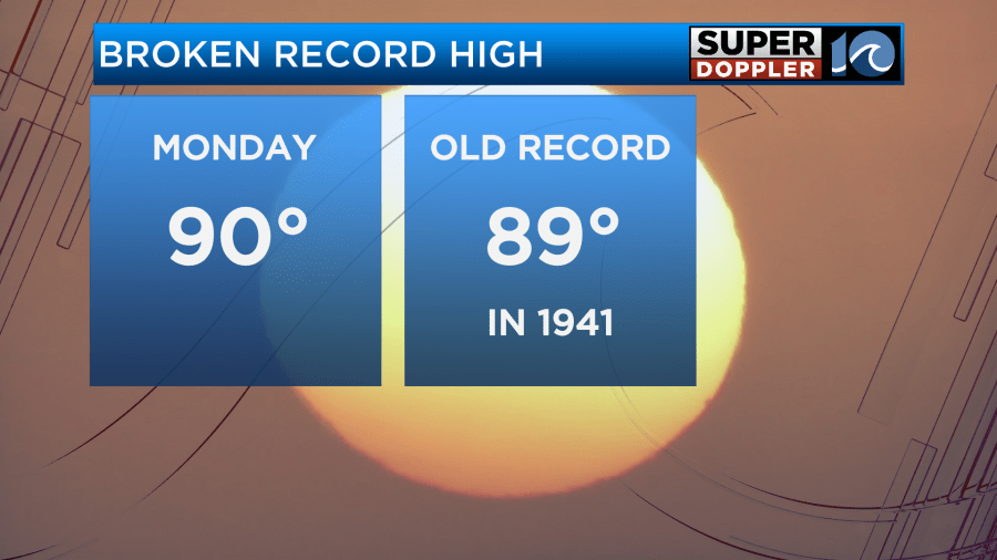
Before the front arrived we had warmed up to the point that we broke a high temperature record. We ended up hitting 90 degrees in Norfolk. That broke the old record of 89 set back in 1941.
Today the front has sunk to our south. It is now going to stall out south of Hatteras.

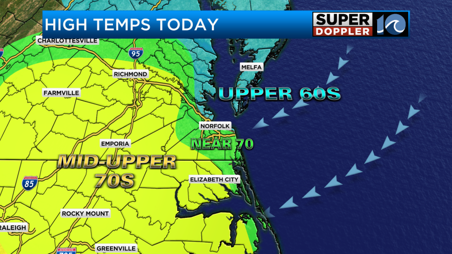
It will be pretty nice out today. We’ll have a mix of sun and clouds with only a stray shower or sprinkle in the whole region. We’ll have a steady northeast then easterly wind at 5-15mph. There will be some gusts to 20mph near the shore. This will produce some mixed temperatures this afternoon. We’ll be in the upper 60s near the shore, near 70 in the metro, and in the mid-upper 70s inland and south.
The pollen did get knocked down a bit. So levels are moderate today for both trees and grass.

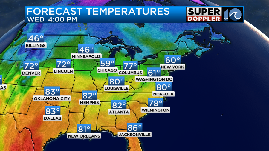
Tomorrow the front will lift back north as a warm front. We’ll have a south/southeast breeze. This will pull up more moisture, and it will increase the temps again. Highs will be near 80 degrees.
We’ll be mostly cloudy with some peeks of sun once in a while. We’ll have a few showers in the afternoon as the front slowly slides north.
We’ll be partly cloudy on Thursday with isolated showers possible. High temps will be in the upper 70s to near 80. On Friday and Saturday we’ll be partly cloudy. There will be a few showers each afternoon. There will be more scattered showers Friday evening into Saturday. High temps will be in the upper 60s on Friday with low 70s on Saturday. Probably!!! These fronts are notorious for stalling out sooner or later than the forecast this time of year. So check back for updates on that. For now I have mostly cloudy skies on Sunday with scattered showers and highs in the 60s.
Meteorologist: Jeremy Wheeler