Update: Thursday Afternoon
Snow lovers… don’t get your hopes up. We only expect a brief chance for some snowflakes for only parts of the region early Saturday morning… the rest of the weekend should just be chilly!
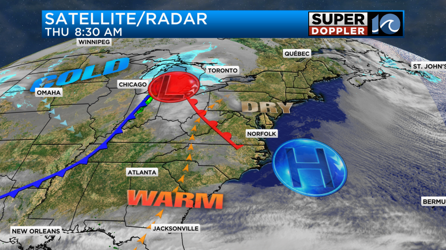
A weakening cool front drops in tonight to set up a cooler Friday — it’ll still be a nice day but we’ll increase the clouds throughout the afternoon. The stalled front will connect the dots to a fast-moving area of moisture that will fly through the region overnight Friday into Saturday morning.
For a majority of us, we’ll just look for some brief scattered rain showers early in the morning. But as cold air wraps in from the north, the rain-snow line will set up to our north. Areas close to Williamsburg, the Middle Peninsula and northern Accomack County could see rain flip over to snow.
Is this the big snow?
No, not at all. But some minor accumulations are possible in those spots on grassy, elevated surfaces.
The precipitation with this system will race by and move out to sea by the time we get out of bed! (mid/late morning). Stubborn clouds will hang on Saturday with the chilly breeze, this will keep it chilly on Sunday but we’ve got sunshine to return then.
Keep it with WAVY as we update/tweak the forecast moving forward!
—Steve
______________________________________________________________________________________________________
Today is going to be pretty nice out. We started with chilly temps in the 20s and 30s this morning, but there was a lot of sunshine.

We’ll warm up fast today. High pressure is sliding offshore. Winds are going to gradually pick up out of the south. Also, we will be brushed by a warm front that will lift to our north.
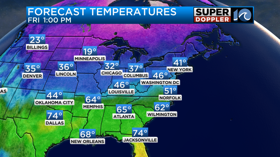
We’ll have fair skies today with some layers of cirrus clouds at times. High temps will rise up to the the mid 50s.

It will be a nice afternoon, but it may be a little cool with the breeze at times.
By late tonight a cold front will sweep through the region. It won’t have any precip with it, but it will create some gusty north winds for a bit. Tomorrow we’ll be cooler as the front drops to our south. High temps will be in the upper 40s to low 50s.
At least we’ll have a lot of sunshine again. However, the breeze will be steady out of the north. We’ll stay dry through Friday night. However, by early Saturday morning a zipper/clipper system will swipe through the region. I call it a zipper system because it will literally zip through the area. Many call it a clipper system because it will clip our region. Either way it will have a little moisture with it, and there will be some cold air in place. I think we are looking at some cold rain showers in Hampton Roads, but there could be a brief wintry mix north of the metro. There may even be some snow showers a little more to the north.
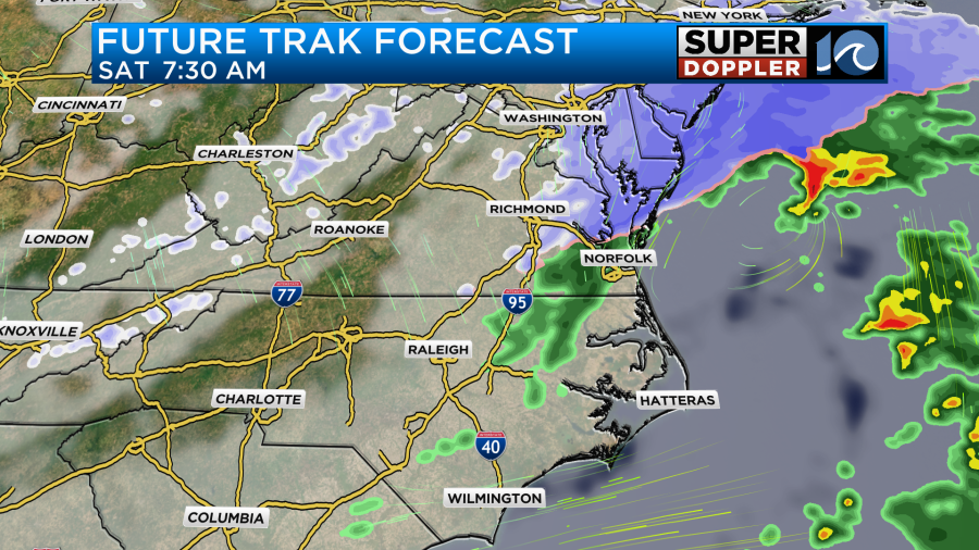
If it does form, then it will be short-lived. It should already move out by the late morning. Then we’ll stay dry through the afternoon. There may be some light accumulations, but I think most of those will be north/northwest of our viewing area. Having said that…Here are a couple of of snowfall forecasts.
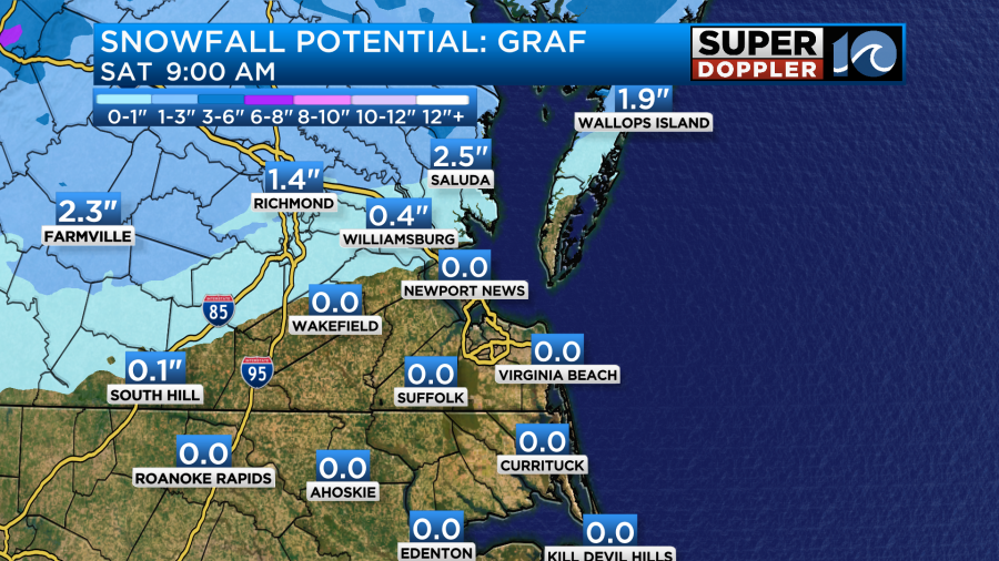
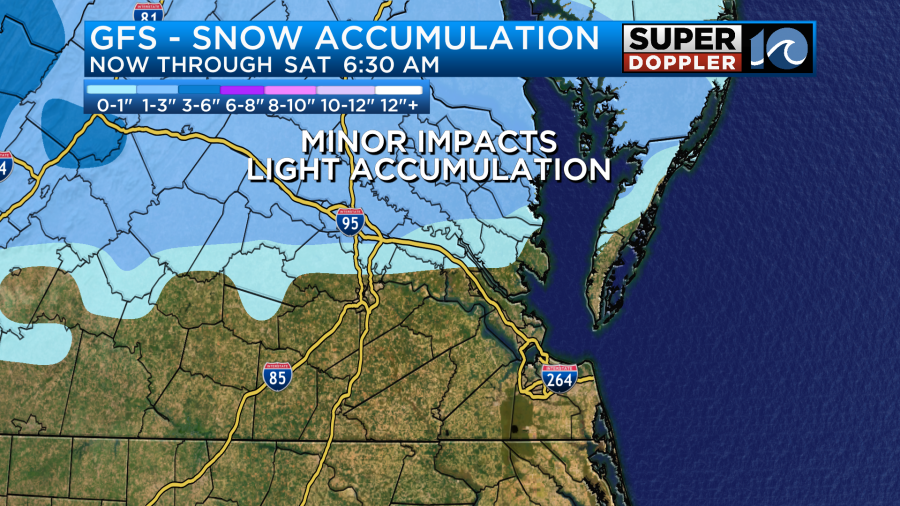
The most recent National Weather Service forecast is very similar. Here’s the thing… Surface temps will likely be above freezing as the precip falls. Ground temps will be well above freezing. Also, this system will move so fast that I wonder if the moisture is a bit overdone. So I think a lot of what falls will melt. The rain/snow line kind of jumped south all of a sudden yesterday. I wouldn’t be surprised if it lifted back north a bit today. We’ll see. Either way I think it will be mainly some cold rain showers for the metro.
The rest of the weekend will be dry and chilly. High temps will be in the 40s both days.
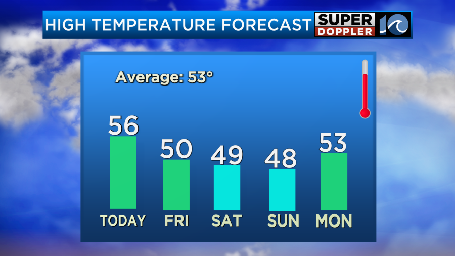
We’ll be dry and cool for President’s Day on Monday.
If you want to think warm thoughts then listen to this (or read it rather): According to NOAA (National Oceanic and Atmospheric Administration) Earth just had its warmest January on record. We were 2.29 degree Fahrenheit above the 20th century average. Our region has been pretty mild, but areas to our northwest have been breaking records left and right.
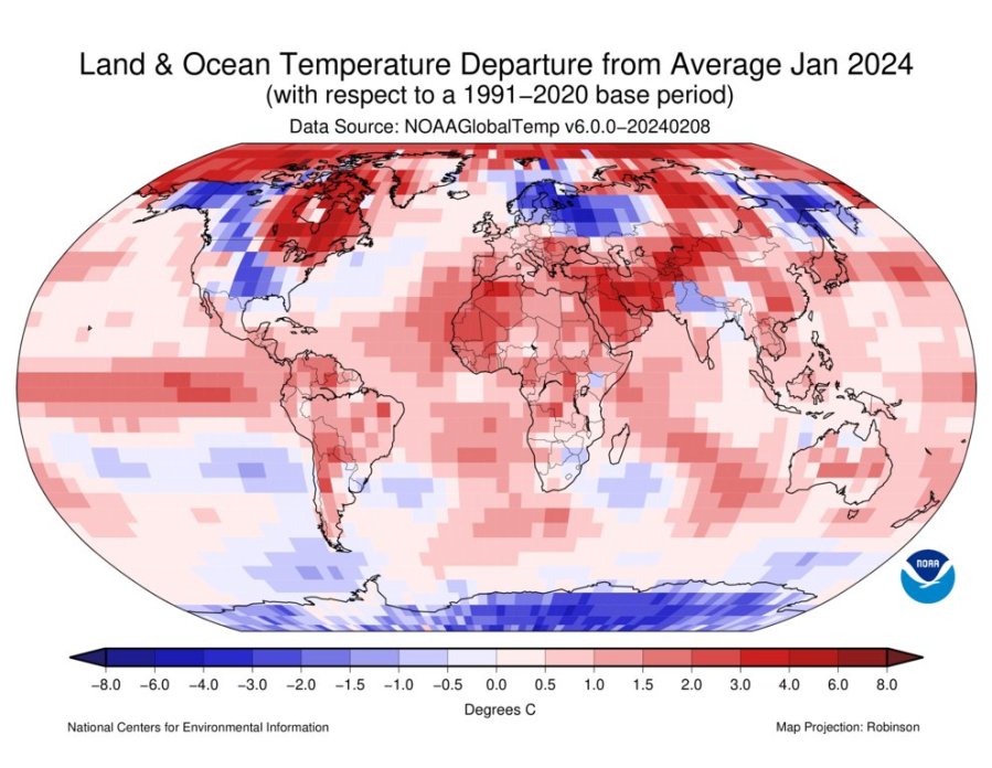
It will be interesting to see what the rest of February brings.
Meteorologist: Jeremy Wheeler


