
Over the last 2 weeks we had some pretty warm temps most of the time.
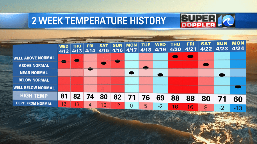
I was gone for part of the time. So that’s why I don’t remember the long stretch. (Spring Break in Illinois). Anyway, yesterday we started a cooler pattern, and that is going to continue for most of the week. We have a cool front sinking to our south with high pressure edging in from the west.
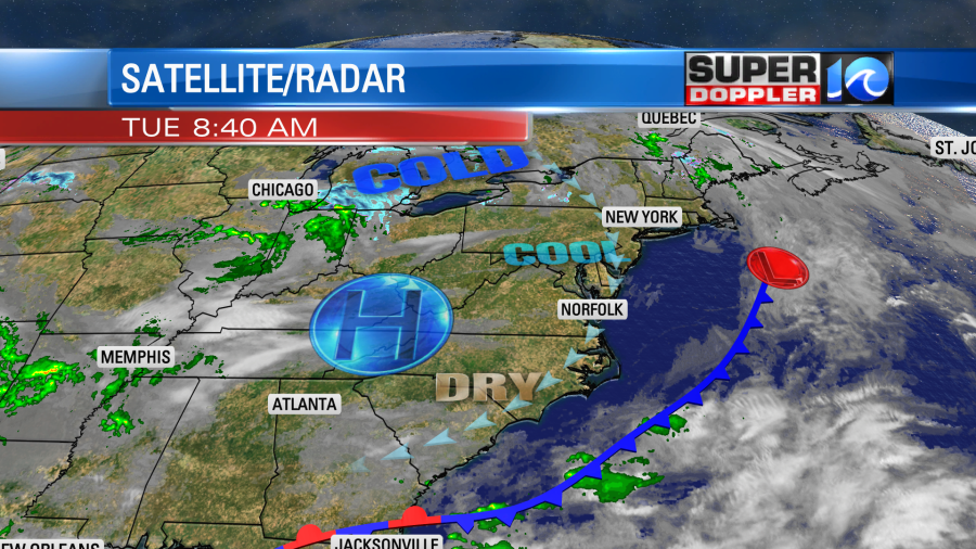
This setup will produce a steady breeze out of the northeast today. It will run at 8-12mph through the day. We’ll be mostly sunny this morning and partly sunny this afternoon. High temps will be in the low-mid 60s this afternoon.
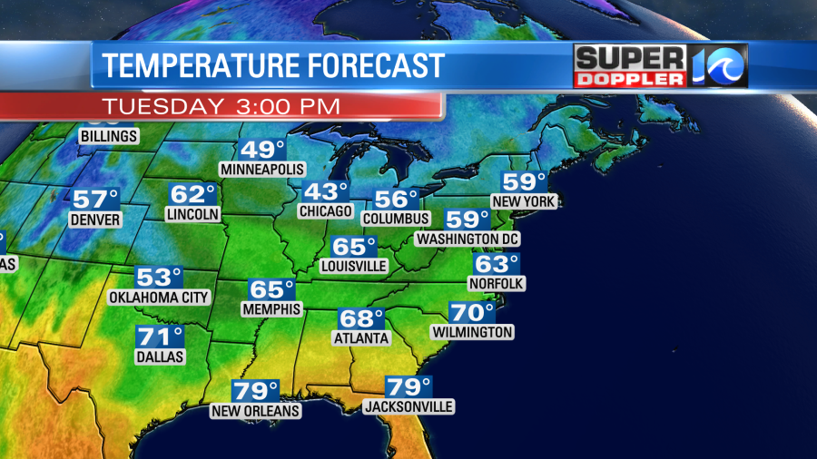
It should be nice out, but temps will run about 10 degrees below average.
We’ll stay mostly dry tomorrow with only some isolated showers north of the metro late in the day. High temps will rise to the upper 60s. Thursday will be a little tricky as the moisture increases a bit in the region. Plus a weak cool front will move in and fall apart. So we’ll have a mix of sun and clouds with a few showers possible. They will probably be later in the day, but the NAM model has a few showers early in the day. High temps will be in the 60s, but one model has us in the lower 60s. One has us in the upper 60s.
Regardless, the model trends for later this week are coming together, and that is important for the Something In The Water festival. The latest GFS and European models are agreeing on a wet Friday.
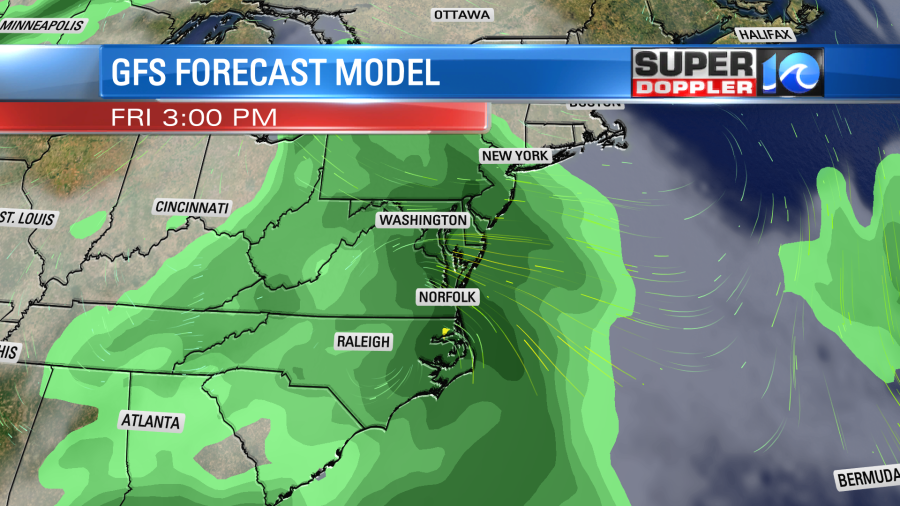
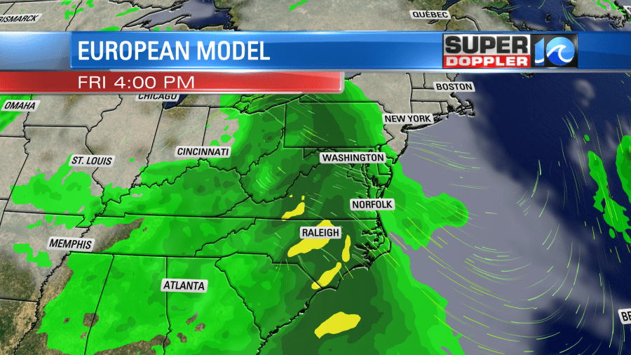
They both have an area of low pressure forming on the southern edge of the region. This will produce an easterly breeze along with the rainfall. This would not be good for the festival, but keep in mind that the details of that low moving through could still change. It is, however, interesting that both models are trending wet for the day. High temps would likely stay in the 60s.
The good news is that they are also trending drier for Saturday as the low moves out to sea. They are generally showing a mix of sun and clouds with some isolated/spotty showers in the area.
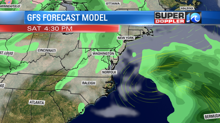
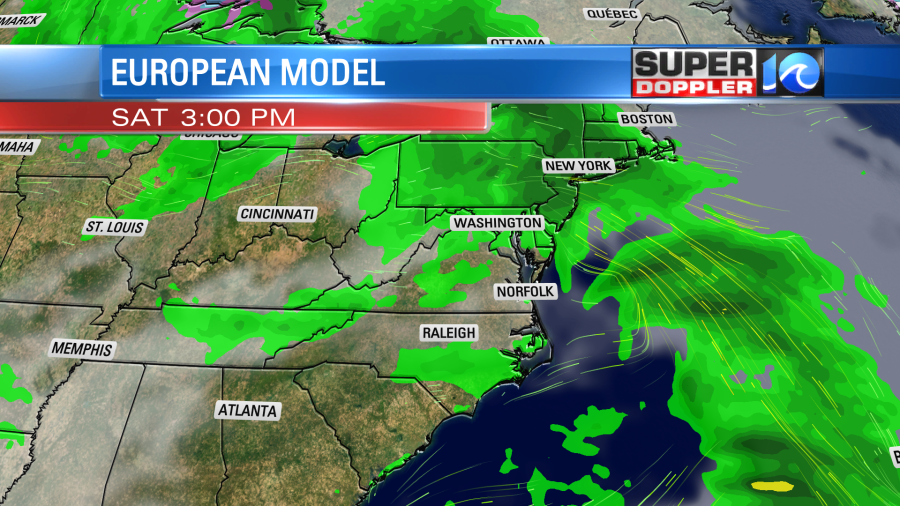
That is good news for the Tour De Cure on Saturday.
After that both models keep the bulk of Sunday dry, but they do have some rain returning later in the day.
Be sure to take all of that with a grain of salt. The forecast for the weekend still could easily change. There will be basically 2 areas of low pressure moving through, and the timing of those still could change. So don’t make any definitive plans just yet. We’ll have more confidence in the long-range forecast over the next couple of days. So be sure to check back.
Meteorologist: Jeremy Wheeler