We will finally get some cooling in the east, but the western U.S. is still baking. Parts of the central U.S. are too. Let’s talk about it…
Yesterday we ended up hitting 90 degrees in Norfolk. It was hot and humid. The average high for this time of year is 84 degrees. There were a few heavy showers over the Southside and northeast North Carolina during the afternoon.
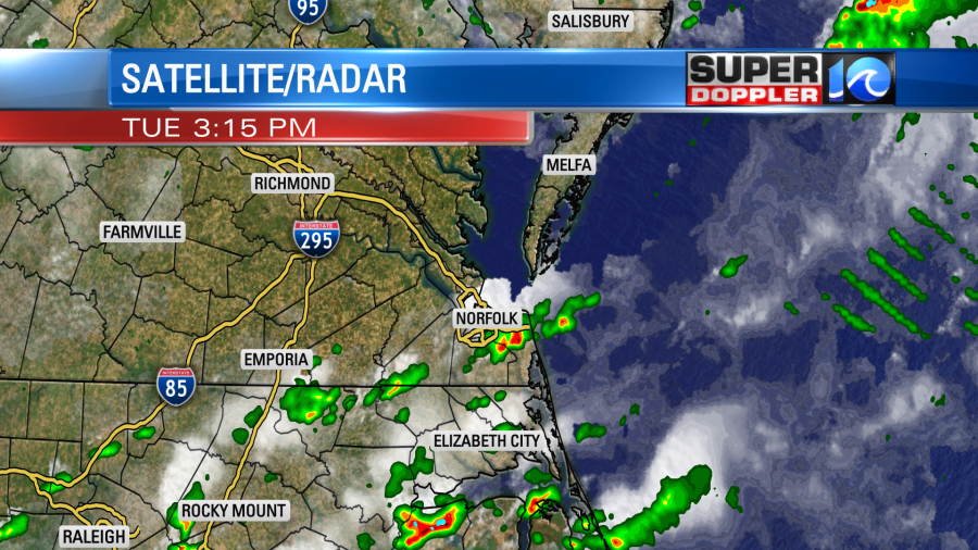
I got a little rain at my house. This was ahead of a cold front that is now slowly sinking to our south.
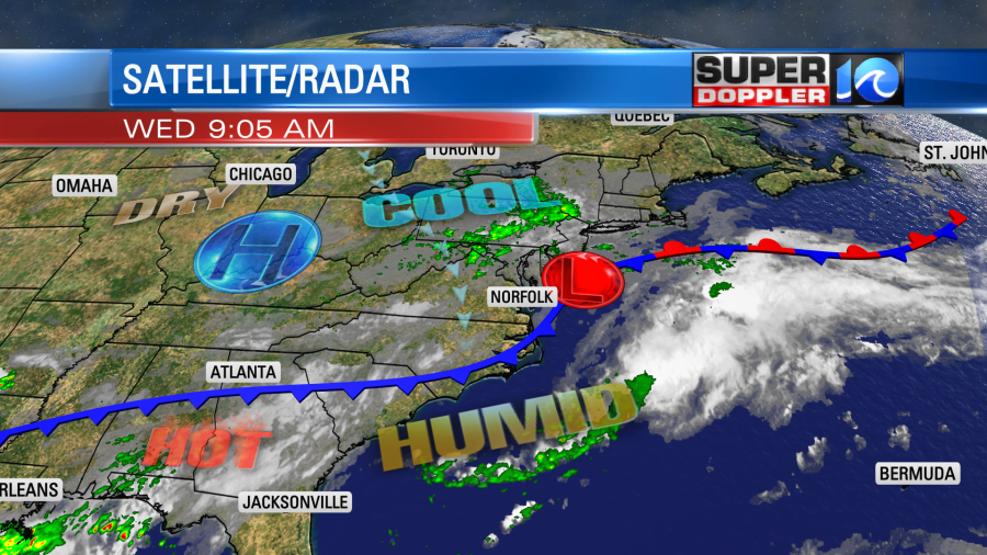
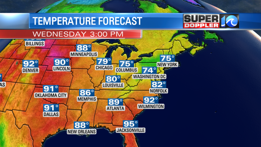
Notice that there is also a weak area of low pressure forming near the coast. This is forecast to strengthen over the next 24 hours as it moves farther offshore. With this setup between the low and the front, we’ll have an increasing wind out of the north/northeast today. It will run at 10-15mph with a few higher gusts near the shore. That will help to keep the temps down today. Highs will be in the low 80s with mid 80s inland.
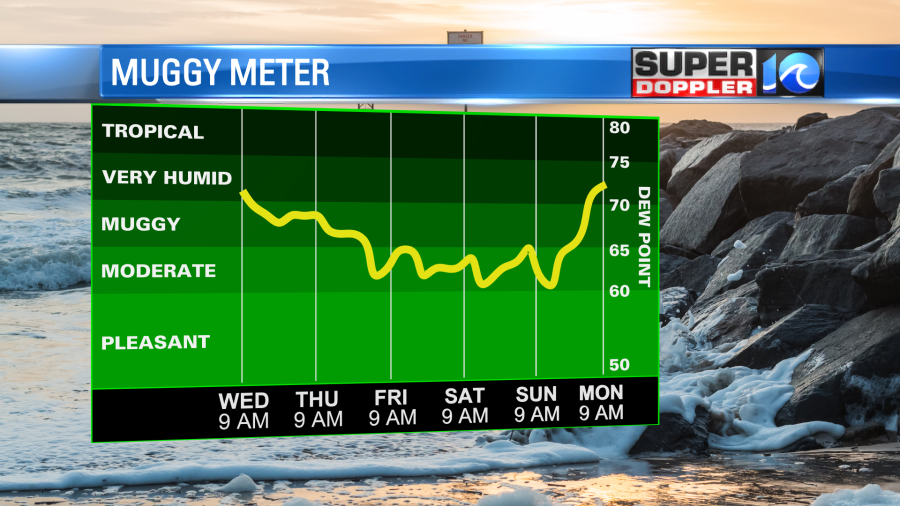
Dew points will gradually drop through the day from the upper 60s to the low 60s. We’ll have a mix of sun and clouds with a few rain showers developing this afternoon.
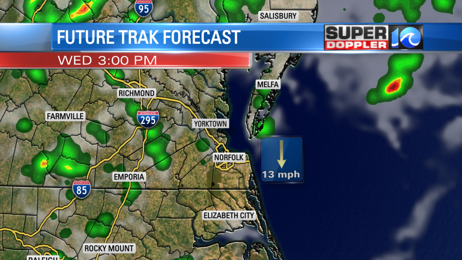
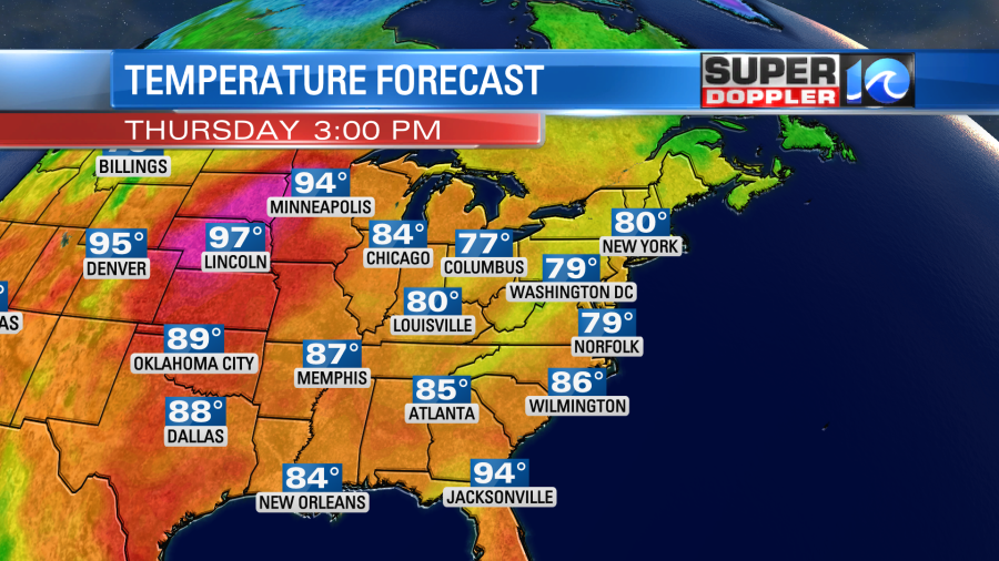
The rain will pick up a little more during the early evening. Then the showers will taper off overnight. Tomorrow is looking pretty good. We’ll be partly cloudy with only some isolated rain showers. Winds will be gusting up to 25mph out of the northeast. This might cause some nuisance to minor tidal flooding in the region. At least for one tide cycle. While that may be a problem for some, that same breeze will pull down some nice fresh air. The temps will be the bright spot. Highs will only rise to the upper 70s Thursday afternoon.
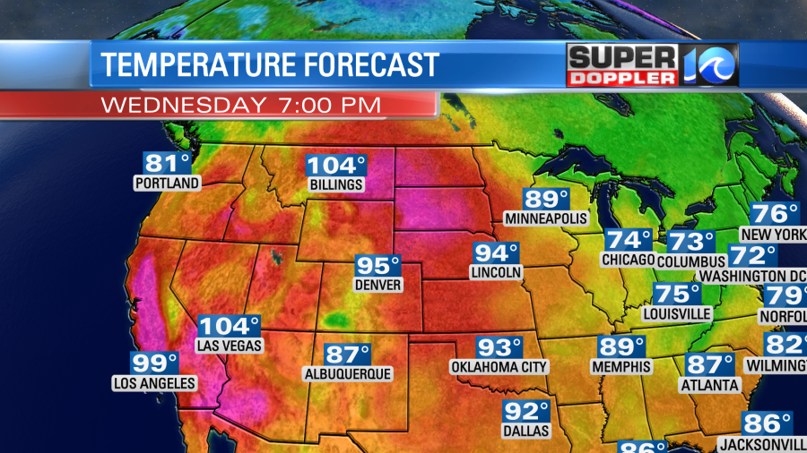
This is in sharp contrast to the western U.S. and the north central U.S. where they will be breaking many records.

We should have some decent weather tomorrow, but the weather should be very nice Friday and Saturday. We’ll be partly cloudy with high temps near 80 degrees. Lows will be in the 60s. The humidity will be lower, and I will be loving it!
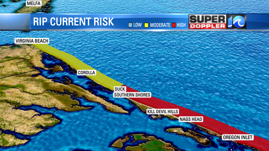
One issue that we will have through that time is a higher threat for rip currents. Today we have a moderate threat for rip currents in Virginia Beach, but a high threat over the Outer Banks.
There will be some good surf (at times) for the surfers between now and Sunday, but it won’t be good for swimmers. Keep in mind that there are less life guards out there now since we are past Labor Day.
Some of the surf will come from the low offshore. However, a lot of it will come from the 2 hurricanes in the tropics.
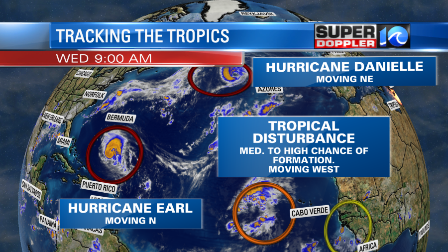
Hurricane Earl is still in the central Atlantic, and it is still on a northerly track. It is expected to take a northeast turn in the next day or two. However, it will pass close enough to Bermuda that they will have some direct impacts. It is forecast to be a category 3 hurricane as it moves southeast of the island.
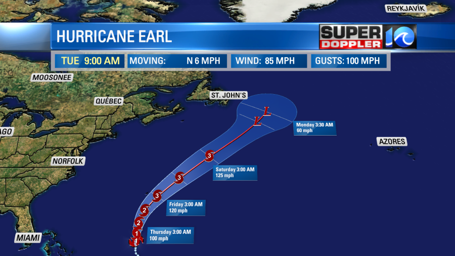
Eventually, Earl will weaken over the North Atlantic. It shouldn’t pose a threat to land.
Meanwhile, hurricane Danielle is over the North Atlantic right now. It is moving to the northeast.
It is forecast to move northeast, do a loop, and then move to the east. It should become post tropical in the next 3-5 days.

Finally, there is a tropical disturbance in the eastern Atlantic. It is moving to the west/northwest. It has a decent chance of formation over the next few days, but it should also stay out to sea.
Meteorologist: Jeremy Wheeler


