Today is looking good, but it is going to be cool for this time of year. A cold front is stalling out to our south with high pressure to the north.
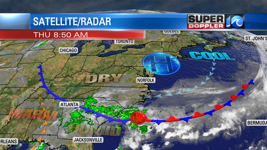
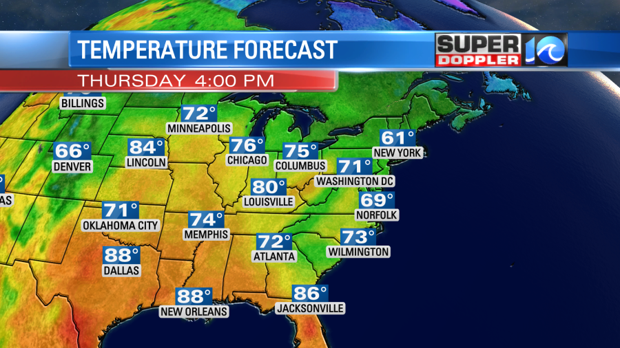
There is also an area of low pressure stalling out to our south. This will play a part in our forecast tomorrow. So more on that in a moment. Today we’ll have a steady breeze out of the east/northeast. Despite lots of sunshine our afternoon highs will only be in the upper 60s with a few 70s inland/south.
By tomorrow that weak area of low pressure will start to move north along the east coast. It will be relatively small and weak. However, it will impact our region with some rain showers.
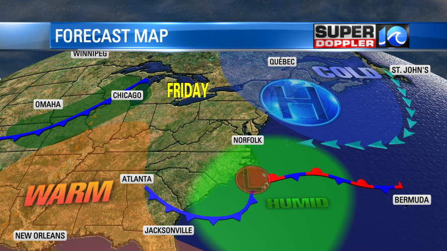
The theme for tomorrow is that there will be a higher chance for rain to the south and east. There will be less of a chance to the north and west. A few showers will kickoff in the morning, but the chance for rain will go up through the day.
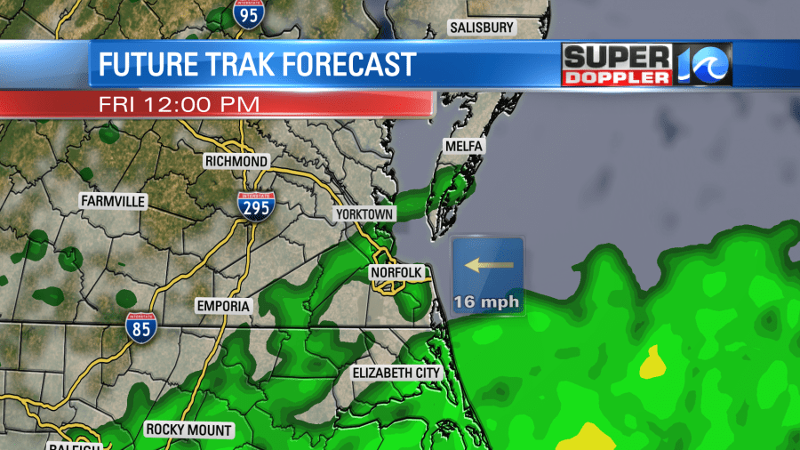
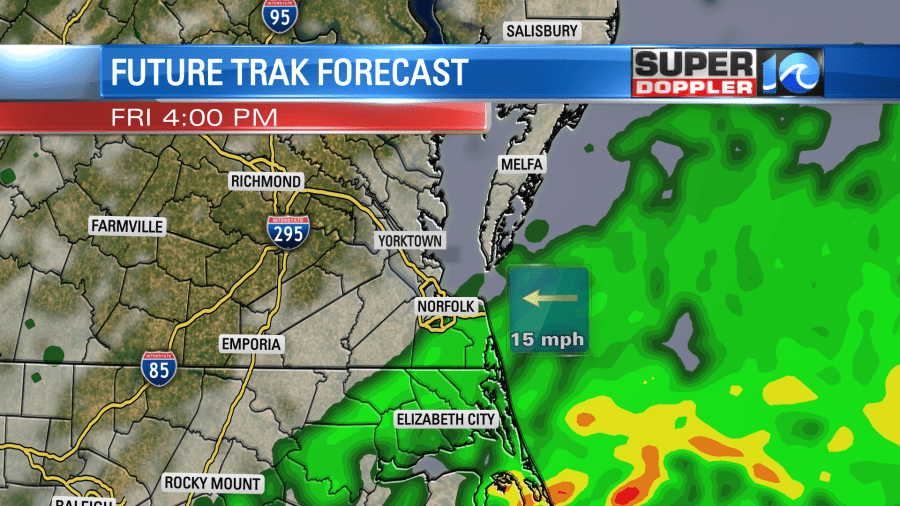
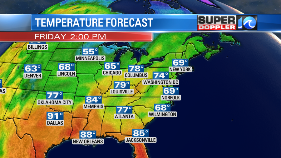
We’ll still have an easterly wind. In fact it could be a little stronger than today. High temps will be held down to near 70, but humidity will be increasing.
On Saturday the low will start moving away from the area over the ocean. However, some moisture will push west on the back side of the system. That will give us a few scattered showers.
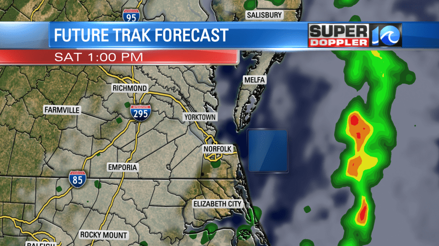
The models handle that moisture differently. So, for now, I have a 30-40% chance, but there’s not a lot of confidence in the coverage. High temps will be in the upper 70s to near 80. So at leas it will be warmer. I don’t expect any thunderstorms. At least that is some good news for the local festivals.
By Saturday night a cold front will roll in from the northwest. This will bring us some more scattered rain showers. The showers will eventually drop to our south on Sunday with the front. However, the models handle the timing of that differently. Some of them have rain only in the early morning. Some others keep the rain going through at least midday. Here is what the GFS model shows.
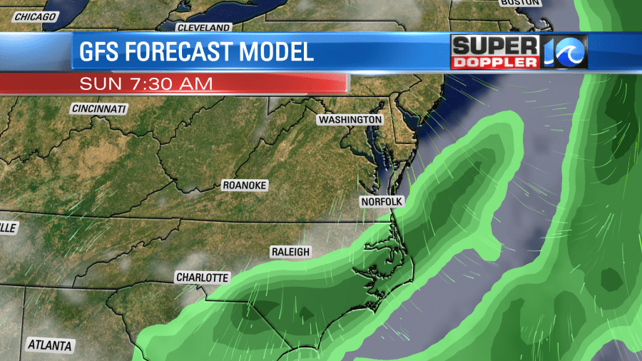
Check back for updates to the weekend forecast as I think the timing may change a little more before we get there.
Finally, in world news… I caught an article this morning about some major flooding in Italy. You may have caught the article I posted recently about the extreme drought happening in Spain. There was also a drought happening over northern parts of Italy, but now they have had some major flooding from a recent storm system. Apparently, thousands were evacuated, and there were even some deaths. The Formula One Grand Prix race was also affected. Here is article with more information: Northern Italy Extreme Flooding.
Meteorologist: Jeremy Wheeler


