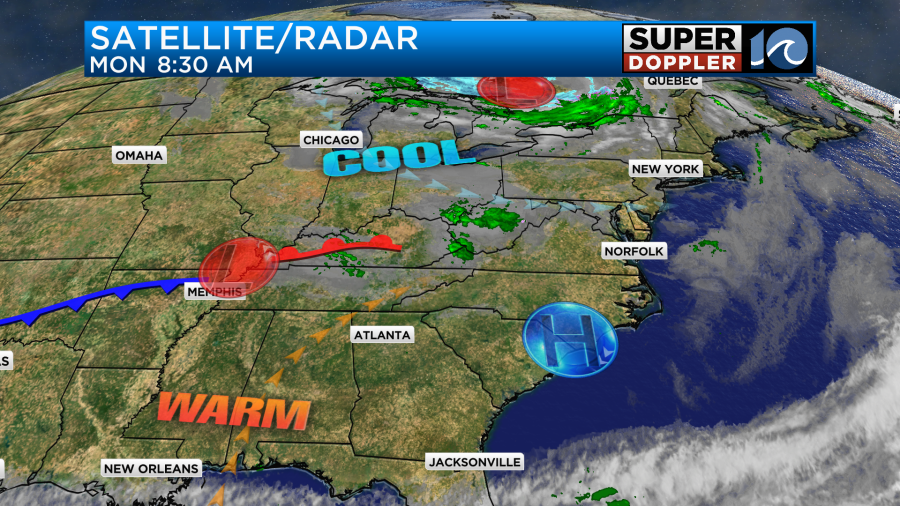
We had some cool Fall weather roll in over the weekend. I was at the Children’s Festival in Norfolk on Saturday, and I was glad that I had a jacket. It was a little wet though, and then a line of showers moved in by 2pm. The drier air finally arrived behind the coolness in the evening. It was good timing for any homecoming dances. Then yesterday was nice with partly sunny skies and highs in the 60s. Today we’ll stay cool and dry to start the work week. We have weak high pressure just to our south with a weak area of low pressure far off to our west.
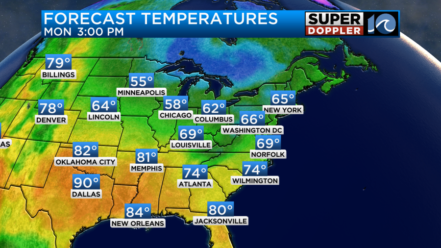
We’ll have fair skies today with a little more clouds arriving late in the day into the evening. High temps will stay in the upper 60s for many, but some will have low 70s inland.
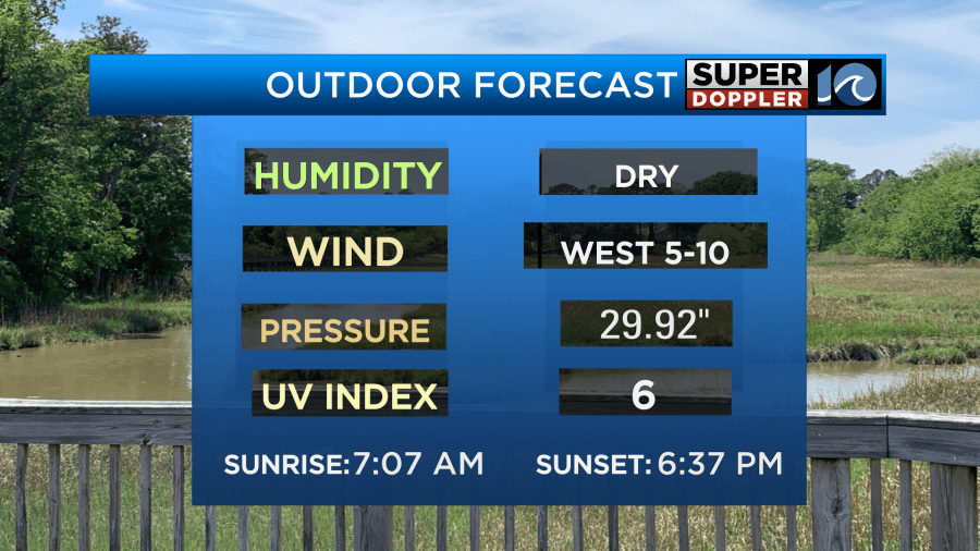
We’ll have a light west wind with a lot of dry air. Dew points are in the 40s. It should be a nice day.
By this evening the clouds will thicken up, and some spotty showers or sprinkles may move in. This will be ahead of that area of low pressure. The low will move through late tonight into early tomorrow morning. It will be attached to a couple of weak fronts. Other than some spotty showers or sprinkles, we should stay mostly dry. Tomorrow that low will move out, and we’ll have clearing. High temps will be in the mid 70s.
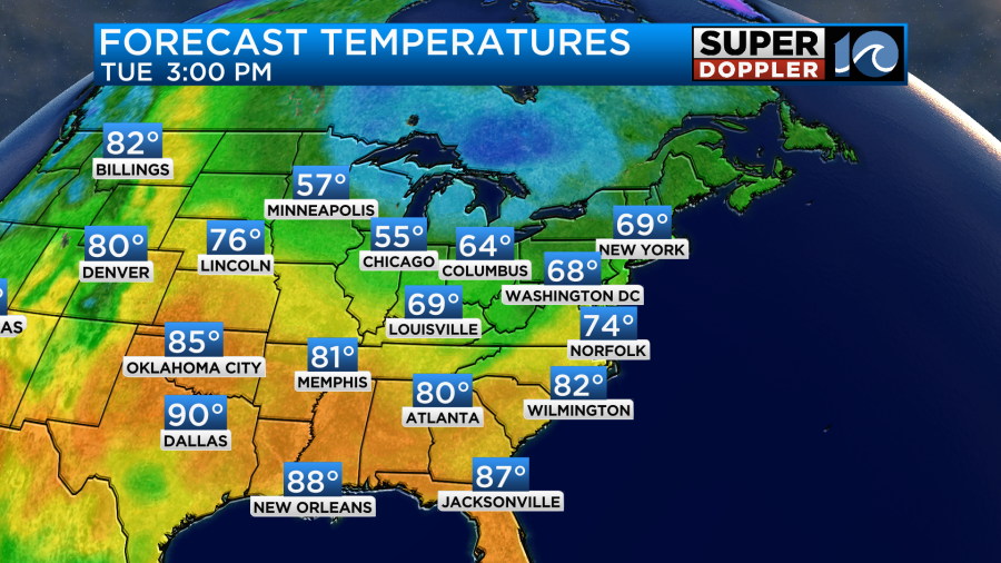
We’ll warm up later this week with temps aiming for the upper 70s to near 80 by Thursday.

We’ll be dry most of the time, but there will be a system just to our south on Thursday.
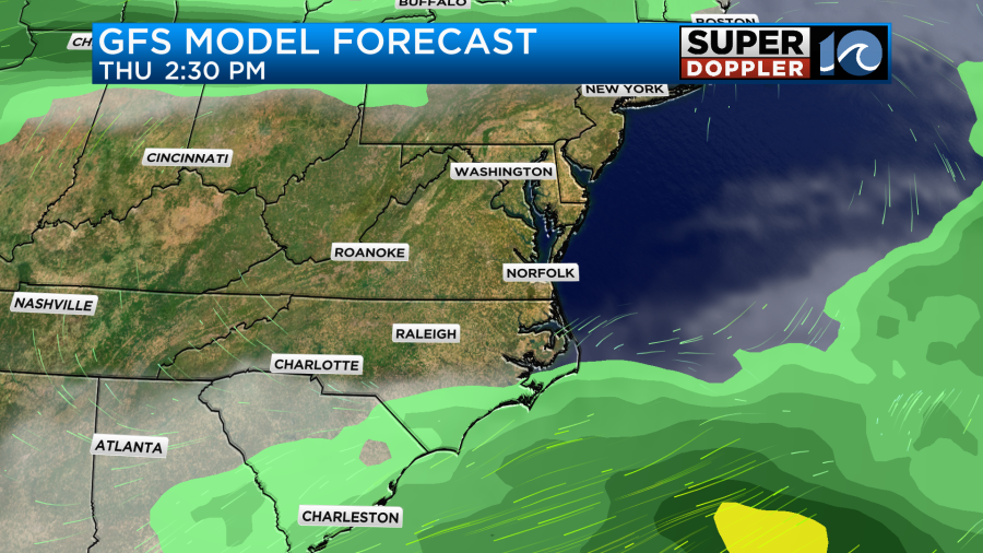
We’ll keep an eye on it to make sure that it stays to the south. The Outer Banks could get skimmed by a few showers. We’ll see. Humidity will go up by the end of the week into the weekend.

There may be a few showers by next weekend. I’ll have more on that in tomorrow’s weather blog.
It’s been a while, but as of right now there are no named systems in the Atlantic Basin. However, there is one area in the eastern Atlantic that has a high chance of formation.
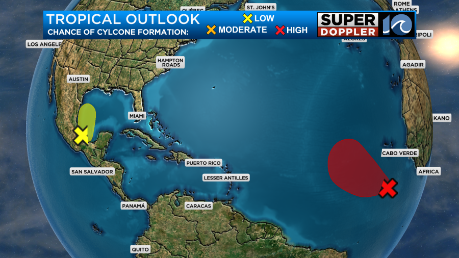
If it does form, then it would most likely stay out to sea.
Meteorologist: Jeremy Wheeler