Over the next 24-48 hours we are going to be talking about 2 big features: Hurricane Lee and a strong cold front. They are actually both connected as the front will help to steer Lee to the north over the next few days. Well…That and the upper level winds ahead of it.
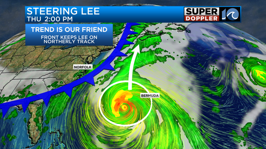
There has been a strong area of high pressure to the north/northeast of Lee lately, and that has kept Lee slowly tracking to the west/northwest lately. However, that will break down in the next 2 days as a big trough sweeps in from the west.
Even today Lee is bringing us some nice waves for surfers. It looked good early this morning, but then there was some chop around 8am for a bit.
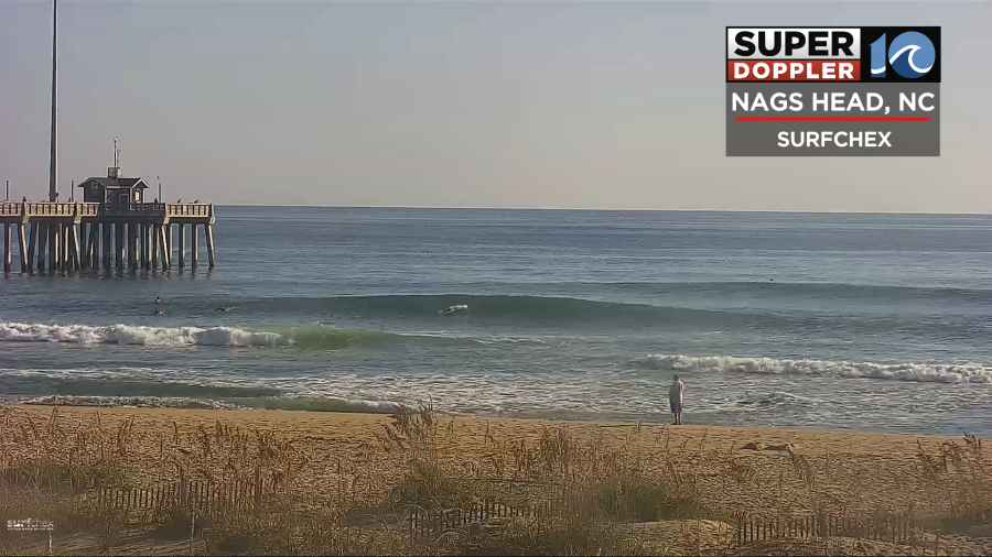
The surf forecast looks great, but there should be experienced surfers only in the water today.
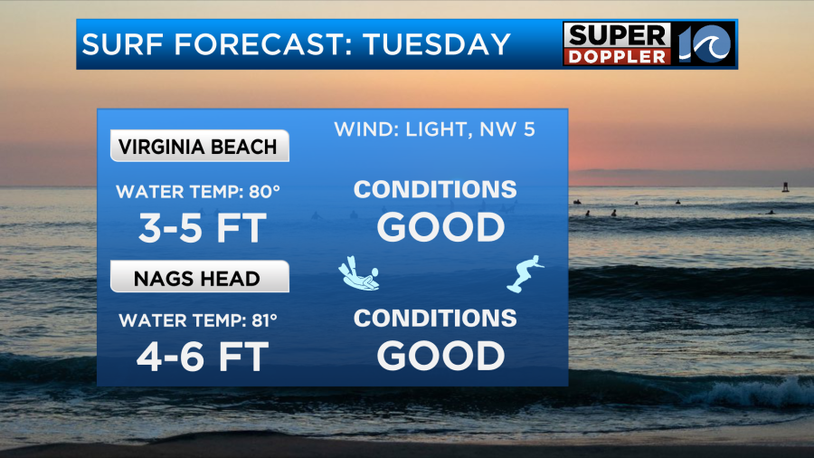
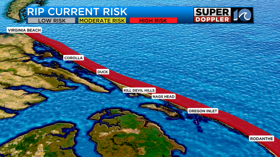
On the downside there is high threat for rip currents at the local beaches, and this will probably be the case for the rest of the week as waves increase.
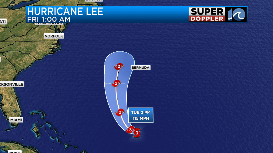
Lee is holding its strength for now. It is hundreds of miles south/southwest of Bermuda, and it is on a WNW track.
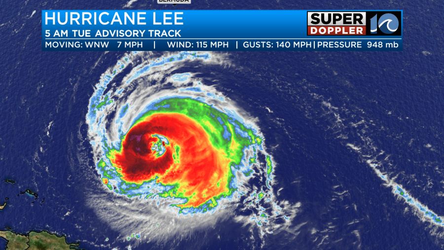
The system will take a northerly turn over the next 48 hours due to the pattern change that I mentioned above. Lee is forecast to pass west of Bermuda by at least 50 miles if not over 100 miles.
It will pass well to our east, but remember the storm will be expanding through that time. They are expecting tropical storm forced winds over Bermuda, but they will miss the hurricane force winds.
The hurricane will work its way northward, and stay east of the U.S. Coast. However, in a few days, it will make its way towards the Gulf of Maine or along the coast of Nova Scotia.
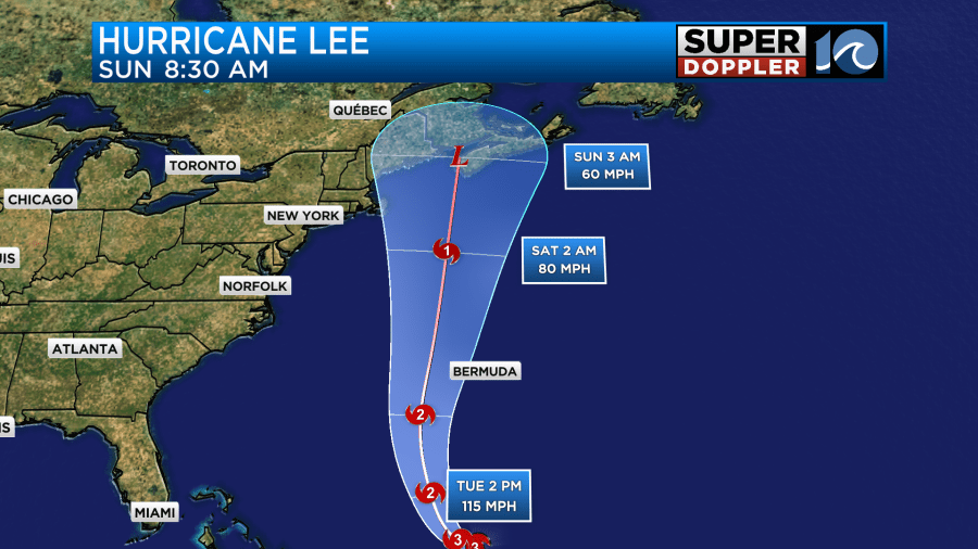
There is still some uncertainty during that part of the forecast, but the models are starting to cluster on that area.
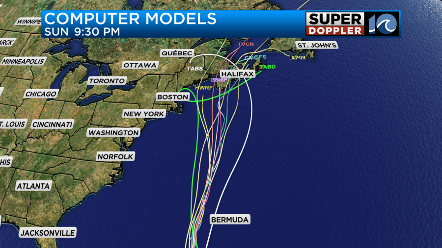
The GFS and Euro are a little different as well. The Euro is a little more west, and is more of a problem for coastal Massachusetts and Maine. The GFS is faster and runs right over Nova Scotia.

The storm is forecast to be more of a hybrid or post-tropical storm at that point. However, it will be large. It will be like a sizeable nor’easter type storm. So there will be a decent surge up there along with strong sustained winds. There could still be some hurricane forced winds in the gusts. We’ll have a better handle on that part of the forecast by tomorrow and Thursday.
Meanwhile Margot is now a hurricane in the eastern Atlantic. It will actually strengthen some more as it meanders to the north over the next few days.
While it will stay out to sea, it will also contribute a little to our waves at the oceanfront. There is another disturbance in the eastern Atlantic that has a high chance of formation in the next several days. It will be on a west/northwest track. We’ll keep an eye on it.
In world news…There was some extreme and terrible flooding in Libya the other day. Unfortunately, it killed thousands and thousands are still missing. Here is an article with more information: Libya Flooding.
Meteorologist: Jeremy Wheeler


