
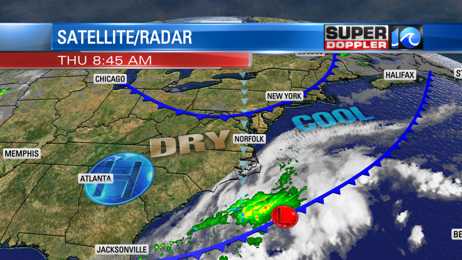
The local weather is going to be awesome for a little while longer. As Aesia Toliver suggested this morning it will be a good day to take the dog for an extra long walk today. We started with a good amount of sunshine with more clouds along the shore and to the southeast.

There is an area of low pressure to our southeast along a cool front. This pushed a thin layer of moisture up our way, but it will move to the east during the day. There is another cool front to our north with high pressure to the west.
We’ll have a lot of sunshine through the daytime. There will also be a light north breeze. This will keep the humidity low and temperatures below average. High temps will rise to near 80 with upper 70s near the shore. It will be some good weather to open the windows and let in some fresh air. Tonight low temps will drop to the 50s and 60s again with clear skies.
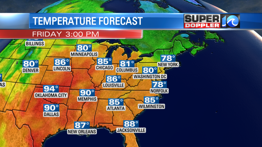
Tomorrow the second cool front will drop to our south. So we’ll be more in the upper 70s with a couple of 80s over North Carolina.
It will be an awesome Fall-like day. The first day of Fall is around the corner. It will happen one week from today.
The nice weather will continue through the weekend. High temps will be near 80 on Saturday with mostly sunny skies. Highs will be in the low-mid 80s on Sunday with fair skies. The humidity will climb some on Sunday, but it will be even higher Monday and Tuesday.
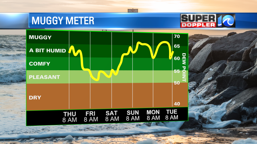
The temps will climb a little too. Highs will be in the mid-upper 80s. With those conditions our heat index might be in the 90s again for a couple of days.
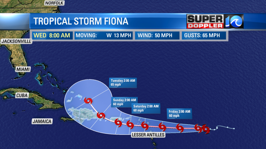
So yes…. As of last night tropical storm Fiona has formed.
It is over the central Atlantic, and it is moving west. It will head towards Puerto Rico over the next couple of days. There is some dry air to the west and north of the system along with some wind shear. So the bulk of the thunderstorms are to the west of the circulation. That’s not a sign of a healthy storm. Hence it should remain weak in the short-term. In about 3-4 days it will be interacting with land (the islands).
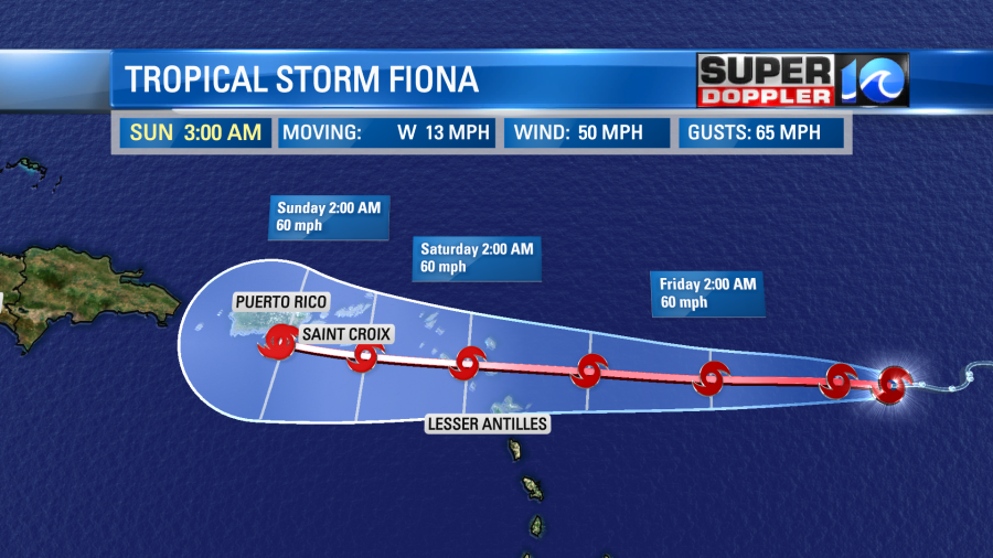
After Puerto Rico and the Dominican Republic then there is a lot of uncertainty in the track and strength of the storm. It is forecast to turn to the northwest. Then possibly to the north.
The models have been trending more northward after those islands. This as it finds a weakness in the ridge to the north/northeast.
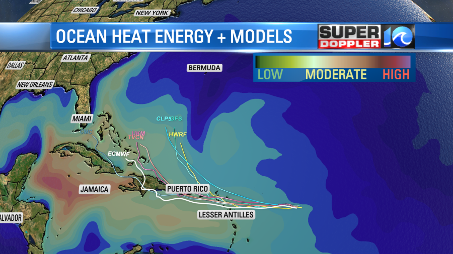
The European and GFS models are split (what else is new?). The GFS keeps Fiona more organized, stronger, and more northward through its lifetime. However, the European model keeps it weak and has it going more to the west.
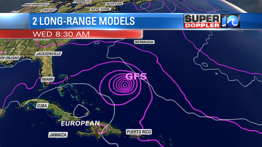
The GFS has been bouncing around a bit. The actual forecast will probably be something between those 2 models. We have plenty of time to watch it. We’ll have plenty of updates over the next couple of days.
Meteorologist: Jeremy Wheeler


