We are starting the new year with a cold front sliding through the region.

This front won’t have too big of an impact today. However, we’ll see a bigger impact behind it tomorrow. Let’s talk about it.
This morning we started off with a mix of sun and clouds.

Luckily, it was dry last night to ring in the new year, and it was also dry for the few commuters/travelers that were on the roads this morning.
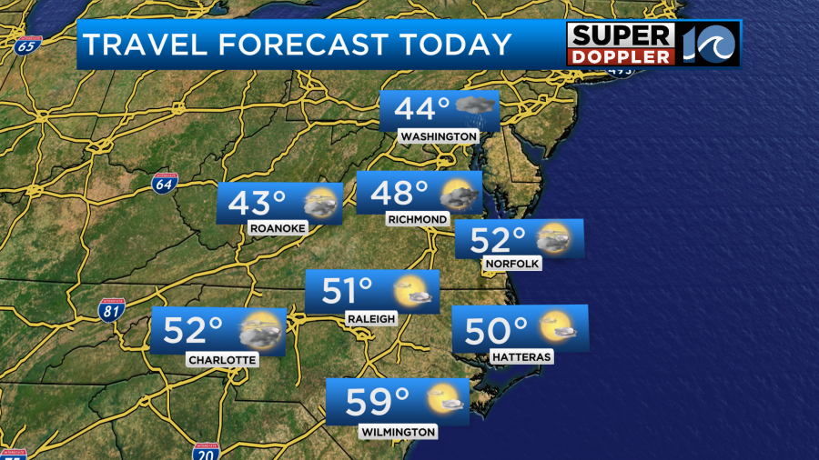
The cold front will slowly slide through the area around midday. After breaking up for a bit the clouds will start to increase again. There may be some spotty showers by that time. Winds will turn from southwest to out of the northwest at 5-10mph. Since the colder air won’t be rushing in behind the front I thought our high temps would be able to make it into the low 50s this afternoon with upper 40s north of the metro.

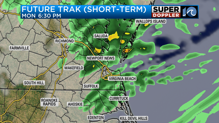
During the afternoon the front will sink south through North Carolina. However, an upper level low will swing down behind it as we head into the afternoon and evening. We’ll have some spotty showers this afternoon with more rain to our north. The upper level feature will increase our rain chances this evening through at least midnight.

There could be a couple of sleet pellets mixing in overnight, but it shouldn’t be enough to cause any problems. This should all clear out by tomorrow morning. Tomorrow through the day the front will sink to our south, and high pressure will build in. We’ll have lots of sunshine, but high temps will only be in the mid 40s.

The wind chills will be in the 20s and 30s in the morning. They will be in the 30s during the afternoon. Winds will gust up to 25mph out of the north.
Things will settle down on Wednesday. We’ll have fair skies and highs in the low 50s. However, another shot of cold air will move in on Thursday. High temps will be in the 40s. After some scattered showers in the morning, we should dry out in the afternoon.
Over the next 5-10 days I don’t see any arctic blasts of cold air that are common this time of year. However, the long range models are starting to show some strong areas of low pressure forming over parts of the eastern U.S. at times. One of those could run through our area on Sunday. We’ll talk more about that over the next couple of days.
Meteorologist: Jeremy Wheeler


