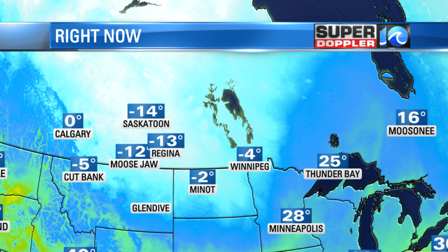
Directly below is a picture showing 6 p.m. ET temperatures all the way up into Canada. Why show a picture showing the temperature in Moose Jaw? Because that cold air is headed here for Monday and Tuesday!
Tomorrow, it’s going to be relatively warm out ahead of that cold air. We’ll likely see highs Sunday in the 55 to 60-degree range.
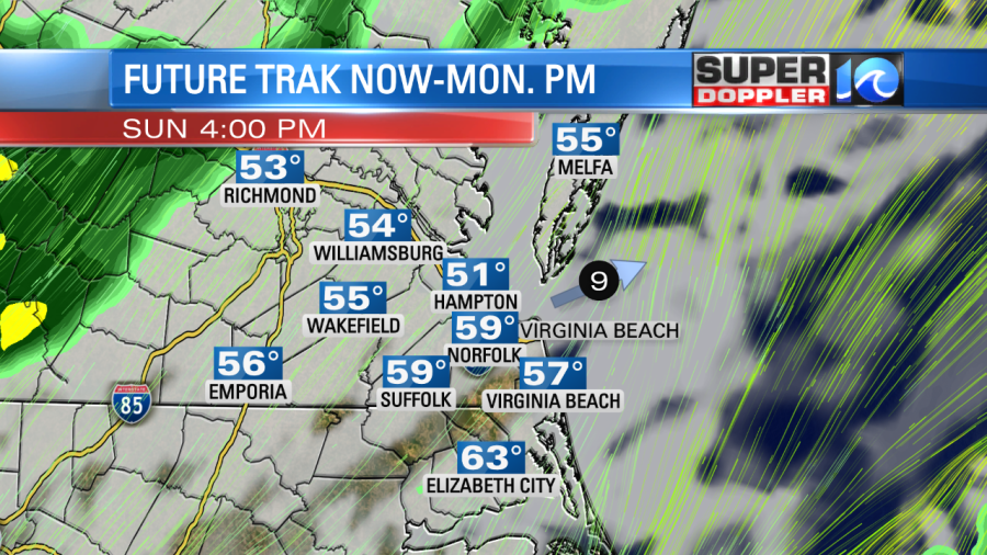
But tomorrow evening, the cold front moves through with around 5.” to .75″ of rain, wind…and a big temperature drop.

High temperatures on Monday will likely hit around 42 early in the morning but remain in the 30s during the daylight hours. The high temperature on Tuesday will only peak around 33 degrees! Moose Jaw will have arrived.
Here’s the forecast through Tuesday:
- Overnight: Mostly clear. Lows around 26 inland 32 shores. Calm wind becoming south 5 to 10 mph after midnight.
- Sunday: Increasing cloudiness with a 30% chance of rain after 4pm. Highs 57-60. South wind 10. Nice day!
- Sunday Night: Rain is likely, mainly before 4am. Low around 34. Breezy, with a southwest wind 10 to 20 (gusts: 30) becoming north after midnight. New precipitation amounts between a half and three quarters of an inch possible.
- Monday: Mostly cloudy, then gradually becoming sunny, with a high near 42. Breezy, with a north wind 15 to 20 and gusty decreasing to 10 mph in the afternoon. Winds could gust as high as 30 mph.
- Monday Night: Mostly clear with a low around 25. Northwest wind 10-15.
- Tuesday: Sunny, breezy, and cold. Highs near 33. Wind chills are likely to be in the teens.
Download the WAVY News App to keep up with the latest news, weather and sports from WAVY-TV 10. Available in both the Apple and Google Play stores.