Over the next 36 hours we are going to be dealing with a coastal storm that will impact us with some heavy rain and strong gusty winds.
Today we will be ahead of that system. We have high pressure to the northeast, but it is moving farther away.
There is a warm front to our southwest with a cold front to the west.
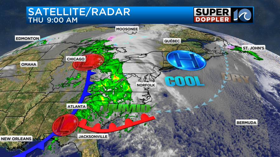
The area of low pressure that is going to develop into the coastal storm is currently over the southern Tennessee River Valley. It is moving steadily to the east/northeast.
We’ll be well ahead of the low today. However, moisture is quickly increasing. We already started with lots of clouds this morning. There weren’t any rain showers though.
Through the day the moisture will keep increasing. We’ll also have an increasing chance for rain showers. A few showers will be possible already by midday. Then we’ll have scattered showers this afternoon.
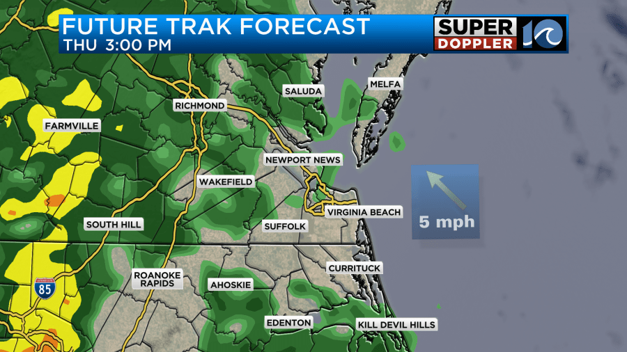
They should be light and scattered at first, but the rain will become more steady by the evening.
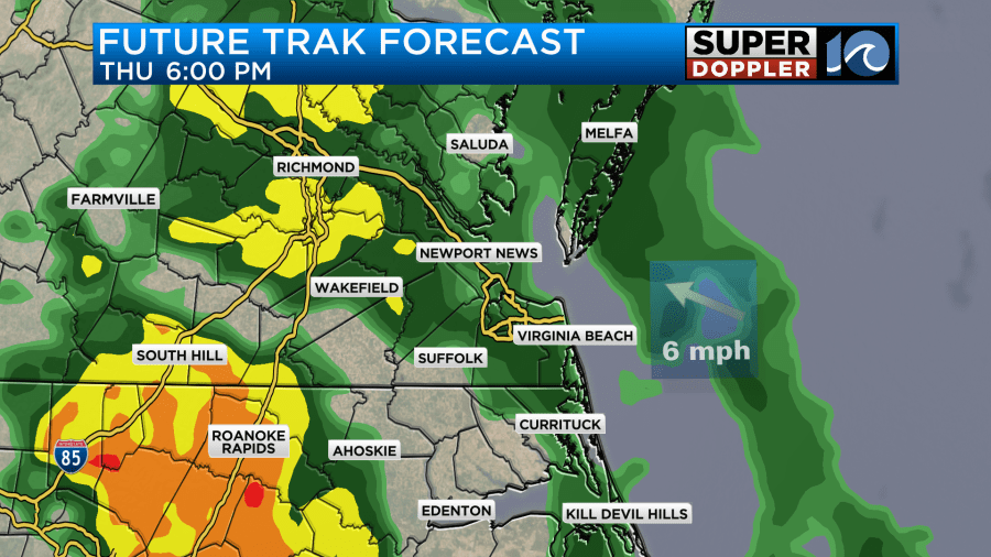
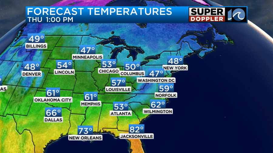
This will impact the evening commuters with wet roads. Luckily, there won’t be much wind today. It will be mainly out of the east at 5-10mph. The clouds and rain will keep our high temperatures down into the upper 50s.
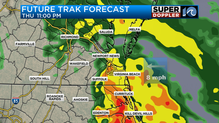
By tonight heavy rain will move into the region. The low will be approaching our area, and the upper level low will be scooting in from the west.
Winds will increase after midnight. There may be a few gusts between 25-30mph.
By early tomorrow morning the upper level low will inject a lot of energy into the surface low. So it should rev up right near the shore.
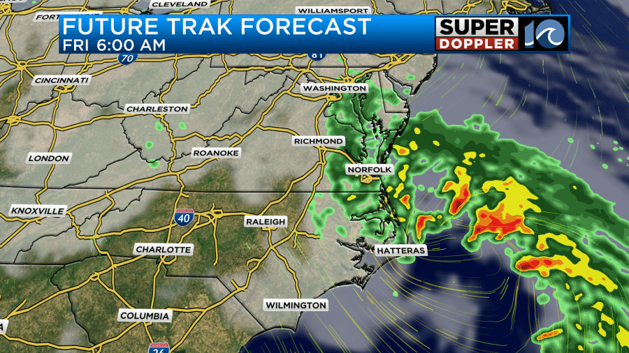
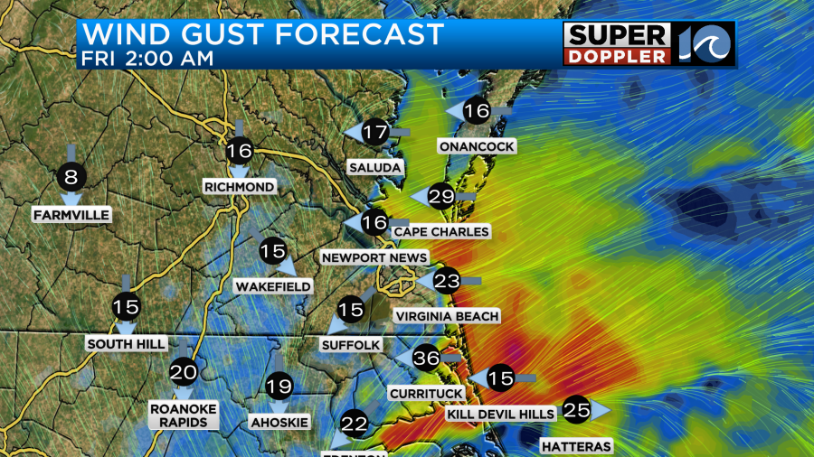
So the low will strengthen as it moves offshore. However, the winds on the back side will be strong from about 2am until the late morning Friday.
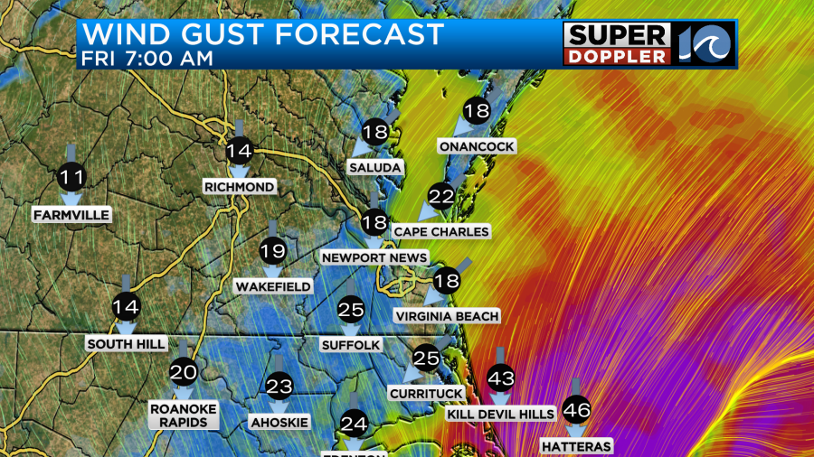
Winds will likely gust to 30mph with gusts to 35mph near the shore. There may be some gusts to over 40mph along the Outer Banks. There may even be a few gusts to 50mph near Hatteras. There will be some rain during that time, but at least our model has lightened up the rain a bit between 5 and 9am.
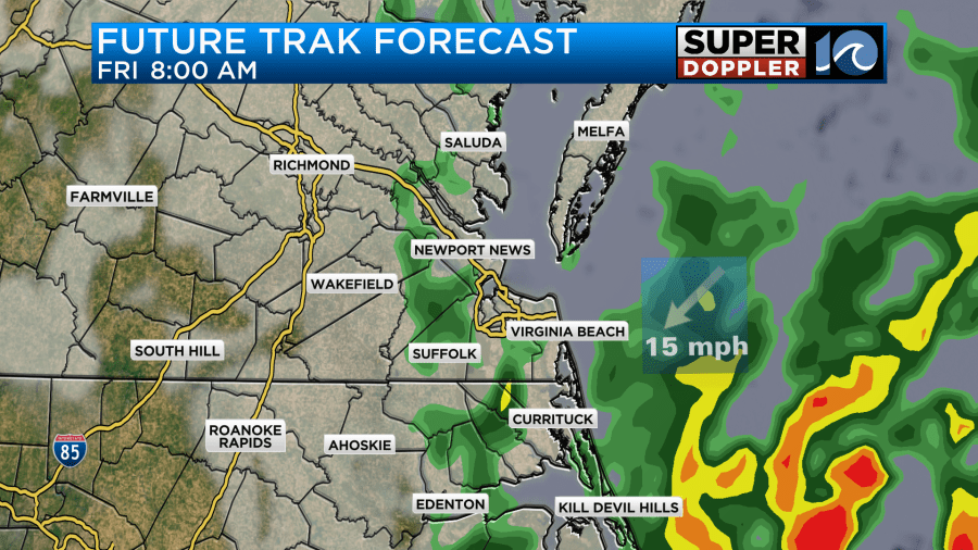
Keep in mind that even if there is light rain in the morning that it will be wind-driven. Winds will steadily decrease through the day Friday.
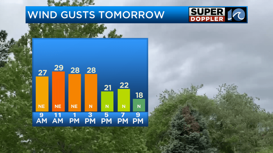
The rain should wrap up by the mid morning. Then we’ll have drying conditions. High temps will be in the upper 50s.
Before it all wraps up I think we are looking at an inch to an inch and a half of rainfall.
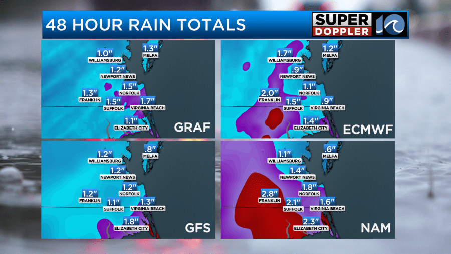
It may be up to two inches in some places. There’s even a potential for three inches or more over parts of North Carolina. This could lead to some brief/isolated flooding. However, the ground is pretty dry. So a lot of the rain should soak in. Remember though that tidal flooding will also be happening.
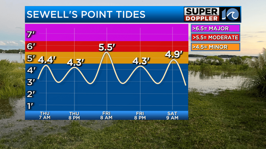
The tide at Sewell’s Point will get up to about 5.5ft. This is low-end moderate tidal flooding. Several areas over the southern Chesapeake Bay will experience similar flooding.
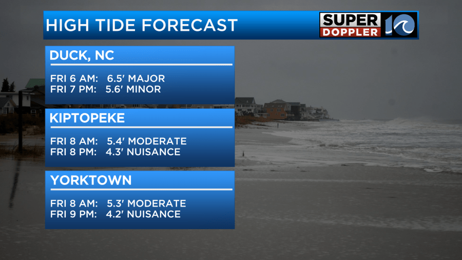
However, the Outer Banks could see moderate to major tidal flooding. This will likely create some ocean overwash along highway 12.
I will say that I overall think the tidal flooding forecast is a little on the high side. While the winds will briefly be strong, I don’t think the tides will have a lot of time to build. Coastal lows that move from west to east do tend to get overforecast. Especially if they move fast. So we’ll see how high the water rises. Until then you can follow this link to the National Weather Service’s tidal page for updates: NWS tide forecast.
At least the weather looks good this weekend. The low will be long-gone, and high pressure will build back in. We’ll be dry with highs in the 60s both days.
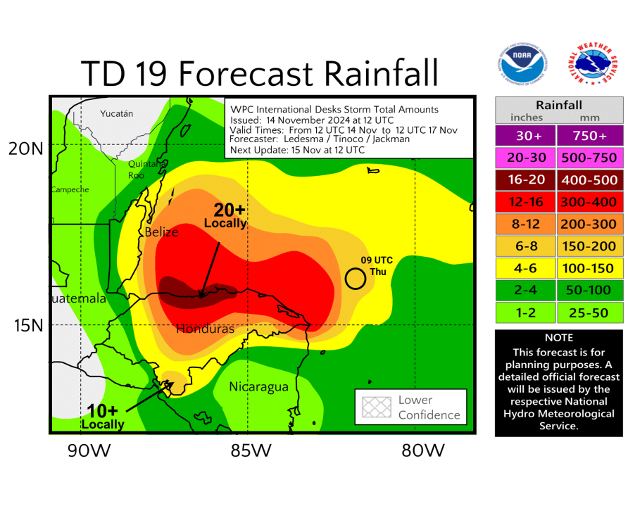
Meanwhile, things are also picking up in the tropics. This morning tropical depression 19 formed in the western Caribbean.
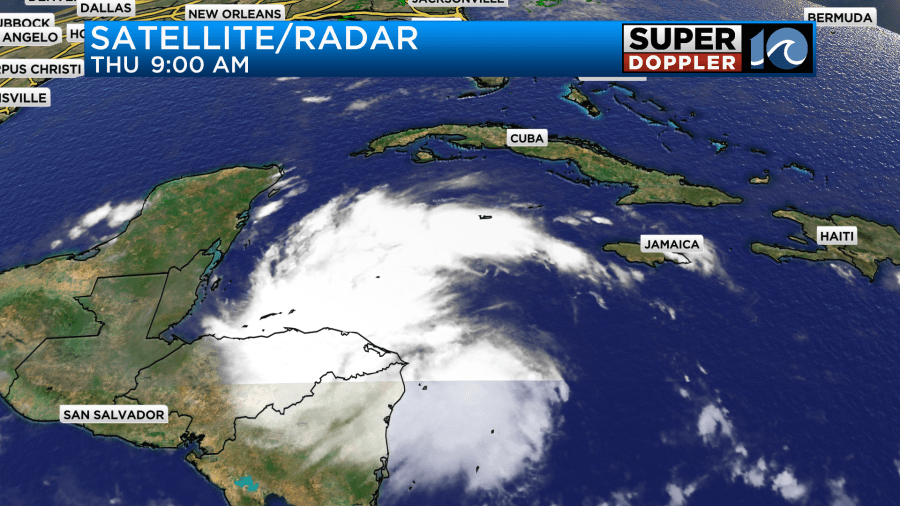
The system is forecast to move over parts of Central America over the next couple of days. It will bring heavy rain and flooding to Honduras where over 20″ of rain could fall.
After that it will move steadily to the northwest. It will then move over or near the Yucatan Peninsula.
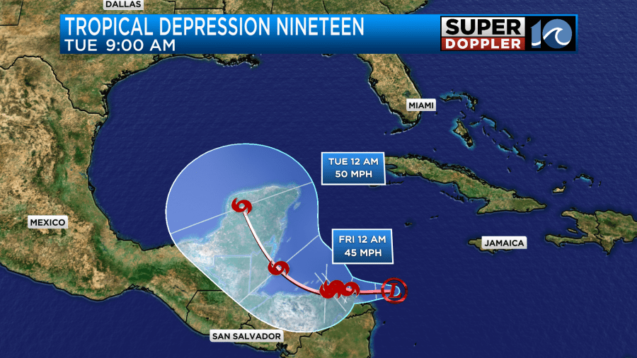
There’s a low chance that it may only brush the east coast of the Yucatan Peninsula. Either way it is then expected to get into the Gulf of Mexico. The trend on the models is still to head northeast towards Florida.
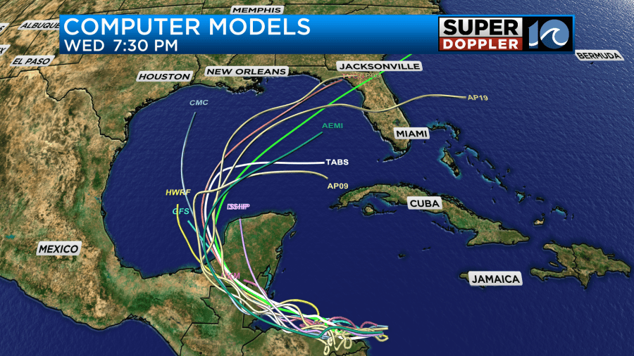
We’ll have updates on it tomorrow.
Meteorologist: Jeremy Wheeler
