Yesterday, I talked about an offshore low that would be strengthening today. That did come to fruition. It caused some coastal rain showers last night, and those showers continued into this morning.
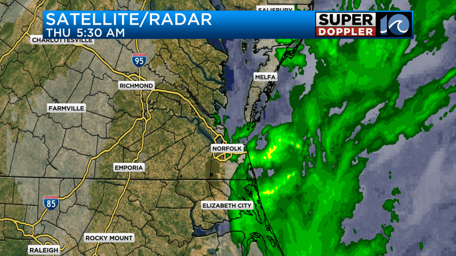
Like yesterday, the showers started to wrap up by 7-8am. The surface low is far offshore, and it is moving to the east.
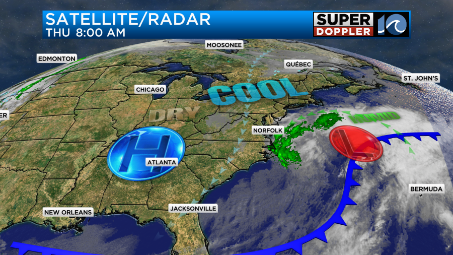
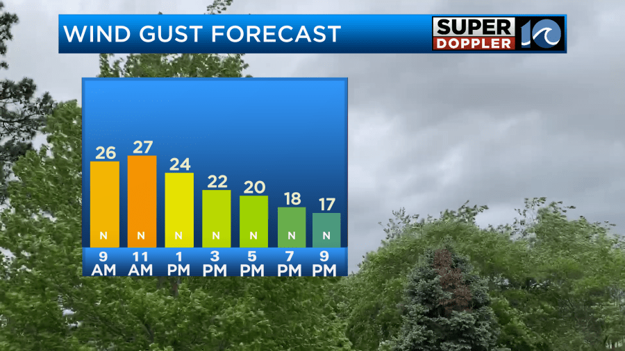
High pressure is to the west. Through the day the low will continue to push east while high pressure gradually builds in. This will push almost all of the rain showers offshore. Though a stray shower may still come in off of the ocean. We’ll have clearing skies overall. However, the breeze will stay up through the day. Gusts will be up to 25mph at times.
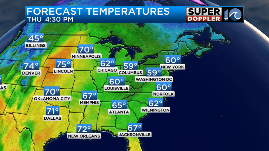
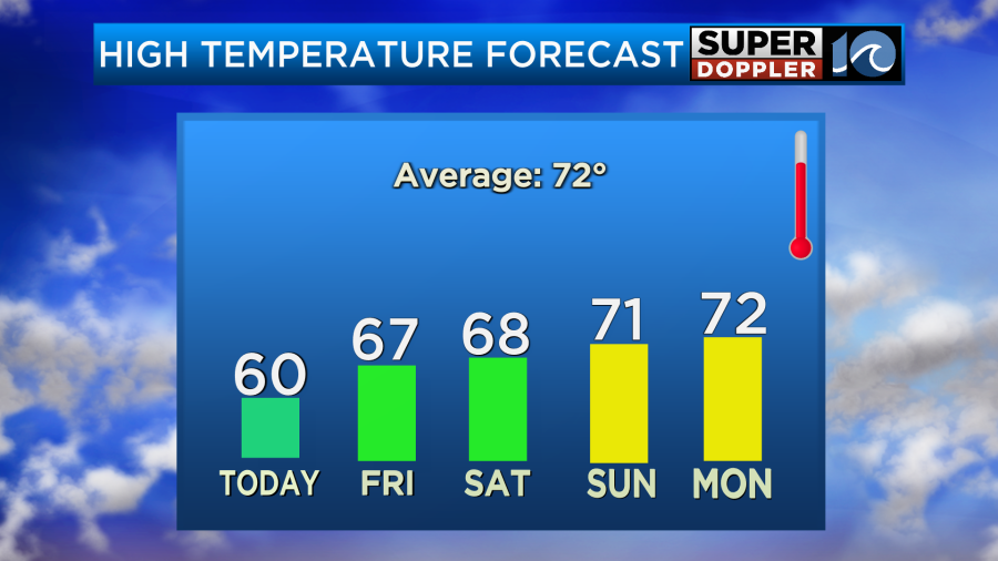
Despite the clearing it will stay pretty chilly. High temps will only be near 60 degrees this afternoon.
The winds should calm down a bit this evening. Then overnight they will run at about 10mph out of the north. With the lighter winds, mostly clear skies, and dry air our temps will be seasonably chilly. The breeze will probably keep temps up around the shore in Norfolk and northern Virginia Beach. It might even be near 50 there. But the rest of the area’s lows will be in the 30s and 40s.
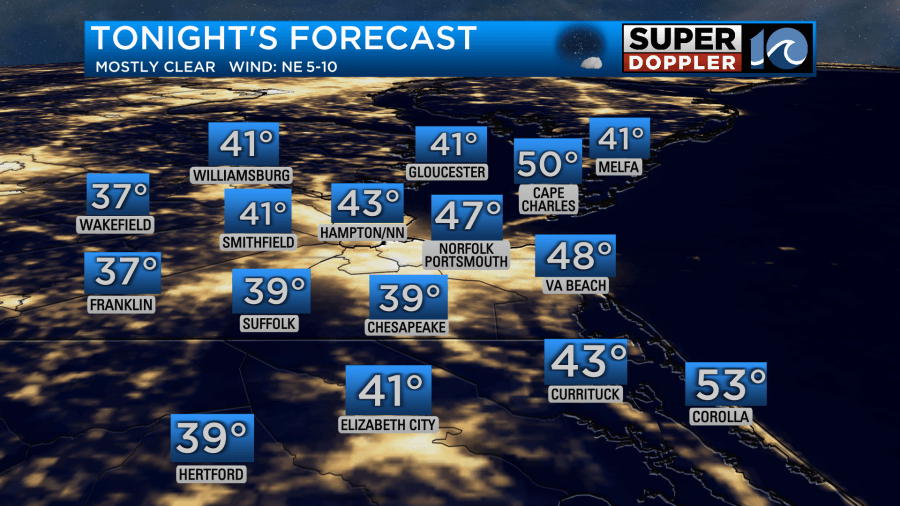
It’s even possible that a few rural/western locations may get down to the mid 30s. I’m thinking that will be closer to I-95. It’s possible that some patchy frost could form out that way. Tomorrow high pressure will build into the area. That offshore low will pretty much be gone. We’ll have a lighter north breeze, but the high amount of sunshine should be able to warm us up to the mid-upper 60s.
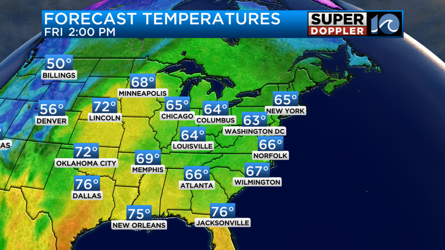
Then we’ll have great weather over the weekend! We’ll be dry with lots of sunshine. High temps will be in the upper 60s Saturday. Then we’ll rise to the low 70s on Sunday.
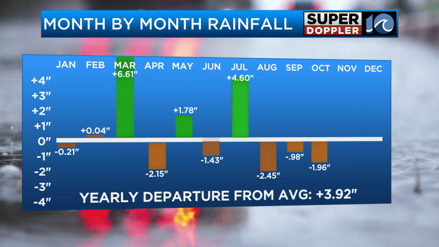
We’ll stay mild and dry through early next week. That will be great for getting outdoors, but a lot of region still needs rain. Luckily, the rain fell for a while over the Outer Banks and along the coast. So there was about 1-2″ over the Outer Banks. However, the rest of the area’s rainfall only added up to a couple hundredths of an inch.
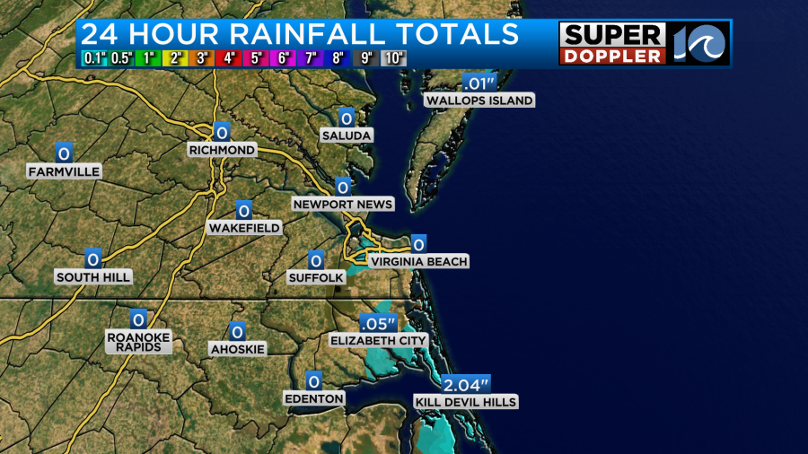
We are down almost 2 inches below the average for the month. We have definitely been dry over the last 3 months.
Meanwhile, there are 2 tropical disturbances near the Caribbean basin and islands. The one near the Lesser Antilles now has a low chance of formation as it moves generally west.
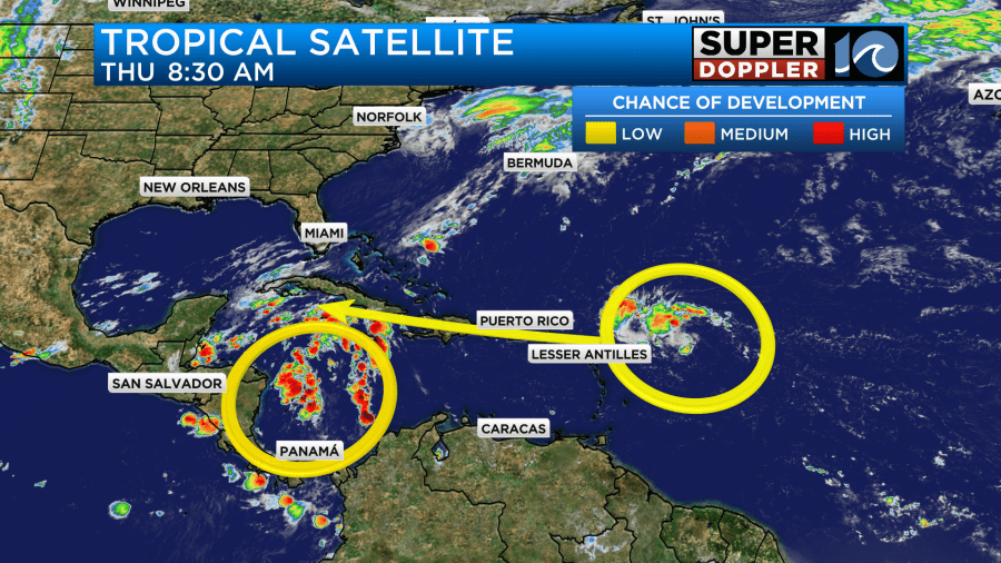
However, it may still bring some heavy rain to Puerto Rico. We’ll keep tracking it over the next couple of days.
One last thing…I didn’t talk about it much this morning, but I will cover it tomorrow. There may be some nuisance to minor tidal flooding over the next 2-3 days as that offshore low builds up the ocean. Plus, we’ll have a persistent northerly breeze for a couple of days. Stay tuned for updates.
Meteorologist: Jeremy Wheeler


