Update: The rain snow line will continue to lift to the north this afternoon, leaving Hampton Roads left in the clouds into the night. Chilly rain showers develop tomorrow before unlocking some big time cold air.
After seeing snow flakes for part of the region for the first time in 2.5 years… the rain snow line will continue to lift northward. So this afternoon and evening we’ll be left with cloudy conditions and temperatures above freeze. Lows tonight will hold in the 40s, with high temperatures tomorrow also holding in the 40s.
The stalled front sags south across the area tomorrow setting up some on & off light rain showers from about mid-morning into early afternoon. It’ll become breezy by the end of the day as the front pulls away, unlocking the arctic air trapped to our north.
Clearing skies Tuesday night with winds gusting to 25mph will drop out temperatures big time – we’ll deal with wind chills between 10°-15° overnight and early Wednesday morning! Sunshine will return, but afternoon highs will only be in the 30s.
As the cold air settles in, another dose of snow showers is possible later this week! Stay tuned for details and stay warm!
-Steve
______________________________________________________________________________________________________
Cold air has moved into the region, but we are going to be on the EDGE of that colder air for the next 24-30 hours. After that we’ll be more solidly in the cold. Being on the edge of the cold is going to make a tricky forecast for today, but we are pretty confident that any wintry weather will have a low-impact. Let’s talk about it…
A cold front has moved into the region, and now it is stalling out over North Carolina.
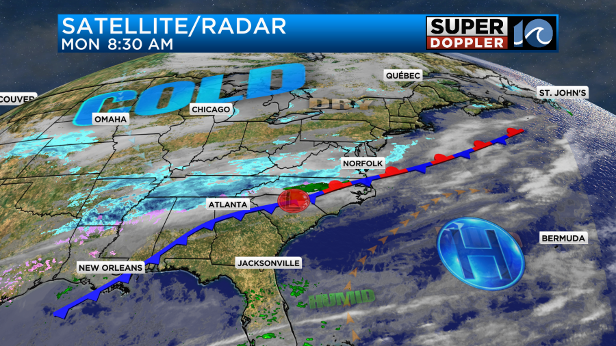
High pressure is offshore. We are still fairly dry at the surface, but moisture is increasing overhead. That’s why it looked like there were some scattered snow showers around our region this morning, but a lot of it dried up before it hit the ground.

Temps started in the 30s and 40s. Through the day the bulk of our temperatures will be above freezing. We’ll top off in the 40s in the metro with a couple of 50s to the south.
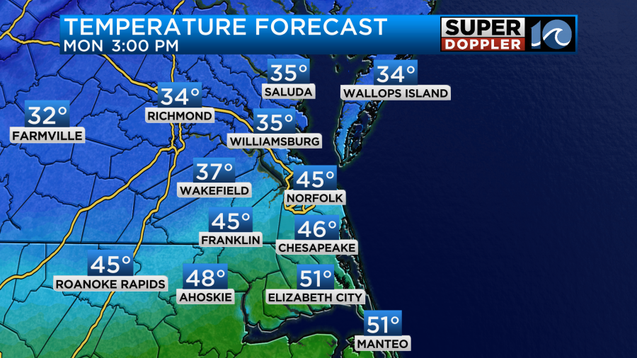
Most of us will be in the 40s. However, it will stay colder north of the metro. This may allow for some snow to fall and stick north/northwest of the metro. Notice the mid 30s there.
So I think we’ll have an isolated to scattered mix for the morning through the midday hours.
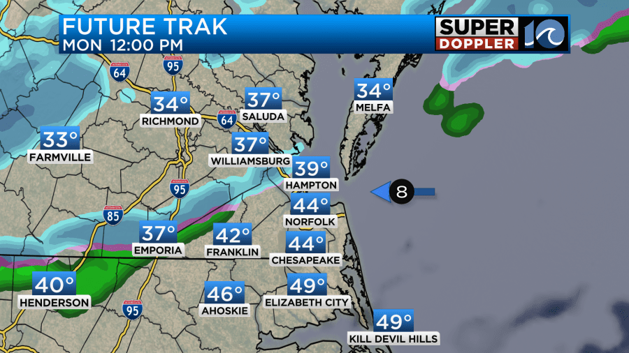
Then in the afternoon the moisture will increase enough at the surface to have some more precip fall. It will likely be rain from Hampton Southward. However, there may be some light snow falling from Williamsburg to Gloucester to Accomack county and points to the north.
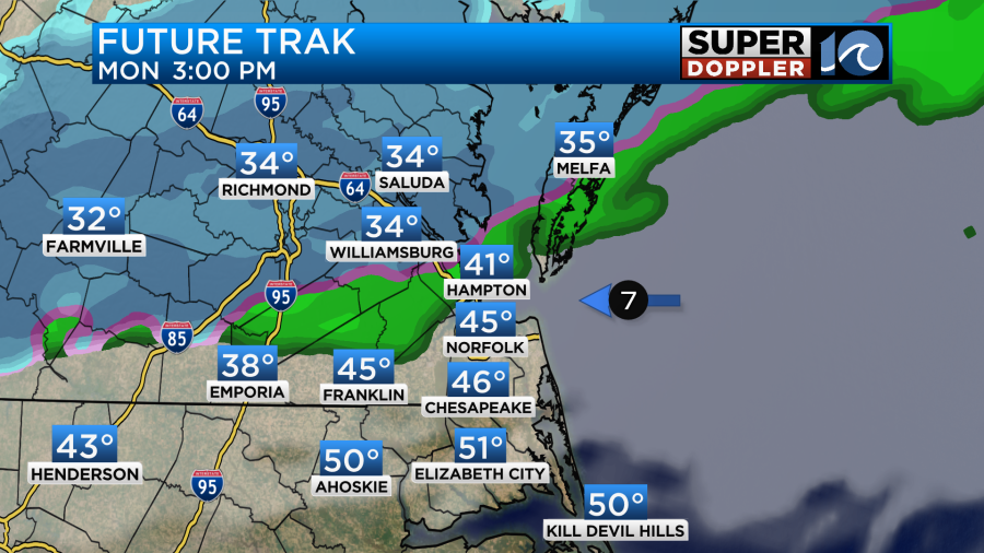
However, in the mid levels and at the surface the milder air will start pushing west and a bit north. This means that the rain/snow line will also push north. This means that by the evening there will only be some cold rain showers in the areas where the snow falls. Snow may continue from Richmond north though.

So, for a little while, there may be some light accumulations on some grassy surfaces north of the metro. Here are some of the models: Our Future Trak model (GRAF) is showing some light amounts in those areas that I mentioned above.

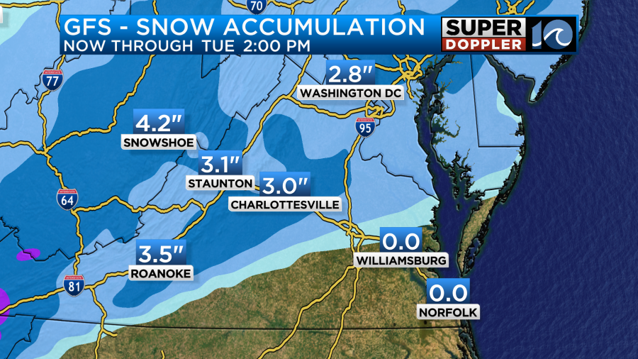
The GFS has even less in those areas. It is, however, showing some decent amounts to our west.
With all of that I put together a snowfall forecast. I think there will be some light amounts on some grassy areas north of Hampton and Cape Charles.
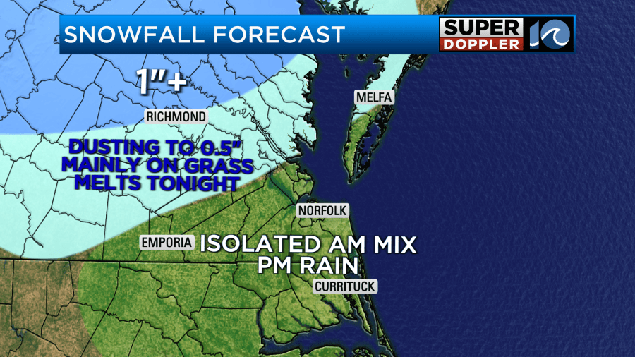
However, even amounts on the grass should be pretty light. Soil temperatures are still pretty far above freezing, and surface temps should be just above freezing. If the precip becomes heavy for a time, then it could briefly overcome that. Keep in mind though that scattered rain showers would likely add to the melting tonight anyway.
Tomorrow a weak area of low pressure will ride northeast along the front. This will create some scattered rain showers. That will mainly be in the afternoon.
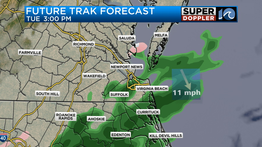
When the low starts to move offshore it will drag the cold front back to the south. This will increase the winds out of the north, and that will drop the temps. We’ll be in the upper 40s around midday, but temps will drop to the upper 30s and low 40s late in the day.

This will allow for the rain to change over to some mixed precip, and that could happen during the evening commute. It should all melt, but any sleet or snow falling during a commute can be distracting. It could also create a few slick spots.
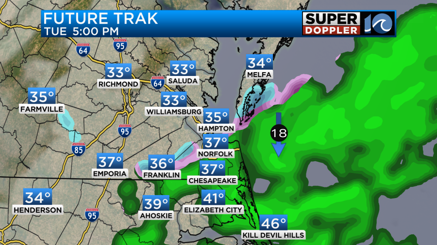
We’ll have updates on that before we get there.
The doors will open up to the cold air on Wednesday. Low temps in the morning will be in the 20s. Wind chills will be in the teens. Then we’ll only rise to the 30s in the afternoon.

This model has mid 30s. I’m calling for mid-upper 30s. At least it will be dry. It will be breezy though. We’ll be dry and chilly on Thursday before some more precip tries to move back into the area on Friday. It could be some rain with a wintry mix late. We can focus on that more in tomorrow’s weather blog.
Meteorologist: Jeremy Wheeler


