This morning was a bit rough. We had a chilly rain that covered most of the area. This caused numerous traffic accidents during the morning commute.
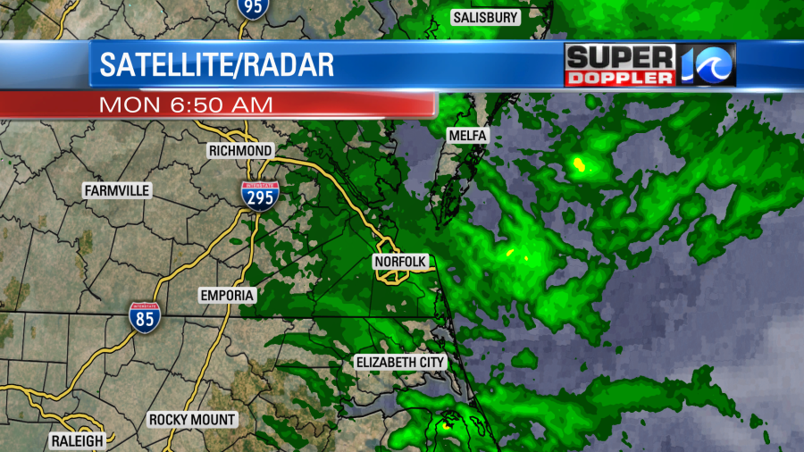
Temps were also chilly this morning, but it was well above freezing. They were in the 40s. Winds increased out of the northeast as an area of low pressure began to move offshore.
High pressure will only edge a little closer to us during the day. The scattered rain showers will decrease quite a bit by midday.
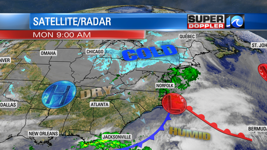
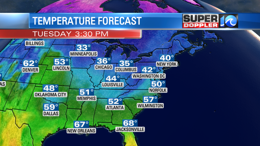
While the deeper moisture will move offshore gradually through the day, there will still be enough moisture wrapping around the back-side of the low to give us cloudy skies and spotty showers this afternoon. Between the clouds, showers, and northeast winds we’ll only top off in the upper 40s to near 50 degrees today.
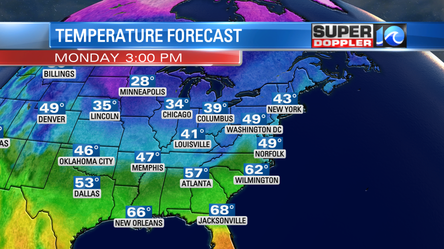
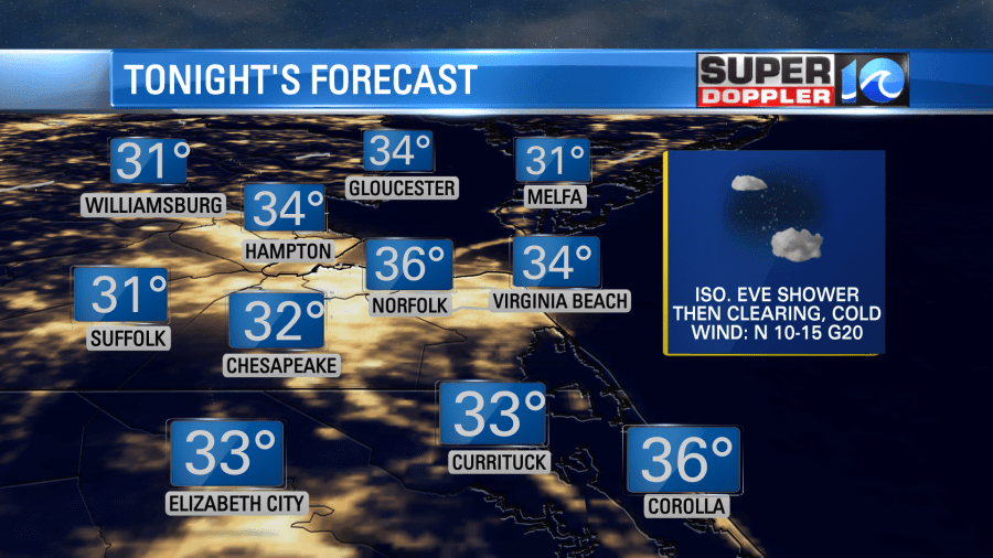
That is pretty chilly for this time of year. The average high temps are in the upper 50s. However, tonight we’ll have some downright cold air sweep into the region. After a spotty shower in the evening we’ll clear out overnight, and winds will pick up out of the northwest. This will also pull down some drier air. Temps will drop to the mid 30s with temps closer to 30 degrees inland and some upper 30s to near 40 along the coast.
There are freeze warnings for some of our inland locations. This was the alerts map from this morning from the National Weather Service.
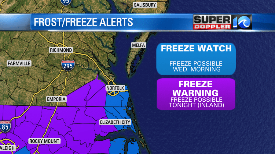
Keep in mind that some other areas could get added to this map later today. You can check for updates here: WAVY Weather alerts.
Tomorrow the offshore low will move northeast and become a nor’easter for the northeast states. High pressure won’t build in too close or our region, but it will edge closer. We’ll have a mix of sun and clouds with a strong northwest breeze. Gusts will be up to 35mph. High temps will only be near 50 in the afternoon.
We’ll be even colder Tuesday night into Wednesday morning, and those colder temperatures could push closer to the coast. That is why there is a Freeze Watch for areas closer to the shore for Wednesday. My advice… Bring in the potted plants if you haven’t already. Also protect the outdoor blooming plants with some mulch, a tarp, or even a trash bag.
High temps will once again be near 50 on Wednesday. We’ll be dry with lots of sunshine. There will be a steady northwest breeze.
Finally, by Thursday the pattern will break up a bit. We’ll be dry and milder with high temps near 60. It should be pretty nice out. It will be even better on Friday for St. Patrick’s day. High temps will rise to the upper 60s to near 70. We’ll have partly cloudy skies. Unfortunately, there may be some rain on Saturday. That could impact the St. Patrick’s Day parade and the race this weekend. So I’ll talk more about that in tomorrow’s weather blog.
Meteorologist: Jeremy Wheeler