
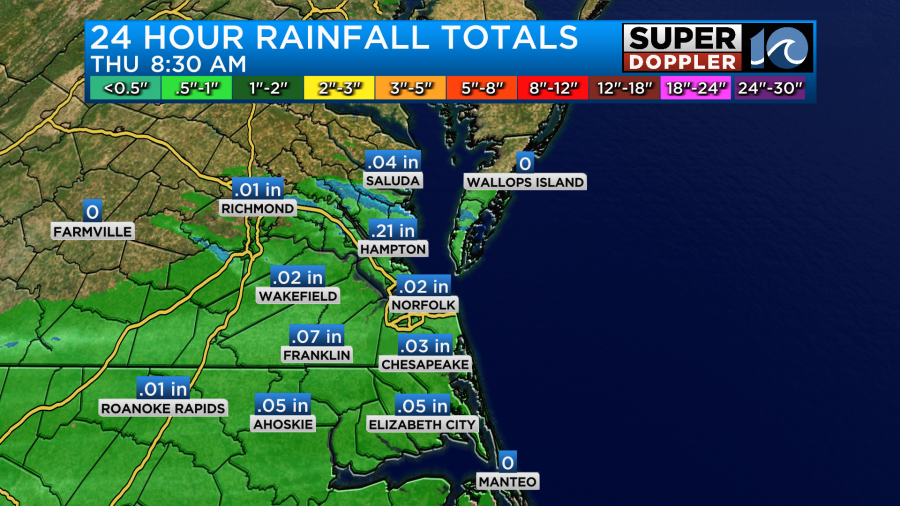
Yesterday we did have some scattered rain showers over the region. They were very light, but it was nice to get a little rain for the lawns and the gardens. Amounts were about as expected. We only had a few hundredths of an inch up to a couple tenths of an inch.
This was well ahead of a cold front. The front moved slowly through the area last night. Now it is steadily sinking to our south.
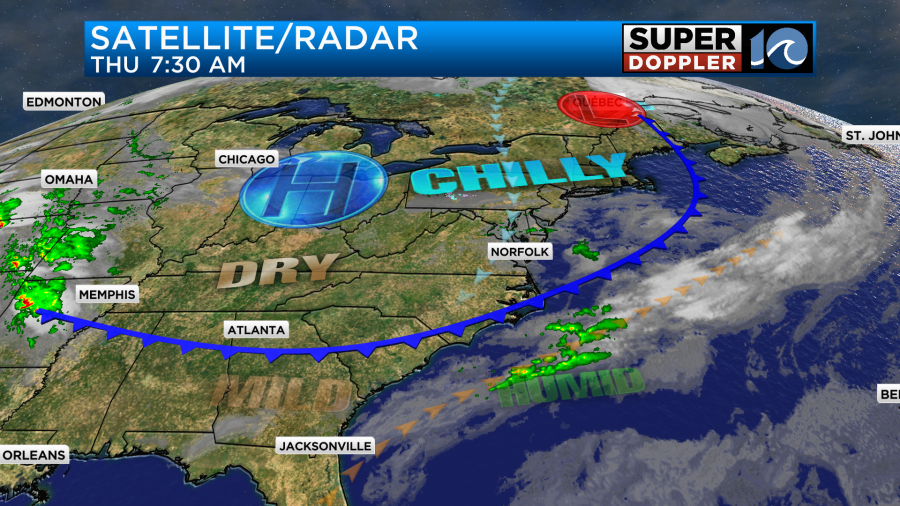
As the front sinks more southward the winds are going to increase. There have already been some gusts between 25 and 30mph on the Eastern Shore. Those stronger winds are riding down the Chesapeake Bay. We’ll have northeast winds running at 10-15mph with gusts to 25mph.

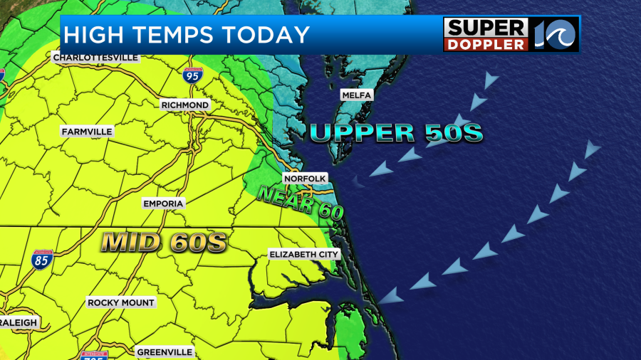
We’ll be partly cloudy through most of the day. There may be some extra clouds between 4 and 6pm. Temps will basically be stuck today. They will only be in the upper 50s near the shore and over parts of the metro. They will be able to warm to the mid-upper 60s later this afternoon.
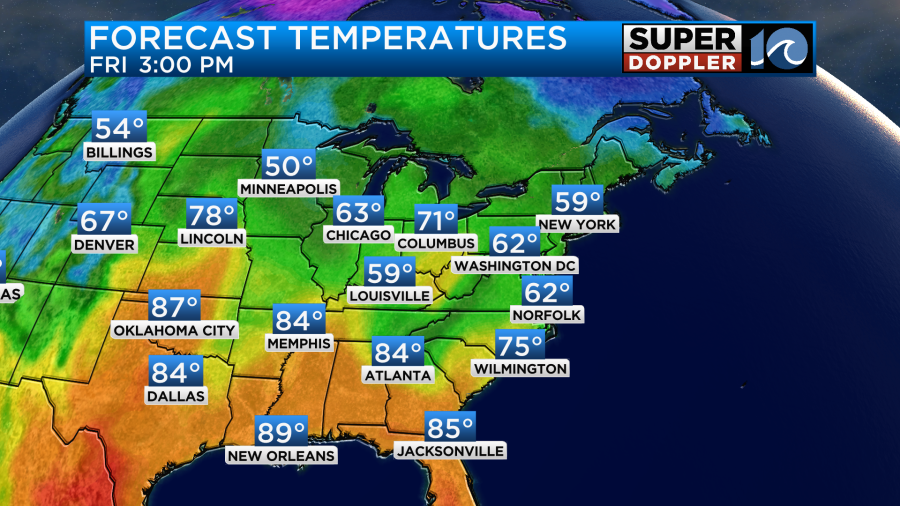
High pressure is building into the region. Tomorrow the front will sink more to the south. We’ll still have a northeast breeze, but it will not be as strong as today. High temps will rise a little bit. They’ll get into the low 60s with some mid-upper 60s inland and south.
Things will get better by the weekend. We’ll be in the upper 60s to low 70s on Saturday with a mix of sun and clouds. Then we’ll warm to the upper 70s by Sunday.
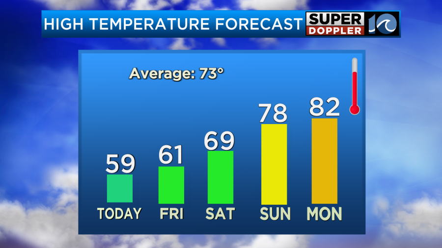
We should be dry this weekend except for a possible stray shower on Saturday. We should be pretty dry until next Wednesday when a few scattered showers are possible. We’ll be warm early next week. High temps will be in the low 80s. It looks like we’ll stay mild for a while. It’s about time for it. We’re almost into May.
Meteorologist: Jeremy Wheeler


