We have now entered the very active weather pattern that will be here for the next 24 hours. This morning we had problems with scattered rain showers and light fog.
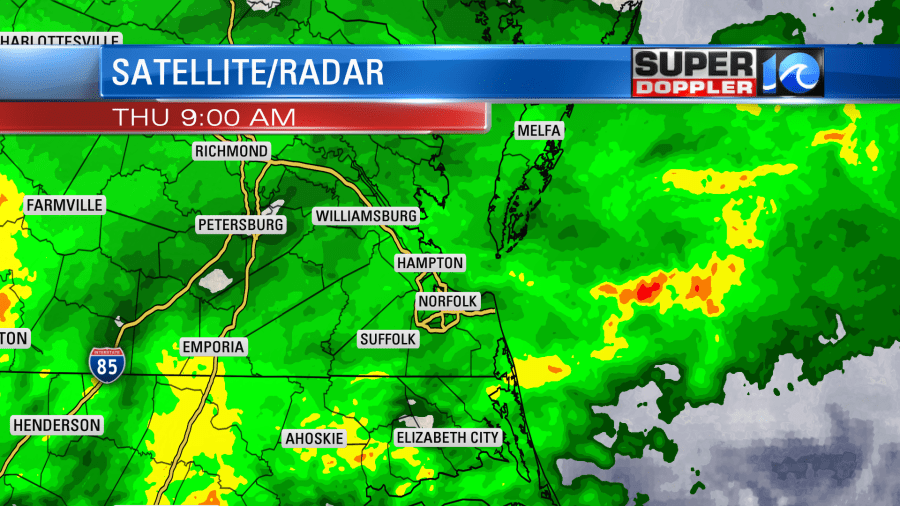
This created some slow downs and accidents on the roads for the morning commute. A warm front was lifting up from the south. Temps started in the 60s over North Carolina with 40s north of Hampton Roads. There is a cold front and an area of low pressure to the west.
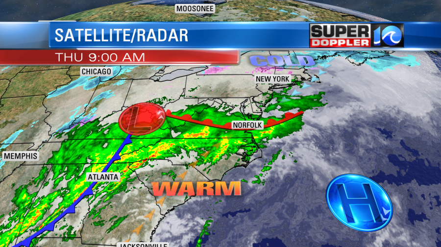
There is a lot of moisture coming up from the south along with the warmer air. South winds will increase from the south at 10-20mph with gusts to 30mph. This will be outside of any thunderstorms that form. This will drive high temperatures back up to near 70 today. This warmth will happen despite full clouds and on-and-off rain showers. The forecast models suggest that the rain will decrease in coverage for a bit during the early afternoon. However, they also suggest that the rain will start to come back in during the late afternoon into the evening.
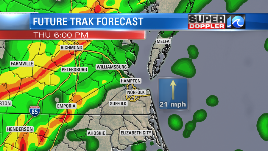
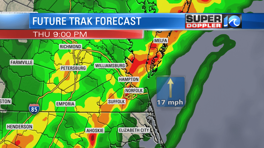
Between the late afternoon and evening, a broken line of showers and storms will start to move in from the west. During the early evening there could already be some heavy rain and strong storms. However, as the cold front moves closer from the west during the later evening there will be a large line of showers and storms that will close in on Hampton Roads.
This time frame will be the highest chance for strong to severe storms.
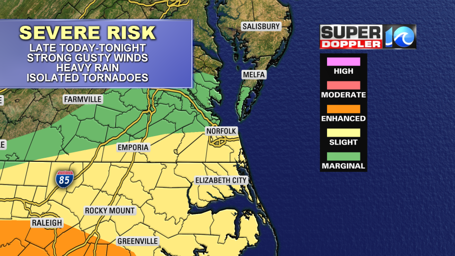
There probably won’t be a lot of instability (tendency for rising air and storm formation). However, there will be some strong mid-upper level winds moving into the region. Sometimes these can support strong storms that have a lack of instability. Some of those winds can also be pulled down to the surface (given the right conditions). So strong gusty winds to over 60mph will be possible. The threat for hail is low, but not zero. There could be some isolated tornadoes in the region, but the higher threat for that will be to our southwest towards the enhances risk.
Overnight the rain will continue, and it will be heavy at times. This could go until about 2-4am as the cold front begins to move offshore.
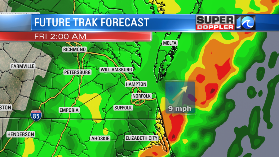
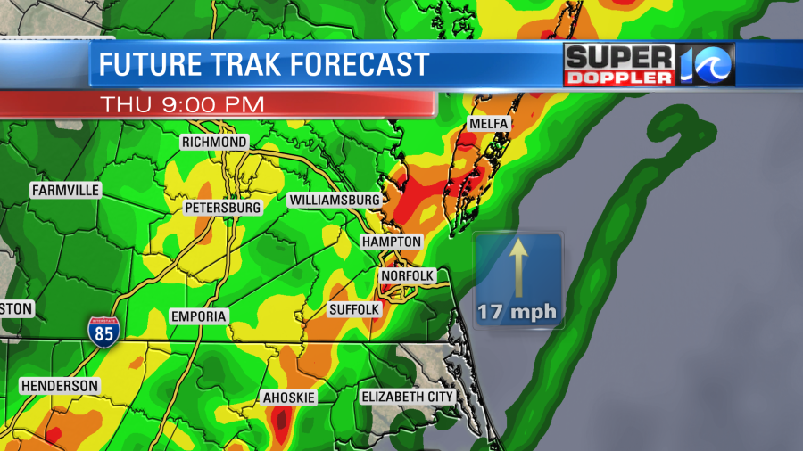
The heavy rain could cause flooding by itself. There is a Flood Watch for part of the area. This morning it was from Sussex County to James City County to the Middle Peninsula and all points north. However, I have a feeling that the watch will get extended to the southeast late today. We’ll see. We will ALL see heavy rain tonight, but the models disagree on where the heaviest rain will set up. Here is what our Future Trak model estimates:
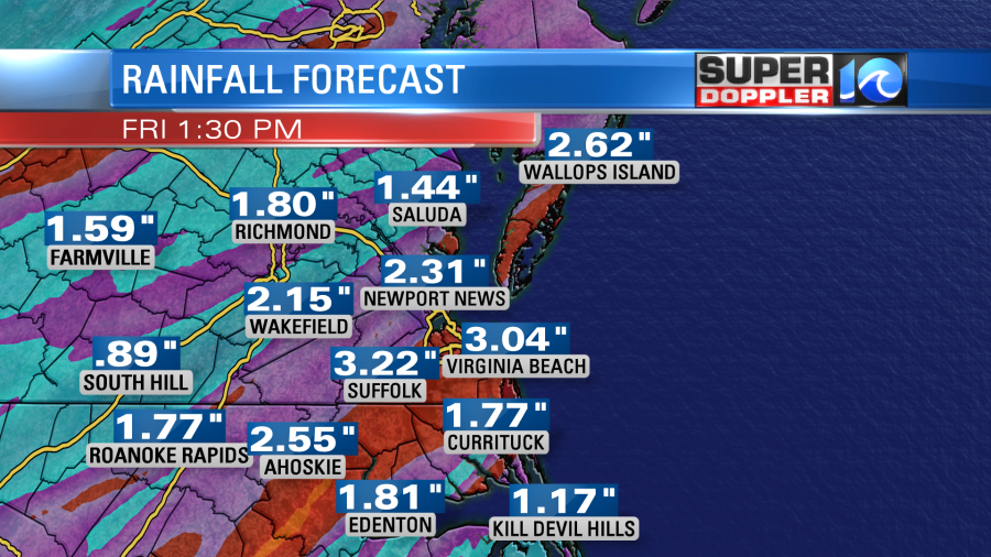
I think this is a fair forecast, but I think some locations will see 4 or more inches. Notice that the higher totals are in Hampton Roads. So that’s why I mentioned the above about the “Flood Watch” from the National Weather Service. Click here to see any updates from them about the watch: NWS Watches/Warnings.
There is one thing I want to mention about the flooding potential. High tide will be between about 5-7 p.m. this evening and 6-8 a.m. tomorrow. The tide won’t be an issue by itself. However, it will lead to some river swell in addition to the heavy rain. Plus, the drainage will be poor during high tide. So that could lead to some street flooding. Keep all of that in mind if you are commuting or traveling.
The rain will come to an end Friday morning. Then we’ll be dry for most of the day. There may be a stray shower or two in the afternoon as a wind-shift slips through the area, but it won’t be much. Winds will be strong from the west. Some of the gusts could be to 35mph. High temps will be in the low 60s.
We’ll be dry and chilly on Saturday with high temps only in the upper 40s. We may see some isolated showers Saturday night into Sunday morning. Otherwise, we’ll be dry and cool with highs in the 50s. We’ll be warm again for most of next week.
Be sure to check back for updates!
Meteorologist: Jeremy Wheeler