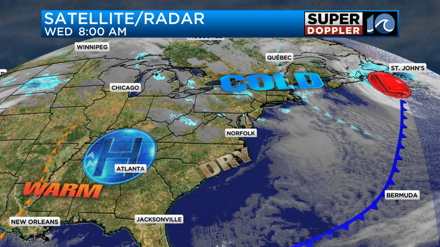
Yesterday, the winds were howling for a bit. Most of the winds gusted between 35-40mph, but there were a few spots where the winds reached up to 50mph. These included Virginia Beach and Elizabeth City. The storm that caused our winds also dumped a lot of snow over parts of the Northeast. It was the snowiest day in New York City in years. Today that system is moving along the Canadian Maritimes. We have high pressure building into our region.
We’ll have lots of sunshine today. There will be a steady breeze out of the northwest and then northeast. It will run at 8-12mph. High temps will be near 50 degrees this afternoon.

Tomorrow we’ll have fair skies. Winds will turn a bit more out of the south. So high temps will rise to the mid 50s. A cold front will move through Thursday night. There will be some brief gusty winds, but I’m not expecting precip. Behind the front high temps will be more in the low 50s Friday.
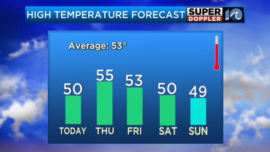
I might even drop it to near 50. We’ll have fair skies.
There will be a few rain showers on Saturday, but it doesn’t look like much. High temps will be near 50. Then we’ll be in the upper 40s and partly cloudy on Sunday.
Happy Valentine’s Day!
Meteorologist: Jeremy Wheeler