The local forecast is calm over the next few days, but not necessarily rain-free. High pressure is in the region today, but there is also a lot of moisture pushing into the area.
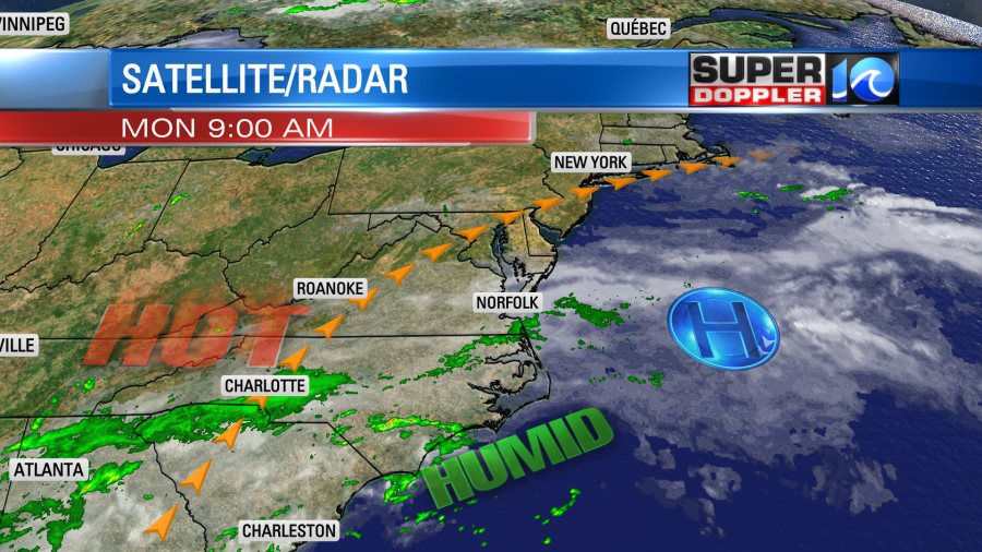
So there are some isolated showers in the region today. It will heat up with high temps near 90 or in the low 90s. The heat index will be in the mid-upper 90s. Luckily there will be a nice breeze out of the southwest. High pressure will build in stronger tomorrow. So we’ll be partly cloudy with only a stray shower in the region. High temps will be in the 90s. We’ll get a 1-Day cool-down on Wednesday. A weak cool front will slip into the region for a day, but it won’t cool us down much. High temps will be in the upper 80s. I think the humidity will drop a bit though. Then we’ll heat right back up again on Thursday with highs in the mid 90s. We’ll have similar weather on Friday. We will probably have some rain coming in on Saturday. That could be from the remnants of a tropical system (Laura).
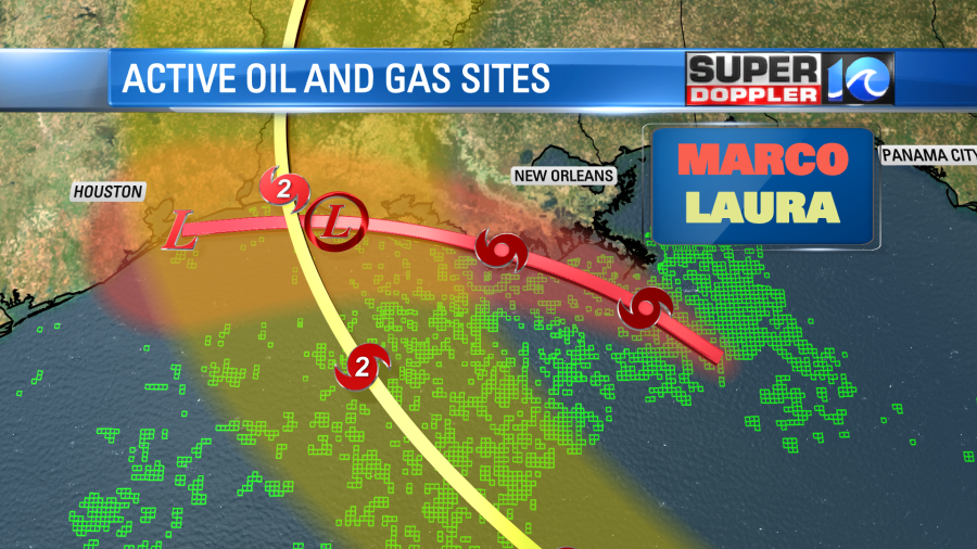
Tropical storm Marco is weakening as it moves towards the Louisiana coast. Meanwhile tropical storm Laura is gaining strength over the Caribbean.
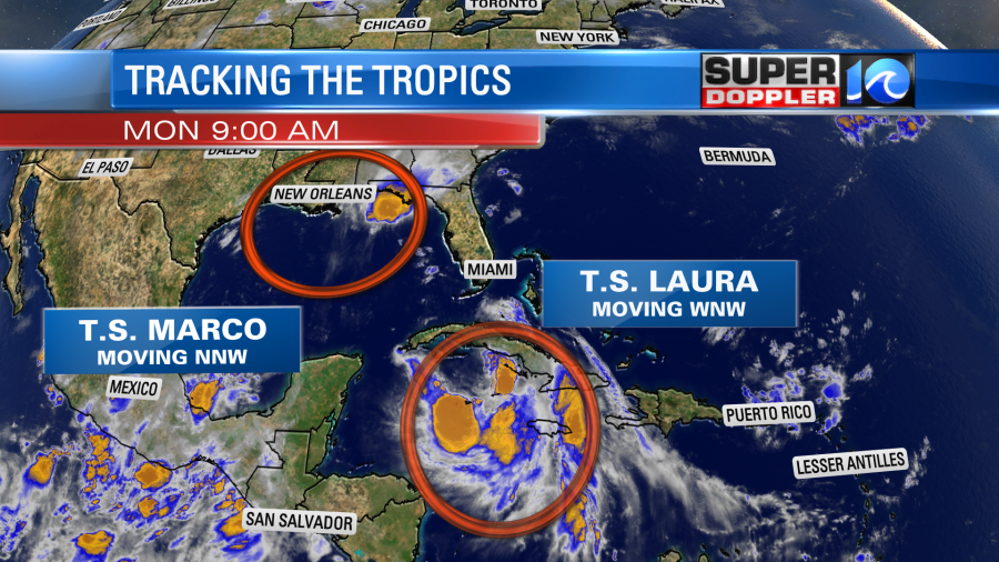
This morning the thunderstorms were mainly to the north of the center of Marco. It isn’t a well organized system…which is good. The sustained surface winds had dropped from 65mph last night to 50mph this morning. Marco is forecast to move along the Louisiana coast today to the west. The winds shouldn’t cause too many problems, but there will be some heavy rain. Especially north of the system.
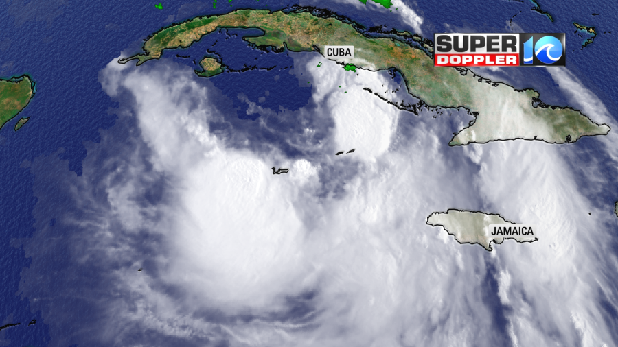
If Marco was by itself, then it would barely make the headlines now. However, it’s the 1-2 punch from Marco and Laura that are making things interesting (in a bad way). This morning tropical storm Laura was located south of Cuba over the Caribbean.
It has taken a more southerly route than many of the models had forecast a few days ago. So now it is expected to be more over the water. This means that the system will be able to maintain its strength in the short-term. That also means that it could become very strong in the long-term. There is a lot of warm water over the Gulf of Mexico, and the wind shear will be pretty weak over the eastern Gulf as well. So Laura is forecast to become a category 2 hurricane as it heads towards either western Louisiana or east Texas.
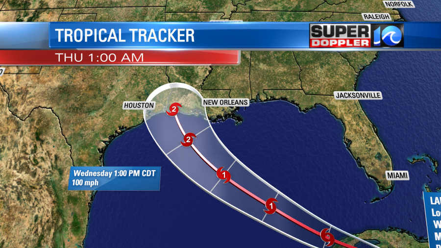
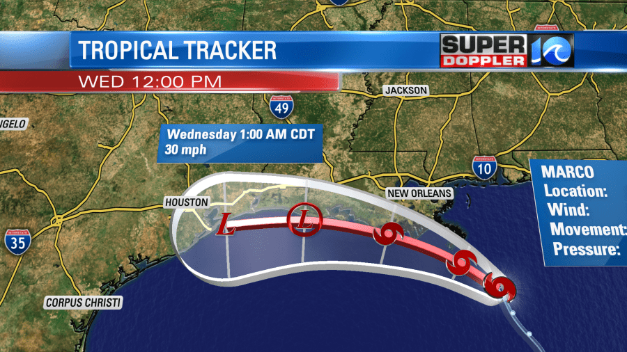
The models vary quite a bit in their forecast strength for Laura, but the consensus is either in the strong cat 1 or a cat 2 hurricane by that time. A few models have it up to a major hurricane before landfall. Along with damaging winds it will bring more rain to the region after Marco’s rainfall.
After landfall early Thursday morning the system is expected to move northward and weaken over the Mississippi River Valley. It will then more northeast and east.

The storm will probably fall apart before it moves towards the east coast. However, the remnants of Laura could bring us a big slug of rain. That would be on Saturday. I highly doubt we’d get any wind from the system. The GFS model actually has it re-forming into a weak non-tropical low as it moves over our area. We’ll see.
The models are in pretty good agreement on the track of Laura. The consensus for landfall is in east Texas or western Louisiana. Laura will likely move across the path of Marco. Marco may have caused some upwelling. This typically pulls up cooler water from below. However, this should barely weaken the system, if at all.
Another thing to think about is the number of oil and gas sites in the Gulf of Mexico. These two tropical systems could really disrupt production. At least for a brief time. I wonder if that would be enough to raise the price of gas.
Stay tuned for updates.
Meteorologist: Jeremy Wheeler