I thought the last couple of weeks have been mostly hot and humid with a few cooler days. However, looking back at the last 2 weeks it has actually been below average most of the time.
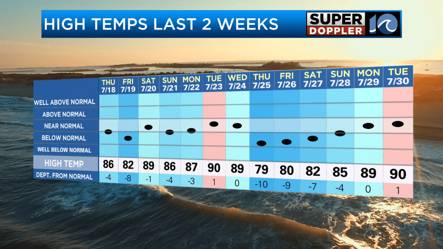
However, it has definitely been muggy with the exception of last weekend and Monday. Also we’ve had a lot of storms keeping the temps down. Yesterday though we started to heat up again. High temps made it to 90s degrees in Norfolk and a few other cities. It wasn’t too bad through midday. There was a nice breeze. Then the heat and humidity built into the afternoon. It became rough.
Today high pressure is offshore. There is a warm front to our north with a cool front over the Ohio River Valley.
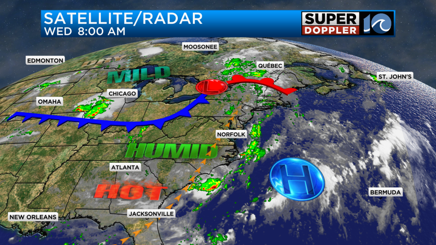
The cool front will move closer to us over the next 36 hours, but it is forecast to fall apart. So the heat is just going to keep building along with the humidity. Today our high temps will rise to the low-mid 90s.
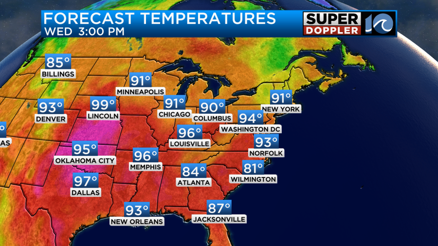
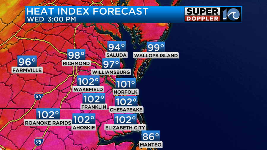
The heat index will be near 101 degrees.
We’ll be partly cloudy with a few pop-up showers and storms this afternoon. There will be a light breeze out of the southwest at 8-12mph.
There is another thing that we will be tracking today. Smoke! Wildfire smoke from fires over the west coast and parts of Canada are traveling far. It affected the Midwest yesterday. Today we’ll have some of it here as well.
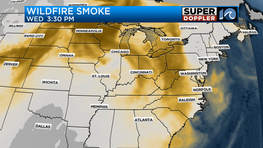
I think it will be mainly elevated. So it will help to create a high level haze. Conditions should be ok at the surface. Air quality will be moderate today. However, tomorrow the smoke will be thicker in the region.
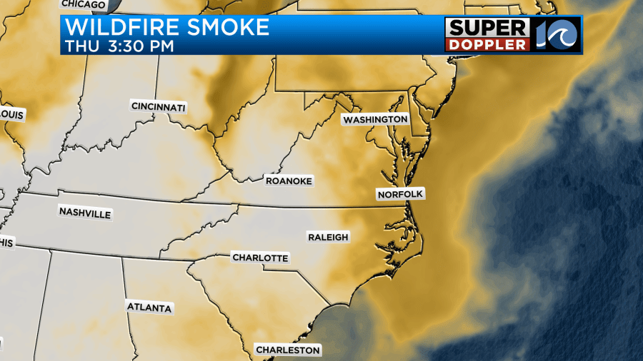
This could allow the smoke to make it down to the surface. At least a little bit could. So the air quality could be unhealthy for some.
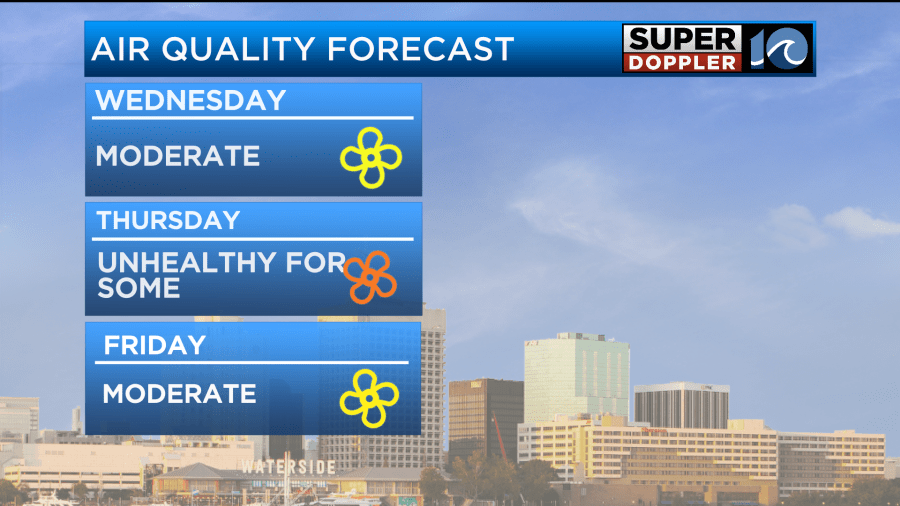
We’ll have updates. Stay tuned if you have asthma, COPD, or other health issues. Also tomorrow, we will heat up some more. High temps will rise more into the mid 90s.
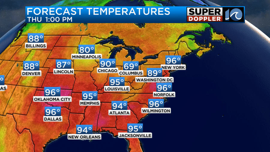
This will depend a little on how much haze we get. If it gets thick enough, then we may only get into the low 90s. Regardless, it will feel hot. The heat index is currently forecast to be around 105 degrees.
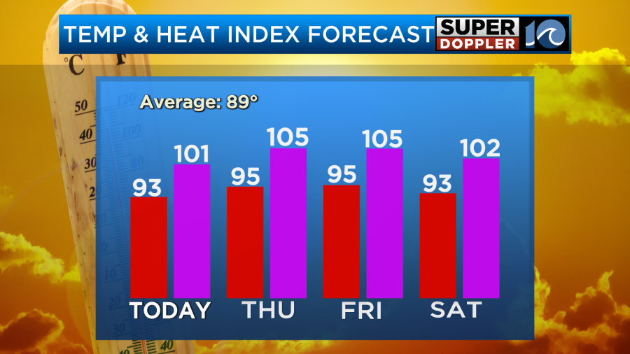
We’ll be mostly sunny to partly cloudy. The models have backed off of the rain chances for now. They only have some isolated showers or storms in the region. That may be why the heat builds some more. We’ll have similar weather on Friday. High temps will be in the mid 90s. The heat index around 105.
By Saturday there will be a cool front working down towards our region. We’ll be ahead of it, and that moisture will be able to pool into our region some more. So we’ll have a lot of clouds with scattered showers and storms forming. We should then cool down slightly on Sunday. More scattered storms are forecast, but the weekend does not look like a washout.
Last but not least, we are still watching the tropical disturbance in the Atlantic. It is close to the Lesser Antilles.
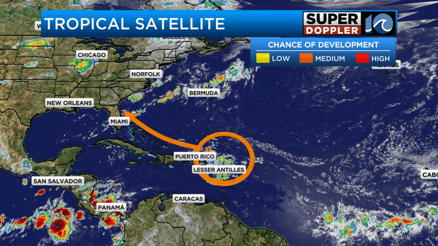
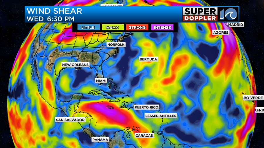
This feature will continue to move west/northwest. It has a little wind shear nearby, and there will be some more light shear in its short-term path.
There is not a lot of deep/warm water in its path despite plenty of warm water at the surface.
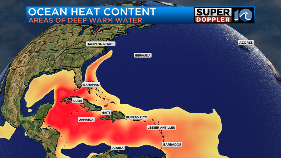
So this disturbance is not forecast to develop in the next 24-48 hours, but it is has a medium chance in the 3-5 day range.
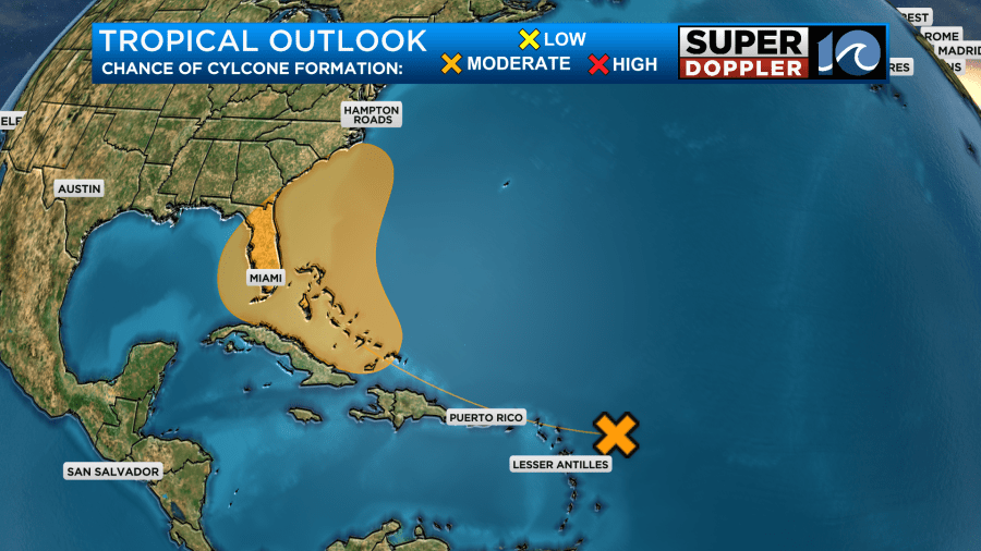
Whatever it does, we’ll track it closely over the next couple of days.
Meteorologist: Jeremy Wheeler


