Yesterday’s weather went about as expected. There was a late afternoon cool down near the shore, but most temps stayed hot through the evening. There wasn’t much rain, but some isolated showers and storms popped in the afternoon. This was as a cool front moved into the area and stalled out. Now that front is very slowly sinking south through the region.
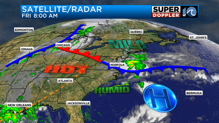
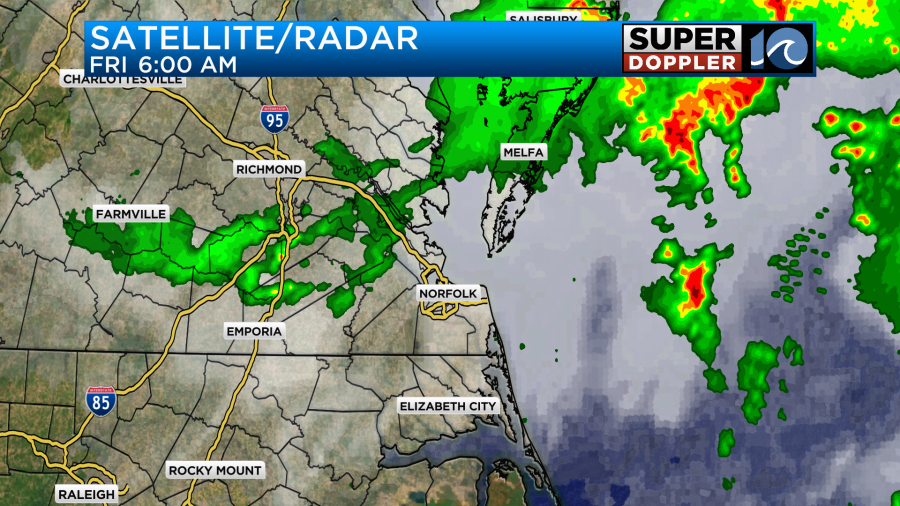
There were some scattered showers before sunrise this morning. A lot of them fell apart as they moved east, but some survived over the Peninsula, Middle Peninsula, and the Eastern Shore.
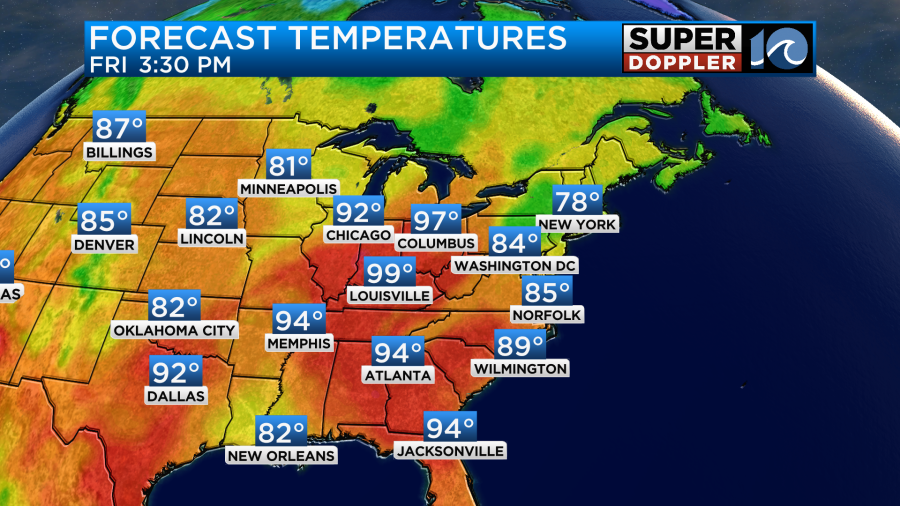
The front will sink just a little more to the south today. This will cool down the area some. However, I think the extra clouds and scattered showers and storms will do more of the cooling work than the front will. High temps will be in the mid 80s.
There will also be a very light breeze out of the east/northeast through the day. We will be mostly cloudy through the afternoon and evening, but we won’t have rain all day. Instead, I think there will be a couple of rounds of showers and storms. After the morning scattered showers, the rain may taper off for a bit. Then scattered showers and storms will probably fire up during the afternoon. Especially close to where that front sets up.
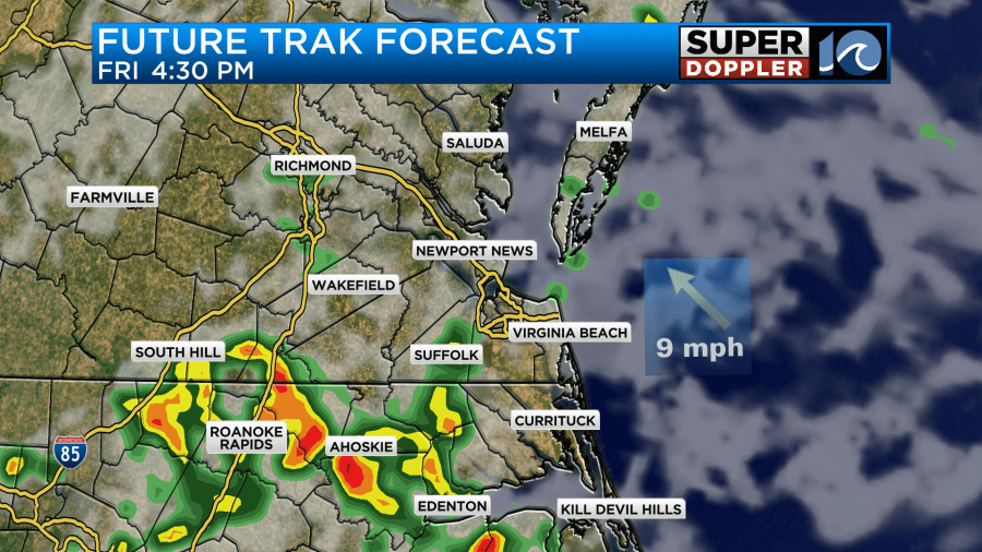
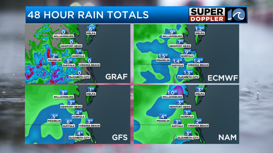
A few more showers and storms will continue through the early evening. Then they will taper off later tonight. If we’re lucky then some of us will get a half inch up to three quarters of an inch. However, most will only get a couple of tenths of an inch.
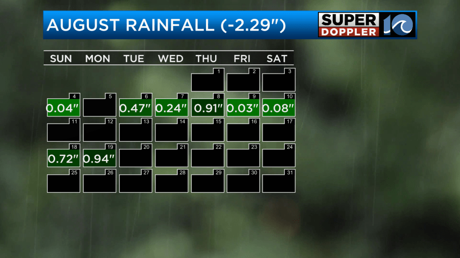
We really need every drop we can get. We are running over a 2 inch deficit for the month.
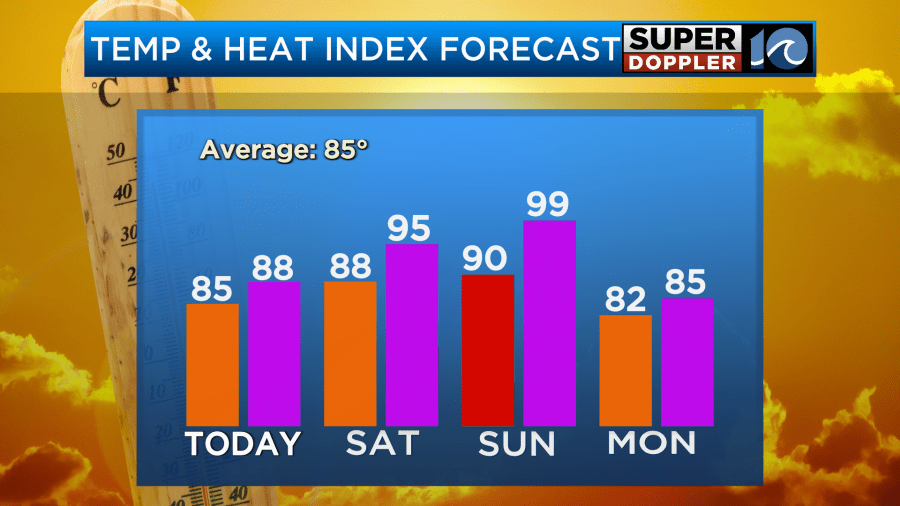
Tomorrow we won’t have much rain. The front will lift north as a warm front. So we’ll be partly cloudy with only an isolated shower or storm. High temps will rise to the upper 80s.

It will feel like the mid 90s with the heat index. It could be a good end-of-the Summer beach day. If you can’t do that day, then fear not. There may be some time on Sunday as well. The weather looks quiet (and hot) up through the early afternoon. However, a few showers and storms will fire up during the afternoon.
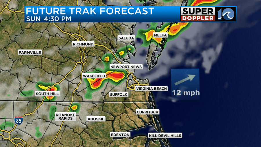
These will grow into an even bigger cluster of showers and storms by the evening. Heavy rain and a few strong storms will be possible. This will be ahead of the stronger cold front that is currently sitting over the Midwest. The good news is that we are going to cool down on Monday. High temps will drop to the low 80s.
After a long stretch of muginess the humidity will drop through the day.
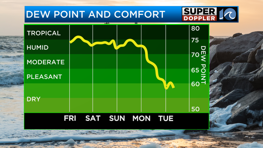
After some scattered showers in the morning, I still think we’ll dry out later in the day. This will be for Labor Day. Then we should drop temps even more by Tuesday with even drier air in the region. It should be nice for most of next week. Highs will be in the 70s Tuesday through Thursday. Yes!
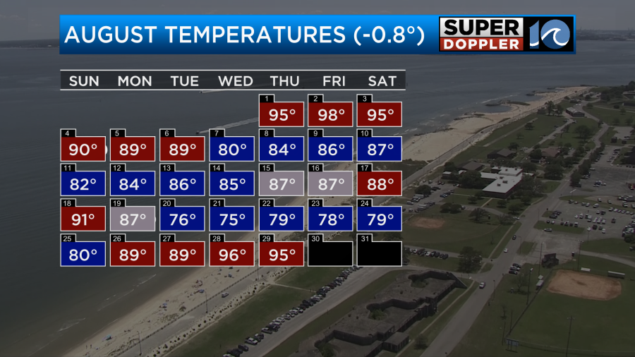
This means that we will definitely finish out August below average for temperatures. So far we are 0.8 degrees below average.
There are 2 tropical disturbances in the Atlantic. The one in the middle of the Atlantic has a medium chance of formation for the next few days as it heads towards the Lesser Antilles.

There is also one in the eastern Atlantic. That one has a low chance for formation for now.
Meteorologist: Jerey Wheeler


