Last night a cold front moved over the region as expected. There was a little bit of light precipitation.
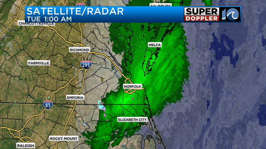
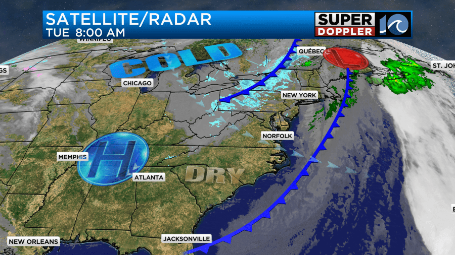
There may have been a few wet snowflakes mixing in, but I didn’t see any reports. The front is now offshore along with the rain. High pressure is building in from the west.
We’ll have a lot of sunshine today. However, the wind is going to pick up out of the northwest. We’ll have some gusts to 25mph at times.
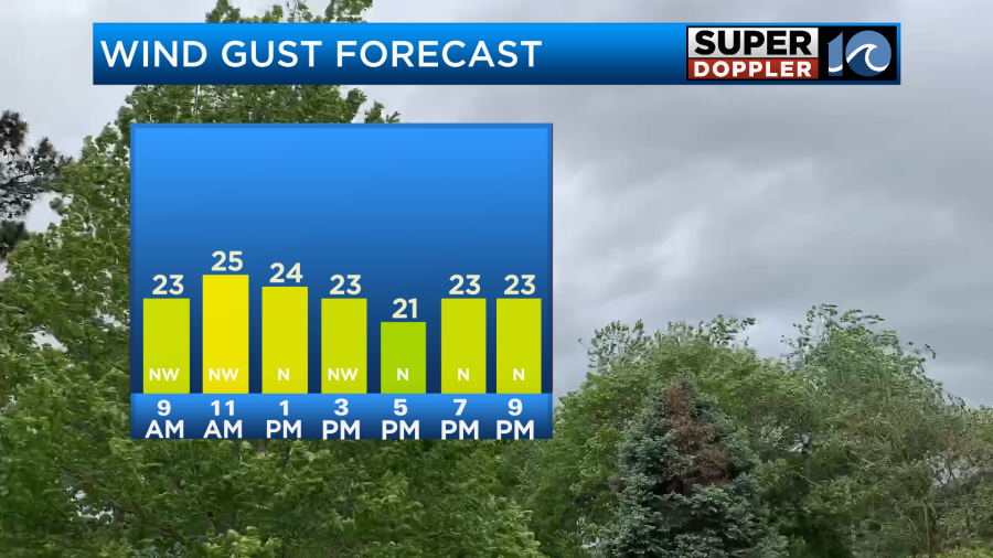
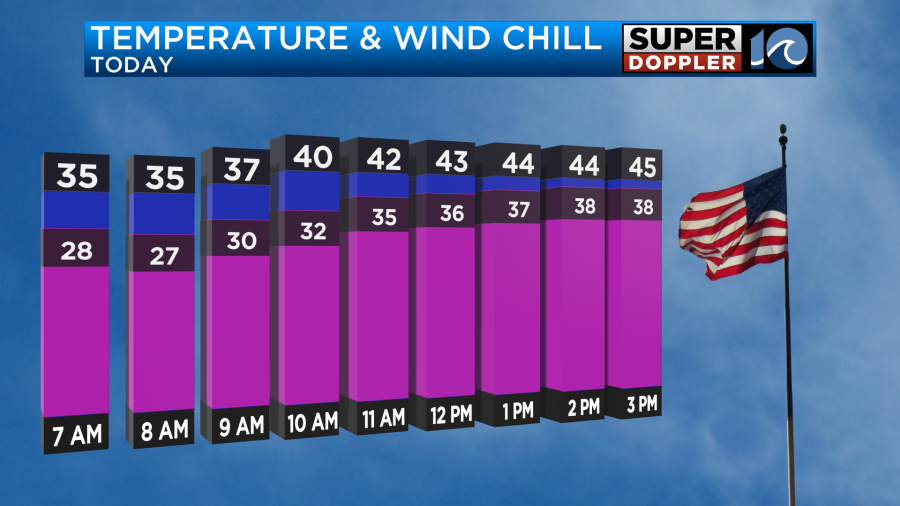
So the high temperatures will only be in the mid 40s this afternoon. The wind chills will be in the 30s.
We’ll have clear skies tonight with light north winds. Low temps will drop to the low 30s with lots of 20s inland. Then tomorrow we’ll have lots of sunshine again, but there will still be a north breeze. At least tomorrow it will be much weaker. So high temps should be able to get into the upper 40s. (A slight improvement).
We’ll be dry and cool Thursday into the weekend. High temps will be mainly in the 50s.
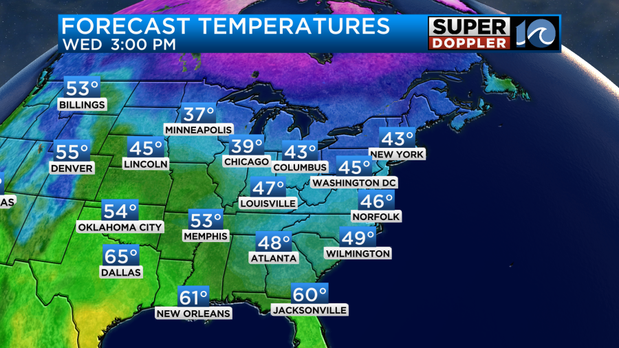
Travel weather should be good over much of the country for the next couple of days. There will be some rain in the west today and tomorrow.

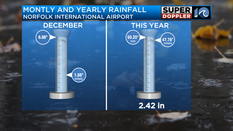
I do want to take a minute to talk about climate. We have just a little light rain last night, but we had a lot of rain last Sunday and Monday. So now we are way above average for the month, and we are over a couple of inches above average for the year.
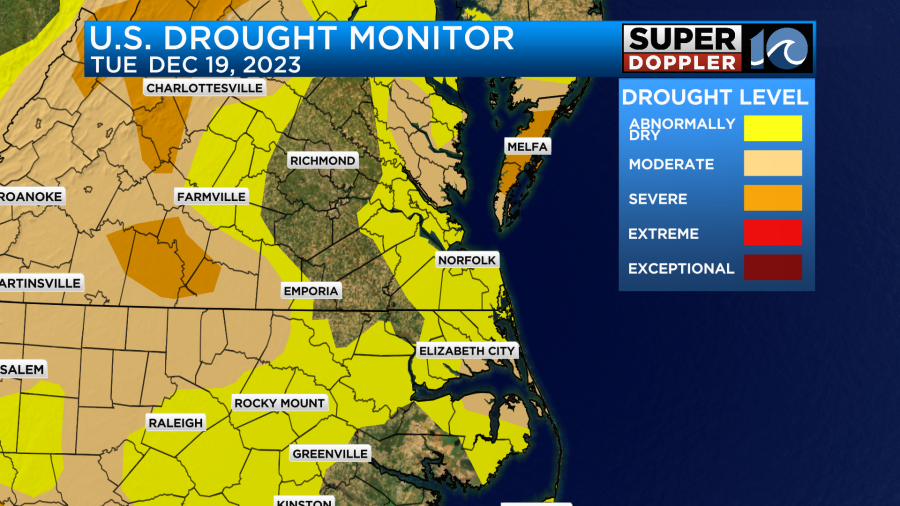
The U.S. Drought monitor gets updated on Thursday. I imagine that most of the area will be out of the current drought. The Eastern Shore may still have an element despite 3-4 inches of rainfall.
Meteorologist: Jeremy Wheeler