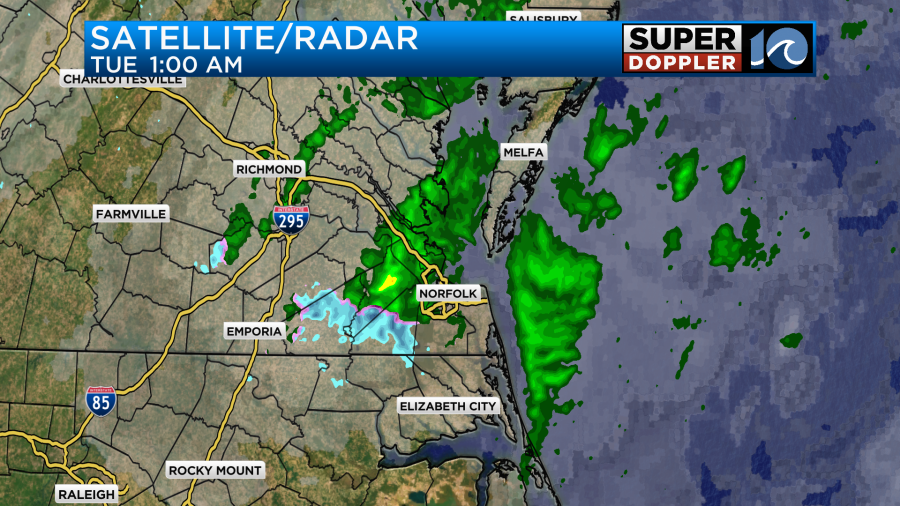
Today is going to be breezy and chilly as many folks head back to work and kids head back to school. There was some rain overnight, but it had moved out by the time we started the morning commute.
There was even a brief mix for a time inland.
A cold front has dropped to our south, and high pressure is building in from the west.
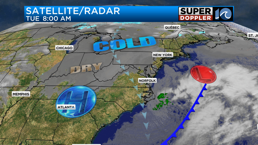
We’ve already seen some clearing in the region, and we’ll have a lot of sunshine today.
Despite having mostly sunny skies for most of the day, high temps will only top off in the mid 40s this afternoon.
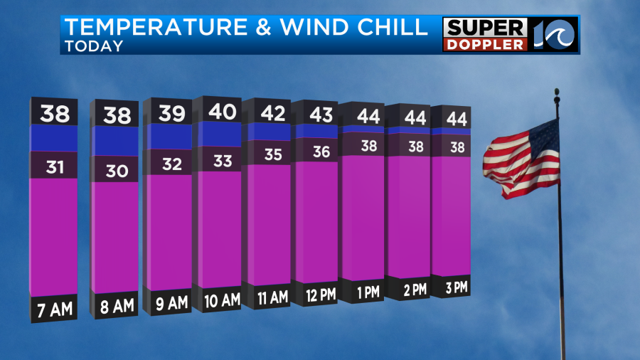
Winds will gust up to 20mph out of the north. So wind chills will be in the upper 30s even this afternoon.
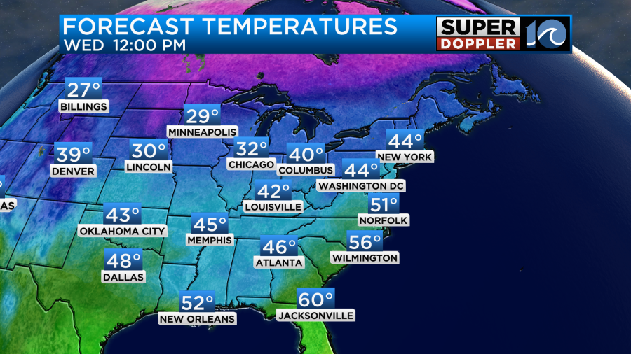
Tomorrow we’ll have some sun in the morning with more clouds during the afternoon. High temps will be in the low 50s.
Overall, it will be a decent day, but it may become mostly cloudy by the late afternoon. At least there won’t be much wind.
A cold front will enter the region Late Wednesday night into early Thursday morning. Some moisture will come up from the south. So we’ll have a batch of rain move into the area through that time.
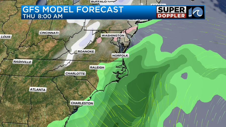
It should move out by the late morning. Then we’ll be dry and chilly in the afternoon. Highs will be in the 40s again. We’ll be dry and chilly on Friday. Then next weekend gets interesting.
As of this time it looks like a strong area of low pressure will move through the area late Saturday into Sunday. The timing may change, but it looks like we’ll get increasing rain showers late Saturday into Saturday night with the showers moving out (gradually) Sunday morning.
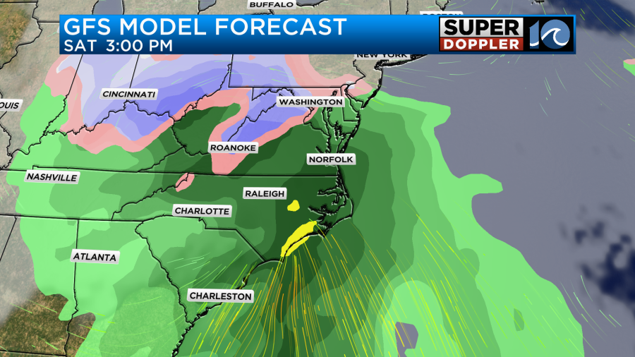
The wind will be picking up during this time as well. With the current track of the low I don’t think we’ll have to deal with tidal flooding. However, we may have some strong gusts of wind along with some brief heavy rain. This will probably also become a sizeable snowmaker for areas to our west and northwest. It’s still a bit early for the details. I’ll talk a lot more about next weekend starting with tomorrow’s weather blog.
Before I go. I got some climate info from the National Weather Service for 2023. Apparently, we had the 6th warmest year on record. We also ended up above average for rainfall thanks to this recent December.
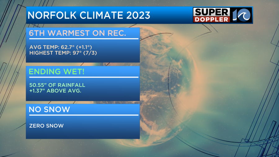
We haven’t had snow for a long time.
Meteorologist: Jeremy Wheeler