Evening Update: A wild ride of wind and rain is expected for the region, with the threat of strong to severe thunderstorms as well. Be sure to stay weather aware!
Wind: The wind will impact all of us – as the strong breeze develops out of the south by the morning hours. Winds will eventually gust to 50-60mph by the afternoon and the evening, expect sporadic power outages and downed trees/tree limbs.
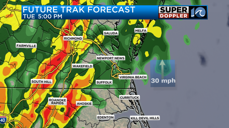
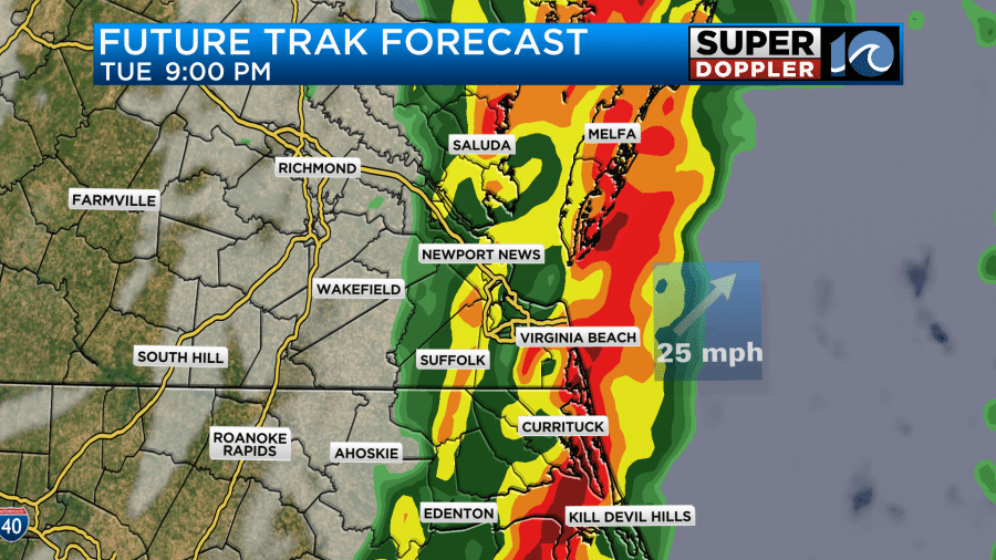
Rain: On and off light to moderate rain is likely from mid/late morning into early afternoon. This, as the warm front lifts through the region. It’s not until the cold front arrives after sunset that will get us with the heavy rainfall. Between about 8p and 11p is when the heaviest rain, and threat of strong/severe thunderstorms blast in. Flash flooding on low lying areas and streets is likely as we could tally 1″-3″.
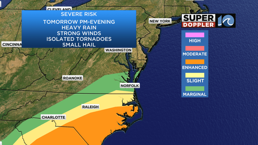
In addition to the rain, there is a threat of a few severe thunderstorms and tornadoes. That threat remains in NE North Carolina by the afternoon and evening. Be sure to have a way to get weather alerts tomorrow!
Tidal Flooding: Because of the aggressive southerly wind, water levels in the Albemarle sound will elevate and likely cause flooding on the northern shorelines of the sound. Similar conditions are likely in southern Virginia Beach near Back Bay. The afternoon high tide is around 5:30pm.
It’ll be a warm (temperatures in the mid 60s through the evening!), wacky and windy day. Buckle up and stay safe! We’ll keep you posted throughout the day as conditions warrant.
–Steve
______________________________________________________________________________________________________
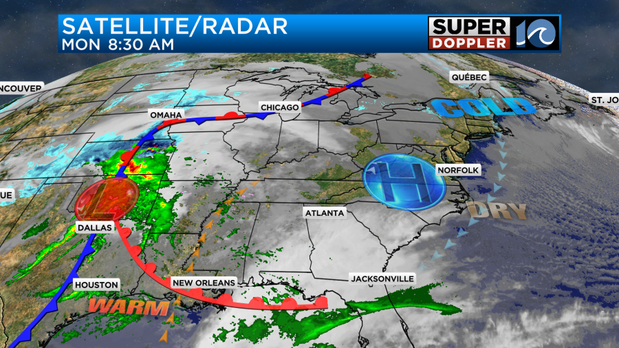
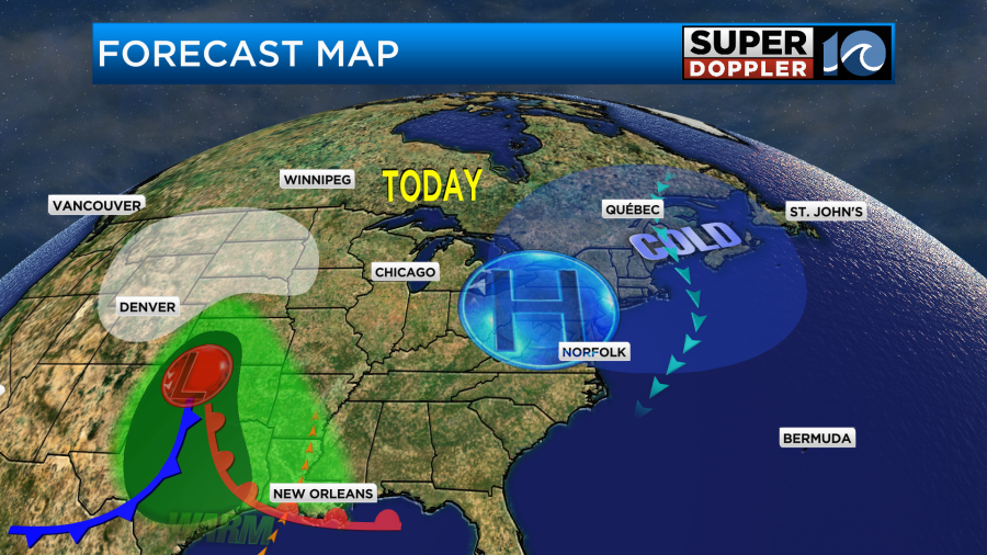
Today will be a decent day to prepare for Tuesday. Today we have high pressure in the area. We’ll have a lot of sunshine with a steady northeast breeze.
High temps will be in the mid-upper 40s.

While we’ll have quiet weather here today. Meanwhile, an area of low pressure will be strengthening to our west. It will bring rain and storms to the south central U.S. with snow in the north central U.S. Some areas in the Midwest could get a foot of snow.
By tomorrow the low will strengthen even more as it heads towards the Appalachian Mountains. High pressure will push offshore.
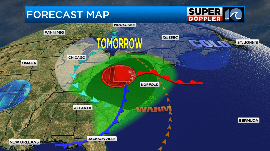
There will also be a sizable upper level trough swinging in behind the surface low.
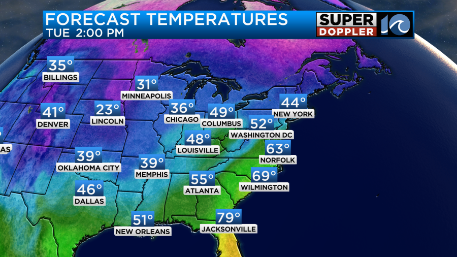
We’ll be in the warm zone for a long stretch of time. Strong southeast winds will push our high temps up to the low 60s.
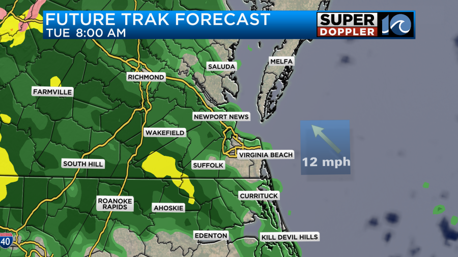
The wind will increase through the day. Gusts will be 25-30mph in the morning. They will reach 45-55mph in the afternoon.
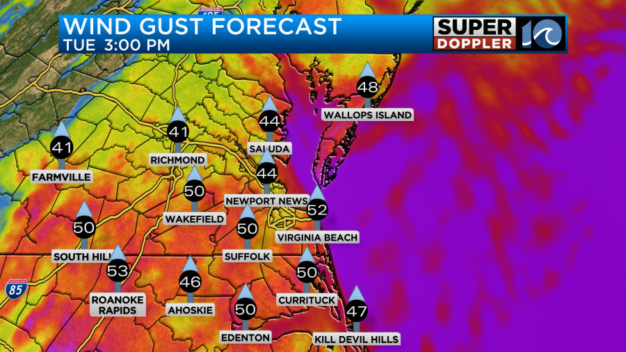
The winds may even gust to 60mph for a time in the evening. At least for some areas near the shore. I will say that sometimes the models tend to overforecast winds for south to north moving storm systems. So we’ll see. Either way this could lead to some scattered power outages. It’s possible that some severe winds could happen in the evening. Isolated tornadoes may also be possible.
There will be some scattered rain showers tomorrow morning as the moisture quickly ramps up.
The models suggest a break in the rain around midday.
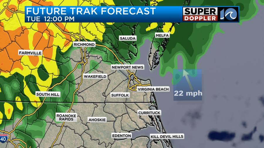
If that happens, then it could help to heat up the temps a bit more than the low 60s, and that could increase the fuel for storms in the evening. A large cluster of showers and storms will be moving in from the west during the early evening.
This activity will still be ahead of the cold front. However, the front will start moving through in the later evening. It looks like a big line will move through between 7 and 10mph with the rain ending after 11pm.
The wind will turn out of the west, and it will stay gusty through Wednesday morning, but it won’t be as windy as tomorrow.
With the prolonged south/southeast winds it is forecast that there will be some moderate tidal flooding along the north end of the Albemarle Sound.
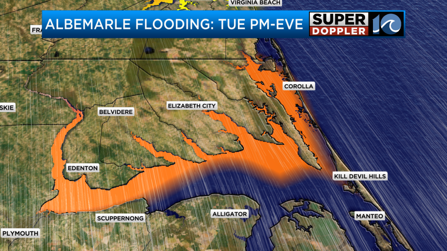
This could stretch up into the Knotts Island area and southern Virginia Beach. The lower Chesapeake Bay shouldn’t have much tidal flooding due to the wind direction (south then west). However, there may be some more tidal flooding on the sound-side of the Outer Banks on Wednesday as the west winds hold steady for a while. This part of the forecast still could change. So check back for updates.
The rainfall forecast is coming into view. It looks like we’ll get about 1 to 1.5″ of rainfall with some locations possibly getting over 2″.
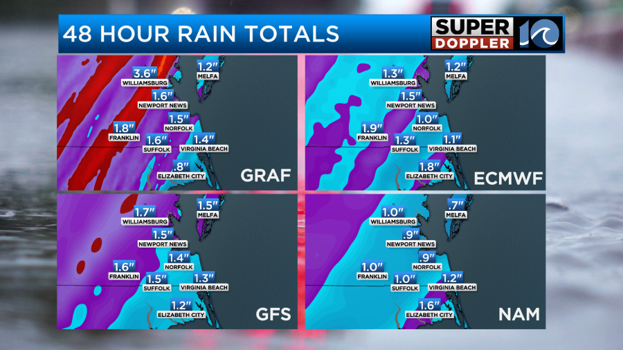
This could lead to some isolated flooding in the region by itself.
We’ll be dry and cool on Wednesday and Thursday with high temps in the 50s.
Meteorologist: Jeremy Wheeler